- Nemaha County, Nebraska
-
Nemaha County, Nebraska  Nemaha County Courthouse in Auburn
Location in the state of Nebraska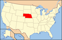
Nebraska's location in the U.S.Founded 1855 Seat Auburn Largest city Auburn Area
- Total
- Land
- Water
412 sq mi (1,067 km²)
409 sq mi (1,059 km²)
3 sq mi (8 km²), 0.63%Population
- (2010)
- Density
7,248
18/sq mi (7/km²)Nemaha County is a county located in the U.S. state of Nebraska. As of 2010, the population was 7,248.[1] Its county seat is Auburn[2].
In the Nebraska license plate system, Nemaha County is represented by the prefix 44 (it had the forty-fourth-largest number of vehicles registered in the county when the license plate system was established in 1922).
Contents
Geography
According to the U.S. Census Bureau, the county has a total area of 412 square miles (1,070 km2), of which, 409 square miles (1,060 km2) of it is land and 3 square miles (7.8 km2) of it (0.63%) is water.
Portions of the county extend past the Missouri River, which is otherwise its border with the state of Missouri.
Major highways
 U.S. Highway 75
 U.S. Highway 136
 Nebraska Highway 62
 Nebraska Highway 67
 Nebraska Highway 105
Adjacent counties
- Otoe County, Nebraska - north
- Atchison County, Missouri - east
- Holt County, Missouri - southeast
- Richardson County, Nebraska - south
- Pawnee County, Nebraska - southwest
- Johnson County, Nebraska - west

Otoe County Johnson County 
Atchison County, Missouri  Nemaha County, Nebraska

Pawnee County Richardson County Holt County, Missouri Demographics
Nemaha County
Population by decade1860 - 3,139
1870 - 7,593
1880 - 10,451
1890 - 12,930
1900 - 14,952
1910 - 13,095
1920 - 12,547
1930 - 12,356
1940 - 12,781
1950 - 10,973
1960 - 9,099
1970 - 8,976
1980 - 8,367
1990 - 7,980
2000 - 7,576
2010 - 7,248As of the census[3] of 2000, there were 7,576 people, 3,047 households, and 1,980 families residing in the county. The population density was 18 people per square mile (7/km²). There were 3,439 housing units at an average density of 8 per square mile (3/km²). The racial makeup of the county was 97.60% White, 0.36% Black or African American, 0.30% Native American, 0.59% Asian, 0.04% Pacific Islander, 0.37% from other races, and 0.74% from two or more races. 1.00% of the population were Hispanic or Latino of any race.
There were 3,047 households out of which 29.50% had children under the age of 18 living with them, 55.00% were married couples living together, 7.20% had a female householder with no husband present, and 35.00% were non-families. 30.50% of all households were made up of individuals and 16.20% had someone living alone who was 65 years of age or older. The average household size was 2.32 and the average family size was 2.91.
In the county the population was spread out with 23.20% under the age of 18, 11.90% from 18 to 24, 23.90% from 25 to 44, 22.70% from 45 to 64, and 18.40% who were 65 years of age or older. The median age was 39 years. For every 100 females there were 93.30 males. For every 100 females age 18 and over, there were 92.00 males.
The median income for a household in the county was $32,588, and the median income for a family was $43,780. Males had a median income of $30,956 versus $19,263 for females. The per capita income for the county was $17,004. About 8.30% of families and 12.60% of the population were below the poverty line, including 13.20% of those under age 18 and 13.50% of those age 65 or over.
Cities and villages
See also
- National Register of Historic Places listings in Nemaha County, Nebraska
- Nemaha Half-Breed Reservation
References
- ^ http://www.omaha.com/article/20110301/NEWS01/110309991/0
- ^ "Find a County". National Association of Counties. http://www.naco.org/Counties/Pages/FindACounty.aspx. Retrieved 2011-06-07.
- ^ "American FactFinder". United States Census Bureau. http://factfinder.census.gov. Retrieved 2008-01-31.
Municipalities and communities of Nemaha County, Nebraska Cities 
Villages Brock | Brownville | Johnson | Julian | Nemaha
Categories:- Nebraska counties
- Nemaha County, Nebraska
- Nebraska counties on the Missouri River


Wikimedia Foundation. 2010.