- Nettlestead Green
-
Nettlestead Green, like its near neighbour Nettlestead lies in the Medway valley SW of Maidstone in Kent.
It has its own church[citation needed], character village 17th century pub (The Hop Pole Inn) and a plant nursery (Wood Cottage Nursery). The Post Office recently closed. The railway station for Yalding is actually closer to Nettlestead Green than to its own village, which lies on the opposite side of the River Medway.
It was here on 26 June 1944 that Warrant Officer R.A.B ("Red") Blumer RAAF died when his Spitfire crashed. A memorial has been erected to his memory and on 26 June each year a memorial service is held at the crash site. Blumer's portrait, and four information panels, hang in the Hop Pole Inn.
External links
 Media related to Nettlestead Green at Wikimedia Commons
Mereworth Nettlestead West Farleigh Peckham Bush 
Yalding  Nettlestead Green

East Peckham Hale Street Benover Towns and villages in the Maidstone borough of Kent, England 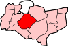 Allington · Barming · Bearsted · Bedmonton · Benover · Bexon · Bicknor · Boughton Green · Boughton Malherbe · Boughton Monchelsea · Boxley · Bredhurst · Broomfield · Caring · Chainhurst · Chart Sutton · Chegworth · Collier Street · Coxheath · Detling · Downswood · East Barming · East Farleigh · East Sutton · Fairbourne Heath · Frinsted · Grove Green · Harrietsham · Hawkenbury · Headcorn · Hollingbourne · Horden · Hucking · Hunton · Kingswood · Kit's Coty · Laddingford · Langley · Leeds · Lenham · Linton · Loose · Lordswood · Maidstone · Marden · Marley · Milebush · Nettlestead · Nettlestead Green · Otham · Otterden · Park Wood · Platt's Heath · Penenden Heath · Pollhill · Ringlestone (hamlet) · Ringlestone (suburb) · Sandling · Sandway · Shepway · Sutton Valence · Staplehurst · Stockbury · Teston · Thurnham · Tovil · Ulcombe · Walderslade · Weavering · West Farleigh · Wichling · Wormshill · Yalding
Coordinates: 51°14′N 0°25′E / 51.23°N 0.41°ECategories:- Maidstone (borough)
- Villages in Kent
- Kent geography stubs

Wikimedia Foundation. 2010.