- Mount Soledad
-
Mount Soledad 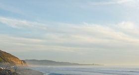
Mount Soledad seen from the north in Torrey Pines State Reserve, La Jolla, San Diego, CaliforniaElevation 822 ft (251 m) NGVD 29[1] Prominence 472 ft (144 m) [1] Location Location within Northwestern San Diego
 Mt. Soledad
Location La Jolla, San Diego, County, California, USA Coordinates 32°50′23″N 117°15′08″W / 32.8397698°N 117.2522590°WCoordinates: 32°50′23″N 117°15′08″W / 32.8397698°N 117.2522590°W[2] Topo map USGS La Jolla OE W  Mount Soledad Latin Cross
Mount Soledad is a prominent landmark in the city of San Diego, California, United States. The mountaintop is the site of the Mount Soledad cross, the subject of a continuing controversy over the involvement of religion in government.
Contents
Geography
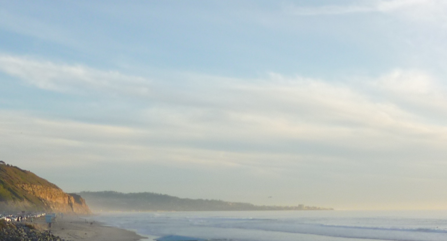
The 822-foot (251 m) tall hill[3] lies between Interstate 5 to the east and the Pacific Ocean to the west. It is mostly within the community of La Jolla where the northern and eastern slopes form a sharp escarpment along the Rose Canyon fault. The community of Pacific Beach is on the gentler southern slope. There are several radio and television transmitters located on the summit including television channels 8 and 10, the CBS and ABC affiliates respectively. Commercial aircraft approaching San Diego from the direction of Los Angeles often use Mount Soledad as their point to start the downwind leg of their approach to San Diego International Airport.
Land events
On October 3, 2007, one home on Soledad Mountain Road and one of the main roads up the mountain was destroyed by a major landslide. Five houses were damaged, and over 20 others were evacuated. The city of San Diego had noticed water and gas main leaks since July, and cracks in the pavement since August, 2007.[4]
Legend of Munchkin land
It is a common urban legend that, in the 1930s, a group of little people who earned money in Hollywood appearing in movies such as The Wizard of Oz, came to San Diego where they built miniature houses on Mount Soledad.[5][6]
The legend gained support due to the fact several houses were built on steep slopes overlooking the Pacific and, as you drove or walked by, it was easy to believe, due to optical illusions created as you looked down at the houses from the road, that the doors and other features were smaller than normal. If you actually walked up to the houses it was easy to see they were normal sized. Most of the supposed "Munchkin Houses" have been remodeled and the effect is no longer present.[7]
Last home of Dr. Seuss
Mount Soledad also holds the last home lived in by Dr. Seuss. His widow, Audrey Geisel still resides atop Mt. Soledad in a lavish home that includes an observation tower that is referred to as the Seuss house by the locals.[8][9]
In literature
Mount Soledad figures in a major location for San Diego-born writer Adam Gnade's 2011 novella, Hey Hey Lonesome. [10]
Cycling on Mount Soledad
Because of the variety of long steady climbs, light traffic on most routes, and great views, Mount Soledad is a popular cycling destination and area. There are numerous routes ranging from the relatively gradual, 3.5-mile (5.6 km) mile climb up Soledad Mountain Road on the southern slopes to the very steep and short, 1.25-mile (2.0 km), Hidden Valley Road to Via Capri route on the north side.
The routes up to the top of Mount Soledad going clockwise starting in Pacific Beach, are (note: the footnotes are links to Google maps showing the routes):
- Pacifica - Pico Street at Garnet Ave, Pico Street, Pacifica Drive (steep), Amity Street, Middleton Road, Middleton Way, Soledad Rancho Road, Soledad Mountain Road, La Jolla Scenic Drive South.[11]
- Soledad Mountain Road - From Garnet Ave up Soledad Mountain Road to La Jolla Scenic Drive South.[12]
- Soledad Road - Lamont Street, which becomes Soledad Road, to Soledad Mountain Road and La Jolla Scenic Drive South.[13]
- Variation (Alta La Jolla Drive) - While going up Soledad Road, turn left at Alta La Jolla Drive, then right on Cardeno Drive and up to the top via La Jolla Scenic Drive.[14]
- Cardeno Drive - Fanuel Street, which becomes Cardeno Drive, to La Jolla Scenic Drive South.[15]
- Rutgers - From Candlelight Dr at Van Nuys, Vista Claridad, Rutgers Rd, to La Jolla Scenic Drive South.[16]
- La Jolla Mesa - Mission Boulevard, which becomes La Jolla Mesa Drive, to La Jolla Scenic Drive South.[17]
- La Jolla Rancho - Forward Street, Linda Rosa Ave, La Jolla Corona Drive, La Jolla Rancho Road, La Jolla Scenic Drive.[18]
- Muirlands Vista - Nautilus Street, Muirlands Vista Way, Muirlands Drive, La Cumbre Drive, El Camino Teatro, La Jolla Scenic Drive South.[19]
- Muirlands - West Muirlands Drive, briefly right on Nautilus, then Muirlands Drive, El Camino Teatro and La Jolla Scenic Drive South.[20]
- Nautilus - Nautilus Street at Neptune Place to La Jolla Scenic Drive South.[21]
- Valverde - Nautilus Street, Via Valverde, Caminito Valverde, Caminito Bassano West, Upper Hillside Drive, Via Casa Alta (steep grade), La Jolla Scenic Drive South.[22]
- Upper Hillside - Exchange Place, Country Club Drive, Romero Drive, Brodieaa Way, Encilia Drive, Upper Hillside Drive[23] (requires walk through side pedestrian gates to get around a short section of private road with locked gates across the road at each end), Via Casa Alta, La Jolla Scenic Drive South.[24]
- Hillside - Hillside Drive at Torrey Pines Road to Via Siena and up Via Capri (very steep).[25]
- Variation (paved path): Where Hillside becomes Via Siena, turn right to continue along the remaining short dead-end section of Hillside, where it becomes a paved path. At the end of the path it is easy to connect to Via Capri near the top.[26]
- Variation (Soledad Ave) - Exchange Place, Soledad Ave, to Hillside Drive....[27]
- Variation (historic bridge detour) - Exchange Place, Soledad Ave, Al Bahr Drive, Crespo Street, Castellana Road to Hillside Drive...[28]
- Via Capri - Hidden Valley Road to Via Capri - very steep in sections.[29]
History of the veterans' memorial
Main article: Mount Soledad cross controversy The cross is visible from the surrounding neighborhoods of Clairemont, La Jolla and Pacific Beach as well as from Interstate 5.
Mount Soledad is topped by a large concrete Latin cross, first built in 1913, and rebuilt twice. After it was challenged in court during the late 1980s, it was designated a Korean War memorial. It became the center of a controversy, known around the world,[30] over the display of religious symbols on government property. It was ruled unconstitutional in January 2011.[31]
“ "...we conclude that the Memorial, presently configured and as a whole, primarily conveys a message of government endorsement of religion that violates the Establishment Clause. This result does not mean that the Memorial could not be modified to pass constitutional muster nor does it mean that no cross can be part of this veterans’ memorial. We take no position on those issues." —Judge McKeown, opinion for the United States Court of Appeals for the Ninth Circuit[31] ” CNN says the case will "almost certainly" be appealed to the Supreme Court.[32]
Restoration of the cross
 Restoration of the cross.
In December 2008, a local San Diego painting contractor donated time and material to restore the cross. "Workers used a 60-foot boom to power-wash the monument and re-weld parts of the steel interior. They used 25 gallons of paint on the cross and applied another four to eight gallons to the fence and green base around the cross. Jim Codde, co-owner of Bay Cal painting, said the project, done by his company and several others, could have cost $40,000 at market prices. That's excluding the maintenance the company has said it will handle for the next 20 years."[33]
 View from Mt. Soledad toward the Golden Triangle.
 Seen from the Scripps Institution of Oceanography
See also
- San Diego Historical Landmarks in La Jolla, California
References
- ^ a b "Soledad Mountain, California". Peakbagger.com. http://www.peakbagger.com/peak.aspx?pid=21350.
- ^ "Soledad Mountain". Geographic Names Information System, U.S. Geological Survey. http://geonames.usgs.gov/pls/gnispublic/f?p=gnispq:3:::NO::P3_FID:1661465.
- ^ "Soledad". NGS data sheet. U.S. National Geodetic Survey. http://www.ngs.noaa.gov/cgi-bin/ds_mark.prl?PidBox=DC1849. Retrieved 2009-08-13.
- ^ "46 homes evacuated after landslide in La Jolla". San Francisco Chronicle. October 3, 2007. Archived from the original on 2008-03-10. http://web.archive.org/web/20080310215203/www.sfgate.com/cgi-bin/article.cgi?f=/n/a/2007/10/03/state/n145815D44.DTL.
- ^ "The Legend of Midgetville". Museum of Hoaxes. http://www.museumofhoaxes.com/hoax/weblog/permalink/the_legend_of_midgetville/.
- ^ "A Big Man Looks for the Land of the Littlepeople". The Daily Aztec. 2003-05-12. Archived from the original on 2008-05-16. http://web.archive.org/web/20080516043755rn_2/media.www.thedailyaztec.com/media/storage/paper741/news/2003/05/12/Tempo/A.Big.Man.Looks.For.The.Land.Of.The.Littlepeople-757722-page2.shtml.
- ^ Google maps street view
- ^ Bell, Diane (March 8, 2008). "Dr. Seuss' menagerie well-tended". San Diego Union-Tribune. http://www.signonsandiego.com/uniontrib/20080308/news_1m8bell.html.
- ^ Sullivan, Robert. "Oh The Places He Did Go". UCSD Alumni Association. http://ucsdmag.ucsd.edu/magazine/vol1no2/features/seuss.htm.
- ^ http://www.adamgnade.bigcartel.com/product/hey-hey-lonesome-novella
- ^ Route from Pico Street at Garnet Ave up Pacifica Drive to Amity Street and to the top
- ^ Route up Soledad Mountain Road from Garnet Ave to the top
- ^ Route from Lamont St. at Grand Ave., via Soledad Rd, to the top
- ^ Route from Lamont St to Soledad Rd, across Alta La Jolla Drive to Cardeno Drive and up
- ^ Route From Fanuel St at Turquoise St to the top via Cardeno Drive
- ^ Route up Candlelight Drive and Rutgers Rd to the top
- ^ Route from Mission Blvd at La Jolla Blvd to the top
- ^ Route from Forward Street to La Jolla Rancho and up to the top
- ^ Route from Nautilus along Muirlands Vista Way to Muirlands Drive and to the top
- ^ Route from West Muirlands Drive, then Muirlands Drive, El Camino Teatro and La Jolla Scenic Drive South to the top
- ^ Route up Nautilus Street to the top
- ^ Route up Nautilus Street to the top via Caminito Valverde and Via Casa Alta
- ^ Route from Exchange Place at Torrey Pines Drive to Upper Hillside Drive
- ^ Route from Upper Hillside Drive to the top
- ^ Route from Hillside Drive at Torrey Pines Road to the top
- ^ Aerial photo that shows the paved path from Hillside Drive that parallels and converges with Via Capri
- ^ Route from Exchange Place and Torrey Pines Road to the top via Soledad Ave and Hillside Drive
- ^ Al Bahr historic bridge detour
- ^ Route up Hidden Valley Road and Via Capri to the top
- ^ "It's a spot known worldwide", in: KUSI announcer (January 5, 2011). Appeals court says cross on federal land is unconstitutional. Time Warner. http://www.cnn.com/2011/US/01/04/california.cross/index.html. Retrieved February 1, 2011.
- ^ a b "Opinion by Judge McKeown, No. 08-56415: Steve Trunk and Jewish War Veterans of the United States of America, Inc.; Richard A. Smith; Mina Sagheb; Judith M. Copeland v. City of San Diego and Robert M. Gates". United States Court of Appeals for the Ninth Circuit. January 4, 2011. p. 219. http://www.ca9.uscourts.gov/datastore/opinions/2011/01/04/08-56415.pdf. Retrieved February 1, 2011.
- ^ "Appeals court says cross on federal land is unconstitutional". Cable News Network (CNN) (Time Warner). January 5, 2011. http://www.cnn.com/2011/US/01/04/california.cross/index.html. Retrieved January 26, 2011.
- ^ Hall, Matthew T. (December 30, 2008). "Paint makeover spruces up aging Mount Soledad cross". Signon San Diego. http://www3.signonsandiego.com/stories/2008/dec/30/1m30soledad235652-paint-makeover-spruces-aging-mou/?zIndex=29555.
Neighborhoods of San Diego Northern Bay Ho · Bay Park · Carmel Valley · Clairemont · Del Mar Heights · Del Mar Mesa · La Jolla · La Jolla Village · Mission Beach · North City · Pacific Beach · Pacific Highlands Ranch · Torrey Hills · Torrey Pines · University City · Village of La JollaNortheastern Black Mountain Ranch · Carmel Mountain Ranch · Mira Mesa · Miramar · Rancho Bernardo · Rancho Encantada · Rancho Peñasquitos · Sabre Springs · San Pasqual Valley · Scripps Ranch · Sorrento Valley · Sorrento Mesa · Torrey HighlandsEastern Birdland · Kearny Mesa · Mission Valley East · Navajo (Allied Gardens · Del Cerro · Grantville · San Carlos) · Serra Mesa · TierrasantaWestern Burlingame · Hillcrest · Linda Vista · Midtown · Mission Hills · Mission Valley West · Morena · North Park · Ocean Beach · Old Town · Point Loma (La Playa · Liberty Station · Loma Portal · Midway · Point Loma Heights · Roseville-Fleetridge · Sunset Cliffs · Wooded Area) · University HeightsCentral Downtown (Columbia · Core · Cortez Hill · East Village · Gaslamp Quarter · Harborview · Little Italy · Marina) · Balboa Park · Bankers Hill · Barrio Logan · Golden Hill · Grant Hill · Logan Heights · Middletown · Sherman Heights · South Park · StocktonMid-City Adams North · Azalea/Hollywood Park · Castle · Cherokee Point · Chollas Creek · City Heights · Colina del Sol · College Area · Corridor · Darnall · El Cerrito · Fairmont Park · Fox Canyon · Gateway · Islenair · Kensington · Normal Heights · Oak Park · Ridgeview · Redwood Village · Rolando · Swan Canyon · Talmadge · Teralta · WebsterSoutheastern Alta Vista · Bay Terraces · Broadway Heights · Chollas View · Emerald Hills · Encanto · Jamacha-Lomita · Lincoln Park · Mountain View · Mount Hope · Paradise Hills · Shelltown · Skyline · Southcrest · Valencia ParkSouthern Border · Egger Highlands · Nestor · Ocean View Hills · Otay Mesa · Otay Mesa West · Palm City · San Ysidro · Tijuana River ValleyCategories:- Mountain monuments and memorials
- United States military memorials and cemeteries
- Visitor attractions in San Diego, California
- Parks in San Diego, California
- Geography of San Diego, California
- Mountains of San Diego County, California


Wikimedia Foundation. 2010.