- Romford
-
Coordinates: 51°34′36″N 0°10′48″E / 51.5768°N 0.1801°E
Romford 
Havering Town Hall on Main Road
 Romford
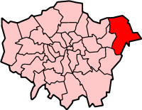
Romford shown within Greater LondonPopulation 36,500 (2005)[1] OS grid reference TQ510887 - Charing Cross 14.1 mi (22.7 km) SW London borough Havering Ceremonial county Greater London Region London Country England Sovereign state United Kingdom Post town ROMFORD Postcode district RM1, RM6 Dialling code 01708 Police Metropolitan Fire London Ambulance London EU Parliament London UK Parliament Romford London Assembly Havering and Redbridge List of places: UK • England • London Romford is a large suburban town in north east London,[2] England and the administrative headquarters of the London Borough of Havering. It is located 14.1 miles (22.7 km) northeast of Charing Cross and is one of the major metropolitan centres identified in the London Plan.[3] It was historically a market town in the county of Essex[4] and formed the administrative centre of the liberty of Havering, until it was dissolved in 1892.[5] Good road links and the opening of the railway station in 1839 were key to the development of the town[4] and the economic history of Romford is underpinned by a shift from agriculture to light industry and more recently to retail and commerce.[4] As part of the suburban growth of London in the 20th century, Romford significantly expanded and increased in population,[6] becoming a municipal borough in 1937[7] and has formed part of Greater London since 1965.[8] It now forms one of the largest commercial, retail, entertainment and leisure districts outside central London[1] and has a developed night time economy.[9]
Contents
History
Romford (parish) population 1881 9,050 1891 10,722 1901 13,656 1911 16,970 1921 19,442 1931 35,918 1941 war # 1951 76,580 1961 114,584 # no census was held due to war source: UK census[6][10] Toponymy
Romford is first recorded in 1177 as Romfort, which is formed from Old English 'rūm' and 'ford' and means "the wide or spacious ford".[11] The naming of the River Rom is a local 'back-formation' from the name of the town; and the river is elsewhere known as the Beam. The ford most likely existed on the main London to Colchester road where it crossed that river.[11]
Economic development
The town developed in the Middle Ages on the main road to London and the regionally significant Romford Market was established in 1247.[4] The early history of Romford and the immediate area is agricultural and it is recorded as being the location of a number of mills used to grind corn.[4] The area was a focus of the leather industry from the 15th to the early 19th centuries and there is record of a wide range of industries such as cloth making, weaving, charcoal burning, metal working and brewing.[4] Communications played an important part in its development; the main road to London was maintained by the Middlesex and Essex Turnpike Trust from 1721 and Romford became a coaching town in the 18th century.[12] Several failed attempts were made in the early 19th century to connect the town to the Thames via a Romford Canal. Initially intended to transport agricultural products to London and later intended to serve growing industrial sites in Romford, only two miles of canal were constructed and the canal company were unable to reach the town.[13]
The development of the town was accelerated by the opening of the railway station in 1839 which stimulated the local economy and was key to the development of the Star Brewery. Initially Eastern Counties Railway services operated between Mile End and Romford, with extensions to Brentwood and to Shoreditch in 1840. A second station was opened on South Street in 1892 by the London, Tilbury and Southend Railway on the line to Upminster and Grays, giving Romford a rail connection to Tilbury Docks. The two stations were combined into one in 1934.[12] Light industry slowly developed, reaching a peak in the 1970s with a number of factories on the edge of town, such as the Roneo Vickers office machinery company, Colvern manufacturers of wireless components, May's Sheet Metal Works and brush manufacturers Betterware.[4] Suburban expansion increased the population and reinforced Romford's position as a significant regional town centre. The Liberty Shopping Centre was constructed in the 1960s and has been recently modernised and supplemented with further shopping centres throughout the town, including The Mall, opened in 2006; and The Brewery, opened in 2000 on the site of the old Star Brewery.[14]
Local government
 The coat of arms granted to Romford Borough Council in 1938 and in use until 1965
Romford formed a chapelry in the large ancient parish of Hornchurch in the Becontree hundred of Essex; it included Collier Row, Harold Wood, and Noak Hill.[15] Through ancient custom the area enjoyed special status and a charter in 1465 removed the parish from the Becontree hundred and the county of Essex and it instead formed the independent liberty of Havering.[5] Over time the vestry of Romford chapelry absorbed the local powers that would usually be held by the parish authorities[15] and in 1849 Romford became a separate parish within the liberty.[16] Improvement commissioners were set up in 1819 for paving, lighting, watching, and cleansing of the marketplace and main streets.[15] As the town grew this arrangement became ineffective at controlling sanitation and in 1851 a local board of health was set up for the parish; although its area was reduced in 1855 to cover only the town.[15] The remainder of the parish became part of the Romford rural sanitary district in 1875. These changes and the introduction of the Romford Poor Law Union in 1836[15] eroded the powers of the liberty and it was finally abolished in 1892 and reincorporated into Essex.[5]
The Local Government Act 1894 reformed local government and created the Romford Urban District and Romford Rural District to replace the local board and sanitary district; and the Romford parish was split into Romford Urban and Romford Rural along the lines of the urban district.[15] In 1900 the parish was recombined and the urban district expanded to cover all of the former area of the historic chapelry, except for Noak Hill which remained in the rural district and had become a parish in its own right in 1895.[15] The enlarged urban district formed part of the London Traffic Area from 1924 and the London Passenger Transport Area from 1933.[17] The suburban expansion of London caused an increase in population during the 1930s[6] and the urban district was expanded further in 1934, taking in the parishes of Havering-atte-Bower and Noak Hill.[7] It was incorporated as the Municipal Borough of Romford in 1937.[7] In 1965 the municipal borough was abolished and its former area was combined with that of Hornchurch Urban District; it was again removed from Essex and since then has formed the northern part of the London Borough of Havering in Greater London.[18]
Suburban expansion
 Romford Urban District (1) absorbed Havering-atte-Bower (2) and Noak Hill (3) in 1934[7]
There was early expansion in the 1840s in the area currently occupied by the Waterloo estate, and then known as New Romford, where 200 cottages were built.[12] To the east of the market place from 1850 middle class suburban housing was constructed with a much larger area of 200 acres (81 ha) built-over to the south of the railway from 1851. Through a gradual process of selling off former manors, houses were built radiating from the town in all directions for about a mile. More significant growth occurred between 1910 and 1911 with the construction of Gidea Park Garden Suburb, which included Raphael Park and Gidea Park railway station.[12] Large sections of land to the north of the town at Collier Row were developed in the interwar period and after World War II, the London County Council built the Harold Hill estate to the north east from 1948 to 1958.[12]
The right to supply electricity to the town was secured by the County of London Electricity Supply Company in 1913. Initially power was generated within the Star Brewery site, with the supply switching to Barking Power Station in 1925.[15] Gas supply began in 1825 with gas works of 25 acres (10 ha) constructed by 1938.[15] Following the Telegraph Act 1899 Romford became part of the Post Office London telephone area[19] and the Romford exchange was recorded as having 240 subscribers in 1916.[20] The town water supply initially came from the Havering Well, and 1859 a new public well and pump was built at the east end of the market.[15] The South Essex Waterworks Company started installing mains water supply in 1863 and had offices in South Street. By 1905 its supply was serving Ilford, Collier Row, Ardleigh Green, Brentwood, and Hornchurch. Sewage works were installed by the local board at Oldchurch in 1862, with further works built in Hornchurch in 1869.[15]
Governance
 Romford constituency in Greater London
The Romford UK Parliament constituency consists of the Havering wards of Brooklands, Havering Park, Mawneys, Pettits, Romford Town, and Squirrel's Heath. In 2001 it had a population of 76,323.[21] The current MP is Andrew Rosindell, a native of the town. Romford forms part of the Havering and Redbridge London Assembly constituency and the London European Parliament constituency. Each ward elects three councillors to Havering London Borough Council. From the next UK general election the constituency will also include the Hylands ward. The councillors elected in 2006 were: Brooklands – 3 Conservative;[22] Havering Park – 2 Conservative and 1 Collier Row and Mawneys Residents Association;[23] Mawneys – 3 Conservative;[24] Pettits – 3 Conservative;[25] Romford Town – 3 Conservative;[26] Squirrel's Heath – 3 Conservative after 2007 by-election;[27] and Hylands – 3 Conservative.[28]
Geography
Further information: Geography of London The River Rom emerges from underground channels at Roneo Corner
 Map of Romford and its environs
The town centre is about 50 feet (15 m) above sea level on a gravel terrace rising from the River Thames.[12] The north of the town has developed on London Clay and is situated as much as 150 feet (46 m) above sea level. The town centre is for the most part contained within a ring road formed of St Edwards Way, Mercury Gardens, Thurloe Gardens, Oldchurch Road and Waterloo Road. The market place and much of South Street and the High Street are pedestrianised.[1] The railway cuts through the town from east to west on a viaduct, with the bulk of the central Romford area to its north. The River Rom flows through the town in underground channels and joins the Thames after flowing through Hornchurch;[12] elsewhere along its course it is known as the River Beam[11] and forms part of the strategic waterways Blue Ribbon Network.[29] Romford has formed part of the continuously built-up area of London since the 1930s[30] and is contiguous with Rush Green to the west, Collier Row to the north, Gidea Park to the east and Hornchurch to the south east. The Romford post town covers all of the former municipal borough and extends over a much wider area, including parts of Barking and Dagenham and Epping Forest.[31] Climate data for Romford is taken from the nearest weather station at Greenwich, around 10 miles (16.1 km) south west of the marketplace:
Climate data for London (Greenwich) Month Jan Feb Mar Apr May Jun Jul Aug Sep Oct Nov Dec Year Record high °C (°F) 14.0
(57.2)16.0
(60.8)21.0
(69.8)26.9
(80.4)31.0
(87.8)35.0
(95.0)35.5
(95.9)37.9
(100.2)30.0
(86.0)28.8
(83.8)19.0
(66.2)15.0
(59.0)37.9
(100.2)Average high °C (°F) 8.1
(46.6)8.4
(47.1)11.4
(52.5)14.2
(57.6)17.9
(64.2)21.1
(70.0)23.5
(74.3)23.2
(73.8)19.9
(67.8)15.6
(60.1)11.2
(52.2)8.3
(46.9)15.2 Average low °C (°F) 2.3
(36.1)2.1
(35.8)3.9
(39.0)5.5
(41.9)8.7
(47.7)11.7
(53.1)13.9
(57.0)13.7
(56.7)11.4
(52.5)8.4
(47.1)4.9
(40.8)2.7
(36.9)7.4 Record low °C (°F) −10
(14.0)−9
(15.8)−8
(17.6)−2
(28.4)−1
(30.2)5.0
(41.0)7.0
(44.6)6.0
(42.8)3.0
(37.4)−4
(24.8)−5
(23.0)−7
(19.4)−10
(14.0)Precipitation mm (inches) 55.2
(2.173)40.8
(1.606)41.6
(1.638)43.6
(1.717)49.3
(1.941)44.9
(1.768)44.5
(1.752)49.5
(1.949)49.1
(1.933)68.5
(2.697)59.0
(2.323)55.0
(2.165)601.5
(23.681)Snowfall cm (inches) 24.4
(9.61)10.8
(4.25)2.7
(1.06)0.4
(0.16)0
(0)0
(0)0
(0)0
(0)0
(0)0
(0)0.2
(0.08)8.2
(3.23)46.7
(18.39)% humidity 91 89 91 90 92 92 93 95 96 95 93 91 92.3 Avg. rainy days (≥ 1 mm) 10.9 8.1 9.8 9.3 8.5 8.4 7.0 7.2 8.7 9.3 9.3 10.1 106.6 Avg. snowy days 4 4 3 1 0 0 0 0 0 0 1 3 16 Sunshine hours 45.9 66.1 103.2 147.0 185.4 180.6 190.3 194.4 139.2 109.7 60.6 37.8 1,460.2 Source no. 1: Record highs and lows from BBC Weather,[32] except August maximum from Met Office[33] Source no. 2: All other data from Met Office,[34] except for humidity and snow data which are from NOAA[35] Demography
Romford compared (2001 Census) Statistic Romford
Town[36]Brooklands[37] Havering[36] London[36] England[36] Ethnic group White 12,247 11,987 213,421 5,103,203 44,679,361 Asian 388 374 4,088 866,693 2,248,289 Black 234 389 3,139 782,849 1,132,508 Mixed 200 161 2,298 226,111 643,373 Chinese/Other 131 113 1,302 193,235 435,300 Population Total 13,200 13,024 224,248 7,172,091 49,138,831 Density(/hectare) 46.05 31.00 19.97 45.62 3.77 Households 5,829 5,361 91,722 3,015,997 20,451,427 The Havering committee area for Romford is defined as the wards of Romford Town and Brooklands.[38] Demographic data is produced by the Office for National Statistics for these wards. In 2001 the population of Romford Town was 13,200[36] and Brooklands was 13,024,[37] giving a total population of 26,224. In contrast, the approximate population of the area within the 2005 Romford Urban Strategy was estimated to be 36,500.[1] 71.52% in Romford Town and 70.48% in Brooklands report their religion as Christian, compared to 76.13% for Havering, 58.23% in London and 71.74% in England. 15.71% in Romford Town and 16.62% in Brooklands report having no religion, compared to 13.18% in Havering, 15.76% in London and 14.59% in England.[36][37]
Economy
Romford is recognised in the London Plan as one of eleven regionally significant metropolitan centres in Greater London, with a considerable catchment area.[1] The total commercial floorspace in the town was 353,258 square metres (3,802,440 sq ft) in 2002, of which 147,627 square metres (1,589,040 sq ft) is retail space and 63,357 square metres (681,970 sq ft) is offices. The retail space is growing and in 2005 consisted of 2,000,000 square feet (190,000 m2).[14] The retail economy is complemented by a central business district close to the railway station, where the offices of employers such as Aon are located. Employment in the town centre was categorised in 2002 as approximately 40% commercial office, 40% comparison retail, 10% hospitality, 5% public sector, 2.5% service retail and 2.5% arts and entertainment.[1] Compared to the similar east London areas of Ilford, Stratford and Barking, there is more comparison retail and commercial office employment in Romford and less public sector work.[1] The total turnover of £413,395,000 in 2002 for Romford was larger than any other comparable town centre in east London and approximately 70% came from the commercial office businesses.[1] There is a developed night time economy, greater than in any other metropolitan centre in Greater London, with 8,360 square metres (90,000 sq ft) of cinemas, theatres and concert hall space; 9,530 square metres (102,600 sq ft) of bars and pubs; 5,510 square metres (59,300 sq ft) of cafes and restaurants; and 2,680 square metres (28,800 sq ft) of fast food and take away venues.[9] The night time economy is almost as significant as the day economy with around 12,000 visit to Romford during the day and 11,000 visit to pubs, clubs and bars at night.[1]
Transport
Further information: Transport in London and Public transport in Havering Romford railway station
The town is served by Romford railway station on the Great Eastern Main Line in London fare zone 6.[39] Trains calling at the station are operated by National Express East Anglia and are primarily of the high-frequency stopping Liverpool Street-Shenfield service.[40] There are also a limited number of outer-suburban express services to Southend-on-Sea[41] and Clacton,[42] mostly during off-peak times. A branch line shuttle on the Romford to Upminster Line connects Romford to Emerson Park and Upminster.[40] Romford is a hub of the London Buses network with services to Canning Town, Stratford, Leytonstone and Dagenham as well as feeder services from the large nearby housing developments at Collier Row and Harold Hill.[43] There are night bus services to Stratford, Harold Hill and Paddington.[44] Romford town centre has a very high Public Transport Accessibility Level score of 6.[1] The trunk A12 road passes to the north of Romford while the A118 road from Stratford connects with it at Gallows Corner at the start of the A127 road to Southend.[45] It is planned that the Liverpool Street-Shenfield service will become part of Crossrail[46] and there is a proposal that Romford will be served by a future extension of the East London Transit.[47]
Culture
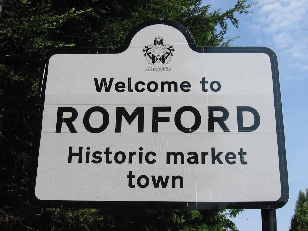
 Welcome sign at Roneo Corner with the coat of arms and motto of Havering London Borough Council
Havering Council's urban strategy aims to make Romford a cultural destination, whilst recognising that Hornchurch forms the main cultural hub of the borough with a large theatre and arts spaces.[1] As a former market and coaching town, Romford is well served by public houses and two that are located in the market place are listed buildings.[48] The market and adjacent streets also form a conservation area.[1][49] Mass entertainment facilities in the town include Romford Greyhound Stadium, one of the few remaining dog racing tracks in London;[50] a 16 screen multiplex cinema;[1] and Romford Ice Arena, which is home to the local Romford Raiders ice hockey team.[51] There is also a Romford F.C. associated with the town.[52] The town is strongly associated with the electronic music group Underworld.[53]
“ Ride the sainted rhythms on the midnight train to Romford ” —Dirty Epic on dubnobasswithmyheadman, Underworld (1994)[53]
Romford's position as a focus for electronic music production was reinforced by the presence of the Strictly Underground and Suburban Base record labels, with Suburban Base developing from the Boogie Times record store.[54] According to a Billboard article in 1992, Romford-produced dance music formed part of a trend favouring suburban and provincial "bedroom" record labels to those in central London.[55] The local newspapers for the town and the borough of Havering are the Romford Recorder, Romford and Havering Post and Romford Yellow Advertiser.
See also
References
- ^ a b c d e f g h i j k l m Urban Practitioners & Allies and Morrison (July 2005). "Romford Urban Strategy". Havering London Borough Council. http://www.havering.gov.uk/CHttpHandler.ashx?id=4743&p=0. Retrieved 2009-08-14.
- ^ Mayor of London (February 2008). "North East London sub region". Greater London Authority. http://www.london.gov.uk/thelondonplan/images/maps-diagrams/jpg/map-5c-1.jpg. Retrieved 2009-08-06.
- ^ Mayor of London (February 2008). "London Plan (Consolidated with Alterations since 2004)". Greater London Authority. http://www.london.gov.uk/thelondonplan/docs/londonplan08.pdf. Retrieved 2009-08-06.
- ^ a b c d e f g Powell, W.R. (Edr.) (1978). Romford: Economic History, A History of the County of Essex: Volume 7. Victoria County History. British History Online. http://www.british-history.ac.uk/report.asp?compid=42817. Retrieved 2009-08-06.
- ^ a b c Powell, W.R. (Edr.) (1978). The liberty of Havering-atte-Bower, A History of the County of Essex: Volume 7. Victoria County History. British History Online. http://www.british-history.ac.uk/report.aspx?compid=42805. Retrieved 2009-08-16.
- ^ a b c Vision of Britain - Romford parish (created 1900) population. Retrieved on 2009-08-06.
- ^ a b c d Vision of Britain - Romford UD/MB (historic map). Retrieved on 2009-08-14.
- ^ Young, K. & Garside, P., (1982). Metropolitan London: Politics and Urban Change 1837-1981.
- ^ a b Mayor of London (June 2006). "Managing the Night Time Economy". Greater London Authority. http://www.london.gov.uk/archive/mayor/strategies/sds/docs/bpg-nighttime-economy.pdf. Retrieved 2009-08-14.
- ^ Vision of Britain - Romford parish (abolished 1894) population. Retrieved on 2009-08-06.
- ^ a b c Mills, A.D. (2001). Dictionary of London Place Names. Oxford.
- ^ a b c d e f g Powell, W.R. (Edr.) (1978). Romford: Introduction, A History of the County of Essex: Volume 7. Victoria County History. British History Online. http://www.british-history.ac.uk/report.aspx?compid=42815. Retrieved 2009-08-06.
- ^ "Archaeological Investigations Project 2001: Greater London". Bournemouth University. 2001. http://csweb.bournemouth.ac.uk/aip/gaz2001/b/gl/17b0101.pdf. Retrieved 2009-08-14.
- ^ a b Havering London Borough Council. "Romford Town Centre". http://www.havering.gov.uk/index.cfm?articleid=2402. Retrieved 2009-08-06.
- ^ a b c d e f g h i j k Powell, W.R. (Edr.) (1978). Romford: Local government, A History of the County of Essex: Volume 7. Victoria County History. British History Online. http://www.british-history.ac.uk/report.aspx?compid=42818. Retrieved 2009-08-06.
- ^ Vision of Britain - Havering atte Bower liberty. Retrieved on 2009-08-06.
- ^ Robson, William (1939). The Government and Mis-government of London. London: Allen & Unwin.
- ^ Vision of Britain - Havering LB (historic map). Retrieved on 2009-08-06.
- ^ Crang, Crang & May (1999). Virtual Geographies. Routledge.
- ^ "London Telephone Area in 1916". Private Line. http://www.privateline.com/TelephoneHistory3A/london1916big.gif. Retrieved 2008-08-14.
- ^ "2001 Census, Census Area Statistics, Key Figures, Area: Romford (Westminster Parliamentary Constituency)". Office for National Statistics. 2001. http://www.neighbourhood.statistics.gov.uk/dissemination/LeadKeyFigures.do?a=7&b=6021560&c=Romford&d=27&e=16&g=336453&i=1001x1003x1004&m=0&r=1&s=1250178624567&enc=1. Retrieved 2009-08-14.
- ^ "Brooklands Ward". Havering London Borough Council. http://www.havering.gov.uk/index.aspx?articleid=2921. Retrieved 2009-08-14.
- ^ "Havering Park Ward". Havering London Borough Council. http://www.havering.gov.uk/index.aspx?articleid=6039. Retrieved 2009-08-14.
- ^ "Mawneys Ward". Havering London Borough Council. http://www.havering.gov.uk/index.aspx?articleid=6042. Retrieved 2009-08-14.
- ^ "Pettits Ward". Havering London Borough Council. http://www.havering.gov.uk/index.aspx?articleid=6043. Retrieved 2009-08-14.
- ^ "Romford Town Ward". Havering London Borough Council. http://www.havering.gov.uk/index.aspx?articleid=6046. Retrieved 2009-08-14.
- ^ "Squirrel's Heath Ward". Havering London Borough Council. http://www.havering.gov.uk/index.aspx?articleid=6048. Retrieved 2009-08-14.
- ^ "Hylands Ward". Havering London Borough Council. http://www.havering.gov.uk/index.aspx?articleid=6041. Retrieved 2009-08-14.
- ^ Mayor of London (2004). "The blue ribbon network". Greater London Authority. http://www.london.gov.uk/thelondonplan/images/maps-diagrams/jpg/map-4c-1.jpg. Retrieved 2009-08-14.
- ^ Robson, William (1939). The Government and Mis-government of London. London: Allen & Unwin. pp. 26–27.
- ^ Royal Mail (2004). Address Management Guide. Royal Mail Group. p. 168.
- ^ "London, Greater London: Average conditions". BBC Weather. Archived from the original on 2011-02-28. http://www.webcitation.org/5wpjdyrKA.
- ^ "August 2003 — Hot spell". Met Office. Archived from the original on 2011-02-28. http://www.webcitation.org/5wpjI9SEw.
- ^ "Met Office: Climate averages 1971-2000". Met Office. Archived from the original on 2011-02-28. http://www.webcitation.org/5wpl3HnmR.
- ^ "NOAA". NOAA. ftp://dossier.ogp.noaa.gov/GCOS/WMO-Normals/RA-VI/UK/03776.TXT.
- ^ a b c d e f Neighbourhood Statistics (2001). "2001 Census: Census Area Statistics, Area: Romford Town (Ward)". Office for National Statistics. http://www.neighbourhood.statistics.gov.uk/dissemination/LeadDatasetList.do?a=7&b=6101459&c=romford+town&d=14&g=336981&i=1001x1003&m=0&r=1&s=1250249935350&enc=1&domainId=16. Retrieved 2008-08-14.
- ^ a b c Neighbourhood Statistics (2001). "2001 Census: Census Area Statistics, Area: Brooklands (Ward)". Office for National Statistics. http://www.neighbourhood.statistics.gov.uk/dissemination/LeadDomainList.do?a=7&c=brooklands&d=14&i=1001x1002&m=0&r=1&s=1250250515670&enc=1&areaId=6095789&OAAreaId=336453. Retrieved 2008-08-14.
- ^ Romford Area Committee (June 2009). "Romford Area Committee (Brooklands and Romford Town Wards) Agenda". Havering London Borough Council. http://www.havering.gov.uk/CHttpHandler.ashx?id=18286&p=0. Retrieved 2008-08-14.
- ^ Transport for London (March 2009). "High frequency services". Greater London Authority. http://www.tfl.gov.uk/assets/downloads/high-frequency-services-map.pdf. Retrieved 2008-08-14.
- ^ a b National Express East Anglia (May 2009). "Table 6". National Express Group. http://www.nationalexpresseastanglia.com/content/download/33035/382359/file/Table+6+Shenfield+to+Liverpool+Street.pdf. Retrieved 2009-08-13.
- ^ National Express East Anglia (May 2009). "Table 7". National Express Group. http://www.nationalexpresseastanglia.com/content/download/33037/382367/file/Table+7+Southed+Victoria+to+Liverpool+Street.pdf. Retrieved 2009-08-16.
- ^ National Express East Anglia (May 2009). "Table 10". National Express Group. http://www.nationalexpresseastanglia.com/content/download/33020/382299/file/Table+10+Clacton+on+Sea+to+Liverpool+Street.pdf. Retrieved 2009-08-16.
- ^ Transport for London (September 2008). "Buses from Romford". Greater London Authority. http://origin.tfl.gov.uk/tfl/gettingaround/maps/buses/pdf/romfordquad-12248.pdf. Retrieved 2009-08-06.
- ^ Transport for London (June 2009). "Night buses in north east London". Greater London Authority. http://www.tfl.gov.uk/tfl/gettingaround/maps/buses/pdf/nightbuseseastlondon-13740.pdf. Retrieved 2009-08-13.
- ^ "Map of Havering". Havering London Borough Council. http://www.havering.gov.uk/media/image/g/i/haveringmap_1.gif. Retrieved 2008-08-16.
- ^ "Crossrail maps: Route map". Crossrail. http://www.crossrail.co.uk/the-railway/crossrail-maps. Retrieved 2009-08-14.
- ^ Transport for London. "East London Transit". Greater London Authority. http://www.tfl.gov.uk/corporate/projectsandschemes/2123.aspx. Retrieved 2009-08-06.
- ^ "Listed buildings in Romford". Havering London Borough Council. http://www.havering.gov.uk/index.aspx?articleid=8760. Retrieved 2010-01-04.
- ^ Planning Department (2006). "Romford Conservation Area". Havering London Borough Council. http://www.havering.gov.uk/CHttpHandler.ashx?id=2372&p=0. Retrieved 2009-09-21.
- ^ BBC News (19 May 2008). "Walthamstow race track to close". BBC. http://news.bbc.co.uk/1/hi/england/london/7408061.stm. Retrieved 2009-08-16.
- ^ "Hockey is Back!". Romford Ice Arena. Archived from the original on April 6, 2008. http://web.archive.org/web/20080406034640/http://www.romfordicearena.co.uk/hockey.htm. Retrieved 2009-08-14.
- ^ Romford Football Club. "History". http://www.romfordfc.com/. Retrieved 2009-08-14.
- ^ a b Ben Thompson (2000-08-25). "On top of the Underworld". London: The Independent. http://www.independent.co.uk/arts-entertainment/music/features/on-top-of-the-underworld-697475.html. Retrieved 2009-08-14.
- ^ Shapiro, Peter (1999). Drum 'n' bass: the rough guide. Rough Guides.
- ^ Sexton, Paul (August 1992). UK indies step outside london for dance hits. Billboard.
External links
London Borough of Havering Districts Ardleigh Green · Chase Cross · Coldharbour · Collier Row · Corbets Tey · Cranham · Elm Park · Emerson Park · Frog Island · Gallows Corner · Gidea Park · Hacton · Harold Hill · Harold Park · Harold Wood · Havering-atte-Bower · Heath Park · Hornchurch · Noak Hill · North Ockendon · Rainham · Rise Park · Romford · Rush Green · South Hornchurch · Upminster · Upminster Bridge · Wennington
Attractions CEME · The Diver · Havering Museum · Langtons · Queen's Theatre · Rainham Hall · Tithe Barn Museum · Upminster WindmillMajor retail Parks and open spaces Bedfords Park · Dagnam Park · Havering Country Park · Hornchurch Country Park · Pyrgo Park · Tylers Common · Wildspace Conservation Park · Upminster ParkConstituencies Tube and rail stations Other topics Categories:- Districts of London
- Districts of Havering
- Metropolitan centres of London
- Market towns in London


Wikimedia Foundation. 2010.