- Meagher County, Montana
-
Meagher County, Montana 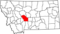
Location in the state of Montana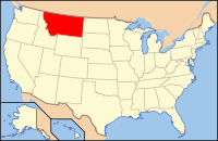
Montana's location in the U.S.Founded 1867 Seat White Sulphur Springs Largest city White Sulphur Springs Area
- Total
- Land
- Water
2,395 sq mi (6,203 km²)
2,392 sq mi (6,195 km²)
3 sq mi (8 km²), 0.13%Population
- (2010)
- Density
1,891Website www.meaghercounty.org Meagher County (pronounced Marr) is a county located in the U.S. state of Montana. As of 2010, the population was 1,891. Its county seat is White Sulphur Springs[1]. The center of population of Montana is also located in Meagher County at 46°48′48″N 111°12′35″W / 46.813302°N 111.209708°W[2]
Contents
Geography
According to the U.S. Census Bureau, the county has a total area of 2,395 square miles (6,200 km2), of which, 2,392 square miles (6,200 km2) of it is land and 3 square miles (7.8 km2) of it (0.13%) is water.
Major highways
 U.S. Highway 12
 U.S. Highway 89
Adjacent Counties
- Cascade County, Montana - north
- Judith Basin County, Montana - northeast
- Wheatland County, Montana - east
- Sweet Grass County, Montana - southeast
- Park County, Montana - south
- Gallatin County, Montana - south
- Broadwater County, Montana - west
- Lewis and Clark County, Montana - northwest

Lewis and Clark County Cascade County Judith Basin County Broadwater County 
Wheatland County  Meagher County, Montana

Park County, Gallatin County Sweet Grass County National protected areas
- Gallatin National Forest (part)
- Helena National Forest (part)
- Lewis and Clark National Forest (part)
Demographics
Historical populations Census Pop. %± 1870 1,387 — 1880 2,743 97.8% 1890 4,749 73.1% 1900 2,526 −46.8% 1910 4,190 65.9% 1920 2,622 −37.4% 1930 2,272 −13.3% 1940 2,237 −1.5% 1950 2,079 −7.1% 1960 2,616 25.8% 1970 2,122 −18.9% 1980 2,154 1.5% 1990 1,819 −15.6% 2000 1,932 6.2% 2010 1,891 −2.1% As of the census[3] of 2000, there were 1,932 people, 803 households, and 529 families residing in the county. The population density was <1/km² (1/sq mi). There were 1,363 housing units at an average density of <1/km² (1/sq mi). The racial makeup of the county was 97.20% White, 1.04% Native American, 0.16% Asian, 0.05% Pacific Islander, 0.57% from other races, and 0.98% from two or more races. 1.50% of the population were Hispanic or Latino of any race. 28.8% were of German, 14.5% Norwegian, 13.3% English, 12.4% Irish and 7.8% American ancestry according to Census 2000.
There were 803 households out of which 27.30% had children under the age of 18 living with them, 56.80% were married couples living together, 6.10% had a female householder with no husband present, and 34.10% were non-families. 31.00% of all households were made up of individuals and 13.70% had someone living alone who was 65 years of age or older. The average household size was 2.37 and the average family size was 3.00.
In the county the population was spread out with 25.00% under the age of 18, 6.10% from 18 to 24, 22.70% from 25 to 44, 28.10% from 45 to 64, and 18.20% who were 65 years of age or older. The median age was 43 years. For every 100 females there were 100.40 males. For every 100 females age 18 and over, there were 100.40 males.
The median income for a household in the county was $29,375, and the median income for a family was $33,879. Males had a median income of $22,083 versus $15,417 for females. The per capita income for the county was $15,019. About 16.40% of families and 18.90% of the population were below the poverty line, including 27.40% of those under age 18 and 13.00% of those age 65 or over.
History
Meagher County was named for Thomas Francis Meagher, territorial governor of Montana.
The first county seat was Diamond City, the main city of the Confederate Gulch mining district. This entire area is no longer part of Meagher County, but today lies in neighboring Broadwater County.
Communities
City
Unincorporated communities
See also
- List of cemeteries in Meagher County, Montana
- List of lakes in Meagher County, Montana
- Confederate Gulch and Diamond City (historically in Meagher County, but now in Broadwater County)
- List of mountains in Meagher County, Montana
- National Register of Historic Places listings in Meagher County, Montana
References
- ^ "Find a County". National Association of Counties. http://www.naco.org/Counties/Pages/FindACounty.aspx. Retrieved 2011-06-07.
- ^ "Population and Population Centers by State:2000" (txt). United States Census Bureau. http://www.census.gov/geo/www/cenpop/statecenters.txt. Retrieved 2007-02-23.
- ^ "American FactFinder". United States Census Bureau. http://factfinder.census.gov. Retrieved 2008-01-31.
Municipalities and communities of Meagher County, Montana City 
Unincorporated
communitiesMartinsdale | Minden | Ringling | Sixteen
 State of Montana
Topics - Index
- History
- Governors
- People
- Geography
- State Government
- Delegations
- Visitor Attractions
Society - Crime
- Demographics
- Economy
- Education
- Politics
Regions - The Flathead
- Glacier National Park
- Regional designations of Montana
- Western Montana
- Yellowstone
Largest cities Counties - Beaverhead
- Big Horn
- Blaine
- Broadwater
- Carbon
- Carter
- Cascade
- Chouteau
- Custer
- Daniels
- Dawson
- Deer Lodge
- Fallon
- Fergus
- Flathead
- Gallatin
- Garfield
- Glacier
- Golden Valley
- Granite
- Hill
- Jefferson
- Judith Basin
- Lake
- Lewis and Clark
- Liberty
- Lincoln
- Madison
- McCone
- Meagher
- Mineral
- Missoula
- Musselshell
- Park
- Petroleum
- Phillips
- Pondera
- Powder River
- Powell
- Prairie
- Ravalli
- Richland
- Roosevelt
- Rosebud
- Sanders
- Sheridan
- Silver Bow
- Stillwater
- Sweet Grass
- Teton
- Toole
- Treasure
- Valley
- Wheatland
- Wibaux
- Yellowstone
Categories:- Montana counties
- Meagher County, Montana
- Montana counties on the Missouri River


Wikimedia Foundation. 2010.