- Randolph County, Missouri
-
Randolph County, Missouri 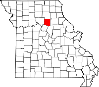
Location in the state of Missouri
Missouri's location in the U.S.Founded 1829 Seat Huntsville Area
- Total
- Land
- Water
487.65 sq mi (1,263 km²)
482.32 sq mi (1,249 km²)
5.33 sq mi (14 km²), 1.09%Population
- (2008)
- Density
25,723
52/sq mi (20/km²)Website www.randolphcounty-mo.gov Randolph County is a county located in the U.S. state of Missouri.As of the 2008 estimate the population is 25,723 . As of 2000, the population was 24,663. Its county seat is Huntsville[1]. The county was organized in 1829 and named for John Randolph of Roanoke, congressman and U.S. senator from Virginia.
Contents
History
Randolph County was settled, primarily, by migrants from the Upper South states, especially Kentucky and Tennessee. They brought slaves and slaveholding traditions with them, and quickly started cultivating crops similar to those in Middle Tennessee and Kentucky: hemp and tobacco. Randolph was one of several counties settled mostly by southerners to the north and south of the Missouri River. Given their culture and traditions, this area became known as Little Dixie and Randolph was at its heart.[2]
Geography
According to the 2000 census, the county has a total area of 487.65 square miles (1,263.0 km2), of which 482.32 square miles (1,249.2 km2) (or 98.91%) is land and 5.33 square miles (13.8 km2) (or 1.09%) is water.[3]
Adjacent counties
- Macon County (north)
- Monroe County (east)
- Shelby County (northeast)
- Audrain County & Boone County (southeast)
- Howard County (south)
- Chariton County (west)
Major highways
 U.S. Route 24
 U.S. Route 63
 Route 3
Demographics
Historical populations Census Pop. %± 1900 24,442 — 1910 26,182 7.1% 1920 27,633 5.5% 1930 26,431 −4.3% 1940 24,458 −7.5% 1950 22,918 −6.3% 1960 22,014 −3.9% 1970 22,434 1.9% 1980 25,460 13.5% 1990 24,370 −4.3% 2000 24,663 1.2% As of the census[4] of 2000, there were 24,663 people, 9,199 households, and 6,236 families residing in the county. The population density was 51 people per square mile (20/km²). There were 10,740 housing units at an average density of 22 per square mile (9/km²). The racial makeup of the county was 90.58% White, 7.03% Black or African American, 0.48% Native American, 0.39% Asian, 0.02% Pacific Islander, 0.24% from other races, and 1.26% from two or more races. 1.14% of the population were Hispanic or Latino of any race. 24.1% were of German, 21.4% American, 10.9% English and 9.1% Irish ancestry according to Census 2000.
There were 9,199 households out of which 31.40% had children under the age of 18 living with them, 52.70% were married couples living together, 11.10% had a female householder with no husband present, and 32.20% were non-families. 27.90% of all households were made up of individuals and 13.10% had someone living alone who was 65 years of age or older. The average household size was 2.43 and the average family size was 2.94.
In the county the population was spread out with 23.80% under the age of 18, 9.60% from 18 to 24, 29.30% from 25 to 44, 22.40% from 45 to 64, and 14.80% who were 65 years of age or older. The median age was 37 years. For every 100 females there were 107.50 males. For every 100 females age 18 and over, there were 108.10 males.
The median income for a household in the county was $31,464, and the median income for a family was $39,268. Males had a median income of $26,878 versus $20,366 for females. The per capita income for the county was $15,010. About 9.20% of families and 12.50% of the population were below the poverty line, including 17.10% of those under age 18 and 13.20% of those age 65 or over.
Cities and towns
See also
- National Register of Historic Places listings in Randolph County, Missouri
References
- ^ "Find a County". National Association of Counties. http://www.naco.org/Counties/Pages/FindACounty.aspx. Retrieved 2011-06-07.
- ^ The Story of Little Dixie, Missouri, Missouri Division, Sons of Confederate Veterans, accessed 3 June 2008
- ^ "Census 2000 U.S. Gazetteer Files: Counties". United States Census. http://www.census.gov/tiger/tms/gazetteer/county2k.txt. Retrieved 2011-02-13.
- ^ "American FactFinder". United States Census Bureau. http://factfinder.census.gov. Retrieved 2008-01-31.
External links
- Digitized 1930 Plat Book of Randolph County from University of Missouri Division of Special Collections, Archives, and Rare Books

Macon County Chariton County 
Monroe County  Randolph County, Missouri

Howard County Audrain County and Boone County Municipalities and communities of Randolph County, Missouri Cities Clark | Clifton Hill | Higbee | Huntsville | Moberly

Villages Cairo | Jacksonville | Renick
Townships Cairo | Chariton | Clifton | Jackson | Moniteau | North Sugar Creek | Prairie | Salt River | Salt Springs | Silver Creek | South Sugar Creek | Union
Categories:- Missouri counties
- Little Dixie (Missouri)
- Randolph County, Missouri


Wikimedia Foundation. 2010.