- Dent County, Missouri
-
Dent County, Missouri 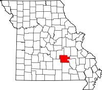
Location in the state of Missouri
Missouri's location in the U.S.Founded February 10, 1851 Named for Lewis Dent, a pioneer settler Seat Salem Largest city Salem Area
- Total
- Land
- Water
754.51 sq mi (1,954 km²)
753.54 sq mi (1,952 km²)
0.97 sq mi (3 km²), 0.13PopulationEst.
- (2008)
- Density
15,199
20/sq mi (8/km²)Time zone Central: UTC-6/-5 Dent County is a county located in South Central Missouri in the United States. As of the 2000 U.S. Census, the county's population was 14,927. A 2008 estimate, however, showed the population to be 15,119. The largest city and county seat is Salem[1]. The county was officially organized on February 10, 1851, and is named after Lewis Dent, a pioneer settler who came from Virginia in 1835.
Contents
History
One of the early visitors to Dent County, largely unmapped and unknown, was Henry Rowe Schoolcraft. In 1818 he and Levi Pettibone left the Potosi area on an adventure which often left them hungry, lost, lonely and in danger. They started their adventure near Potosi heading west on what is now Highway 8. They turned south through southern Dent and Shannon counties where Schoolcraft found the Current River, "a fine stream with fertile banks and clear, sparkling water.” Today these features attract tourists—particularly floaters who launch canoes by the thousands during the summer to enjoy the springs, caves and fast-moving water of the Current and Jack's Fork Rivers in the Ozark National Scenic Riverways. Schoolcraft traveled on to the Springfield area, then east on White River and north back to Potosi after a trip of 89 days.
The White River trail had been used by Native Americans in Dent County. It later became one of the branches of the Trail of Tears, which brought many Cherokees on their forced trek to Oklahoma. Some stopped in Dent County and many old families are proud of their Cherokee heritage. The "trace" wound from Sligo southwest to the Ephraim Bressie Farm on Spring Creek north of Salem. It left the county about the present Maples.
The first white settler was George Cole, who cleared and cultivated a farm on the Meramec near Short Bend. It was later the site of the Nelson Mill. An abundance of waterpower and difficulty of transportation made mills important in the settling of the new land. Some of the first settlers came in 1829, mostly to the Meramec, Spring Creek and Dry Fork valleys. Land could be purchased for five cents or less an acre. William Thornton, Daniel Troutman and Daniel W. Wooliver were among the 1829 settlers, followed by William Blackwell, Elisha Nelson, Jerry Potts, Ephraim Bressie, Robert Leonard, Abner Wingfield, Lewis Dent, Wilson Craddock, Thomas Higginbotham, Jack Berry, Silas Hamby, Smith Wofford, Turkill McNeill, Dr. John Hyer, Samuel Hyer and David Lenox.
In 1851 the Missouri Assembly created Dent County from Crawford and Shannon counties. It was named for early settler Lewis Dent, who served as the first representative. First county officers were G.D. Breckenridge, Samuel Hyer, Jr., and Jotham Clark. Joseph Millsap served as sheriff and David Henderson as clerk. They met at the Bressie Farm.
Just after the State of Missouri's Legislature passed the laws relating to Village government in 1860, the first mayor of Salem was appointed or elected. He was W.P. Williams, often referred to as "Rip" from the positive and oftentimes violent expression of his feelings and opinions. He lived here a long time and was a prominent citizen throughout his long life. He became mayor in 1860, but how long he served is not known. The American Civil War came about in 1861 and city governments were suspended. After Williams, records show that O.A. Kenemore, a prominent farmer with a home in Salem, became mayor. Next was E.T. Wingo, a lawyer and representative, then C.L. Allen who was also a lawyer but never practiced law. He did, however, serve as Deputy Circuit Clerk and Probate Judge. Allen was followed by Samuel Sachs. No dates are available listing terms of office for these mayors, but it is likely they served from 1870 to 1881.
An earlier log courthouse, built about 1851 or 1852, was Dent County's first and was located on the Wingfield farm northeast of Salem. In 1852-53 a courthouse was built south of the present courthouse. The building measured about 20 by 40 feet (12 m) and was built by J.T. Garvin for $800. It was burned during the Civil War. The next courthouse built in 1864 also fell victim to fire in May 1866. The beautiful Victorian courthouse—which is listed in the National Register of Historic Places—was built in 1870 for $15,500. A.E. Dye came to Dent County to build this courthouse. His son, E.L. Dye, assisted him and was to become the leading builder in the county. W.P. Elmer in his history reports that when the courthouse was finished, pictures of it were published in McClure's Magazine and newspapers in the East to show the development of the West.
Minerals have greatly influenced the Dent County economy. Greatest was the iron furnace built at Sligo starting in 1880 and active until 1923, 43 years. Sligo was the fourth iron works built in the state, following Meramec, Midland and Nova Scotia. There was plenty of iron ore—Simmons Hill in Salem, Orchard and Cherry Valley, Millsap, Pomeroy, Hawkins Banks, Red Hill and Scotia. Mr. Elmer writes in his history that the Sligo furnace was the most successful and continued longer than any other iron furnace in Missouri. The Sligo furnace was built on Crooked Creek and produced 60 to 80 tons of pig iron a day with some runs of up to 100 tons. E.B. Sankey came from New Castle, Pennsylvania in 1870 to survey the St. Louis-Salem and Little Rock Railroad from Cuba to Salem. The Sligo & Eastern Railroad ran a branch to East End to gather wood for the kilns producing charcoal for the furnace. Sligo’s population in its big years reached 1,000.
In recent times the largest mining and milling operations were in the "New Lead Belt" some 30 miles (48 km) east of Salem. St. Joe Lead started the mining boom at Viburnum and soon other major mining companies bought land and mineral rights. The mines brought new families and well-paying jobs with many choosing to live in Salem. Doe Run continues mining and battery reclamation in the area today.
In 1909 a band of 23 pioneers realized the dream of bringing electric lights to Salem with the formation of the Salem Light & Power Co. The city eventually took over the electric system and produced electricity with two big diesel generators. When the generators could no longer meet the demand and were costly to operate the city contracted with Show-Me-Power Cooperative. Mrs. Thomas A. Bruce organized the first telephone system. Charlie Jeffries joined the Bruces to install the system around 1900. Homes paid $1 and stores $1.25 per month. Mrs. Bruce suffered agony from her eyes and was blind for 30 years until her death May 8, 1942. The telephone system was sold to United Telephone, now Sprint.
For a time Salem led the world in the production and shipping of railroad ties. While the early lumber companies cut the vast Ozark pine forests, timber has remained a major asset, with white oak staves for barrels, oak flooring, pallets, charcoal briquettes and lumber. The Bunker-Cul1er Lumber Co. in Bunker was one of the area's biggest industries, and like the mines which hauled wood for the kilns from a large area, Bunker-Cul1er used rails to bring in logs.
Dent County has had its ups and downs economically, but is proud of its record of having five banks during the Great Depression without a failure. The Great Depression years brought many changes. The Civilian Conservation Corps (CCC) brought young men to the area, many of whom stayed. There were CCC camps at Boss and Indian Trail. In the 13,503 acres (54.64 km2) of the Indian Trail Conservation Area, crews built most of the area's 55 miles (89 km) of access roads. The Conservation Department purchased much of the cut-over land for $2.50/acre.
Dent County's skilled labor force made needlework industries a natural. Ely & Walker's four-story factory (now the Fourth Street Mall) was the first. After World War II the Industrial Building Corporation raised funds for the International Shoe Factory. Other factories followed, including Salem Sportswear, Barad Lingerie, Paramount Cap and Hagale. Today, foreign competition has all but wiped out the local needlework industry.
Today's largest employer in Dent County, US Foodservice, is an institutional food business and began in Salem as Craig Distributing. After World War II, Farris Craig started with a panel truck and peanut vending machines. In 1986, the Craigs sold their business to Kraft Foods, which later sold to Alliant, and is now owned by US Foodservice. The Craigs have left their imprint on Salem with Craig Plaza, the Alice Lou Craig Municipal Swimming Pool, the Salem Visitor Center, and the Ozark Natural and Cultural Resource Center.
After World War II and through the 1950s, 60s and 70s, Dent County underwent changes. There were 60 one-room schools in 1950 and consolidation reduced this number to five districts/plus high schools in Salem and Bunker. Roads were built and improved. Salem Memorial District Hospital was built and became a major industry and health provider.
With guidance from Missouri University Extension the county became the Feeder Pig & Calf Capitol of Missouri, with huge sales in spring and fall auctioning large numbers of livestock graded into pens for size and quality. Loss of farm population often due to the aging of farm owners ended these sales.
Education
Of adults 25 years of age and older in Dent County, 66.3% possesses a high school diploma or higher while 10.1% holds a bachelor's degree or higher as their highest educational attainment.
Public Schools
- Dent-Phelps R-III School District - Salem
- Green Forest R-II School District - Salem
- Green Forest Elementary School (K-08)
- North Wood R-IV School District - Salem
- North Wood Elementary School (PK-08)
- Oak Hill R-I School District - Salem
- Oak Hill Elementary School (PK-08)
- Dent-Phelps Elementary School (K-08)
- Salem R-80 School District - Salem
- William H. Lynch Elementary School (K-02)
- Salem Upper Elementary School (03-06)
- Salem Jr. High School (07-09)
- Salem High School (10-12)
Alternative & Vocational Schools
- Salem 61 School - Salem - (K-12) - Special Education
- Ozark Hills State School - Salem - (K-12) - A school for handicapped students and those with other special needs.
Colleges & Universities
- Southwest Baptist University Annex - Salem - A satellite campus of Southwest Baptist University.
Religion
According to the Association of Religion Data Archives County Membership Report (2000), Dent County is a part of the Bible Belt with evangelical Protestantism being the majority religion. The most predominant denominations among residents in Dent County who adhere to a religion are Southern Baptists (67.22%), Pentecostals (6.43%), and Roman Catholics (5.91%).
Geography
According to the 2000 census, the county has a total area of 754.51 square miles (1,954.2 km2), of which 753.54 square miles (1,951.7 km2) (or 99.87%) is land and 0.97 square miles (2.5 km2) (or 0.13%) is water.[2]
Adjacent counties
- Crawford County (north)
- Iron County (northeast)
- Reynolds County (southeast)
- Shannon County (south)
- Texas County (southwest)
- Phelps County (northwest)
National protected areas
- Mark Twain National Forest (part)
- Ozark National Scenic Riverways (part)
Transportation
Major highways
Airports
- Salem Memorial Airport
Demographics
As of the census[3] of 2000, there were 14,927 people, 5,982 households, and 4,277 families residing in the county. The population density was 20 people per square mile (8/km²). There were 6,994 housing units at an average density of 9 per square mile (4/km²). The racial makeup of the county was 97.07% White, 0.40% Black or African American, 0.73% Native American, 0.21% Asian, 0.01% Pacific Islander, 0.17% from other races, and 1.41% from two or more races. Approximately 0.75% of the population were Hispanic or Latino of any race.
There were 5,982 households out of which 30.60% had children under the age of 18 living with them, 59.00% were married couples living together, 9.10% had a female householder with no husband present, and 28.50% were non-families. 25.00% of all households were made up of individuals and 13.10% had someone living alone who was 65 years of age or older. The average household size was 2.45 and the average family size was 2.90.
In the county the population was spread out with 24.90% under the age of 18, 7.60% from 18 to 24, 25.60% from 25 to 44, 24.10% from 45 to 64, and 17.70% who were 65 years of age or older. The median age was 40 years. For every 100 females there were 94.30 males. For every 100 females age 18 and over, there were 90.70 males.
The median income for a household in the county was $32,991, and the median income for a family was $40,258. Males had a median income of $26,590 versus $17,500 for females. The per capita income for the county was $16,728. About 12.70% of families and 17.20% of the population were below the poverty line, including 24.30% of those under age 18 and 12.20% of those age 65 or over.
Cities and towns
Politics
Local
Politics at the local level in Dent County is equally split between the Democratic Party and the Republican Party.
Dent County, Missouri Elected countywide officials Assessor Brenda Bell Democratic Circuit Clerk Ruth Ann Lough-Williams Democratic County Clerk Angie Curley Democratic Collector Dennis O. Medlock Democratic Commissioner
(Presiding)Darrell Skiles Republican Commissioner
(District 1)Dennis Purcell Republican Commissioner
(District 2)Gary Larson Republican Coroner Gina White Democratic Prosecuting Attorney Brandi Baird Democratic Public Administrator Larry Edwards Republican Recorder Cindy Ard Republican Sheriff Rick Stallings Democratic Surveyor Craig Ruble Democratic Treasurer Denita Williams Republican State
Past Gubernatorial Elections Results Year Republican Democratic Third Parties 2008 44.71% 3,055 52.44% 3,583 2.85% 195 2004 65.18% 4,122 33.08% 2,092 1.84% 110 2000 57.39% 3,403 40.49% 2,401 2.12% 126 1996 43.87% 2,445 53.54% 2,984 2.59% 144 In the Missouri House of Representatives, all of Dent County is a part of Missouri’s 150th District and is currently represented by Jason T. Smith (R-Salem). In 2010, Smith ran unopposed and was reelected with 100 percent of the vote.
Missouri House of Representatives - District 150 - Dent County (2010) Party Candidate Votes % ±% Republican Jason T. Smith* 4,508 100.00 In the Missouri Senate, all of Dent County is a part of Missouri's 16th District and is currently represented by Frank A. Barnitz (D-Lake Spring). The 16th Senatorial District consists of Crawford, Dent, Gasconade, Maries, Montgomery, Osage, Phelps, and Pulaski counties. In 2010, incumbent Barnitz was ousted by Republican Dan W. Brown; Dent County, however, backed Barnitz.
Missouri Senate - District 16 - Dent County (2010) Party Candidate Votes % ±% Democratic Frank A. Barnitz* 3,020 58.67 -0.56 Republican Dan W. Brown 2,127 41.33 +0.56 Federal
In the U.S. House of Representatives, Dent County is represented by Jo Ann Emerson (R-Cape Girardeau) who represents all of Southeast Missouri as part of Missouri's 8th Congressional District.
U.S. House of Representatives - District 8 - Dent County (2010) Party Candidate Votes % ±% Republican Jo Ann Emerson 3,647 70.69 -5.20 Democratic Tommy Sowers 1,321 25.61 +5.15 Independent Larry Bill 98 1.90 +1.90 Libertarian Rick Vandeven 93 1.80 +0.34 Political Culture
Past Presidential Elections Results Year Republican Democratic Third Parties 2008 67.78% 4,655 29.94% 2,056 2.28% 157 2004 69.31% 4,369 29.58% 1,865 1.11% 70 2000 66.73% 3,996 30.71% 1,839 2.56% 153 1996 45.90% 2,542 40.34% 2,234 13.76% 762 At the presidential level, Dent County is a fairly Republican-leaning county. George W. Bush carried Dent County by two-to-one margins in 2000 and 2004. Bill Clinton was the last Democratic presidential nominee to carry Dent County in 1992, and like many of the rural counties throughout Missouri, Dent County strongly favored John McCain over Barack Obama in 2008.
Like most rural areas throughout Southeast Missouri, voters in Dent County generally adhere to socially and culturally conservative principles which tend to influence their Republican leanings. In 2004, Missourians voted on a constitutional amendment to define marriage as the union between a man and a woman—it overwhelmingly passed Dent County with 85.93 percent of the vote. The initiative passed the state with 71 percent of support from voters as Missouri became the first state to ban same-sex marriage. In 2006, Missourians voted on a constitutional amendment to fund and legalize embryonic stem cell research in the state—it failed in Dent County with 66.49 percent voting against the measure. The initiative narrowly passed the state with 51 percent of support from voters as Missouri became one of the first states in the nation to approve embryonic stem cell research. Despite Dent County’s longstanding tradition of supporting socially conservative platforms, voters in the county have a penchant for advancing populist causes like increasing the minimum wage. In 2006, Missourians voted on a proposition (Proposition B) to increase the minimum wage in the state to $6.50 an hour—it passed Dent County with 69.70 percent of the vote. The proposition strongly passed every single county in Missouri with 78.99 percent voting in favor as the minimum wage was increased to $6.50 an hour in the state. During the same election, voters in five other states also strongly approved increases in the minimum wage.
Missouri Presidential Preference Primary (2008)
In the 2008 Missouri Presidential Preference Primary, voters in Dent County from both political parties supported candidates who finished in second place in the state at large and nationally.
- Former U.S. Senator Hillary Rodham Clinton (D-New York) received more votes, a total of 962, than any candidate from either party in Dent County during the 2008 Missouri Presidential Primaries. She narrowly edged out former Governor Mike Huckabee (R-Arkansas) who received a total of 959 votes in Dent County.
Dent County, Missouri 2008 Republican primary in Missouri John McCain 442 (22.48%) Mike Huckabee 959 (48.78%) Mitt Romney 411 (20.91%) Ron Paul 127 (6.46%) Dent County, Missouri 2008 Democratic primary in Missouri Hillary Rodham Clinton 962 (62.23%) Barack Obama 493 (31.89%) John Edwards (withdrawn) 74 (4.79%) Uncommitted 13 (1.06%) See also
- National Register of Historic Places listings in Dent County, Missouri
References
- ^ "Find a County". National Association of Counties. http://www.naco.org/Counties/Pages/FindACounty.aspx. Retrieved 2011-06-07.
- ^ "Census 2000 U.S. Gazetteer Files: Counties". United States Census. http://www.census.gov/tiger/tms/gazetteer/county2k.txt. Retrieved 2011-02-13.
- ^ "American FactFinder". United States Census Bureau. http://factfinder.census.gov. Retrieved 2008-01-31.
External links
- Digitized 1930 Plat Book of Dent County from University of Missouri Division of Special Collections, Archives, and Rare Books
Municipalities and communities of Dent County, Missouri Cities 
Townships Current | Franklin | Gladden | Linn | Meramec | Norman | Osage | Short Bend | Sinkin | Spring Creek East | Spring Creek West | Texas | Watkins
Unincorporated
communitiesFootnotes ‡This populated place also has portions in an adjacent county or counties
Categories:- Missouri counties
- Dent County, Missouri
- 1851 establishments in the United States


Wikimedia Foundation. 2010.