- Dade County, Missouri
-
Dade County, Missouri 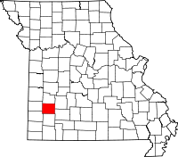
Location in the state of Missouri
Missouri's location in the U.S.Founded 1841 Named for Major Francis L. Dade of Virginia, who was killed in the Seminole War in 1835 Seat Greenfield Largest city Greenfield Area
- Total
- Land
- Water
506.30 sq mi (1,311 km²)
490.34 sq mi (1,270 km²)
15.96 sq mi (41 km²), 3.15Population
- (2010)
- Density
7,883
16/sq mi (6/km²)Time zone Central: UTC-6/-5 Dade County is a county located in the U.S. state of Missouri. As of 2010, the population is 7,883. Its county seat is Greenfield[1]. The county was organized in 1841 and is named after Major Francis L. Dade of Virginia, who was killed in the Seminole War in 1835.
Contents
Geography
According to the 2000 census, the county has a total area of 506.30 square miles (1,311.3 km2), of which 490.34 square miles (1,270.0 km2) (or 96.85%) is land and 15.96 square miles (41.3 km2) (or 3.15%) is water.[2]
Adjacent counties
- Cedar County (north)
- Polk County (northeast)
- Greene County (southeast)
- Lawrence County (south)
- Jasper County (southwest)
- Barton County (west)
Major highways
Demographics
Historical populations Census Pop. %± 1850 4,246 — 1860 7,072 66.6% 1870 8,086 14.3% 1880 12,557 55.3% 1890 17,528 39.6% 1900 18,125 3.4% 1910 15,613 −13.9% 1920 14,173 −9.2% 1930 11,764 −17.0% 1940 11,248 −4.4% 1950 9,324 −17.1% 1960 7,577 −18.7% 1970 6,850 −9.6% 1980 7,383 7.8% 1990 7,449 0.9% 2000 7,923 6.4% 2010 7,883 −0.5% U.S. Decennial Census As of the census[3] of 2000, there were 7,923 people, 3,202 households, and 2,276 families residing in the county. The population density was 16 people per square mile (6/km²). There were 3,758 housing units at an average density of 8 per square mile (3/km²). The racial makeup of the county was 97.45% White, 0.27% Black or African American, 0.71% Native American, 0.14% Asian, 0.05% Pacific Islander, 0.19% from other races, and 1.20% from two or more races. 0.85% of the population were Hispanic or Latino of any race.
There were 3,202 households out of which 29.10% had children under the age of 18 living with them, 61.30% were married couples living together, 6.50% had a female householder with no husband present, and 28.90% were non-families. 26.50% of all households were made up of individuals and 14.70% had someone living alone who was 65 years of age or older. The average household size was 2.44 and the average family size was 2.93.
In the county the population was spread out with 24.30% under the age of 18, 6.80% from 18 to 24, 24.10% from 25 to 44, 24.40% from 45 to 64, and 20.30% who were 65 years of age or older. The median age was 42 years. For every 100 females there were 95.90 males. For every 100 females age 18 and over, there were 92.50 males.
The median income for a household in the county was $29,097, and the median income for a family was $33,651. Males had a median income of $26,092 versus $18,464 for females. The per capita income for the county was $14,254. About 9.30% of families and 13.40% of the population were below the poverty line, including 17.10% of those under age 18 and 13.10% of those age 65 or over.
Cities and towns
See also
- National Register of Historic Places listings in Dade County, Missouri
References
- ^ "Find a County". National Association of Counties. http://www.naco.org/Counties/Pages/FindACounty.aspx. Retrieved 2011-06-07.
- ^ "Census 2000 U.S. Gazetteer Files: Counties". United States Census. http://www.census.gov/tiger/tms/gazetteer/county2k.txt. Retrieved 2011-02-13.
- ^ "American FactFinder". United States Census Bureau. http://factfinder.census.gov. Retrieved 2008-01-31.
External links
- Digitized 1930 Plat Book of Dade County from University of Missouri Division of Special Collections, Archives, and Rare Books
- http://www.census.gov/

Cedar County Polk County Barton County 
 Dade County, Missouri

Jasper County Lawrence County Greene County Municipalities and communities of Dade County, Missouri Cities 
Villages Townships Cedar | Center | Ernest | Grant | Lockwood | Marion | North | North Morgan | Pilgrim | Polk | Rock Prairie | Sac | Smith | South | South Morgan | Washington
Unincorporated
communityBona | Dudenville‡
Footnotes ‡This populated place also has portions in an adjacent county or counties
Categories:- Missouri counties
- Dade County, Missouri
- 1841 establishments in the United States
- Populated places established in 1841


Wikimedia Foundation. 2010.