- Clark County, Missouri
-
Clark County, Missouri 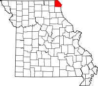
Location in the state of Missouri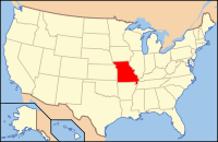
Missouri's location in the U.S.Founded 1836 Named for William Clark, leader of the Lewis and Clark Expedition and later a Governor of Missouri Territory Seat Kahoka Largest city Kahoka Area
- Total
- Land
- Water
511.90 sq mi (1,326 km²)
507.31 sq mi (1,314 km²)
4.59 sq mi (12 km²), 0.90Population
- (2010)
- Density
7,139
15/sq mi (6/km²)Time zone Central: UTC-6/-5 Clark County is a county located in the U.S. state of Missouri. As of 2010, the population was 7,139. Its county seat is Kahoka[1]. The county was organized in 1836 and named after William Clark, leader of the Lewis and Clark Expedition and later a Governor of Missouri Territory.
Clark County is part of the Fort Madison–Keokuk, IA-MO Micropolitan Statistical Area.
Contents
Geography
According to the 2000 census, the county has a total area of 511.90 square miles (1,325.8 km2), of which 507.31 square miles (1,313.9 km2) (or 99.10%) is land and 4.59 square miles (11.9 km2) (or 0.90%) is water.[2]
Adjacent counties
- Van Buren County, Iowa (northwest)
- Lee County, Iowa (north)
- Hancock County, Illinois (east)
- Lewis County (south)
- Knox County (southwest)
- Scotland County (west)
Major highways
National protected area
- Great River National Wildlife Refuge (part)
Demographics
Historical populations Census Pop. %± 1900 15,383 — 1910 12,818 −16.7% 1920 11,874 −7.4% 1930 10,254 −13.6% 1940 10,166 −0.9% 1950 9,003 −11.4% 1960 8,725 −3.1% 1970 8,260 −5.3% 1980 8,493 2.8% 1990 7,547 −11.1% 2000 7,416 −1.7% 2010 7,139 −3.7% As of the census[3] of 2010, there were 7,139 people, 2,966 households, and 2,079 families residing in the county. The population density was 15 people per square mile (6/km²). There were 3,483 housing units at an average density of 7 per square mile (3/km²). The racial makeup of the county was 98.83% White, 0.07% Black or African American, 0.20% Native American, 0.07% Asian, 0.01% Pacific Islander, 0.22% from other races, and 0.61% from two or more races. 0.70% of the population were Hispanic or Latino of any race.
There were 2,966 households out of which 30.30% had children under the age of 18 living with them, 58.70% were married couples living together, 7.00% had a female householder with no husband present, and 29.90% were non-families. 26.40% of all households were made up of individuals and 13.60% had someone living alone who was 65 years of age or older. The average household size was 2.46 and the average family size was 2.95.
In the county the population was spread out with 25.00% under the age of 18, 7.80% from 18 to 24, 25.50% from 25 to 44, 25.00% from 45 to 64, and 16.70% who were 65 years of age or older. The median age was 39 years. For every 100 females there were 97.60 males. For every 100 females age 18 and over, there were 94.00 males.
The median income for a household in the county was $29,457, and the median income for a family was $36,270. Males had a median income of $27,279 versus $19,917 for females. The per capita income for the county was $15,988. About 10.80% of families and 14.10% of the population were below the poverty line, including 19.70% of those under age 18 and 12.70% of those age 65 or over.
By 2006 the population of Clark County had fallen to 7,305.
Cities and towns
See also
References
- ^ "Find a County". National Association of Counties. http://www.naco.org/Counties/Pages/FindACounty.aspx. Retrieved 2011-06-07.
- ^ "Census 2000 U.S. Gazetteer Files: Counties". United States Census. http://www.census.gov/tiger/tms/gazetteer/county2k.txt. Retrieved 2011-02-13.
- ^ "American FactFinder". United States Census Bureau. http://factfinder.census.gov. Retrieved 2008-01-31.
External links
- Digitized 1930 Plat Book of Clark County from University of Missouri Division of Special Collections, Archives, and Rare Books

Van Buren County, Iowa Lee County, Iowa Scotland County 
Hancock County, Illinois  Clark County, Missouri

Knox County Lewis County Municipalities and communities of Clark County, Missouri Cities Alexandria | Kahoka | Wayland | Wyaconda

Villages Townships Clay | Des Moines | Folker | Grant | Jackson | Jefferson | Lincoln | Madison | Sweet Home | Union | Vernon | Washington | Wyaconda
Unincorporated
communityCategories:- Missouri counties
- Clark County, Missouri
- Missouri counties on the Mississippi River


Wikimedia Foundation. 2010.