- Monroe County, Mississippi
-
Monroe County, Mississippi 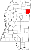
Location in the state of Mississippi
Mississippi's location in the U.S.Founded 1821 Seat Aberdeen Largest city Amory Area
- Total
- Land
- Water
772.04 sq mi (2,000 km²)
764.17 sq mi (1,979 km²)
7.87 sq mi (20 km²), 1.02%Population
- (2010)
- Density
36,989
49/sq mi (19/km²)Website www.monroecountyms.org Monroe County is a county in the U.S. state of Mississippi. As of 2010, the population was 36,989. Its county seat is Aberdeen[1].
Contents
History
The county is named in honor of U.S. President James Monroe.
Geography
According to the 2000 census, the county has a total area of 772.04 square miles (1,999.6 km2), of which 764.17 square miles (1,979.2 km2) (or 98.98%) is land and 7.87 square miles (20.4 km2) (or 1.02%) is water.[2]
Major highways
 U.S. Highway 45
 U.S. Highway 278
 Mississippi Highway 6
 Mississippi Highway 8
 Mississippi Highway 25
 Mississippi Highway 145
Adjacent counties
- Lowndes County (south)
- Clay County (southwest)
- Chickasaw County (west)
- Lee County (northwest)
- Itawamba County (north)
- Lamar County, Alabama (east)

Lee County Itawamba County Chickasaw County 
Lamar County, Alabama  Monroe County, Mississippi

Clay County Lowndes County Demographics
Historical populations Census Pop. %± 1820 2,721 — 1830 3,861 41.9% 1840 9,250 139.6% 1850 21,172 128.9% 1860 21,283 0.5% 1870 22,631 6.3% 1880 28,553 26.2% 1890 30,730 7.6% 1900 31,216 1.6% 1910 35,178 12.7% 1920 32,613 −7.3% 1930 36,141 10.8% 1940 37,648 4.2% 1950 36,543 −2.9% 1960 33,953 −7.1% 1970 34,043 0.3% 1980 36,404 6.9% 1990 36,582 0.5% 2000 38,014 3.9% 2010 36,989 −2.7% MS Counties 1900-1990
GeoHive - 2000 & 2010 statisticsAs of the census[3] of 2000, there were 38,014 people, 14,603 households, and 10,660 families residing in the county. The population density was 50 people per square mile (19/km²). There were 16,236 housing units at an average density of 21 per square mile (8/km²). The racial makeup of the county was 68.37% White, 30.77% Black or African American, 0.10% Native American, 0.17% Asian, 0.01% Pacific Islander, 0.11% from other races, and 0.47% from two or more races. 0.69% of the population were Hispanic or Latino of any race.
There were 14,603 households out of which 34.70% had children under the age of 18 living with them, 52.00% were married couples living together, 17.20% had a female householder with no husband present, and 27.00% were non-families. 24.70% of all households were made up of individuals and 11.80% had someone living alone who was 65 years of age or older. The average household size was 2.57 and the average family size was 3.07.
In the county the population was spread out with 27.20% under the age of 18, 8.70% from 18 to 24, 27.60% from 25 to 44, 22.50% from 45 to 64, and 14.00% who were 65 years of age or older. The median age was 36 years. For every 100 females there were 89.70 males. For every 100 females age 18 and over, there were 84.70 males.
The median income for a household in the county was $30,307, and the median income for a family was $36,749. Males had a median income of $30,232 versus $20,411 for females. The per capita income for the county was $14,072. About 13.60% of families and 17.20% of the population were below the poverty line, including 22.30% of those under age 18 and 21.70% of those age 65 or over.
Communities
- Towns
- Hatley
- Nettleton (partly in Lee County)
- Smithville
- Caledonia
- Villages
- Unincorporated places
- Ghost towns
See also
References
- ^ "Find a County". National Association of Counties. http://www.naco.org/Counties/Pages/FindACounty.aspx. Retrieved 2011-06-07.
- ^ "Census 2000 U.S. Gazetteer Files: Counties". United States Census. http://www.census.gov/tiger/tms/gazetteer/county2k.txt. Retrieved 2011-02-13.
- ^ "American FactFinder". United States Census Bureau. http://factfinder.census.gov. Retrieved 2008-01-31.
Municipalities and communities of Monroe County, Mississippi Cities 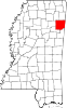
Towns Caledonia‡ | Hatley | Nettleton‡ | Smithville
Village Unincorporated
ommunitiesGhost towns Footnotes ‡This town also has portions in adjacent county or counties
Categories:- Mississippi counties
- Monroe County, Mississippi
- 1821 establishments in the United States
- Populated places established in 1821


Wikimedia Foundation. 2010.