- Coahoma County, Mississippi
-
Coahoma County, Mississippi 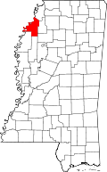
Location in the state of Mississippi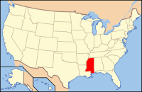
Mississippi's location in the U.S.Founded February 9, 1836 Seat Clarksdale Largest city Clarksdale Area
- Total
- Land
- Water
583.14 sq mi (1,510 km²)
554.15 sq mi (1,435 km²)
28.99 sq mi (75 km²), 4.97%Population
- (2010)
- Density
26,151
54/sq mi (21/km²)Coahoma County is a county located in the Mississippi Delta region of the U.S. state of Mississippi. As of 2010, the population was 26,151. Its county seat is Clarksdale[1].
The Clarksdale Micropolitan Statistical Area includes all of Coahoma County.
Contents
History
Coahoma County was established February 9, 1836, and is located in the northwestern part of the state in the fertile Yazoo Delta region. The name "Coahoma" is a Choctaw word meaning "red panther." The act creating the county defined its limits as follows:
Beginning at the point where the line between townships 24 and 25 of the surveys of the late Choctaw cession intersects the Mississippi River, and running thence up the said river to the point where the dividing line between the Choctaw and Chickasaw tribes of Indians intersects the same; thence with the dividing line to the point where the line between ranges two and three of the survey of the said Choctaw cession intersects the same; thence with said range line, to the line between townships 24 and 25 aforesaid, and thence with the said township line to the beginning.
Port Royal was once the county seat of Coahoma County. It was a rival of Friars Point, five miles up the Mississippi River. In the early days the county seats of the Mississippi River counties were always located on the banks of that stream. When Port Royal was cut off from the river in 1848, its fate was sealed and the county seat of justice was located at Friars Point, which still remained a river town. The latter place had a population of about 1,000 (census of 1920), and received its name in honor of Robert Friar, one of its earliest settlers. Clarksdale, one of the county seats, is now the largest and most important city in the county, and had a population of 7,500 in 1920. Clarksdale was named for John Clark, a brother-in-law of Governor James L. Alcorn, whose home, Eagle’s Nest, was in this county.
Geography
According to the 2000 census, the county has a total area of 583.14 square miles (1,510.3 km2), of which 554.15 square miles (1,435.2 km2) (or 95.03%) is land and 28.99 square miles (75.1 km2) (or 4.97%) is water.[2]
Major highways
 U.S. Highway 49
 U.S. Highway 61
 Mississippi Highway 1
 Mississippi Highway 6
Adjacent counties
- Tunica County (north)
- Quitman County (east)
- Tallahatchie County (southeast)
- Bolivar County (southwest)
- Phillips County, Arkansas (west)

Tunica County Phillips County, Arkansas 
Quitman County  Coahoma County, Mississippi

Bolivar County Sunflower County Tallahatchie County Demographics
Historical populations Census Pop. %± 1840 1,290 — 1850 2,780 115.5% 1860 6,606 137.6% 1870 7,144 8.1% 1880 13,568 89.9% 1890 18,342 35.2% 1900 26,293 43.3% 1910 34,217 30.1% 1920 41,511 21.3% 1930 46,327 11.6% 1940 48,333 4.3% 1950 49,361 2.1% 1960 46,212 −6.4% 1970 40,447 −12.5% 1980 36,918 −8.7% 1990 31,665 −14.2% 2000 30,622 −3.3% 2010 26,151 −14.6% MS Counties 1900-1990
GeoHive - 2000 & 2010 statistics
As of the census[3] of 2000, there were 30,622 people, 10,553 households, and 7,482 families residing in the county. The population density was 55 people per square mile (21/km²). There were 11,490 housing units at an average density of 21 per square mile (8/km²). The racial makeup of the county was 29.28% White, 69.21% Black or African American, 0.09% Native American, 0.47% Asian, 0.02% Pacific Islander, 0.34% from other races, and 0.60% from two or more races. 0.90% of the population were Hispanic or Latino of any race.There were 10,553 households out of which 36.80% had children under the age of 18 living with them, 37.20% were married couples living together, 28.70% had a female householder with no husband present, and 29.10% were non-families. 26.20% of all households were made up of individuals and 11.50% had someone living alone who was 65 years of age or older. The average household size was 2.83 and the average family size was 3.42.
In the county the population was spread out with 33.00% under the age of 18, 10.30% from 18 to 24, 25.30% from 25 to 44, 19.10% from 45 to 64, and 12.30% who were 65 years of age or older. The median age was 30 years. For every 100 females there were 84.90 males. For every 100 females age 18 and over, there were 77.50 males.
The median income for a household in the county was $22,338, and the median income for a family was $26,640. Males had a median income of $26,841 versus $19,611 for females. The per capita income for the county was $12,558. About 29.80% of families and 35.90% of the population were below the poverty line, including 45.90% of those under age 18 and 31.50% of those age 65 or over.
Communities
- Cities
- Towns
- Unincorporated places
- Bobo
- Claremont
- Clover Hill
- Dublin
- Farrell
- Hillhouse
- Lu-Rand
- Mattson
- Moon Lake (community)
- Rena Lara
- Rich
- Roundaway
- Rudyard
- Sherard
- Stovall
Education
- Colleges
- Coahoma Community College (Clarksdale)
Coahoma County was previously in the service area of the Mississippi Delta Community College (MDCC). As a result of the 1995 Mississippi Legislature session, Coahoma County is no longer in the MDCC service area.[4]
- Public School Districts
- Private Schools
- Lee Academy (Clarksdale)
Notable residents
- James L. Alcorn, United States Senator from Mississippi, owned and died at "Eagle Nest" in Coahoma County[5]
- Thomas Harris, author of Hannibal Lecter novels; he was born in Jackson, Tennessee, but raised in Rich, Mississippi, an unincorporated community in Coahoma County.
- John Lee Hooker (1917–2001), influential blues singer, was born on August 22, 1917 in Coahoma County into a sharecropper and Baptist preacher family.
- Ransom A. Myers (b. Lula, Mississippi, 1952 - d. Halifax, Nova Scotia, 2007) was a renowned Canada-based marine biologist, conservationist and scholar at Dalhousie University who published a seminal study on overfishing.
- Rick Ross the rapper was born in Coahoma County in 1976. Soon moved to Miami-Dade County, Florida.
- Ike Turner was born in Clarksdale
- Nate Dogg spent his childhood in Clarksdale.
- Tennessee Williams spent much of his childhood in Clarksdale and Coahoma County. A Tennessee Williams Festival is held annually in Clarksdale.
- Blac Elvis was born in Clarksdale, Mississippi. Award-winning music producer/song-writer.
See also
External links
- http://www.clarksdale.com/chamber/
- Coahoma County, Mississippi at the Open Directory Project
- Coahoma County Courthouse Pictures
- Delta News Online: Hometown News for the Mississippi Delta
References
- ^ "Find a County". National Association of Counties. http://www.naco.org/Counties/Pages/FindACounty.aspx. Retrieved 2011-06-07.
- ^ "Census 2000 U.S. Gazetteer Files: Counties". United States Census. http://www.census.gov/tiger/tms/gazetteer/county2k.txt. Retrieved 2011-02-13.
- ^ "American FactFinder". United States Census Bureau. http://factfinder.census.gov. Retrieved 2008-01-31.
- ^ "The History of MDCC." Mississippi Delta Community College. Retrieved on October 18, 2010.
- ^ Who Was Who in America, Historical Volume, 1607-1896. Marquis Who's Who. 1967.
Coordinates: 34°14′N 90°36′W / 34.23°N 90.60°W
Municipalities and communities of Coahoma County, Mississippi City 
Towns Coahoma | Friars Point | Jonestown | Lula | Lyon
Unincorporated
communitiesBobo | Cagles Crossing | Claremont | Clover Hill | Dublin | Eagles Nest | Farrell | Hillhouse | Lurand | Mattson | Moon Lake | Rena Lara | Rich | Roundaway | Rudyard | Sherard | Stovall
Ghost town Ingram‡
Footnotes ‡This populated place also has portions in an adjacent county or counties
Categories:- Mississippi counties
- Coahoma County, Mississippi
- Counties of the United States with African American majority populations
- Mississippi counties on the Mississippi River


Wikimedia Foundation. 2010.