- Nobles County, Minnesota
-
Nobles County, Minnesota 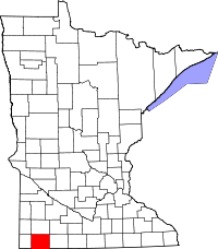
Location in the state of Minnesota
Minnesota's location in the U.S.Founded May 23, 1857 [3] Named for William H. Nobles, a member of the Territorial Legislature. Seat Worthington Largest city Worthington Area
- Total
- Land
- Water
722.33 sq mi (1,871 km²)
715.39 sq mi (1,853 km²)
6.94 sq mi (18 km²), 0.96%Population
- (2010)
- Density
21,378
29/sq mi (11/km²)Time zone Central: UTC-6/-5 Website www.co.nobles.mn.us Nobles County is a county located in the U.S. state of Minnesota. As of 2010, the population was 21,378.[1] Its county seat is Worthington[2].
Contents
Geography
 Nobles County Courthouse in Worthington, Minnesota
 Map of Nobles County from 1882 Geological Report[3]
According to the 2000 census, the county has a total area of 722.33 square miles (1,870.8 km2), of which 715.39 square miles (1,852.9 km2) (or 99.04%) is land and 6.94 square miles (18.0 km2) (or 0.96%) is water.[4]
Lakes
- East Graham Lake: Graham Lakes Township
- Fulda First Lake: Seward Township
- Indian Lake: Indian Lake Township
- Iowa Lake: western half in Indian Lake Township; eastern half in Round Lake Township in Jackson County
- Jack Lake: Graham Lakes Township
- Kinbrae Lake: Graham Lakes Township
- Lake Bella: Bigelow Township
- Lake Ocheda: Bigelow Township and Indian Lake Township
- Lake Okabena: Worthington Township
- West Graham Lake: Graham Lakes Township
- Willow Lake: southern third in Bloom Township; northern two thirds in Iona Township of Murray County
Major highways
Adjacent counties
- Murray County (north)
- Cottonwood County (northeast)
- Jackson County (east)
- Osceola County, Iowa (southeast)
- Lyon County, Iowa (southwest)
- Rock County (west)
History
 1874 map of Nobles County - Note that six of the townships had yet to be named
 Haying operation in Nobles County 1895 Photo by E.F. Buchanan
 Buffalo Ridge
 The Buffalo Ridge is visible on this satellite photograph extending north to south, just west of the community of Worthington, MN.
Nobles County was first occupied by the Sisseton Sioux. The first white man to set foot on the land was Joseph Nicollet who came to map out the area in 1842. Nicollet named Lake Okabena (there were two Lake Okabenas at the time), Lake Ocheda, East and West Graham Lake and the Kanaranzi Creek.
The first settlement was near Graham Lakes in 1846. Nobles County was established May 23, 1857, and organized October 27, 1870. The county was named for William H. Nobles, who was a member of the Minnesota territorial legislature in 1854 and 1856. In the autumn of the latter year he began the construction of a wagon road for the U.S. government, crossing southwestern Minnesota and Nobles County, to extend from Fort Ridgely to the South Pass in the Rocky Mountains. This work was continued in 1857 but was not completed.[5] Nobles County was created by the Minnesota Legislature on May 23, 1857, just before the full force of the Panic of 1857 was felt. Settlers were further discouraged from coming by the Spirit Lake Massacre of 1857. In this incident, a band of Sioux ruthlessly murdered settlers in Spirit Lake and along the Des Moines River in Jackson and Cottonwood Counties. The few whites in the area were understandably reluctant to stay.
During the summer of 1867, a mail route was established from Blue Earth through the Graham Lakes settlement to Yankton, South Dakota. In January, a Post Office was established in each settlement. The population in the spring of 1870 was 117 and nearly doubled by fall. County Government did not start until 1870. The first railroad, the St. Paul & Sioux City Railway, was built in 1871. This later became the Chicago Northwestern Railroad, and is presently operated by the Union Pacific Railroad.
In 1871, a group of men from Toledo, Ohio organized a company to locate a colony of settlers in some western county. After traveling 20,000 miles in the Midwest, they decided on Nobles County and by the spring of 1872, hundreds of people came in and took up land. Worthington became the County Seat in 1873. The Worthington & Sioux Falls Railway was established in 1876. This led to rapid settlement in Rushmore, Adrian, and the western portions of the county.
The U.S. census of 1861: 11 families, 35 persons, (3 from Norway, 3 from Bavaria, 1 from Ireland and the rest from the eastern states). In 1880, the population was 4,435. In 1895, the population was 11,905 and in 1970, the population was up to 22,959. In 2000, the population was 20,832.[6]
- Learn more about Nobles County History by reading Rose's History of Nobles County online
Geology
Buffalo Ridge: Nobles County sits atop a geologic structure known as the Buffalo Ridge, a large expanse of rolling hills in southwestern Minnesota reaching a height of 1,995 feet (608 m) above sea level. The Buffalo Ridge extends 60 miles through Lincoln, Lyon, Pipestone, Murray, Rock, and Nobles counties. It is a drainage divide separating the watersheds of the Mississippi and Missouri Rivers. Because of its high altitude and high average wind speed, the Buffalo Ridge has become a major site for wind energy. Currently, over 200 wind turbines stand along the Buffalo Ridge.
The Buffalo Ridge is part of the inner coteau and is the highest point of the Coteau des Prairies in Minnesota.[7] Its bedrock is formed of Cretaceous shale, sandstone and clay that lie above the pinkish-red Upper Precambrian Sioux Quartzite.[8] These units are covered in most areas by thick deposits of glacial drift, which consist of up to 800 feet (244 m) of pre-Wisconsin age glacial till left after the glaciers receded. The inner coteau is made up of extremely stream-eroded glacial deposits of pre-Wisconsin glacial drift, which is then covered by a 6 to 15 foot (1.8 to 4.6 m) thick deposit of a wind-blown silt called loess.[7] This covering results in the creation of an area with long, gently sloping hills. Loess is an easily eroded material, and because of this there are few lakes and wetlands in the inner coteau area. Loess however promotes well established dendritic drainage networks, the majority of which flow into the Missouri River and Minnesota River systems.
Demographics
Historical populations Census Pop. %± 1860 35 — 1870 117 234.3% 1880 4,435 3,690.6% 1890 7,958 79.4% 1900 14,932 87.6% 1910 15,210 1.9% 1920 17,917 17.8% 1930 18,618 3.9% 1940 21,215 13.9% 1950 22,435 5.8% 1960 23,365 4.1% 1970 23,208 −0.7% 1980 21,840 −5.9% 1990 20,098 −8.0% 2000 20,832 3.7% 2010 21,378 2.6% U.S. Decennial Census  Age pyramid of county residents based on 2000 U.S. census data
As of the census[9] of 2000, there were 20,832 people, 7,939 households, and 5,517 families residing in the county. The population density was 29 people per square mile (11/km²). There were 8,465 housing units at an average density of 12 per square mile (5/km²). The racial makeup of the county was 86.50% White, 1.07% Black or African American, 0.31% Native American, 3.98% Asian, 0.07% Pacific Islander, 6.64% from other races, and 1.43% from two or more races. 11.16% of the population were Hispanic or Latino of any race. 47.0% were of German, 8.3% Dutch and 8.0% Norwegian ancestry according to Census 2000.
There were 7,939 households out of which 32.10% had children under the age of 18 living with them, 58.80% were married couples living together, 6.90% had a female householder with no husband present, and 30.50% were non-families. 26.50% of all households were made up of individuals and 14.10% had someone living alone who was 65 years of age or older. The average household size was 2.58 and the average family size was 3.11.
In the county the population was spread out with 26.50% under the age of 18, 8.20% from 18 to 24, 26.60% from 25 to 44, 21.30% from 45 to 64, and 17.40% who were 65 years of age or older. The median age was 38 years. For every 100 females there were 99.50 males. For every 100 females age 18 and over, there were 98.40 males.
The median income for a household in the county was $35,684, and the median income for a family was $43,076. Males had a median income of $27,853 versus $20,346 for females. The per capita income for the county was $16,987. About 8.20% of families and 11.70% of the population were below the poverty line, including 15.30% of those under age 18 and 12.50% of those age 65 or over.
Cities and towns
Cities Townships Unincorporated CDP Lakes - Org
- Reading
- St. Kilian
- Lake Okabena
- Indian Lake
- East Graham Lake
- West Graham Lake
- Lake Ocheda
Buildings on the National Historic Register in Nobles County, Minnesota
Landmark name Image Date listed Location City or Town Summary 1 Adrian State Bank 
May 15, 1980 Maine Ave. and 2nd St. W.
43°38′14″N 95°56′0″W / 43.63722°N 95.933333°WAdrian Although it has since been demolished, the Adrian State Bank building can be seen in the center of this photo on the far side of Maine Street, Adrian, Minnesota 2 Church of St. Adrian-Catholic 
May 15, 1980 Maine Ave and 6th St. E.
43°37′58″N 95°55′58″W / 43.63278°N 95.93278°WAdrian St Adrian's Catholic Church located in Adrian, Minnesota 3 Church of St. Kilian (Catholic) 
March 30, 1998 Approximately 3 mi (4.8 km) northwest of Wilmont
43°47′20″N 95°52′6″W / 43.78889°N 95.86833°WWilmont Township St Kilian Catholic Church, located in St. Kilian, Minnesota 4 Citizens' National Bank (Worthington, Minnesota) 
March 18, 1982 326 10th St.
43°37′13″N 95°35′49″W / 43.62028°N 95.59694°WWorthington Citizens' National Bank building in Worthington, Minnesota. Now houses The Cow's Outside Giftshop and Leather Goods 5 George D. Dayton House 
December 23, 2003 1311 4th Ave.
43°37′22″N 95°35′36″W / 43.62278°N 95.59333°WWorthington Former home of George D. Dayton, founder of Dayton's and Target Department Store chain, located in Worthington, Minnesota 6 Hotel Thompson, Worthington, Minnesota 
February 16, 1984 300-310 10th St.
43°37′12″N 95°35′46″W / 43.62°N 95.59611°WWorthington Historic Hotel Thompson located in Worthington, Minnesota 7 Dr. E. A. Kilbride Clinic November 23, 1977 701 11th St.
43°37′24″N 95°35′57″W / 43.62333°N 95.59917°WWorthington Former clinic of Dr. E. F. Kilbride, located in Worthington, Minnesota 8 Siemer Silo and Barn May 15, 1980 County Highway 19
43°34′40″N 96°0′44″W / 43.57778°N 96.01222°WEllsworth 9 Sioux City and St. Paul Railroad Section House May 15, 1980 Spencer and 1st Sts.
43°50′45″N 95°27′58″W / 43.84583°N 95.46611°WDundee 10 Slade Hotel 
June 30, 1975 Maine Ave. and 2nd St. E.
43°38′13″N 95°55′58″W / 43.63694°N 95.93278°WAdrian Historic Slade Hotel located in Adrian, Minnesota has been renovated to apartments, and the basement houses Adrian's Senior Citizen Dining and Community Hall References
- ^ "2010 Census Redistricting Data (Public Law 94-171) Summary File". American FactFinder. United States Census Bureau. http://factfinder2.census.gov/faces/tableservices/jsf/pages/productview.xhtml?pid=DEC_10_PL_GCTPL2.ST05&prodType=table. Retrieved 25 April 2011.
- ^ "Find a County". National Association of Counties. http://www.naco.org/Counties/Pages/FindACounty.aspx. Retrieved 2011-06-07.
- ^ The Geology of Minnesota
- ^ "Census 2000 U.S. Gazetteer Files: Counties". United States Census. http://www.census.gov/tiger/tms/gazetteer/county2k.txt. Retrieved 2011-02-13.
- ^ [1] Warren Upham's Minnesota Places: A Geographical Encyclopedia]
- ^ [2] Nobles County Government Website
- ^ a b DNR, Minnesota DNR, http://www.dnr.state.mn.us/ecs/251Bc/index.html.
- ^ Anderson RR (1987) Precambrian Sioux Quartzite at Gitchie Manitou State Preserve, Iowa. Centennial Field Guide Volume 3: North-Central Section of the Geological Society of America: Vol. 3, No. 0 pp. 77–80. http://www.gsajournals.org/perlserv/?request=res-loc&uri=urn%3Aap%3Apdf%3Adoi%3A10.1130%2F0-8137-5403-8.77
- ^ "American FactFinder". United States Census Bureau. http://factfinder.census.gov. Retrieved 2008-01-31.
External links

Murray County Cottonwood County Rock County 
Jackson County  Nobles County, Minnesota

Lyon County, Iowa Osceola County, Iowa Municipalities and communities of Nobles County, Minnesota Cities 
Townships CDP Unincorporated
communitiesOrg | Reading | St. Kilian
Lakes Lake Okabena | Lake Ocheda | Indian Lake | Graham Lakes
Categories:- Minnesota counties
- Nobles County, Minnesota


Wikimedia Foundation. 2010.