- Ottawa County, Michigan
-
Ottawa County, Michigan 
Seal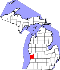
Location in the state of Michigan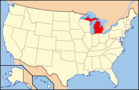
Michigan's location in the U.S.Founded 1837 Seat Grand Haven Area
- Total
- Land
- Water
1,631.97 sq mi (4,227 km²)
565.65 sq mi (1,465 km²)
1,066.32 sq mi (2,762 km²), 65.34%Population
- (2010)
- Density
263,801
466/sq mi (180/km²)Website www.miottawa.org Ottawa County is a county in the U.S. state of Michigan. As of the 2010 census, the population was 263,801.[1] The county seat is Grand Haven[2].
Contents
Geography
According to the 2000 census, the county has a total area of 1,631.97 square miles (4,226.8 km2), of which 565.65 square miles (1,465.0 km2) (or 34.66%) is land and 1,066.32 square miles (2,761.8 km2) (or 65.34%) is water.[3]
Geographic Features
Adjacent counties
- Muskegon County (north)
- Kent County (east)
- Allegan County (south)
- Milwaukee County, Wisconsin (west)
- Racine County, Wisconsin (west)

Muskegon County Milwaukee County, Wisconsin 
Kent County  Ottawa County, Michigan

Racine County, Wisconsin Allegan County Demographics
As of the census[4] of 2000, there were 238,314 people, 81,662 households, and 61,328 families residing in the county. The population density was 421 people per square mile (163/km²). There were 86,856 housing units at an average density of 154 per square mile (59/km²). The racial makeup of the county was 91.52% White, 1.05% Black or African American, 0.36% Native American, 2.09% Asian, 0.02% Pacific Islander, 3.48% from other races, and 1.48% from two or more races. 7.00% of the population were Hispanic or Latino of any race. 37.3% were of Dutch, 14.6% German, 6.2% English, 5.6% Irish and 5.4% American ancestry according to Census 2000. 91.5% spoke English and 5.4% Spanish as their first language.
There were 81,662 households out of which 39.30% had children under the age of 18 living with them, 64.60% were married couples living together, 7.50% had a female householder with no husband present, and 24.90% were non-families. 19.60% of all households were made up of individuals and 7.40% had someone living alone who was 65 years of age or older. The average household size was 2.81 and the average family size was 3.25.
Summer seasonal residents are also a member of the populous Ottawa County. Port Sheldon Township has many lakefront homes and other inland retreats that serve as summer getaways for residents of Grand Rapids, Detroit, and Chicago. No official statistics are compiled on seasonal residents.
In the county the population was spread out with 28.70% under the age of 18, 11.90% from 18 to 24, 29.30% from 25 to 44, 20.00% from 45 to 64, and 10.10% who were 65 years of age or older. The median age was 32 years. For every 100 females there were 97.00 males. For every 100 females age 18 and over, there were 94.20 males.
The median income for a household in the county was $52,347, and the median income for a family was $59,896. Males had a median income of $42,180 versus $27,706 for females. The per capita income for the county was $21,676. About 3.10% of families and 5.50% of the population were below the poverty line, including 4.70% of those under age 18 and 4.90% of those age 65 or over.
Government
The county government operates the jail, maintains rural roads, operates the major local courts, keeps files of deeds and mortgages, maintains vital records, administers public health regulations, and participates with the state in the provision of welfare and other social services. The county board of commissioners controls the budget but has only limited authority to make laws or ordinances. In Michigan, most local government functions — police and fire, building and zoning, tax assessment, street maintenance, etc. — are the responsibility of individual cities and townships.
Ottawa County elected officials
- Prosecuting Attorney: Ronald J. Frantz
- Sheriff: Gary A. Rosema
- County Clerk: Daniel C. Krueger
- County Treasurer: Bradley Slagh
- Register of Deeds: Gary Scholten
- Drain Commissioner: Paul Geerlings
(information as of September 2005)
Politics
Ottawa County is a stronghold of the Republican Party. The last Democratic Party candidate to carry the county was George B. McClellan in 1864.[5]
In the 2008 presidential election, Republican John McCain received 83,330 votes in the county (61.03% of the total) to Democrat Barack Obama's 50,828 (37.23%), even as Obama carried the state of Michigan by a double-digit margin.[6]
In 2004, Republican president George W. Bush received 92,048 votes in the county (71.55%) to Democrat John Kerry's 35,552 (27.64%).[7]
In 2000, Bush received 78,703 votes (71.16%) to Democrat Al Gore's 29,600 (26.76%).[8]
2008 election results are as follows: Republican Jack Hoogendyk received 59.08% of Ottawa County's vote in his failed bid against US Senator Carl Levin; Republican Representative Peter Hoekstra received 71.7% of the vote; Republican David Agema received 73.45% in the race for the 74th district; Republican Arlan B. Meekhof received 60.71% in his race for the 89th District; Republican Joseph Haveman received 71.92% in his race for the 90th District; and Holly Hughes received 61.55% in her failed bid against Mary Valentine for the 91st District. No Republican lost any race in the county, and Republicans ran unopposed in several local races. The county voted against stem-cell research, but narrowly favored the legalization of medical marijuana and voted to allow the sales of beer and liquor on Sundays.[9]
Cities, villages,townships and unincorporated communities
Villages
Unincorporated
- Allendale
- Beechwood
- Borculo
- Conklin
- Drenthe
- Eastmanville
- Jenison
- Marne
Townships
Transportation
Interstates
US highways
Michigan State Trunklines
Ottawa County Intercounty Highways
 A-37
A-37 B-31
B-31 B-35
B-35 B-72
B-72
See also
References
- ^ Population of Michigan Counties: 2000 and 2010, retrieved April 5, 2011
- ^ "Find a County". National Association of Counties. http://www.naco.org/Counties/Pages/FindACounty.aspx. Retrieved 2011-06-07.
- ^ "Census 2000 U.S. Gazetteer Files: Counties". United States Census. http://www.census.gov/tiger/tms/gazetteer/county2k.txt. Retrieved 2011-02-13.
- ^ "American FactFinder". United States Census Bureau. http://factfinder.census.gov. Retrieved 2008-01-31.
- ^ Geographie Electorale
- ^ http://www.uselectionatlas.org/RESULTS/statesub.php?year=2008&off=0&elect=0&fips=26139&f=0
- ^ http://www.uselectionatlas.org/RESULTS/statesub.php?year=2004&fips=26139&off=0&elect=0&f=0
- ^ http://www.uselectionatlas.org/RESULTS/statesub.php?year=2000&fips=26139&off=0&elect=0&f=0
- ^ Ottawa Michigan County Government site
External links
- County of Ottawa
- Grand Haven & Tri-Cities Alumni
- Clarke Historical Library, Central Michigan University, Bibliography on Ottawa County
Municipalities and communities of Ottawa County, Michigan Cities Coopersville | Ferrysburg | Grand Haven | Holland‡ | Hudsonville | Zeeland
Village Charter
townshipsAllendale | Georgetown | Grand Haven | Holland | Jamestown | Polkton | Tallmadge | Zeeland
General law
townshipsBlendon | Chester | Crockery | Olive | Park | Port Sheldon | Robinson | Spring Lake | Wright
Unincorporated
communitiesAgnew | Allendale | Beechwood | Conklin | Drenthe | Eastmanville | Grand Valley | Lamont | Marne | Nunica | Jenison | West Olive
Footnotes ‡This populated place also has portions in an adjacent county or counties
Categories:- Michigan counties
- Ottawa County, Michigan


Wikimedia Foundation. 2010.