- Newaygo County, Michigan
-
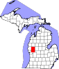
Newaygo County, Michigan 
Seal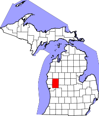
Location in the state of Michigan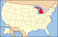
Michigan's location in the U.S.Founded 1851 Seat White Cloud Area
- Total
- Land
- Water
861.39 sq mi (2,231 km²)
842.37 sq mi (2,182 km²)
19.03 sq mi (49 km²), 2.21%Population
- (2010)
- Density
48,460
57/sq mi (22/km²)Website www.countyofnewaygo.com Historical populations Year Pop. ±% 1900 17,673 — 1910 19,220 +8.8% 1920 17,378 −9.6% 1930 17,029 −2.0% 1940 19,286 +13.3% 1950 21,567 +11.8% 1960 24,160 +12.0% 1970 27,992 +15.9% 1980 34,917 +24.7% 1990 38,202 +9.4% 2000 47,874 +25.3% 2010 48,460 +1.2% Source: "American FactFinder". United States Census Bureau. http://factfinder.census.gov. Newaygo County is a county in the U.S. state of Michigan. It is part of the Grand Rapids–Wyoming, MI, Metropolitan Statistical Area. As of the 2010 census, the population was 48,460. The county seat is White Cloud[1]. Newaygo County was either named for an Ojibwe leader who signed the Saginaw Treaty of 1819[2] or for a Native American word meaning much water.[3] See List of Michigan county name etymologies.
Contents
Geography
- According to the 2000 census, the county has a total area of 861.39 square miles (2,231.0 km2), of which 842.37 square miles (2,181.7 km2) (or 97.79%) is land and 19.03 square miles (49.3 km2) (or 2.21%) is water.[4]
- The county is considered to be part of West Michigan.
- Newaygo County is considered to be part of the Roman Catholic Diocese of Grand Rapids.[5]
Geographic features
- The county contains more than 230 natural lakes. The combined total of all the rivers and streams is longer than 350 miles.
- Built at the beginning of the 20th century, there are three huge dams: Croton, Hardy and Newaygo. The Hardy Dam is the largest earthen dam east of the Mississippi.[6]
- Over half of the county is in the Manistee National Forest.
Rivers
- Muskegon River
- Rogue River
- White River
Highways
Michigan State Trunklines
Newaygo County Intercounty Highways
 B-31 (runs along Muskegon County line; maintained by Muskegon County)
 B-35
B-35 B-96
B-96
Adjacent counties
- Lake County (north)
- Mecosta County (east)
- Montcalm County (east)
- Kent County (southeast)
- Muskegon County (southwest)
- Oceana County (west)

Lake County Oceana County 
Mecosta County and Montcalm County  Newaygo County, Michigan

Muskegon County Kent County National protected area
- Manistee National Forest (part)
Demographics
As of the census[7] of 2000, there were 47,874 people, 17,599 households, and 12,935 families residing in the county. The population density was 57 people per square mile (22/km²). There were 23,202 housing units at an average density of 28 per square mile (11/km²). The racial makeup of the county was 94.80% White, 1.12% Black or African American, 0.65% Native American, 0.29% Asian, 0.03% Pacific Islander, 1.63% from other races, and 1.48% from two or more races. 3.85% of the population were Hispanic or Latino of any race. 20.5% were of German, 14.4% Dutch, 12.1% American, 9.4% English, 8.1% Irish and 5.0% Polish ancestry according to Census 2000. 95.7% spoke English and 3.2% Spanish as their first language.
There were 17,599 households out of which 35.20% had children under the age of 18 living with them, 60.20% were married couples living together, 9.00% had a female householder with no husband present, and 26.50% were non-families. 22.20% of all households were made up of individuals and 9.00% had someone living alone who was 65 years of age or older. The average household size was 2.68 and the average family size was 3.13.
In the county the population was spread out with 29.10% under the age of 18, 7.40% from 18 to 24, 27.50% from 25 to 44, 23.20% from 45 to 64, and 12.80% who were 65 years of age or older. The median age was 36 years. For every 100 females there were 99.60 males. For every 100 females age 18 and over, there were 97.20 males.
The median income for a household in the county was $37,130, and the median income for a family was $42,498. Males had a median income of $35,549 versus $22,738 for females. The per capita income for the county was $16,976. About 9.00% of families and 11.60% of the population were below the poverty line, including 14.60% of those under age 18 and 8.50% of those age 65 or over.
Economy
Tourism is the most important economic activity in Newaygo County.[citation needed] Secondly is a blend of agricultural and small manufacturing. International baby food manufacturer Gerber Products Company is currently the county's largest employer with approximately 1,300 employees.[8]
Newaygo County also has a large number summer cottage residents. Fishermen can find many steelhead in the spring and salmon in the fall within the county's rivers and streams. Camping, hunting, cross country skiing, bicycling, birding and ORVing is common in the Manistee National Forest.[6]
Notable Companies
- Bolthouse Farms - Grant (Closed operations in Grant June 2010. Still in operating in CA)
- County of Newaygo - White Cloud
- Dura Automotive Systems - Fremont
- Gerber Memorial Health Services - Fremont
- Gerber Products Company - Fremont
- Grant Tower - Grant
- Magna Donnelly - Newaygo
- North American Refractories - White Cloud
- Valspar Corporation - Fremont
- Wilbur Ellis - Grant
Government
The county government operates the jail, maintains rural roads, operates the major local courts, keeps files of deeds and mortgages, maintains vital records, administers public health regulations, and participates with the state in the provision of welfare and other social services. The county board of commissioners controls the budget but has only limited authority to make laws or ordinances. In Michigan, most local government functions — police and fire, building and zoning, tax assessment, street maintenance, etc. — are the responsibility of individual cities and townships.
Newaygo County elected officials
- Prosecuting Attorney: Chrystal Roach
- Sheriff: Michael S. Mercer
- County Clerk: Laurel J. Breuker
- County Treasurer: Holly Moon
- Register of Deeds: Linda M. Landheer
- Drain Commissioner: Patricia L. Baker
- County Surveyor: Norman L. Ochs
(information as of July 2010)
Festivals & Events
- City-Wide Yard Sales - Grant
- Frontier Festival - Grant
- Harvest Festival - Fremont
- Logging Festival - Newaygo
- Bitely Home Coming - Bitely
- National Baby Food Festival - Fremont
- Pow Wow - White Cloud
- Santa Parade - Fremont
- Trout Fest - Newaygo
- West Michigan’s Longest Yard Sale - Grant, Newaygo, White Cloud, Bitely
- Winterfest - Newaygo
Historical Sites
In Newaygo County there are 16 locations that the Michigan's State Historic Preservation Office has designated as historical. Two of the sixteen sites have been listed with the National Register of Historic Places.[9]
- Big Prairie Grange Hall No. 935 - Goodwell Twp
- Birch Grove School - Lincoln Twp
- Croton Congregational Church - Croton Twp
- Croton Hydroelectric Plant - Croton Twp
- Ensley Windmill Tower
- First Christian Reformed Church (Demolished) - Fremont
- Gerber, Cornelius, Cottage - Sheridan Charter Twp
- Grant Depot and Water Tower - Grant
- Hardy Hydroelectric Plant - Big Prairie - Twp
- Lilley District No. 5 School - Lilley Twp
- Oak Grove District No. 3 Schoolhouse - Croton Twp
- Penoyer's Sawmill - Newaygo
- Saint Mark's Episcopal Church - Newaygo
- Weaver, Daniel, House - Denver Twp
- White Cloud Village Hall (Demolished) - White Cloud
- Woods, John F., Residence - Newaygo
Cities, villages, and townships
Cities
- Fremont, city
- Grant, city
- Newaygo, city
- White Cloud, city
Villages
- Hesperia, village (partially)
Unincorporated communities
- Bitely, unincorporated community
- Brunswick, unincorporated community
- Riverview, unincorporated community
- Woodland Park, unincorporated community
Townships
See also
Notes
- ^ "Find a County". National Association of Counties. http://www.naco.org/Counties/Pages/FindACounty.aspx. Retrieved 2011-06-07.
- ^ Clarke Historical Library, Central Michigan University, Bibliography for Newaygo County
- ^ Michigan government on county names
- ^ "Census 2000 U.S. Gazetteer Files: Counties". United States Census. http://www.census.gov/tiger/tms/gazetteer/county2k.txt. Retrieved 2011-02-13.
- ^ Diocese of Grand Rapids, Michigan.
- ^ a b Newaygo County government
- ^ "American FactFinder". United States Census Bureau. http://factfinder.census.gov. Retrieved 2008-01-31.
- ^ Michigan Works! West Central
- ^ "State Historical Site Listings". http://www.mcgi.state.mi.us/hso/advancematch.asp?ctype=county&cname=&cnty=Newaygo. Retrieved 2008-12-06.
External links
- County of Newaygo
- Newaygo County Convention and Visitors Bureau
- Newaygo County Economic Development Office
- Newaygo County Road Commission
- Newaygo County Regional Educational Service Agency
- District Health Department #10
- Recycling for Newaygo County
Municipalities and communities of Newaygo County, Michigan Cities Fremont | Grant | Newaygo | White Cloud
Village Charter
townshipGeneral law
townshipsUnincorporated
communitiesFootnotes ‡This populated place also has portions in an adjacent county or counties
Categories:- Michigan counties
- Newaygo County, Michigan
- Grand Rapids – Wyoming metropolitan area
- 1851 establishments in the United States


Wikimedia Foundation. 2010.