Ballinode

Ballinode

Infobox Irish Place
name = Ballinode
gaeilge = Béal Átha an Fhóid
crest

motto =
map

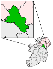
pin coords = left: 45px; top: 40px
north coord = 54.2691
west coord = 7.0338
irish grid =
area = | elevation =
province = Ulster
county = County Monaghan
population = | town pop = | rural pop =
census yr =
web = |

Ballinode or Bellanode ("Béal Átha an Fhóid" in Irish) is a village situated some 6 km from Monaghan Town and 3 km from Scotstown in County Monaghan, Ireland. The village straddles the River Blackwater and has a Church of Ireland church with clock tower, cemetery, and church hall; one public house, called "Maggie's"; and a Centra shop, with post office and hardware store.

Industry

*Maguire Transport International Ltd [http://www.monaghanonline.ie/items.php?id=77#] – a haulage company
*McAree Engineering Works Ltd [http://mcaree-eng.com/] – specializing in feed silos for chicken houses.

ee also

*List of towns in the Republic of Ireland


Wikimedia Foundation. 2010.

Игры ⚽ Поможем сделать НИР

Look at other dictionaries:

  • County Monaghan — Coordinates: 54°14′37″N 7°02′22″W / 54.243563°N 7.039490°W / 54.243563; 7.039490 …   Wikipedia

  • Баллинод — Деревня Ирландии Баллинод англ. Ballinode, ирл. Béal Átha an Fhóid Страна …   Википедия

  • Apprentice Boys of Derry — Une parade des Apprentices Boys of Derry à Bushmills. Les Apprentices Boys of Derry (français : Apprentis de Derry) sont une fraternité protestante basée à Derry en Irlande du Nord. Liée à l …   Wikipédia en Français

  • List of towns and villages in the Republic of Ireland — This is a link page for cities and towns in Ireland, including villages, townships or urban centres in Dublin. Cities are shown in bold; see Cities in Ireland for an independent list. See also : * List of towns in the Republic of Ireland/Largest… …   Wikipedia

  • Clones — This article is about the Irish town. For other uses, see Clones (disambiguation). Clones Cluain Eois   Town   …   Wikipedia

  • Monaghan — For other uses, see Monaghan (disambiguation). Monaghan Muineachán   Town   …   Wikipedia

  • Cheltenham Gold Cup — Coordinates: 51°55′13″N 2°3′28″W / 51.92028°N 2.05778°W / 51.92028; 2.05778 …   Wikipedia

  • Clontibret — Cluain Tiobrad   Town   …   Wikipedia

  • Corblonog — (Irish: Corr Bhlonaige, meaning round hill of the fat/lard ) is a townland in the north of County Monaghan in Ireland, to the east of the townland of Sheskin in the parish of Tydavnet. During the late 19th century, and during the Irish famine,… …   Wikipedia

  • Corlat — Corlatt   Town   …   Wikipedia

Share the article and excerpts

Direct link
Do a right-click on the link above
and select “Copy Link”