- Berrien County, Michigan
-
Berrien County, Michigan 
Seal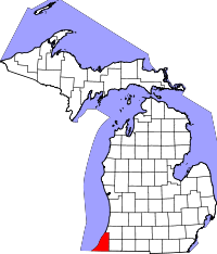
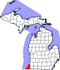
Location in the state of Michigan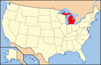
Michigan's location in the U.S.Founded October 29, 1829 Seat St. Joseph Largest city Niles Area
- Total
- Land
- Water
1,581.38 sq mi (4,096 km²)
571.00 sq mi (1,479 km²)
1,010.39 sq mi (2,617 km²), 63.89%Population
- (2000)
- Density
162,453
285/sq mi (110/km²)Website www.berriencounty.org Berrien County is a county located in the extreme southwest of the U.S. state of Michigan. It is included in the Niles-Benton Harbor, Michigan Metropolitan Statistical Area. As of the 2010 census, the population was 156,813. The county seat is St. Joseph.[1]
Contents
History
As one of the Cabinet counties, Berrien county was named for John M. Berrien of Georgia, U.S. Attorney General under U.S. President Andrew Jackson (1829–1831).
After creation of the Michigan Territory in 1805, the territory now comprising Berrien County was part of Wayne County, Michigan. The first White settlement came in December 1822, when missionary Isaac McCoy moved his family and 18 Indian students from Indiana to a site on the St. Joseph River near the present-day city of Niles to open a mission to the Potawatomi Indians. The Carey Mission, as he named it, was 100 miles from the nearest White settlement.[2] In 1827 St. Joseph Township was organized as part of Wayne County. The township included all lands acquired from the Native Americans by the Treaty of Chicago of 1821.
Berrien county's boundaries were set off by an act of the legislature of the Michigan Territory on October 29, 1829, with its present limits, but it was initially attached as Niles Township to Cass County for administrative purposes. In 1831 Berrien County was detached from Cass County.
The county was initially divided into three townships: Berrien Township, consisting of present-day townships of Berrien, Oronoko, and Lake plus a two-mile strip north of that territory; St. Joseph Township, consisting of everything north of Berrien Township; and Niles Township, consisting of everything south of Berrien Township.[3]
Government
The county government operates the jail, maintains rural roads, operates the major local courts, keeps files of deeds and mortgages, maintains vital records, administers public health regulations, and participates with the state in the provision of welfare and other social services. The county board of commissioners controls the budget but has only limited authority to make laws or ordinances. In Michigan, most local government functions — police and fire, building and zoning, tax assessment, street maintenance, etc. — are the responsibility of individual cities and townships.
Berrien County elected officials
- Prosecuting Attorney: Arthur Cotter
- Sheriff: L. Paul Bailey
- County Clerk: M. Louise Stine
- County Treasurer: Bret E. Witkowski
- Register of Deeds: Lori D. Jarvis
- Drain Commissioner: Roger Zilke
- County Surveyor: John G. Kamer
(information as of September 2005)
Geography
The county borders the state of Indiana to the South and includes a portion of Lake Michigan to the West. Van Buren County is to the north and northeast. Cass County is to the east.
According to the 2000 census, the county has a total area of 1,581.38 square miles (4,095.8 km2), of which 571.00 square miles (1,478.9 km2) (or 36.11%) is land and 1,010.39 square miles (2,616.9 km2) (or 63.89%) is water.[4]
The St. Joseph River is a major geographical feature, flowing mostly north and west through the county from Niles to its mouth on Lake Michigan at St. Joseph. The southwest of the county is drained by the Galien River and its tributaries. Paw Paw Lake is in the north of the county, along with the Paw Paw River, which flows into the St. Joseph River just before it enters Lake Michigan. A tiny portion along the Indiana state line is drained by small tributaries of the Kankakee River, which ultimately flows into the Mississippi River. This is one of the few areas of Michigan drained by the Mississippi River, the other being an area of Michigan's Upper Peninsula near the Wisconsin border.
Cities, villages and townships
Unincorporated
- Benton Heights
- Berrien Center
- Bethany Beach
- Birchwood
- Dayton
- Fair Plain
- Glendora
- Harbert
- Hazelhurst
- Lake Michigan Beach
- Lakeside
- Millburg
- New Troy
- Paw Paw Lake
- Riverside
- Sawyer
- Scottdale
- Shorewood Hills
- Shorewood-Tower Hills-Harbert
- Tower Hill Shorelands
- Union Pier
Townships
- Lake Charter Township
- Lincoln Charter Township
- New Buffalo Township
- Niles Charter Township
Highways
Interstates
 I-94 runs north along the western edge of the county, staying near Lake Michigan, until bending inland to skirt the St. Joseph/Benton Harbor urban area. It then turns east as it continues toward Kalamazoo. There is a Business Loop 94 which passes through downtown Benton Harbor and St. Joseph.
 BL I-94 runs through the downtowns of both St. Joseph and Benton Harbor.
 I-196 branches off of I-94 just east of Benton Harbor and continues north to Holland and then east to Grand Rapids.
US Highways
 US 12, is an east-west route crossing through the southern portion of the county from south of Niles through Three Oaks to New Buffalo and Michiana, Michigan, before leaving the state and continuing to Michigan City, Indiana.
 US 31, which connects the area with the South Bend, Indiana metropolitan area, enters the southeast of the county as the St. Joseph Valley Parkway, near Niles, and continues north and west. A new segment of the freeway was completed in August 2003, running from Berrien Springs north to Napier Avenue east of Benton Harbor. US 31 follows Napier Avenue west to I-94 before branching off with I-196. A final segment is planned to continue the freeway from Napier Avenue north to the junction with I-94 and Business I-94 with a full cloverleaf interchange. The former route of US 31 between Berrien Springs and St. Joseph was redesignated as M-139.
Michigan State Trunklines
 M-51 has its southern terminus at the state line as a continuation of State Road 933. It runs north through Niles, then turns northeast and exits the county as it continues toward Dowagiac.
 M-140 has its southern terminus in Niles, runs north along the eastern portion of the county, and exits the county as it continues north toward South Haven.
 M-60 runs east from Niles to I-94 at Jackson.
 Business M-60 routes through the city of Niles.
 M-62 has its western terminus at a junction with M-140 and runs only a short distance east before it exits the county as it continues toward Dowagiac.
 M-63 has its southern terminus at a junction with M-139 (formerly US 31) in Scottdale. It runs northwest into downtown St. Joseph, then runs northeast along Lake Michigan before its northern terminus at a junction with US 31 and I-196 just south of the county boundary.
 M-139 has its southern terminus at a junction with US 31 near Berrien Springs. It runs northwest until a junction with M-63 in Scottdale where it turns north and passes to the east of St. Joseph and Benton Harbor before reaching its northern terminus at a junction with Business Loop I-94.
 M-239 is only 1.1 miles long and links I-94 at exit 1 near New Buffalo to State Road 39 north of LaPorte, Indiana.
Berrien County Intercounty Highways
 A-2 is Berrien's only signed county highway. Its southern terminus is in Hagar Shores at M-63 and I-196. It follows the Lake Michigan shoreline and exits the county, continuing toward South Haven.
Adjacent counties
- Van Buren County (north)
- Van Buren County (northeast)
- Cass County (east)
- St. Joseph County, Indiana (southeast)
- LaPorte County, Indiana (south)
- Porter County, Indiana (southwest)
- Cook County, Illinois (west)
- Lake County, Illinois (northwest)

Lake County, Illinois Van Buren County Van Buren County Cook County, Illinois 
Cass County  Berrien County, Michigan

Porter County, Indiana LaPorte County, Indiana St. Joseph County, Indiana Demographics
Historical populations Census Pop. %± 1900 49,165 — 1910 53,622 9.1% 1920 62,653 16.8% 1930 81,066 29.4% 1940 89,117 9.9% 1950 115,702 29.8% 1960 149,865 29.5% 1970 163,875 9.3% 1980 171,276 4.5% 1990 161,378 −5.8% 2000 162,453 0.7% 2010 156,813 −3.5% As of the 2000 census,[5] there were 162,453 people, 63,569 households, and 43,354 families residing in the county. The population density was 284 people per square mile (110/km²). There were 73,445 housing units at an average density of 129 per square mile (50/km²). The racial makeup of the county was 79.69% White, 15.93% Black or African American, 0.43% Native American, 1.14% Asian, 0.04% Pacific Islander, 1.14% from other races, and 1.64% from two or more races. 3.01% of the population were Hispanic or Latino of any race. 25.8% were of German, 8.8% American, 7.9% Irish and 7.3% English ancestry according to Census 2000. 93.5% spoke English, 3.0% Spanish and 1.0% German as their first language.
There were 63,569 households out of which 31.20% had children under the age of 18 living with them, 51.20% were married couples living together, 13.20% had a female householder with no husband present, and 31.80% were non-families. 27.10% of all households were made up of individuals and 10.80% had someone living alone who was 65 years of age or older. The average household size was 2.49 and the average family size was 3.01.
In the county the population was spread out with 26.00% under the age of 18, 8.30% from 18 to 24, 27.50% from 25 to 44, 23.70% from 45 to 64, and 14.40% who were 65 years of age or older. The median age was 37 years. For every 100 females there were 94.10 males. For every 100 females age 18 and over, there were 89.90 males.
The median income for a household in the county was $38,567, and the median income for a family was $46,548. Males had a median income of $36,582 versus $23,800 for females. The per capita income for the county was $19,952. About 9.30% of families and 12.70% of the population were below the poverty line, including 17.80% of those under age 18 and 9.00% of those age 65 or over.
State parks
Other parks, preserves and natural areas
- Galien River County Park Preserve
- Kiwanis Park – St. Joseph
- Love Creek County Park
- Madeline Bertrand County Park
- Riverview Park – St. Joseph
- Rocky Gap County Park
- Silver Beach County Park
Resorts and beaches
- Hagar Park – Hagar Township
- Jean Klock Park - Benton Harbor
- Lion’s Park Beach – St. Joseph
- New Buffalo Beach Park – New Buffalo
- Paw Paw Lake
- Rocky Gap Beach Park - Benton Harbor
- Silver Beach - St. Joseph
- Tiscornia Park
- Weko Beach - Bridgman
Golf courses
- The Golf Club at Harbor Shores - Benton Harbor
- Berrien Hills Country Club – Benton Harbor
- Blossom Trails Golf Club – Benton Harbor
- Brookwood Golf Course - Buchanan
- Lake Michigan Hills Golf Club - Benton Harbor
- Lost Dunes Golf Club - Bridgman
- Oaks Golf Club – St. Joseph
- Orchard Hills Country Club - Buchanan
- Paw Paw Lake Golf Club - Coloma/Watervliet
- Pebble Wood Country Club - Bridgman
- Point O'Woods Golf & Country Club - Benton Harbor
Wineries
- Lemon Creek Winery and Fruit Farm – Baroda
- Round Barn Winery - Baroda
- Tabor Hill Winery and Restaurant - Buchanan
- Contessa Winery - Coloma
- Karma Vista Winery - Coloma
- Hickory Creek Winery - Buchanan
- Free Run Cellars - Berrien Springs
- Domaine Berrien Cellars - Baroda
Plans are in the works for three more wineries in the Baroda area.
Annual events
- Antiques on the Bluff (first Sunday every month May - October, St. Joseph)
- Berrien County Youth Fair (late August, Berrien Springs)
- Blossomtime Festival (late May, multi-community)
- Cherry Festival (4 July, Eau Claire)
- Coloma Glad-Peach Festival (first full weekend of August, Coloma)
- Four Flags Area Apple Festival (October, Niles)
- Hunter Ice Festival (January, Niles)
- Independence Day Celebration (early July, Watervliet)
- Krasl Art Fair on the Bluff (second weekend in July, St. Joseph)
- Venetian Festival (mid-July, St. Joseph)
- Watervliet Ice Festival (last week of February, Watervliet)
See also
References
- ^ "Find a County". National Association of Counties. http://www.naco.org/Counties/Pages/FindACounty.aspx. Retrieved 2011-06-07.
- ^ ”Rev. Isaac McCoy” http://baptisthistoryhomepage.com/mccoy.isaac.1st.indn.miss.html, accessed 19 Feb 2011
- ^ Coolidge, Orville W. (1906). A Twentieth Century History of Berrien County Michigan, p. 24. The Lewis Publishing Company.
- ^ "Census 2000 U.S. Gazetteer Files: Counties". United States Census. http://www.census.gov/tiger/tms/gazetteer/county2k.txt. Retrieved 2011-02-13.
- ^ Statistical profile of Berrien County, Michigan, United States Census Bureau, Census 2000
External links
- Berrien County government official web site
- Berrien County Health Department
- Berrien County Road Commission
- Berrien County Sheriff's Department
- Berrien County GenGuide for Berrien County Genealogy Information
- Clarke Historical Library, Central Michigan University, Bibliography on Berrien County
- History of Berrien and Van Buren counties, Michigan (Ensign, 1880)
- [1] (US census)
- History of Berrien County (Southwest Michigan Directory)
Municipalities and communities of Berrien County, Michigan County seat: St. Joseph Cities Benton Harbor | Bridgman | Buchanan | Coloma | New Buffalo | Niles‡ | St. Joseph | Watervliet
Villages Baroda | Berrien Springs | Eau Claire | Galien | Grand Beach | Michiana | Shoreham | Stevensville | Three Oaks
Charter
townshipsBenton | Coloma | Lake | Lincoln | Niles | Oronoko | St. Joseph | Watervliet
General law
townshipsBainbridge | Baroda | Berrien | Bertrand | Buchanan | Chikaming | Galien | Hagar | New Buffalo | Pipestone | Royalton | Sodus | Three Oaks | Weesaw
Unincorporated
communitiesBenton Heights | Berrien Center | Dayton | Fair Plain | Glendora | Harbert | Lake Michigan Beach | Lakeside | Millburg | New Troy | Paw Paw Lake | Riverside | Sawyer | Scottdale | Shorewood Hills | Union Pier
Footnotes ‡This populated place also has portions in an adjacent county or counties
Categories:- Michigan counties
- Berrien County, Michigan


Wikimedia Foundation. 2010.