- Chouteau County, Montana
-
Chouteau County, Montana 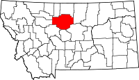
Location in the state of Montana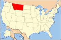
Montana's location in the U.S.Founded 1865 Seat Fort Benton Largest city Fort Benton Area
- Total
- Land
- Water
3,997 sq mi (10,352 km²)
3,973 sq mi (10,290 km²)
24 sq mi (62 km²), 0.59%Population
- (2010)
- Density
5,813
3/sq mi (1/km²)Website www.co.chouteau.mt.us Chouteau County is a county located in the North-Central region of the U.S. state o f Montana. As of 2010, the population was 5,813.[1] Its county seat is Fort Benton[2]. It was established in 1865 as one of the original nine counties of Montana, and named in 1882 after Pierre Chouteau, Jr., a fur trader who established a trading post that became Fort Benton, which was once an important port on the Missouri River.
It is home to the Chippewa-Cree tribe on the Rocky Boy Indian Reservation. It contains part of the Lewis and Clark National Forest.
Contents
Geography
According to the U.S. Census Bureau, the county has a total area of 3,997 square miles (10,352.2 km2). 3,973 square miles (10,290.0 km2) is land and 24 square miles (62.2 km2) (0.59%) is water.
Chouteau County was once the largest county in the Montana Territory and the second largest in the United States, with an area of 15,439 square miles (39,990 km2) in the early 20th century. However, some parts of the county were over 250 miles (400 km) from Fort Benton, and in 1909 an agreement was reached to subdivide the county.
Chouteau County lost half of its population from 1910 to 1930.
The land is mostly prairie. The Bear Paw Mountains rise in the eastern section and the Little Rockies and the Highwood ranges are in the southern portion. Major rivers include the Teton River, Marias River, [[Missouri River] and the Arrow River.
Adjacent counties
- Liberty County, Montana - north
- Hill County, Montana - north
- Blaine County, Montana - east
- Fergus County, Montana - southeast
- Judith Basin County, Montana - south
- Cascade County, Montana - south
- Teton County, Montana - west
- Pondera County, Montana - northwest

Pondera County Liberty County and Hill County Teton County 
Blaine County  Chouteau County, Montana

Judith Basin County and Cascade County Fergus County National protected areas
Economy
Chouteau County is the largest winter wheat producer for the state of Montana.[3] They are located in the heart of the "Golden Triangle", an area which produces about 45% of Montana's wheat crop each year.[4]
Demographics
Historical populations Census Pop. %± 1870 517 — 1880 3,068 493.4% 1890 4,741 54.5% 1900 10,966 131.3% 1910 17,191 56.8% 1920 11,051 −35.7% 1930 8,635 −21.9% 1940 7,316 −15.3% 1950 6,974 −4.7% 1960 7,348 5.4% 1970 6,473 −11.9% 1980 6,092 −5.9% 1990 5,452 −10.5% 2000 5,970 9.5% 2010 5,813 −2.6% As of the census[5] of 2000, there were 5,970 people, 2,226 households, and 1,613 families residing in the county. The population density was 2 people per square mile (1/km²). There were 2,776 housing units at an average density of <1/km² (1/sq mi). The racial makeup of the county was 84.00% White, 0.08% Black or African American, 14.62% Native American, 0.23% Asian, 0.10% Pacific Islander, 0.23% from other races, and 0.72% from two or more races. 0.67% of the population were Hispanic or Latino of any race. 23.9% were of German, 11.7% Norwegian, 8.2% English and 7.3% Irish ancestry according to Census 2000. 96.0% spoke English, 2.5% Cree and 1.0% Spanish as their first language.
There were 2,226 households out of which 34.00% had children under the age of 18 living with them, 60.90% were married couples living together, 8.40% had a female householder with no husband present, and 27.50% were non-families. 24.90% of all households were made up of individuals and 10.60% had someone living alone who was 65 years of age or older. The average household size was 2.59 and the average family size was 3.11.
In the county the population was spread out with 28.80% under the age of 18, 6.50% from 18 to 24, 24.10% from 25 to 44, 23.10% from 45 to 64, and 17.50% who were 65 years of age or older. The median age was 39 years. For every 100 females there were 100.80 males. For every 100 females age 18 and over, there were 97.10 males.
The median income for a household in the county was $29,150, and the median income for a family was $32,399. Males had a median income of $22,080 versus $19,318 for females. The per capita income for the county was $14,851. About 16.50% of families and 20.50% of the population were below the poverty line, including 29.30% of those under age 18 and 8.40% of those age 65 or over.
Communities
City
 Chouteau County Courthouse
Towns
Census-designated places
Major Highways
US Route 87
See also
- List of cemeteries in Chouteau County, Montana
- List of lakes in Chouteau County, Montana
- List of mountains in Chouteau County, Montana
- National Register of Historic Places listings in Chouteau County, Montana
References
- ^ 2010 Census. "Montana". http://2010.census.gov/2010census/data/. Retrieved 31 May 2011.
- ^ "Find a County". National Association of Counties. http://www.naco.org/Counties/Pages/FindACounty.aspx. Retrieved 2011-06-07.
- ^ Merrill, Andrea; Judy Jacobson (1997). Montana almanac. Helena, Montana: Falcon Publishing. ISBN 1-56044-493-2.
- ^ Wheat and Barley Committee. "The basics of wheat - and more!". http://wbc.agr.mt.gov/consumers/basics_wheat.html. Retrieved 23 July 2011.
- ^ "American FactFinder". United States Census Bureau. http://factfinder.census.gov. Retrieved 2008-01-31.
External links
- "History of Chouteau County". http://www.pa-roots.org/~chouteau/history.html. Retrieved 2007-02-23.
Municipalities and communities of Chouteau County, Montana City 
Towns CDP Ghost town Lonetree
Indian reservation Footnotes ‡This populated place also has portions in an adjacent county or counties
 State of Montana
Topics - Index
- History
- Governors
- People
- Geography
- State Government
- Delegations
- Visitor Attractions
Society - Crime
- Demographics
- Economy
- Education
- Politics
Regions - The Flathead
- Glacier National Park
- Regional designations of Montana
- Western Montana
- Yellowstone
Largest cities Counties - Beaverhead
- Big Horn
- Blaine
- Broadwater
- Carbon
- Carter
- Cascade
- Chouteau
- Custer
- Daniels
- Dawson
- Deer Lodge
- Fallon
- Fergus
- Flathead
- Gallatin
- Garfield
- Glacier
- Golden Valley
- Granite
- Hill
- Jefferson
- Judith Basin
- Lake
- Lewis and Clark
- Liberty
- Lincoln
- Madison
- McCone
- Meagher
- Mineral
- Missoula
- Musselshell
- Park
- Petroleum
- Phillips
- Pondera
- Powder River
- Powell
- Prairie
- Ravalli
- Richland
- Roosevelt
- Rosebud
- Sanders
- Sheridan
- Silver Bow
- Stillwater
- Sweet Grass
- Teton
- Toole
- Treasure
- Valley
- Wheatland
- Wibaux
- Yellowstone
Categories:- Montana counties
- Chouteau County, Montana
- Montana counties on the Missouri River


Wikimedia Foundation. 2010.