- Cumberland County, Maine
-
Cumberland County, Maine 
Seal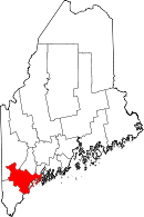
Location in the state of Maine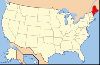
Maine's location in the U.S.Founded 1760 Seat Portland Largest city Portland Area
- Total
- Land
- Water
1,216.89 sq mi (3,152 km²)
835.51 sq mi (2,164 km²)
381.38 sq mi (988 km²), 31.34%Population
- (2010)
- Density
281,674
336.9/sq mi (130.10/km²)Website www.cumberlandcounty.org Cumberland County is a county located in the U.S. state of Maine. As of 2010, the population was 281,674. Its county seat is Portland[1], and is the most populous of the sixteen Maine counties, as well as the most affluent. Cumberland County has the deepest and second largest body of water in the state, Sebago Lake, which supplies tap water to most of the county. The county is the economic and industrial center of the state, having the resources of the Port of Portland, the Maine Mall, and having corporate headquarters of major companies such as Fairchild Semiconductor, IDEXX Laboratories, Unum, and TD Bank.
Cumberland County is part of the Portland–South Portland–Biddeford, Maine, Metropolitan Statistical Area.
Cumberland County was founded in 1760 from a portion of Yorkshire County.
Contents
Geography
According to the 2000 census, the county has a total area of 1,216.89 square miles (3,151.7 km2), of which 835.51 square miles (2,164.0 km2) (or 68.66%) is land and 381.38 square miles (987.8 km2) (or 31.34%) is water.[2]
Adjacent counties
- Androscoggin County, Maine - north
- Oxford County, Maine - northwest
- Sagadahoc County, Maine - northeast
- York County, Maine - southwest
Major highways
 Interstate 95
 Interstate 295
 U.S. Route 302
 U.S. 1
 Maine State Route 9
 Maine State Route 77
National protected area
Demographics
Historical populations Census Pop. %± 1790 25,530 — 1800 38,208 49.7% 1810 42,831 12.1% 1820 49,445 15.4% 1830 60,102 21.6% 1840 68,658 14.2% 1850 79,538 15.8% 1860 75,591 −5.0% 1870 82,021 8.5% 1880 86,359 5.3% 1890 90,949 5.3% 1900 100,689 10.7% 1910 112,014 11.2% 1920 124,376 11.0% 1930 134,645 8.3% 1940 146,000 8.4% 1950 169,201 15.9% 1960 182,751 8.0% 1970 192,528 5.3% 1980 215,789 12.1% 1990 243,135 12.7% 2000 265,612 9.2% 2010 281,674 6.0% [3][4][5] As of the census[6] of 2000[7] , there were 265,612 people, 107,989 households, and 67,709 families residing in the county. The population density was 318 people per square mile (123/km²). There were 122,600 housing units at an average density of 147 per square mile (57/km²). The racial makeup of the county was 95.74% White, 1.06% Black or African American, 0.29% Native American, 1.40% Asian, 0.04% Pacific Islander, 0.35% from other races, and 1.13% from two or more races. 0.95% of the population were Hispanic or Latino of any race.
There were 107,989 households out of which 30.10% had children under the age of 18 living with them, 50.10% were married couples living together, 9.50% had a female householder with no husband present, and 37.30% were non-families. 28.40% of all households were made up of individuals and 10.20% had someone living alone who was 65 years of age or older. The average household size was 2.38 and the average family size was 2.95.
In the county the population was spread out with 23.30% under the age of 18, 8.40% from 18 to 24, 31.30% from 25 to 44, 23.60% from 45 to 64, and 13.30% who were 65 years of age or older. The median age was 38 years. For every 100 females there were 93.80 males. For every 100 females age 18 and over, there were 90.20 males.
The median income for a household in the county was $44,048, and the median income for a family was $54,485. Males had a median income of $35,850 versus $27,935 for females. The per capita income for the county was $23,949. About 5.20% of families and 7.90% of the population were below the poverty line, including 9.10% of those under age 18 and 7.40% of those age 65 or over.
19.6% were of English, 15.5% Irish, 9.6% French, 7.8% United States or American, 7.7% Italian, 6.3% French Canadian and 5.9% German ancestry according to Census 2000. Most of those claiming to be of "American" ancestry are actually of English descent, but have family that has been in the country for so long, in many cases since the early seventeenth century that they choose to identify simply as "American".[8][9][10][11][12] 94.4% spoke English and 2.1% French as their first language.
Government
Cumberland county is represented by county commissioners and the daily operations are run by a county manager. The county has several responsibilities, including running a Sheriff's department, the Cumberland County Jail, and a county court system. Cumberland County also has its own treasury department, emergency management agency and also has a district attorney office. The county also has a stake in the Cumberland County Civic Center (an entertainment facility), as well as programs in local economic development and tourism.
Cumberland County is divided into three districts of equal population, each of which elects one county commissioner. The sheriff is elected countywide and runs the Cumberland County Sheriff's office and the Cumberland County Jail.
Politics
Presidential election results[13] Year Democrat Republican 2008 64.1% 105,218 34.2% 56,186 2004 58.2% 94,846 40.1% 65,384 2000 52.0% 74,203 41.0% 58,543 Voter registration
Voter registration
Voter Registration and Party Enrollment as of August 2011[14] Party Total Voters Percentage Democratic 77,663 37.05% Unenrolled 70,538 33.65% Republican 53,343 25.45% Green Party 8,050 3.84% Total 209,594 100% In popular culture
The fictional town of Jerusalem's Lot, featured in the vampire novel 'Salem's Lot by Stephen King, is situated in Cumberland County. King makes passing reference to other nearby towns and cities, including Portland, Falmouth, and Westbrook.
The video game Trauma Team takes place in Cumberland County in the year 2020, referencing Portland and Portland's Back Cove. Neither actual hospital housed in Portland is mentioned in-game; instead, a fictional trauma center called Resurgam First Care is fabricated for the plot (in real life, Portland's city motto is "Resurgam," Latin for "I will rise again"). Two other fictional places are mentioned that reference the county name: "Cumberland College" and "Cumberland Institute of Forensic Medicine".
Cities and towns
See also
References
- ^ "Find a County". National Association of Counties. http://www.naco.org/Counties/Pages/FindACounty.aspx. Retrieved 2011-06-07.
- ^ "Census 2000 U.S. Gazetteer Files: Counties". United States Census. http://www.census.gov/tiger/tms/gazetteer/county2k.txt. Retrieved 2011-02-13.
- ^ http://www.census.gov/population/www/censusdata/cencounts/files/me190090.txt
- ^ http://factfinder2.census.gov/faces/tableservices/jsf/pages/productview.xhtml?pid=DEC_10_PL_QTPL&prodType=table
- ^ http://mapserver.lib.virginia.edu/
- ^ "American FactFinder". United States Census Bureau. http://factfinder.census.gov. Retrieved 2008-01-31.
- ^ "State & County "QuickFacts": Cumblerand County". U.S. Census Bureau. http://quickfacts.census.gov/qfd/states/23/23005lk.html. Retrieved 2007-05-13.
- ^ Sharing the Dream: White Males in a Multicultural America By Dominic J. Pulera.
- ^ Reynolds Farley, 'The New Census Question about Ancestry: What Did It Tell Us?', Demography, Vol. 28, No. 3 (August 1991), pp. 414, 421.
- ^ Stanley Lieberson and Lawrence Santi, 'The Use of Nativity Data to Estimate Ethnic Characteristics and Patterns', Social Science Research, Vol. 14, No. 1 (1985), pp. 44-6.
- ^ Stanley Lieberson and Mary C. Waters, 'Ethnic Groups in Flux: The Changing Ethnic Responses of American Whites', Annals of the American Academy of Political and Social Science, Vol. 487, No. 79 (September 1986), pp. 82-86.
- ^ Mary C. Waters, Ethnic Options: Choosing Identities in America (Berkeley: University of California Press, 1990), p. 36.
- ^ "Dave Leip's Atlas of U.S. Presidential Elections". http://uselectionatlas.org/RESULTS/. Retrieved 2011-06-11.
- ^ "Registration and Party Enrollment Statistics as of August, 2011". Maine Bureau of Corporations. http://www.maine.gov/sos/cec/elec/2011/20110817r-e-active.pdf.
External links

Oxford County Androscoggin County Sagadahoc County 
Atlantic Ocean  Cumberland County, Maine

York County Municipalities and communities of Cumberland County, Maine Cities 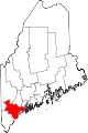
Towns Baldwin | Bridgton | Brunswick | Cape Elizabeth | Casco | Chebeague Island | Cumberland | Falmouth | Freeport | Frye Island | Gorham | Gray | Harpswell | Harrison | Long Island | Naples | New Gloucester | North Yarmouth | Pownal | Raymond | Scarborough | Sebago | Standish | Windham | Yarmouth
CDPs Other
village State of Maine
Topics - Index
- Culture
- Geography
- Government
- Governors
- History
- Images
- People
- Visitor Attractions
- Congressional districts
Regions Counties Cities Largest towns Categories:- Maine counties
- Cumberland County, Maine
- States and territories established in 1760
- Portland – South Portland – Biddeford metropolitan area
- Former counties in Massachusetts


Wikimedia Foundation. 2010.