- Ohio County, Kentucky
-
Ohio County, Kentucky  Ohio County Courthouse in Hartford, Kentucky
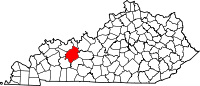
Location in the state of Kentucky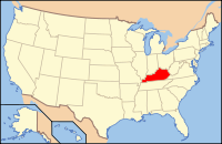
Kentucky's location in the U.S.Founded 1799 Named for The Ohio River, which formed the county's northern border until its division to creation Daviess and Hancock counties. Seat Hartford Largest city Beaver Dam Area
- Total
- Land
- Water
596.73 sq mi (1,546 km²)
593.79 sq mi (1,538 km²)
2.94 sq mi (8 km²), 0.49%Population
- (2000)
- Density
22,916
39/sq mi (15/km²)Time zone Central: UTC-6/-5 Website www.ohiocounty.com Ohio County is a county located in the U.S. state of Kentucky. As of 2000, the population was 22,916. Its county seat is Hartford[1]. The county is named for the Ohio River, which originally formed its northern boundary. It is a dry county, which means that the sale of alcohol is restricted or prohibited.
Contents
Geography
Ohio County is part of the Western Coal Fields region of Kentucky. According to the 2000 census, the county has a total area of 596.73 square miles (1,545.5 km2), of which 593.79 square miles (1,537.9 km2) (or 99.51%) is land and 2.94 square miles (7.6 km2) (or 0.49%) is water.[2] Of the 120 counties in Kentucky, it is the fifth largest.[citation needed]
Adjacent counties
- Hancock County (north)
- Breckinridge County (northeast)
- Grayson County (east)
- Butler County (southeast)
- Muhlenberg County (southwest)
- McLean County (west)
- Daviess County (northwest)
History
Ohio County was formed on December 17, 1798 from portions of Hardin County, Kentucky. It was named for the Ohio River, which originally formed its northern boundary, but lost its northern portions in 1829, when Daviess County and Hancock County were formed.
Ohio County was the birth place of western lawman Wyatt Earp's three older brothers, but is best known as the birth place of Bill Monroe, the father of Bluegrass music.
Demographics
Historical populations Census Pop. %± 1800 1,223 — 1810 3,792 210.1% 1820 3,879 2.3% 1830 4,715 21.6% 1840 6,592 39.8% 1850 9,749 47.9% 1860 12,209 25.2% 1870 15,561 27.5% 1880 19,669 26.4% 1890 22,946 16.7% 1900 27,287 18.9% 1910 27,642 1.3% 1920 26,473 −4.2% 1930 24,469 −7.6% 1940 24,421 −0.2% 1950 20,840 −14.7% 1960 17,725 −14.9% 1970 18,790 6.0% 1980 21,765 15.8% 1990 21,105 −3.0% 2000 22,916 8.6% Est. 2007 23,844 4.0% http://ukcc.uky.edu/~census/21183.txt As of the census[3] of 2000, there were 22,916 people, 8,899 households, and 6,585 families residing in the county. The population density was 39 per square mile (15 /km2). There were 9,909 housing units at an average density of 17 per square mile (6.6 /km2). The racial makeup of the county was 97.71% White, 0.75% Black or African American, 0.19% Native American, 0.20% Asian, 0.03% Pacific Islander, 0.45% from other races, and 0.67% from two or more races. 1.01% of the population were Hispanic or Latino of any race.
There were 8,899 households out of which 33.00% had children under the age of 18 living with them, 61.20% were married couples living together, 9.20% had a female householder with no husband present, and 26.00% were non-families. 23.20% of all households were made up of individuals and 11.10% had someone living alone who was 65 years of age or older. The average household size was 2.54 and the average family size was 2.98.
In the county the population was spread out with 24.90% under the age of 18, 8.60% from 18 to 24, 27.50% from 25 to 44, 24.60% from 45 to 64, and 14.40% who were 65 years of age or older. The median age was 38 years. For every 100 females there were 96.60 males. For every 100 females age 18 and over, there were 94.20 males.
The median income for a household in the county was $29,557, and the median income for a family was $34,970. Males had a median income of $29,778 versus $19,233 for females. The per capita income for the county was $15,317. About 13.90% of families and 17.30% of the population were below the poverty line, including 21.90% of those under age 18 and 15.70% of those age 65 or over.
Cities and towns
- Baizetown
- Beaver Dam
- Centertown
- Cool Springs
- Cromwell
- Dundee
- Echols
- Fordsville
- Hartford
- Magan
- Horse Branch
- McHenry
- Pleasant Ridge
- Prentiss
- Rockport
- Rosine
See also
References
- ^ "Find a County". National Association of Counties. http://www.naco.org/Counties/Pages/FindACounty.aspx. Retrieved 2011-06-07.
- ^ "Census 2000 U.S. Gazetteer Files: Counties". United States Census. http://www.census.gov/tiger/tms/gazetteer/county2k.txt. Retrieved 2011-02-13.
- ^ "American FactFinder". United States Census Bureau. http://factfinder.census.gov. Retrieved 2008-01-31.
Municipalities and communities of Ohio County, Kentucky Cities Beaver Dam | Centertown | Fordsville | Hartford | McHenry | Rockport
Unincorporated
communityCategories:- Kentucky counties
- 1799 establishments in the United States
- Dry counties of Kentucky
- Ohio County, Kentucky
- Populated places established in 1799


Wikimedia Foundation. 2010.