- Sheridan County, Kansas
Infobox U.S. County
county=Sheridan County
state=Kansas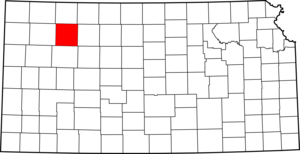
founded=1873
seat=Hoxie
area_total_km2=2322|area_total_sq_mi=897
area_land_km2=2322|area_land_sq_mi=896
area_water_km2=1|area_water_sq_mi=0
area percentage=0.03%
census estimate yr=2005
pop=2591
density_km2=1.1|density_sq_mi=2.9
time zone=Central
UTC offset=-6
DST offset=-5|Sheridan County (standard abbreviation: SD) is a
county located in theU.S. state ofKansas . As of 2000, the population is 2,813. Itscounty seat is Hoxie.GR|6 The county was named in honor ofPhillip H. Sheridan , a general of the American Civil War era.Law and government
Although the
Kansas Constitution was amended in 1986 to allow the sale of alcoholic liquor by the individual drink with the approval of voters, Sheridan County has remained a prohibition, or "dry", county. [Cite web| url=http://www.ksrevenue.org/abcwetdrymap.htm| title=Map of Wet and Dry Counties| publisher=Alcoholic Beverage Control, Kansas Department of Revenue| month=November | year=2004| accessdate=2007-01-21]Geography
According to the
U.S. Census Bureau , the county has a total area of 897square mile s (2,322km² ), of which, 896 square miles (2,322 km²) of it is land and 0 square miles (1 km²) of it (0.03%) is water.Adjacent counties
*Decatur County (north)
*Norton County (northeast)
*Graham County (east)
*Gove County (south)
*Thomas County (west)Demographics
As of the
census GR|2 of 2000, there were 2,813 people, 1,124 households, and 795 families residing in the county. Thepopulation density was 3 people per square mile (1/km²). There were 1,263 housing units at an average density of 1 per square mile (1/km²). The racial makeup of the county was 98.65% White, 0.14% Black or African American, 0.07% Native American, 0.07% Asian, 0.14% Pacific Islander, 0.36% from other races, and 0.57% from two or more races. 1.46% of the population were Hispanic or Latino of any race.There were 1,124 households out of which 30.40% had children under the age of 18 living with them, 63.80% were married couples living together, 4.50% had a female householder with no husband present, and 29.20% were non-families. 27.60% of all households were made up of individuals and 14.80% had someone living alone who was 65 years of age or older. The average household size was 2.46 and the average family size was 3.01.
In the county the population was spread out with 26.30% under the age of 18, 5.80% from 18 to 24, 23.70% from 25 to 44, 23.90% from 45 to 64, and 20.30% who were 65 years of age or older. The median age was 42 years. For every 100 females there were 100.10 males. For every 100 females age 18 and over, there were 95.80 males.
The median income for a household in the county was $33,547, and the median income for a family was $38,292. Males had a median income of $26,351 versus $16,250 for females. The
per capita income for the county was $16,299. About 12.00% of families and 15.70% of the population were below thepoverty line , including 27.30% of those under age 18 and 5.50% of those age 65 or over.Cities and towns
Incorporated cities
Name and population (2004 estimate):
*Hoxie, 1,158 (county seat)
*Selden, 186Townships
Sheridan County is divided into fourteen townships. None of the cities within the county are considered "governmentally independent", and all figures for the townships include those of the cities. In the following table, the population center is the largest city (or cities) included in that township's population total, if it is of a significant size.
Education
Unified school districts
* Hoxie USD 412
See also
*
Dry counties References
External links

Wikimedia Foundation. 2010.