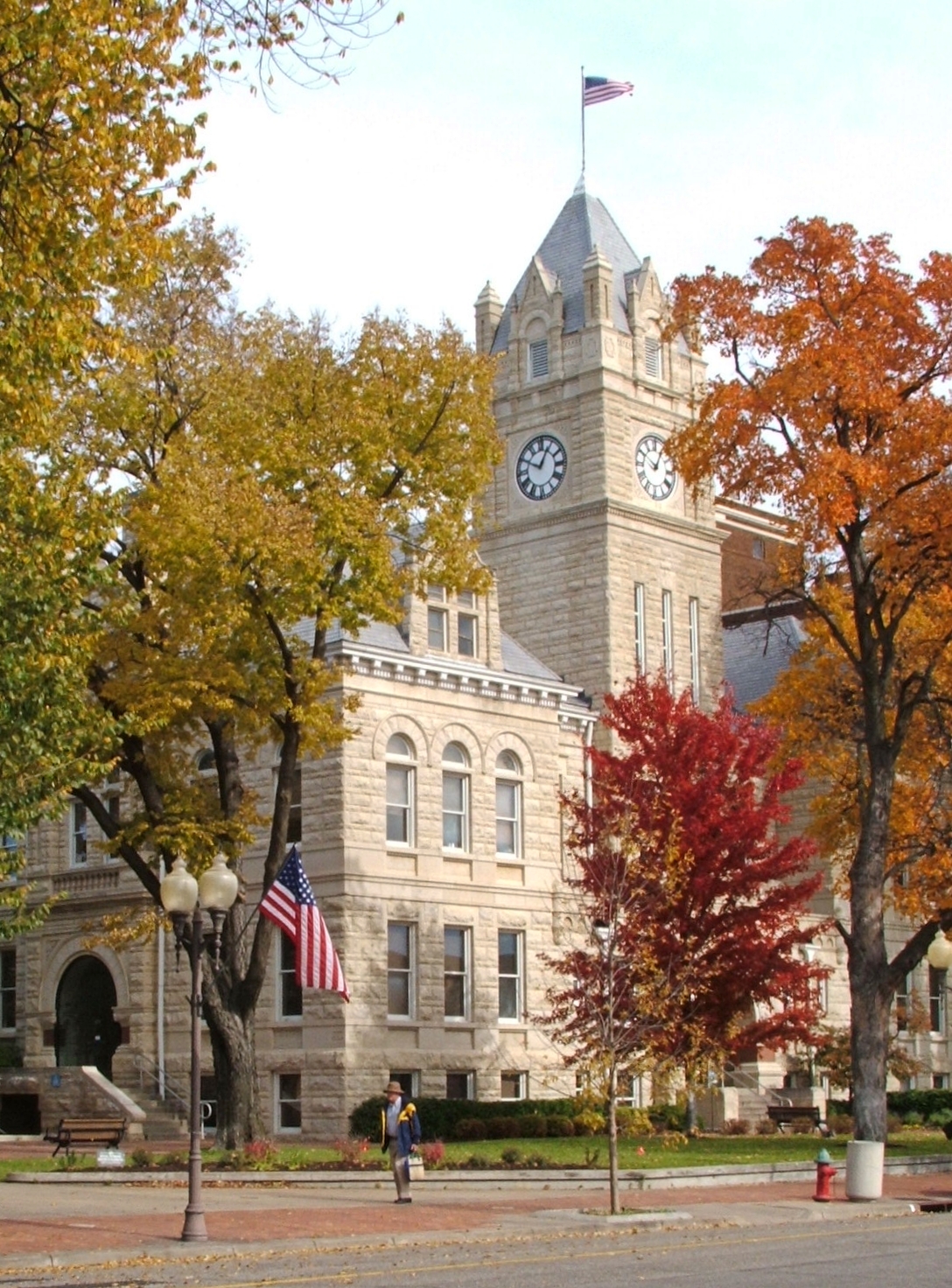
- Riley County, Kansas
-
Riley County, Kansas 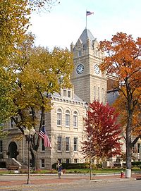
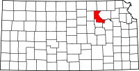
Location in the state of Kansas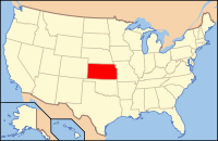
Kansas's location in the U.S.Founded August 25, 1855 Seat Manhattan Area
- Total
- Land
- Water
622.11 sq mi (1,611 km²)
609.55 sq mi (1,579 km²)
12.55 sq mi (33 km²), 2.02%Population
- (2010)
- Density
71,115
103.0/sq mi (39.8/km²)Time zone Central: UTC-6/-5 Website RileyCountyKS.gov Riley County (standard abbreviation: RL) is a county located in the U.S. state of Kansas. The county's population was 71,115 for the 2010 census.[1] The largest city and county seat is Manhattan. The county is part of the Manhattan, Kansas, Metropolitan Statistical Area.
Riley County is home to two of Kansas' largest employers: Fort Riley and Kansas State University. Among notable current and former residents of Riley County are former Governor John W. Carlin, General Glen Edgerton and millionaire miner Horace A. W. Tabor.
Contents
History
Riley County, named for Mexican-American War general Bennet Riley, was on the western edge of the 33 original counties established by the Kansas Territorial Legislature in August 1855. For organizational purposes, Riley County initially had attached to it Geary County and all land west of Riley County, stretching most of the way across Kansas Territory into present-day Colorado.[citation needed]
The first Territorial Capital of Kansas Territory was located in the boundaries of Riley County, in the former town of Pawnee, Kansas. The site now falls within the boundaries of Fort Riley, a U.S. Army post.[citation needed]
Manhattan was selected as county seat in contentious fashion. In late 1857, an election was held to select the county seat, with Ogden prevailing. However, Manhattanites suspected election fraud, and were eventually able to prove that a number of votes were illegally cast. Sheriff David A. Butterfield was forced to secure the county's books and records for Manhattan, and Manhattan was finally officially declared the county seat in 1858.[2]
On May 30, 1879, the "Irving, Kansas Tornado" began in Riley county. This tornado measured F4 on the Fujita scale and had a damage path 800 yards (700 m) wide and 100 miles (200 km) long. Eighteen people were killed and sixty were injured.[3]
Law and government
Riley County was a prohibition, or "dry", county until the Kansas Constitution was amended in 1986 and voters approved the sale of alcoholic liquor by the individual drink with a 30% food sales requirement. The food sales requirement was removed with voter approval in 2004.[4]
 2005 KDOT Map of Riley County (map legend)
Geography
According to the 2000 census, the county has a total area of 622.11 square miles (1,611.3 km2), of which 609.55 square miles (1,578.7 km2) (or 97.98%) is land and 12.55 square miles (32.5 km2) (or 2.02%) is water.[5]
Geographic features
The eastern border of the county follows the former course of the Big Blue River. The river was dammed in the 1960s and Tuttle Creek Lake was created as a result. The county falls within the Flint Hills region of the state.
Adjacent counties
- Marshall County (northeast)
- Pottawatomie County (east)
- Wabaunsee County (southeast)
- Geary County (south)
- Clay County (west)
- Washington County (northwest)
Demographics
 Age pyramid
Historical populations Census Pop. %± 1860 1,224 — 1870 5,105 317.1% 1880 10,430 104.3% 1890 13,183 26.4% 1900 13,828 4.9% 1910 15,783 14.1% 1920 20,650 30.8% 1930 19,882 −3.7% 1940 20,617 3.7% 1950 33,405 62.0% 1960 41,914 25.5% 1970 56,788 35.5% 1980 63,505 11.8% 1990 67,139 5.7% 2000 62,843 −6.4% 2010 71,115 13.2% U.S. Decennial Census As of the census[6] of 2000, there were 62,843 people, 22,137 households, and 12,263 families residing in the county. The population density was 103 people per square mile (40/km²). There were 23,397 housing units at an average density of 38 per square mile (15/km²). The racial makeup of the county was 84.78% White, 6.88% Black or African American, 0.63% Native American, 3.22% Asian, 0.17% Pacific Islander, 1.89% from other races, and 2.43% from two or more races. 4.57% of the population were Hispanic or Latino of any race.
There were 22,137 households out of which 27.80% had children under the age of 18 living with them, 46.20% were married couples living together, 6.80% had a female householder with no husband present, and 44.60% were non-families. 27.50% of all households were made up of individuals and 6.10% had someone living alone who was 65 years of age or older. The average household size was 2.42 and the average family size was 2.99.
In the county the population was spread out with 18.80% under the age of 18, 34.50% from 18 to 24, 25.90% from 25 to 44, 13.30% from 45 to 64, and 7.50% who were 65 years of age or older. The median age was 24 years. For every 100 females there were 114.30 males. For every 100 females age 18 and over, there were 115.40 males.
The median income for a household in the county was $32,042, and the median income for a family was $46,489. Males had a median income of $26,856 versus $23,835 for females. The per capita income for the county was $16,349. About 8.50% of families and 20.60% of the population were below the poverty line, including 11.20% of those under age 18 and 6.70% of those age 65 or over.
Cities and towns
Incorporated cities
Name and population (2004 estimate):
- Manhattan, 47,916 (county seat)
- Ogden, 1,544
- Riley, 760
- Leonardville, 384
- Randolph, 149
Unincorporated places
- Ashland
- Bala
- Keats
- Lasita
- May Day
- Rocky Ford
- Zeandale
Former communities
These former places were flooded when Tuttle Creek Lake was created in the 1950s and 1960s. Randolph was also flooded, but moved a mile west of its original location.
- Cleburn
- Garrison Cross
- Stockdale
Fort Riley
Located north of the junction of the Smoky Hill and Republican rivers in Geary County, the Fort Riley Military Reservation covers 100,656 acres (407 km2) in Geary and Riley counties. The fort has a daytime population of nearly 25,000 and includes two census-designated places:
- Fort Riley North
- Fort Riley-Camp Whiteside (located only in Geary County)
Townships
Riley County is divided into fourteen townships. The city of Manhattan is considered governmentally independent and is excluded from the census figures for the townships. In the following table, the population center is the largest city (or cities) included in that township's population total, if it is of a significant size.
Sources: 2000 U.S. Gazetteer from the U.S. Census Bureau. Township FIPS Population
centerPopulation Population
density
/km² (/sq mi)Land area
km² (sq mi)Water area
km² (sq mi)Water % Geographic coordinates Ashland 02725 150 2 (4) 89 (35) 1 (0) 0.75% 39°6′48″N 96°37′42″W / 39.11333°N 96.62833°W Bala 03825 Leonardville 762 7 (18) 108 (42) 0 (0) 0.12% 39°20′34″N 96°53′47″W / 39.34278°N 96.89639°W Center 12100 81 1 (3) 82 (32) 0 (0) 0.04% 39°29′22″N 96°52′54″W / 39.48944°N 96.88167°W Fancy Creek 22950 126 2 (4) 83 (32) 0 (0) 0.07% 39°24′55″N 96°53′14″W / 39.41528°N 96.88722°W Grant 28075 833 9 (23) 92 (35) 7 (3) 7.38% 39°17′52″N 96°41′31″W / 39.29778°N 96.69194°W Jackson 34900 Randolph 326 4 (10) 84 (32) 10 (4) 10.30% 39°26′43″N 96°45′1″W / 39.44528°N 96.75028°W Madison 44125 Fort Riley North CDP (part) 8,173 22 (58) 366 (141) 0 (0) 0.11% 39°15′32″N 96°50′26″W / 39.25889°N 96.84056°W Manhattan 44275 3,275 37 (95) 89 (35) 3 (1) 3.28% 39°12′45″N 96°35′46″W / 39.2125°N 96.59611°W May Day 45225 78 1 (2) 81 (31) 0 (0) 0.04% 39°32′39″N 96°53′41″W / 39.54417°N 96.89472°W Ogden 52300 Ogden 2,423 69 (178) 35 (14) 1 (0) 2.32% 39°7′6″N 96°41′54″W / 39.11833°N 96.69833°W Sherman 65075 524 7 (18) 76 (29) 5 (2) 6.06% 39°22′30″N 96°43′58″W / 39.375°N 96.73278°W Swede Creek 69650 157 1 (3) 125 (48) 4 (1) 3.00% 39°32′24″N 96°42′9″W / 39.54°N 96.7025°W Wildcat 79175 750 10 (25) 77 (30) 0 (0) 0.10% 39°13′26″N 96°42′28″W / 39.22389°N 96.70778°W Zeandale 80900 357 2 (6) 154 (60) 2 (1) 0.97% 39°7′39″N 96°27′19″W / 39.1275°N 96.45528°W Education
Colleges and universities
Unified school districts
See also
Information on this and other counties in Kansas
- List of counties in Kansas
- National Register of Historic Places listings in Kansas
- Kansas locations by per capita income
Other information for Kansas
- List of cities in Kansas
- List of unified school districts in Kansas
- List of colleges and universities in Kansas
References
- ^ "2010 County Population and Housing Occupancy Status". U.S. Census Bureau. http://factfinder2.census.gov/faces/tableservices/jsf/pages/productview.xhtml?pid=DEC_10_PL_GCTPL2.ST05&prodType=table. Retrieved March 5, 2011.
- ^ Riley County Official Website - History
- ^ Joe Furr, "Historical Tornadoes"
- ^ "Map of Wet and Dry Counties". Alcoholic Beverage Control, Kansas Department of Revenue. November 2006. http://www.ksrevenue.org/abcwetdrymap.htm. Retrieved 2007-12-28.
- ^ "Census 2000 U.S. Gazetteer Files: Counties". United States Census. http://www.census.gov/tiger/tms/gazetteer/county2k.txt. Retrieved 2011-02-13.
- ^ "American FactFinder". United States Census Bureau. http://factfinder.census.gov. Retrieved 2008-01-31.
Further reading
- History of the State of Kansas; William G. Cutler; A.T. Andreas Publisher; 1883. (Online HTML eBook)
- Kansas : A Cyclopedia of State History, Embracing Events, Institutions, Industries, Counties, Cities, Towns, Prominent Persons, Etc; 3 Volumes; Frank W. Blackmar; Standard Publishing Co; 944 / 955 / 824 pages; 1912. (Volume1 - Download 54MB PDF eBook), (Volume2 - Download 53MB PDF eBook), (Volume3 - Download 33MB PDF eBook)
External links
- Official websites
- General county information
- Local History and Genealogy
- List of 150 Notable Residents of Riley County
- The Irving, KS Tornado
- Cutler's History of Riley County, Kansas
- Riley County GenWeb
- Riley County Kansas AHGP
- County Level Data
- Maps
- Riley County Map, KDOT
- Kansas Highway Map, KDOT
- Kansas Railroad Map, KDOT
- Kansas School District Boundary Map, KSDE

Washington County Marshall County Clay County 
Pottawatomie County  Riley County, Kansas

Geary County Wabaunsee County Municipalities and communities of Riley County, Kansas Cities Leonardville | Manhattan‡ | Ogden | Randolph | Riley

CDP Unincorporated
communityFootnotes ‡This populated place also has portions in an adjacent county or counties
Categories:- Kansas counties
- Riley County, Kansas
- 1855 establishments in the United States
- Manhattan, Kansas metropolitan area


Wikimedia Foundation. 2010.