- Ness County, Kansas
-
Ness County, Kansas 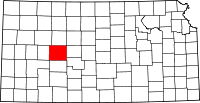
Location in the state of Kansas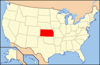
Kansas's location in the U.S.Founded February 26, 1867 Seat Ness City Area
- Total
- Land
- Water
1,075.00 sq mi (2,784 km²)
1,074.75 sq mi (2,784 km²)
0.26 sq mi (1 km²), 0.02%Population
- (2010)
- Density
3,107
2.8/sq mi (1.1/km²)Time zone Central: UTC-6/-5 Website www.NessCountyKS.com Ness County (standard abbreviation: NS) is a county located in the U.S. state of Kansas. As of the 2010 census, the county population was 3,107.[1] The largest city and county seat is Ness City. Ness County was named for Corporal Noah V. Ness of the 7th Kansas Cavalry. Ness died of wounds received in a skirmish at Abbeville, Mississippi in August 1864.[2]
Contents
Law and government
Following amendment to the Kansas Constitution in 1986, the county remained a prohibition, or "dry", county until 2004, when voters approved the sale of alcoholic liquor by the individual drink with a 30% food sales requirement.[3]
Geography
According to the 2000 census, the county has a total area of 1,075.00 square miles (2,784.2 km2), of which 1,074.75 square miles (2,783.6 km2) (or 99.98%) is land and 0.26 square miles (0.67 km2) (or 0.02%) is water.[4]
Adjacent counties
- Trego County (north)
- Ellis County (northeast)
- Rush County (east)
- Pawnee County (southeast)
- Hodgeman County (south)
- Finney County (southwest)
- Lane County (west)
- Gove County (northwest)
See also: List of counties bordering eight counties
Demographics
Historical populations Census Pop. %± 1900 4,535 — 1910 5,883 29.7% 1920 7,490 27.3% 1930 8,358 11.6% 1940 6,864 −17.9% 1950 6,322 −7.9% 1960 5,470 −13.5% 1970 4,791 −12.4% 1980 4,498 −6.1% 1990 4,033 −10.3% 2000 3,454 −14.4% 2010 3,107 −10.0% U.S. Decennial Census  Age pyramid
As of the census[5] of 2000, there were 3,454 people, 1,516 households, and 977 families residing in the county. The population density was 3 people per square mile (1/km²). There were 1,835 housing units at an average density of 2 per square mile (1/km²). The racial makeup of the county was 98.23% White, 0.06% Black or African American, 0.23% Native American, 0.09% Asian, 0.49% from other races, and 0.90% from two or more races. 1.51% of the population were Hispanic or Latino of any race.
There were 1,516 households out of which 26.10% had children under the age of 18 living with them, 57.10% were married couples living together, 4.70% had a female householder with no husband present, and 35.50% were non-families. 33.50% of all households were made up of individuals and 18.30% had someone living alone who was 65 years of age or older. The average household size was 2.23 and the average family size was 2.83.
In the county the population was spread out with 22.90% under the age of 18, 4.60% from 18 to 24, 24.00% from 25 to 44, 24.20% from 45 to 64, and 24.20% who were 65 years of age or older. The median age was 44 years. For every 100 females there were 98.50 males. For every 100 females age 18 and over, there were 95.10 males.
The median income for a household in the county was $32,340, and the median income for a family was $39,775. Males had a median income of $27,892 versus $20,037 for females. The per capita income for the county was $17,787. About 6.50% of families and 8.70% of the population were below the poverty line, including 9.50% of those under age 18 and 10.20% of those age 65 or over.
Cities and towns
Incorporated cities
Name and population (2004 estimate):
Unincorporated towns
Townships
Ness County is divided into ten townships. None of the cities within the county are considered governmentally independent, and all figures for the townships include those of the cities. In the following table, the population center is the largest city (or cities) included in that township's population total, if it is of a significant size.
Sources: 2000 U.S. Gazetteer from the U.S. Census Bureau. Township FIPS Population
centerPopulation Population
density
/km² (/sq mi)Land area
km² (sq mi)Water area
km² (sq mi)Water % Geographic coordinates Bazine 04800 Bazine 441 1 (4) 312 (120) 0 (0) 0 % 38°27′30″N 99°41′15″W / 38.45833°N 99.6875°W Center 11925 Ness City 1,567 13 (33) 124 (48) 0 (0) 0.01% 38°27′40″N 99°53′45″W / 38.46111°N 99.89583°W Eden 19775 70 0 (1) 266 (103) 0 (0) 0 % 38°28′57″N 100°8′49″W / 38.4825°N 100.14694°W Forrester 23875 109 1 (1) 206 (80) 0 (0) 0 % 38°30′45″N 99°59′28″W / 38.5125°N 99.99111°W Franklin 24475 132 0 (1) 372 (144) 0 (0) 0.02% 38°21′22″N 99°54′25″W / 38.35611°N 99.90694°W Highpoint 32100 93 0 (1) 312 (121) 0 (0) 0.08% 38°20′13″N 99°42′26″W / 38.33694°N 99.70722°W Johnson 35550 76 0 (1) 308 (119) 0 (0) 0.05% 38°18′37″N 100°5′25″W / 38.31028°N 100.09028°W Nevada 50125 Ransom 479 2 (4) 278 (107) 0 (0) 0.04% 38°37′55″N 99°55′22″W / 38.63194°N 99.92278°W Ohio 52400 Utica 345 1 (3) 298 (115) 0 (0) 0 % 38°38′28″N 100°7′45″W / 38.64111°N 100.12917°W Waring 75400 Brownell 142 0 (1) 308 (119) 0 (0) 0.03% 38°37′50″N 99°42′56″W / 38.63056°N 99.71556°W Education
 2005 KDOT Map of Ness County (map legend)
Unified school districts
See also
Information on this and other counties in Kansas
- List of counties in Kansas
- National Register of Historic Places listings in Kansas
- Kansas locations by per capita income
Other information for Kansas
- List of cities in Kansas
- List of unified school districts in Kansas
- List of colleges and universities in Kansas
References
- ^ "2010 County Population and Housing Occupancy Status". U.S. Census Bureau. http://factfinder2.census.gov/faces/tableservices/jsf/pages/productview.xhtml?pid=DEC_10_PL_GCTPL2.ST05&prodType=table. Retrieved March 31, 2011.
- ^ Kansas Place-Names,John Rydjord, University of Oklahoma Press, 1972, ISBN 0-8061-0994-7
- ^ "Map of Wet and Dry Counties". Alcoholic Beverage Control, Kansas Department of Revenue. November 2006. http://www.ksrevenue.org/abcwetdrymap.htm. Retrieved 2007-12-26.
- ^ "Census 2000 U.S. Gazetteer Files: Counties". United States Census. http://www.census.gov/tiger/tms/gazetteer/county2k.txt. Retrieved 2011-02-13.
- ^ "American FactFinder". United States Census Bureau. http://factfinder.census.gov. Retrieved 2008-01-31.
Further reading
- History of the State of Kansas; William G. Cutler; A.T. Andreas Publisher; 1883. (Online HTML eBook)
- Kansas : A Cyclopedia of State History, Embracing Events, Institutions, Industries, Counties, Cities, Towns, Prominent Persons, Etc; 3 Volumes; Frank W. Blackmar; Standard Publishing Co; 944 / 955 / 824 pages; 1912. (Volume1 - Download 54MB PDF eBook),(Volume2 - Download 53MB PDF eBook), (Volume3 - Download 33MB PDF eBook)
External links
- Official
- General county information
- County Level Data
- Maps
- Ness County Map, KDOT
- Kansas Highway Map, KDOT
- Kansas Railroad Map, KDOT
- Kansas School District Boundary Map, KSDE

Gove County Trego County Ellis County Lane County 
Rush County  Ness County, Kansas

Finney County Hodgeman County Pawnee County Municipalities and communities of Ness County, Kansas Cities 
Unincorporated
communitiesCategories:- Kansas counties
- Ness County, Kansas
- 1867 establishments


Wikimedia Foundation. 2010.