- Johnson County, Kansas
-
Johnson County, Kansas 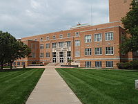 Johnson Courthouse in Olathe
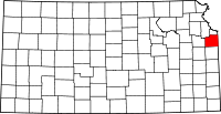
Location in the state of Kansas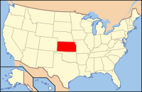
Kansas's location in the U.S.Founded August 25, 1855 Seat Olathe Largest city Overland Park Area
- Total
- Land
- Water
480.15 sq mi (1,244 km²)
476.78 sq mi (1,235 km²)
3.37 sq mi (9 km²), 0.70%Population
- (2010)
- Density
544,179
1,138.3/sq mi (440/km²)Time zone Central: UTC-6/-5 Website www.jocogov.org Johnson County (county code JO) is a county located in northeast Kansas, in the central United States. The county is largely suburban, being part of the Kansas City metropolitan area, and containing many of its affluent southwestern suburbs. As of the 2010 census, the county population was 544,179.[1] Its county seat is Olathe,[2] and its most populous city is Overland Park. The county has the highest median household income and highest per-capita income in Kansas and is among the most affluent in the United States, boasting the 19th highest median household income in 2000 [3] and the 46th highest per-capita income in 2005.[3]
In 2010, Money magazine, in its list of the 100 Best Cities in the United States in which to live, ranked Overland Park 7th (ranked 6th in 2006 and 9th in 2008) and Shawnee 17th (ranked 39th in 2008).[4] In 2008 the same magazine also ranked Olathe 11th.[5]
Contents
History
Johnson County is named for Thomas Johnson, and was one of the first counties established in the Kansas Territory in 1855. The Oregon-California and Santa Fe Trails, pass through nearby Independence, Missouri, also passed through the county. The renowned gunfighter Wild Bill Hickok settled for a time in the county, becoming constable of Monticello Township in 1858. Johnson County was the site of many battles between Abolitionists and pro-slavery advocates during Bleeding Kansas. In 1862 Confederate Guerrillas from nearby Missouri led by William Quantrill raided the Johnson County communities of Olathe and Spring Hill, killing half a dozen men and destroying numerous homes and businesses.[citation needed]
The county was largely rural until the early 20th century, when housing subdivisions were developed in the northeastern portion of the county adjacent to Kansas City, Missouri. Developer J.C. Nichols spurred the boom in 1914 when he built the Mission Hills Country Club to lure upscale residents who previously had been reluctant to move from Missouri to Kansas.[6] Suburban development continued at a steady pace until the close of World War II. Following the war, the pace of development exploded, triggered by the return of soldiers in need of housing and white flight, a common occurrence throughout the United States during the post-war period. The US Supreme Court 1954 school desegration ruling and its impact in Kansas City, Missouri contributed to white flight throughout the region, resulting in increased migration from Kansas City, Missouri to the county and the furthering the county's reputation as a destination for quality public schools and as a good location for families. This growth slowed slightly in the 1970s, however beginning in the mid 1980's the pace of growth increased significantly, with the county adding 100,000 residents each decade between the 1990 census and 2010 census.
Law and government
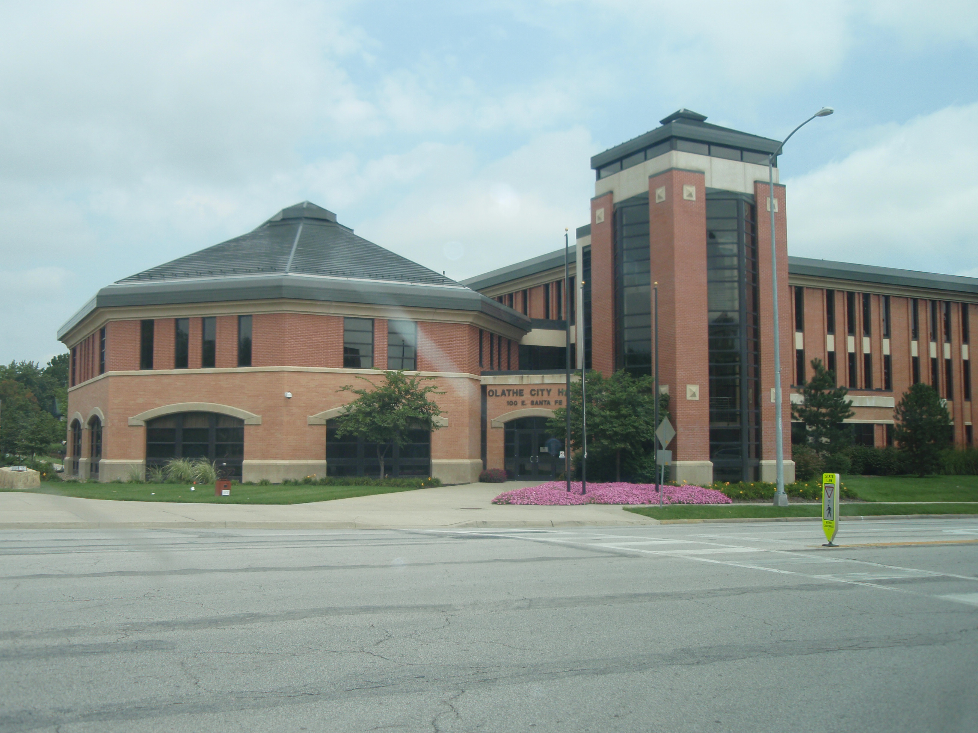
 Olathe City Hall
Laws
Johnson County was a prohibition, or "dry", county until the Kansas Constitution was amended in 1986 and voters approved the sale of alcoholic liquor by the individual drink with a 30% food sales requirement.[7]
Federal representation
Johnson County is a part of Kansas's 3rd congressional district, which elected Republican Kevin Yoder in the 2010 midterm elections. The two U.S. Senators from Kansas are Republican Senators Pat Roberts and Jerry Moran. The most affluent county in Kansas, Johnson County is solidly Republican. President George W. Bush received 61% of the vote in 2004. Johnson County has not supported a Democrat on the Presidential ticket since Woodrow Wilson in the 1916 election.[8][9]
State representation
Johnson County is home to 22 Kansas state representatives and 7 Kansas state senators. 21 out of 22 of Johnson County's representatives are Republicans, as are all 7 of the county's senators.[10][11] Most Johnson County Republicans identify themselves as moderates, the more socially progressive and fiscally conservative faction of the Kansas Republican Party.[citation needed] Johnson County House and Senate members at times come into conflict with representatives from other areas of the state, most notably in 2004 in the debate over school finance.[12]
County Government & Unincorporated Areas
The county government is administered by an elected, seven-member Board of County Commissioners.[13] Ed Eilert, former mayor of Overland Park serves as the current County Chairman. Governance of the county is divided into six districts. The county government has full jurisdiction of the unincorporated areas of the county and limited jurisdiction of those areas of the county within incorporated places. For instance, decisions regarding the regulation of land use, development and zoning in unincorporated areas of the county are the responsibility of the county government, whereas such decisions for areas within incorporated places are the jurisdiction of the incorporated city of which the property is a part.
District Area Served Commissioner Term Expires One Northeast C. Edward Peterson January 12, 2015 Two North James Allen January 14, 2014 Three Southeast David Lindstrom January 14, 2013 Four East Central Jason Osterhaus January 12, 2015 Five West Central Michael Ashcraft January 12, 2015 Six Western Calvin Hayden January 14, 2013 Incorporated Places
There are twenty incorporated places with land area within Johnson County.
Sales taxes
The current sales tax rate in Johnson County is 6.4%, slightly higher than the 6.3% rate in Wyandotte (where Kansas City, Kansas is located).[14] The sales tax rates of each of the surrounding counties are nearly the same as the rate in Johnson County.[14] Individual cities also have additional sales taxes that are added on to these figures.
Property taxes
Property taxes are a conglomeration of state, county, city, and school district taxes. Property tax rates are generally lower in Johnson County because property values in the county are higher than in other counties throughout Kansas.
Property tax rates by city in Johnson County (2005)[15] City Commercial Real Property Motor Vehicle De Soto 3.20 1.47 3.84 Gardner 3.39 1.56 4.07 Leawood 3.39 1.56 4.07 Lenexa 2.75 1.26 3.30 Merriam 2.57 1.18 3.08 Olathe 3.09 1.42 3.71 Overland Park 2.31 1.06 2.77 Prairie Village 2.71 1.25 3.25 Shawnee 2.61 1.20 3.13 Note: Some cities have multiple tax rates because they are divided among multiple school districts. The above rates are what exist for the majority of residents in the city.
Geography
Topography
The natural topography of the county consists of gently rolling terrain. The Kansas River forms a portion of the northwest boundary of the county. The elevation generally increases from north to south as the distance from the Kansas River and Missouri River increases.
Watersheds & Streams
The county is drained by the watersheds of the Kansas River, Blue River and Marais des Cygnes River all of which are part of the Missouri River watershed.[16] Being located in northeastern Kansas, the county receives plentiful rainfall. Consequently, the county contains numerous small streams, including Kill Creek, Mill Creek, Turkey Creek, Indian Creek, Brush Creek, Tomahawk Creek, the Blue River, Bull Creek and Little Bull Creek.
Kill Creek begins in the southwest portion of the county and flows northward into the Kansas River at DeSoto. Mill Creek begins in the central portion of the county in Olathe, flowing northward it empties into the Kansas River at Shawnee. Turkey Creek and Brush Creek each begin in northeast Johnson County. Turkey Creek flows northeastward into Wyandotte County and joins the Kansas River just before its confluence with the Missouri River at Kaw Point. Brush Creek flows east-northeastward through Prairie Village and Mission Hills, entering Kansas City, Missouri within the median of Ward Parkway and passing the Country Club Plaza before emptying into the Blue River east of the Country Club Plaza and north of Swope Park. Indian Creek begins in the southern portion of Olathe and Tomahawk Creek begins in south Overland Park. Each flows northeastward meeting in Leawood, where the stream retains the name of Indian Creek, just before crossing the state line and entering the Blue River in Kansas City, Missouri. The Blue River begins in rural southern Johnson County and flows north-northeastward through the southeastern portion of the county and crossing the state line just east of the intersection of 151st Street and Kenneth Road in southern Overland Park. The Blue River flows through southern and eastern Kansas City before joining the Missouri River. Bull Creek and Little Bull Creek begin in rural southwestern Johnson County and flow southward where they enter Hillsdale Lake before continuing into Miami County, eventually joining the Marais des Cygnes at Paola.
Flora & Fauna
The county consists primarily of prairie grassland with corridors of forested areas along streams and rivers.
Land & Water Area
According to the 2000 census, the county has a total area of 480.15 square miles (1,243.6 km2), of which 476.78 square miles (1,234.9 km2) (or 99.30%) is land and 3.37 square miles (8.7 km2) (or 0.70%) is water.[17]
Adjacent counties
- Wyandotte County (north)
- Jackson County, Missouri (east)
- Cass County, Missouri (southeast)
- Miami County (south)
- Franklin County (southwest)
- Douglas County (west)
- Leavenworth County (northwest)
Demographics
Historical populations Census Pop. %± 1860 4,364 — 1870 13,684 213.6% 1880 16,853 23.2% 1890 17,385 3.2% 1900 18,104 4.1% 1910 18,288 1.0% 1920 18,314 0.1% 1930 21,179 15.6% 1940 33,327 57.4% 1950 62,783 88.4% 1960 143,792 129.0% 1970 220,073 53.0% 1980 270,269 22.8% 1990 357,048 32.1% 2000 451,086 26.3% 2010 544,179 20.6% U.S. Decennial Census  2005 KDOT Map of Johnson County (map legend)
As of the U.S. Census in 2000,[18] there were 451,086 people, 174,570 households, and 121,675 families residing in the county. The population density was 946 people per square mile (365/km2). There were 181,612 housing units at an average density of 381 per square mile (147/km2). The racial makeup of the county was 91.11% White, 2.83% Asian, 2.61% Black or African American, 0.33% Native American, 0.03% Pacific Islander, 1.55% from other races, and 1.54% from two or more races. Hispanic or Latino of any race were 3.98% of the population. 25.1% were of German, 12.2% Irish, 12.0% English and 7.9% American ancestry according to Census 2000.
By 2005 85.8% of Johnson County's population was non-Hispanic whites. 3.7% of the population was African-American. An equal amount were of Asian descent. 0.4% of the population was Native American. 5.5% of the population was Latino.[19]
There were 174,570 households out of which 36.00% had children under the age of 18 living with them, 59.20% were married couples living together, 7.80% had a female householder with no husband present, and 30.30% were non-families. 24.50% of all households were made up of individuals and 6.70% had someone living alone who was 65 years of age or older. The average household size was 2.56 and the average family size was 3.09.
In the county the population was spread out with 27.10% under the age of 18, 7.60% from 18 to 24, 32.80% from 25 to 44, 22.50% from 45 to 64, and 10.00% who were 65 years of age or older. The median age was 35 years. For every 100 females there were 95.50 males. For every 100 females age 18 and over, there were 92.00 males.
The median income for a household in the county was $61,455, and the median income for a family was $72,987. Males had a median income of $49,790 versus $32,145 for females. The per capita income for the county was $30,919. About 2.10% of families and 3.40% of the population were below the poverty line, including 3.30% of those under age 18 and 3.60% of those age 65 or over.
Cities and towns
Incorporated cities
Name and population (2005 estimate):[20]
- Overland Park,* 164,811
- Olathe, 111,334 (county seat)
- Shawnee,* 57,628
- Lenexa,* 43,434
- Leawood,* 30,145
- Prairie Village,* 21,454
- Gardner, 14,317
- Merriam,* 10,769
- Mission,* 9,751
- Roeland Park,* 6,975
- Bonner Springs, 6,942, of which about 0.5 square miles (1.3 km2) is inside the county with the majority being in Wyandotte County and Leavenworth County
- De Soto, 5,170
- Spring Hill, 4,494
- Fairway,* 3,840
- Mission Hills,* 3,523
- Edgerton, 1,692
- Westwood,* 1,488
- Lake Quivira,* 919, of which a quarter of the city lies in Wyandotte County
- Westwood Hills,* 365
- Mission Woods,* 160
*Cities included in Shawnee Mission, a postal designation encompassing cities or regions thereof in northeastern Johnson County. The main Shawnee Mission post office is in Mission.
Unincorporated places
- Bonita
- Clare
- Ocheltree
- Stanley
- Stilwell
Townships
Johnson County was originally divided into nine townships, two of which have since been eliminated by the annexation of all their territory into independent municipalities. All of the cities are considered governmentally independent and are excluded from the census figures for the townships. In the following table, the population center is the largest city (or cities) included in that township's population total, if it is of a significant size.
Township FIPS Population
centerPopulation Population
density
/km² (/sq mi)Land area
km² (sq mi)Water area
km² (sq mi)Water % Geographic coordinates Aubry 03225 5,440 43 (112) 126 (49) 0 (0) 0.31% 38°46′48″N 94°41′4″W / 38.78°N 94.68444°W Gardner 25450 2,143 21 (55) 102 (39) 1 (0) 0.53% 38°49′7″N 94°54′31″W / 38.81861°N 94.90861°W Lexington 39800 1,315 10 (25) 135 (52) 2 (1) 1.79% 38°55′0″N 95°0′13″W / 38.916667°N 95.00361°W McCamish 43625 878 8 (20) 112 (43) 0 (0) 0.34% 38°47′22″N 94°59′48″W / 38.78944°N 94.99667°W Monticello 47950 0 0 (0) 0 (0) 0 (0) 0 % 39°1′59″N 94°47′57″W / 39.03306°N 94.79917°W Olathe 52600 1,187 27 (70) 44 (17) 0 (0) 0.04% 38°54′21″N 94°49′18″W / 38.90583°N 94.82167°W Oxford 53825 2,020 121 (313) 17 (6) 0 (0) 1.54% 38°49′58″N 94°40′54″W / 38.83278°N 94.68167°W Spring Hill 67650 2,059 29 (76) 70 (27) 0 (0) 0.30% 38°46′35″N 94°48′55″W / 38.77639°N 94.81528°W Sources: "Census 2000 U.S. Gazetteer Files". U.S. Census Bureau, Geography Division. http://www.census.gov/geo/www/gazetteer/places2k.html. Transportation and infrastructure
Johnson County has a grid network through most of the county with a road every mile. The grid has facilitated rapid growth and easy access. Interstate 435 runs through much of the county, and serves as a developmental "border" in the along the northbound–southbound portion. The westbound–eastbound part of I-435 divides the county into a northern and southern section. The northern section is older, while the southern portion is the fastest-growing area in Johnson County, as well as containing a massive volume of new homes.[citation needed]
The Johnson County street grid begins at around Johnson Drive (near 55th Street), and is a continuation of the adjacent Kansas City, Missouri street grid. The grid continues to about 175th Street, with most suburban development ending around 159th Street.
Another principal highways running through the area is Interstate 35, which runs diagonally through the county, entering it near Downtown Kansas City, Missouri and continuing through Olathe and Gardner. Outside the county, it eventually leads to Duluth, Minnesota in the north and the US–Mexico border in the south. U.S. 69 also serves Johnson County, entering from Wyandotte County at the south end of Interstate 635. Much of U.S. 69 within the county is freeway; this freeway eventually heads south and connects to Fort Scott and the rest of southeast Kansas.
Major highways
- I-35 – Southwest corner with Franklin County northeast through Edgerton, Gardner, Olathe, Lenexa, Overland Park, and Merriam to the northeast corner with downtown Kansas City
- I-435 – Northern border with Wyandotte County south through Shawnee and Lenexa to K-10 then east through Overland Park and Leawood to the Missouri border
- K-10 – Western border with Douglas County east through DeSoto, Lenexa, and Olathe to I-435
- US-69 – Southeast border with Miami County north through Stilwell and Overland Park past I-435 to I-35
- K-7 – Southern border with Miami County north through Spring Hill, Olathe, Lenexa, and Shawnee to Wyandotte County
- US-56 Southwest border with Douglas County east though Edgerton and Gardner to I-35
- US-169 – Southern border with Miami County. Joins with I-35 in Olathe.
Other major roads
- Shawnee Mission Parkway – Interchange with K-7 in Shawnee east through Merriam, Mission, Fairway, and Mission Woods then joining up with Ward Parkway in Missouri
- Metcalf Avenue – Runs parallel with US-69 from Miami County north through Stilwell and Overland Park past I-435 and Shawnee Mission Parkway to join up with I-635 and I-35 in Wyandotte County
- 135th Street / Santa Fe Street – Interchange with State Line Road at MO-150 in south Kansas City, Missouri, west to Spoon Creek Road. Within the city limits of Olathe, 135th Street is legally known as Santa Fe Street. The numbering system changes to reflect the change in street name.
- 175/179th Street – Interchange with US-56 and I-35 as 175th St. east to Pflumm Rd. where it turns southeast to become 179th street then east to US-69 and Metcalf Ave.
- 199th Street – Intersection with US-56 in Edgerton east through Spring Hill and Stilwell to the Missouri border
- 119th Street – Major street that connects Olathe, Overland Park, and I-35 to each other.
- 151st Street – Major street that connects I-35 with U.S. 69 skirting the Johnson County Executive Airport and The Great Plains Mall.
Public transit
Johnson County Transit is the public transit operator.
Education
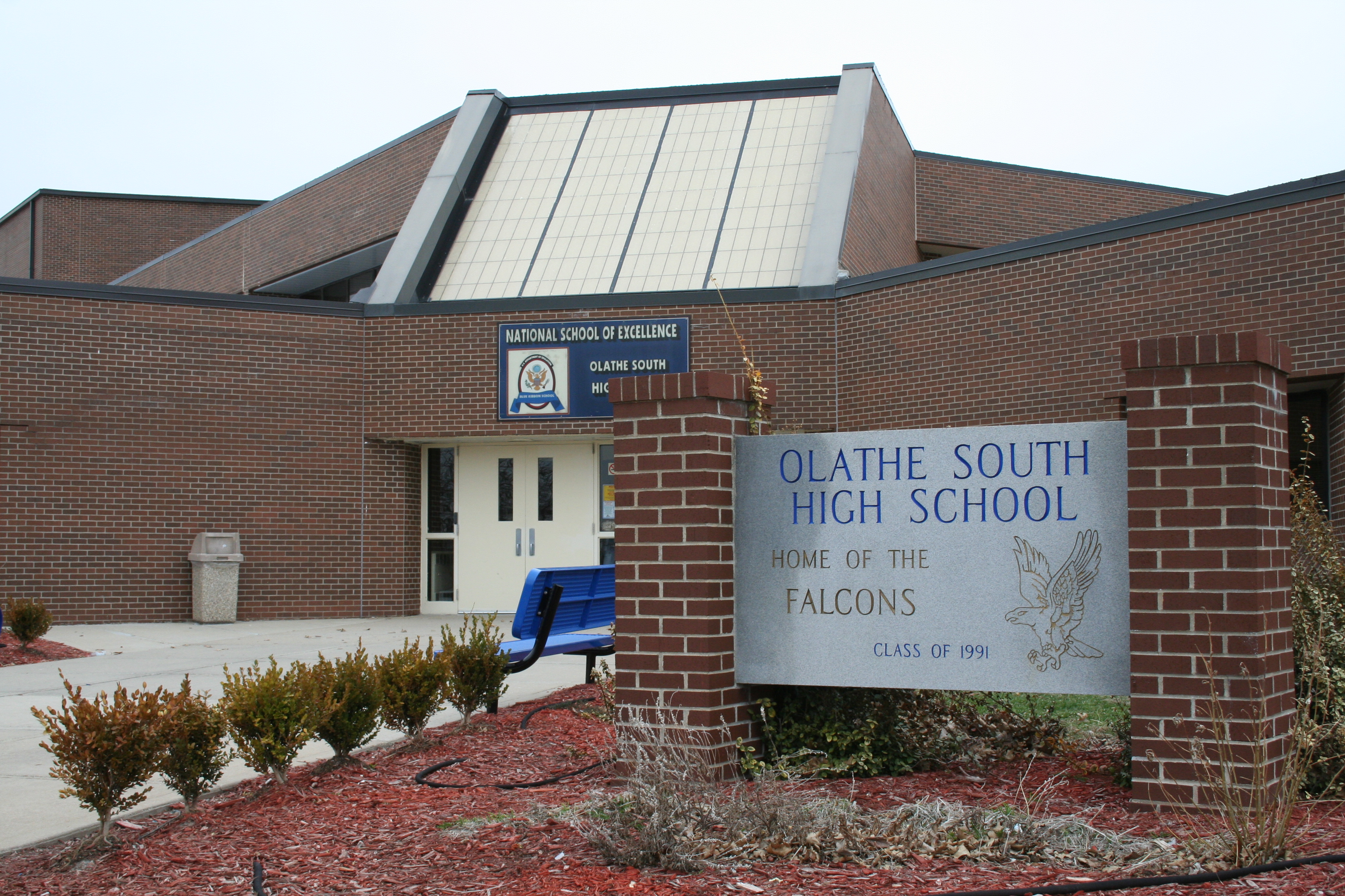
 Olathe South High School
Unified school districts
- Blue Valley USD 229 (Web site)
- Spring Hill USD 230 (Web site)
- Gardner-Edgerton USD 231 (Web site)
- De Soto USD 232 (Web site)
- Olathe USD 233 (Web site)
- Shawnee Mission USD 512 (Web site)
Colleges and universities
- Johnson County Community College (Web site)
- University of Kansas, Edwards Campus (Web site)
- MidAmerica Nazarene University (Web site)
Popular culture
- Johnson County was the setting of the TV show Married to the Kellys.[citation needed]
- Overland Park is the setting for The United States of Tara.[citation needed]
- Blue Valley Northwest High School students were featured in the series High School Confidential, centered in south Johnson County.[citation needed]
See also

Information on this and other counties in Kansas
- List of counties in Kansas
- National Register of Historic Places listings in Kansas
- Kansas locations by per capita income
Other information for Kansas
- List of cities in Kansas
- List of unified school districts in Kansas
- List of colleges and universities in Kansas
References
- ^ "2010 County Population and Housing Occupancy Status". U.S. Census Bureau. http://factfinder2.census.gov/faces/tableservices/jsf/pages/productview.xhtml?pid=DEC_10_PL_GCTPL2.ST05&prodType=table. Retrieved March 31, 2011.
- ^ "Find a County". National Association of Counties. http://www.naco.org/Counties/Pages/FindACounty.aspx. Retrieved 2011-06-07.
- ^ a b "Error: no
|title=specified when using {{Cite web}}". http://en.wikipedia.org/wiki/Highest-income_counties_in_the_United_States. - ^ "Money Magazine". CNN. http://money.cnn.com/magazines/moneymag/bplive/2010/top100/index2.html. Retrieved June 8, 2011.
- ^ "Best Places to Live 2008 – Kansas". Money Magazine. http://money.cnn.com/magazines/moneymag/bplive/2008/states/KS.html. Retrieved 2008-08-11.
- ^ A Standard History of Kansas and Kansans – William E. Connelly – Lewis Publishing Company – 1918
- ^ "Map of Wet and Dry Counties". Alcoholic Beverage Control, Kansas Department of Revenue. November 2006. http://www.ksrevenue.org/abcwetdrymap.htm. Retrieved 2007-12-28.
- ^ Presidential Election Results by County 1960–Present
- ^ Presidential Election Results by County Pre 1960
- ^ Kansas Senate
- ^ Kansas House of Representatives
- ^ LJWorld.com / Lawmakers debate what constitutes 'suitable education'
- ^ a b "Error: no
|title=specified when using {{Cite web}}". http://bocc.jocogov.org/. Retrieved 6/9/11. - ^ a b Kansas County Treasurer's Association Kansas Sales Tax Rates by County
- ^ Kansas City Area Development Council ThinkKC Property Taxes (accessed 6/7/06)
- ^ "Error: no
|title=specified when using {{Cite web}}". http://en.wikipedia.org/wiki/Missouri_River#Watershed. - ^ "Census 2000 U.S. Gazetteer Files: Counties". United States Census. http://www.census.gov/tiger/tms/gazetteer/county2k.txt. Retrieved 2011-02-13.
- ^ "American FactFinder". United States Census Bureau. http://factfinder.census.gov. Retrieved 2008-01-31.
- ^ Johnson County QuickFacts from the US Census Bureau, United States Census Bureau, 2007-05-07. Retrieved 2007-08-22.
- ^ "Population Estimates". U.S. Census Bureau, Population Division. http://www.census.gov/popest/estimates.php. Annual estimates of the population to 2005-07-01. Released 2006-06-21.
Further reading
- History of the State of Kansas; William G. Cutler; A.T. Andreas Publisher; 1883. (Online HTML eBook)
- Kansas : A Cyclopedia of State History, Embracing Events, Institutions, Industries, Counties, Cities, Towns, Prominent Persons, Etc; 3 Volumes; Frank W. Blackmar; Standard Publishing Co; 944 / 955 / 824 pages; 1912. (Volume1 - Download 54MB PDF eBook), (Volume2 - Download 53MB PDF eBook), (Volume3 - Download 33MB PDF eBook)
External links
- Official sites
- Johnson County
- Johnson County History
- Johnson County Library
- Johnson County Genealogical Society and Library
- Additional information
- Maps
- 2010 Johnson County Map, KDOT
- 2011 Kansas Highway Map, KDOT
- 2011 Kansas Railroad Map, KDOT
- 2005 Kansas School District Boundary Map, KSDE

Leavenworth County Wyandotte County Douglas County 
Jackson County, Missouri  Johnson County, Kansas

Franklin County Miami County Cass County, Missouri Municipalities and communities of Johnson County, Kansas Cities Bonner Springs‡ | De Soto‡ | Edgerton | Fairway | Gardner | Lake Quivira‡ | Leawood | Lenexa | Merriam | Mission | Mission Hills | Mission Woods | Olathe | Overland Park | Prairie Village | Roeland Park | Shawnee | Spring Hill‡ | Westwood | Westwood Hills

Townships Aubry | Gardner | Lexington | McCamish | Olathe | Oxford | Shawnee | Spring Hill
Unincorporated
communityFootnotes ‡This populated place also has portions in an adjacent county or counties
Kansas City Metropolitan Area's cities and counties Central city 
Largest cities (over 100,000 in 2000) Medium-sized cities (10,000 to 100,000 in 2000) Blue Springs • Belton • Excelsior Springs • Gladstone • Grandview • Lansing • Leawood • Leavenworth • Lee's Summit • Lenexa • Liberty • Merriam • Ottawa • Prairie Village • Raymore • Raytown • ShawneeCounties Categories:- Kansas counties
- Johnson County, Kansas
- 1855 establishments in the United States
- Kansas City metropolitan area


Wikimedia Foundation. 2010.