- Chaplin Estates, Toronto
Infobox City
official_name = Chaplin Estates (part of Yonge-Eglinton)
subdivision_type2 = Country
subdivision_name2 =Canada
subdivision_type1 = Province
subdivision_name1 =Ontario
subdivision_type = City
subdivision_name =Toronto 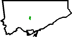
mapsize=150px
map_caption=Location of Yonge-Eglinton within Toronto
Chaplin Estates is an area within the Yonge-Eglinton neighbourhood in
Toronto , Ontario, Canada. It lies west of Yonge Street and is bounded by Eglinton Avenue to the north and Avenue Road to the west. The southern boundary is Chaplin Crescent which itself runs parallel to the former Beltline Railway line, now a scenic walking and biking trail known as the Kay GardnerBeltline Trail . A portion of theToronto Transit Commission 's Yonge-University-Spadina subway line runs aboveground in the eastern fringe of Chaplin Estates, and transit access is provided through Davisville station and Eglinton station.Chaplin Estates began with a plan of subdivision, registered by William John Chaplin and his son James D. Chaplin, in 1913. The Chaplin family had been landowners in this area dating back to 1860, when this district was known simply as 'Eglinton'.
Chaplin Estates was marketed as a high-class residential district. The developers included a long list of building restrictions and zoning bylaws, in the sale of each property. There were no semi-detached houses allowed, and stucco exteriors were not to cover more than half the house. Housing lots feature generous set backs.
The marketing of the subdivision was handled by the Chaplin Realty Company. Prices ranged from $500 to $9,000 a lot. Most of the lots were sold between 1921 and 1925. The majority of its houses were built in the 1920s and 1930s, and include many fine examples of Tudor, Georgian, and English Cottage style architecture.
Toronto Neighbourhood Geography
North =Lawrence Park South
East =Mount Pleasant West
South = Yonge-St. Clair
West = Forest Hill South,Lawrence Park South
Center = Chaplin Estates (Yonge-Eglinton)External links
* [http://www.toronto.ca/demographics/cns_profiles/cns100.htm City of Toronto - Yonge-Eglinton Neighbourhood Profile]
Wikimedia Foundation. 2010.