- Crawford County, Kansas
-
Crawford County, Kansas 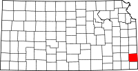
Location in the state of Kansas
Kansas's location in the U.S.Founded February 13, 1867 Seat Girard Largest city Pittsburg Area
- Total
- Land
- Water
595.05 sq mi (1,541 km²)
592.91 sq mi (1,536 km²)
2.14 sq mi (6 km²), 0.36%Population
- (2010)
- Density
39,134
64.2/sq mi (24.8/km²)Time zone Central: UTC-6/-5 Website CrawfordCountyKansas.org Crawford County (county code CR) is a county located in southeastern Kansas in the United States. As of the 2010 census, the county population was 39,134.[1] Its county seat is Girard, and its most populous city is Pittsburg.[2] The county was named in honor of Samuel J. Crawford, Governor of Kansas. The Pittsburg Micropolitan Statistical Area includes all of Crawford County.
Crawford County, and much of southeast Kansas, was founded on coal mining, the Pittsburg-Weir Coalfield being located here, and is still known for mining today. Pittsburg State University is located in Crawford County.
Contents
History
On Sunday, May 4, 2003, a strong and violent F4 tornado touched down in western Crawford County, several miles west of Frontenac at around 4:40 p.m. The tornado remained on the ground throughout Crawford County until it entered neighboring Barton County, Missouri—traveling a total of 35 miles (56 km) and ending near Liberal, Missouri. The towns of Ringo, Franklin, and Mulberry, all in Crawford County, were devastated. The tornado cut a path of destruction roughly one quarter mile wide. Several F4 and F5 tornadoes hit Kansas, Missouri, and several other states that day, including the Kansas City metropolitan area. Six deaths were reported in Kansas, and Governor Sebelius declared much of eastern and southeastern Kansas a disaster area, including Crawford County.[3]
Law and government
Crawford County was a prohibition, or "dry", county until the Kansas Constitution was amended in 1986 and voters approved the sale of alcoholic liquor by the individual drink with a 30% food sales requirement. The food sales requirement was removed with voter approval in 1992.[4]
Geography
According to the 2000 census, the county has a total area of 595.05 square miles (1,541.2 km2), of which 592.91 square miles (1,535.6 km2) (or 99.64%) is land and 2.14 square miles (5.5 km2) (or 0.36%) is water.[5]
Adjacent counties
- Bourbon County (north)
- Vernon County, Missouri (northeast)
- Barton County, Missouri (east)
- Jasper County, Missouri (southeast)
- Cherokee County (south)
- Labette County (southwest)
- Neosho County (west)
Demographics
Historical populations Census Pop. %± 1870 8,160 — 1880 16,851 106.5% 1890 30,286 79.7% 1900 38,809 28.1% 1910 51,178 31.9% 1920 61,800 20.8% 1930 49,329 −20.2% 1940 44,191 −10.4% 1950 40,231 −9.0% 1960 37,032 −8.0% 1970 37,850 2.2% 1980 37,916 0.2% 1990 35,568 −6.2% 2000 38,242 7.5% 2010 39,134 2.3% U.S. Decennial Census  2005 KDOT Map of Crawford County (map legend)
As of the U.S. Census in 2000,[6] there were 38,242 people, 15,504 households, and 9,441 families residing in the county. The population density was 64 people per square mile (25/km²). There were 17,221 housing units at an average density of 29 per square mile (11/km²). The racial makeup of the county was 93.29% White, 1.83% Black or African American, 0.94% Native American, 1.11% Asian, 0.09% Pacific Islander, 1.11% from other races, and 1.63% from two or more races. Hispanic or Latino of any race were 2.38% of the population. 23.5% were of German, 12.5% American, 10.4% English, 10.2% Irish and 8.6% Italian ancestry according to Census 2000.
There were 15,504 households out of which 28.50% had children under the age of 18 living with them, 47.90% were married couples living together, 9.30% had a female householder with no husband present, and 39.10% were non-families. 30.60% of all households were made up of individuals and 13.40% had someone living alone who was 65 years of age or older. The average household size was 2.35 and the average family size was 2.96.
In the county the population was spread out with 22.90% under the age of 18, 16.40% from 18 to 24, 25.00% from 25 to 44, 20.20% from 45 to 64, and 15.50% who were 65 years of age or older. The median age was 34 years. For every 100 females there were 95.00 males. For every 100 females age 18 and over, there were 92.40 males.
The median income for a household in the county was $29,409, and the median income for a family was $40,582. Males had a median income of $27,881 versus $21,517 for females. The per capita income for the county was $16,245. About 9.40% of families and 16.00% of the population were below the poverty line, including 17.00% of those under age 18 and 10.30% of those age 65 or over.
Cities and towns
Incorporated cities
Name and population:
- Pittsburg, 20,233
- Frontenac, 3,437
- Girard, 2,789
- Arma, 1,481
- Cherokee, 711
- Mulberry, 520
- McCune, 405
- Arcadia, 330
- Walnut, 220
- Hepler, 132
Unincorporated places
- Beulah
- Brazilton
- Camp 50
- Capaldo
- Chicopee
- Cornell
- Croweburg
- Curranville
- Dunkirk
- Englevale
- Farlington
- Foxtown
- Franklin
- Greenbush
- Gross
- Kirkwood
- Klondike
- Monmouth
- Opolis
- Radley
- Ringo
- South Radley
- Yale
Townships
Crawford County is divided into nine townships. The cities of Frontenac, Girard, Mulberry, and Pittsburg are considered governmentally independent and are excluded from the census figures for the townships. In the following table, the population center is the largest city (or cities) included in that township's population total, if it is of a significant size.
Township FIPS Population
centerPopulation Population
density
/km² (/sq mi)Land area
km² (sq mi)Water area
km² (sq mi)Water % Geographic coordinates Baker 03750 Pittsburg 3,640 25 (64) 147 (57) 0 (0) 0.05% 37°22′57″N 94°42′35″W / 37.3825°N 94.70972°W Crawford 16250 Girard 883 6 (14) 159 (62) 0 (0) 0.09% 37°30′3″N 94°51′13″W / 37.50083°N 94.85361°W Grant 27575 No center city 247 2 (4) 145 (56) 1 (0) 0.45% 37°30′10″N 95°1′8″W / 37.50278°N 95.01889°W Lincoln 40575 Arcadia 942 5 (13) 181 (70) 0 (0) 0.23% 37°37′21″N 94°39′31″W / 37.6225°N 94.65861°W Osage 53125 McCune 756 5 (14) 141 (54) 1 (0) 0.44% 37°22′46″N 95°1′21″W / 37.37944°N 95.0225°W Sheridan 64675 Cherokee 1,501 7 (19) 206 (80) 1 (0) 0.31% 37°22′32″N 94°51′33″W / 37.37556°N 94.85917°W Sherman 64875 Farlington 520 3 (7) 187 (72) 1 (0) 0.45% 37°37′24″N 94°51′35″W / 37.62333°N 94.85972°W Walnut 74975 Walnut 624 4 (10) 166 (64) 0 (0) 0.27% 37°36′15″N 95°1′38″W / 37.60417°N 95.02722°W Washington 75575 Frontenac 3,540 23 (59) 154 (60) 1 (1) 0.96% 37°31′7″N 94°41′44″W / 37.51861°N 94.69556°W Sources: "Census 2000 U.S. Gazetteer Files". U.S. Census Bureau, Geography Division. http://www.census.gov/geo/www/gazetteer/places2k.html. Education
Unified school districts
- Northeast USD 246 (Web site) - Serves the northeast portion of Crawford County, namely Lincoln and Washington Townships, including the towns of Arcadia, Arma, Cockerall, Camp 50, Franklin, Mulberry and Breezy Hill. Mascot - Vikings Colors - Burgundy and White
- Southeast USD 247 (Web site) - Serves primarily portions of Crawford and Cherokee counties, but also includes small portions of Labette and Neosho counties. The 300-square-mile (780 km2) district serves over 800 students in grades Pre-K through 12. Southeast High School (the "Lancers") is located just west of the city of Cherokee (the district office is located in the Cherokee/McCune Township). In Crawford County the district also serves the city of McCune.[7] Mascot - Lancers Colors - Columbia Blue and White
- Girard USD 248 (Web Site) - Serves Girard and the Girard Township, including the towns of Farlington, Walnut, Greenbush and Hepler. Mascot - Trojans Colors - Maroon and Yellow/Gold
- Frontenac USD 249 (Web site) - Serves Frontenac and the Frontenac Township, including the towns of Yale, Radley, Ringo and Mindenmines, Missouri. Mascot - Raiders Colors - Black and White/Silver
- Pittsburg USD 250 (Web site) - Serves Pittsburg and the Pittsburg Township, including the towns of Chicopee, Opolis, and Asbury, Missouri. Mascot - Purple Dragons Colors - Purple and White
- Saint Mary's - Colgan (Web site) is a private Catholic K-12 school located in Pittsburg. Mascot - Panthers Colors - Blue and White
Higher education
- Pittsburg State University is located in Pittsburg.
Libraries
- Pittsburg Public Library
- Girard Public Library
See also
Information on this and other counties in Kansas
- List of counties in Kansas
- National Register of Historic Places listings in Kansas
- Kansas locations by per capita income
Other information for Kansas
- List of cities in Kansas
- List of unified school districts in Kansas
- List of colleges and universities in Kansas
References
- ^ "2010 County Population and Housing Occupancy Status". U.S. Census Bureau. http://factfinder2.census.gov/faces/tableservices/jsf/pages/productview.xhtml?pid=DEC_10_PL_GCTPL2.ST05&prodType=table. Retrieved March 31, 2011.
- ^ "Find a County". National Association of Counties. http://www.naco.org/Counties/Pages/FindACounty.aspx. Retrieved 2011-06-07.
- ^ "5 years later". The Morning Sun. 2008-05-04. http://www.morningsun.net/news/x1755079282. Retrieved 2011-06-03.
- ^ "Map of Wet and Dry Counties". Alcoholic Beverage Control, Kansas Department of Revenue. November 2006. http://www.ksrevenue.org/abcwetdrymap.htm. Retrieved 2007-12-28.
- ^ "Census 2000 U.S. Gazetteer Files: Counties". United States Census. http://www.census.gov/tiger/tms/gazetteer/county2k.txt. Retrieved 2011-02-13.
- ^ "American FactFinder". United States Census Bureau. http://factfinder.census.gov. Retrieved 2008-01-31.
- ^ Burns, Tim (September 19, 2005). "Welcome To USD #247". Cherokee, USD 247. http://www.usd247.com/vnews/display.v/ART/2005/09/19/424dad21d2550. Retrieved 2007-01-23.
Further reading
- History of the State of Kansas; William G. Cutler; A.T. Andreas Publisher; 1883. (Online HTML eBook)
- Kansas : A Cyclopedia of State History, Embracing Events, Institutions, Industries, Counties, Cities, Towns, Prominent Persons, Etc; 3 Volumes; Frank W. Blackmar; Standard Publishing Co; 944 / 955 / 824 pages; 1912. (Volume1 - Download 54MB PDF eBook), (Volume2 - Download 53MB PDF eBook), (Volume3 - Download 33MB PDF eBook)
External links
- Official sites
- Additional information
- Maps
- 2007 Crawford County Map, KDOT
- 2011 Kansas Highway Map, KDOT
- 2011 Kansas Railroad Map, KDOT
- 2005 Kansas School District Boundary Map, KSDE

Bourbon County Vernon County, Missouri Neosho County 
Barton County, Missouri  Crawford County, Kansas

Labette County Cherokee County Jasper County, Missouri Municipalities and communities of Crawford County, Kansas Cities 
Townships Unincorporated
communitiesCategories:- Kansas counties
- 1867 establishments
- Crawford County, Kansas


Wikimedia Foundation. 2010.