- Comanche County, Kansas
-
Comanche County, Kansas 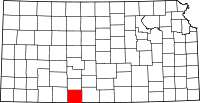
Location in the state of Kansas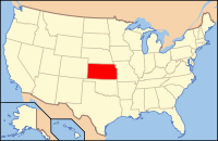
Kansas's location in the U.S.Founded February 26, 1867 Seat Coldwater Area
- Total
- Land
- Water
789.70 sq mi (2,045 km²)
788.31 sq mi (2,042 km²)
1.39 sq mi (4 km²), 0.18%Population
- (2010)
- Density
1,891
2.4/sq mi (0.9/km²)Time zone Central: UTC-6/-5 Website ComancheCounty.com Comanche County (county code CM) is a county located in Southwest Kansas, in the Central United States. As of the 2010 census, the county population was 1,891.[1] Its county seat and most populous city is Coldwater.[2]
Contents
Law and government
Although the Kansas Constitution was amended in 1986 to allow the sale of alcoholic liquor by the individual drink with the approval of voters, Comanche County has remained a prohibition, or "dry", county.[3]
Geography
According to the 2000 census, the county has a total area of 789.70 square miles (2,045.3 km2), of which 788.31 square miles (2,041.7 km2) (or 99.82%) is land and 1.39 square miles (3.6 km2) (or 0.18%) is water.[4]
Adjacent counties
- Kiowa County (north)
- Barber County (east)
- Woods County, Oklahoma (south)
- Harper County, Oklahoma (southwest)
- Clark County (west)
Demographics
Historical populations Census Pop. %± 1880 372 [5] — 1890 2,549 585.2% 1900 1,619 −36.5% 1910 3,281 102.7% 1920 5,302 61.6% 1930 5,238 −1.2% 1940 4,412 −15.8% 1950 3,888 −11.9% 1960 3,271 −15.9% 1970 2,702 −17.4% 1980 2,554 −5.5% 1990 2,313 −9.4% 2000 1,967 −15.0% 2010 1,891 −3.9% U.S. Decennial Census  2005 KDOT Map of Comanche County (map legend)
As of the U.S. Census in 2000,[6] there were 1,967 people, 872 households, and 540 families residing in the county. The population density was 2 people per square mile (1/km2). There were 1,088 housing units at an average density of 1 per square mile (1/km2). The racial makeup of the county was 97.97% White, 0.05% Black or African American, 0.25% Native American, 0.05% Asian, 0.20% Pacific Islander, 0.61% from other races, and 0.86% from two or more races. Hispanic or Latino of any race were 1.78% of the population.
There were 872 households out of which 24.40% had children under the age of 18 living with them, 54.40% were married couples living together, 6.20% had a female householder with no husband present, and 38.00% were non-families. 35.90% of all households were made up of individuals and 21.20% had someone living alone who was 65 years of age or older. The average household size was 2.18 and the average family size was 2.81.
In the county the population was spread out with 22.10% under the age of 18, 4.50% from 18 to 24, 21.00% from 25 to 44, 26.50% from 45 to 64, and 25.80% who were 65 years of age or older. The median age was 47 years. For every 100 females there were 93.60 males. For every 100 females age 18 and over, there were 87.50 males.
The median income for a household in the county was $29,415, and the median income for a family was $36,790. Males had a median income of $24,844 versus $18,221 for females. The per capita income for the county was $17,037. About 8.50% of families and 10.20% of the population were below the poverty line, including 9.70% of those under age 18 and 7.70% of those age 65 or over.
Cities and towns
Incorporated cities
Name and population (2004 estimate):
- Coldwater, 763
- Protection, 533
- Wilmore, 56
Unincorporated places
Townships
Comanche County is divided into four townships. None of the cities within the county are considered governmentally independent, and all figures for the townships include those of the cities. In the following table, the population center is the largest city (or cities) included in that township's population total, if it is of a significant size.
Township FIPS Population
centerPopulation Population
density
/km2 (/sq mi)Land area
km2 (sq mi)Water area
km2 (sq mi)Water % Geographic coordinates Avilla 03525 58 0 (0) 309 (119) 0 (0) 0.15% 37°5′14″N 99°17′20″W / 37.08722°N 99.28889°W Coldwater 14725 Coldwater 1,086 1 (3) 1,099 (424) 2 (1) 0.17% 37°16′6″N 99°18′5″W / 37.26833°N 99.30139°W Powell 57325 89 0 (1) 186 (72) 0 (0) 0.03% 37°20′36″N 99°8′37″W / 37.34333°N 99.14361°W Protection 57875 Protection 734 2 (4) 448 (173) 1 (0) 0.28% 37°12′20″N 99°29′16″W / 37.20556°N 99.48778°W Sources: "Census 2000 U.S. Gazetteer Files". U.S. Census Bureau, Geography Division. http://www.census.gov/geo/www/gazetteer/places2k.html. Education
Unified school districts
See also
- Dry counties
- National Register of Historic Places listings in Comanche County, Kansas
Information on this and other counties in Kansas
- List of counties in Kansas
- National Register of Historic Places listings in Kansas
- Kansas locations by per capita income
Other information for Kansas
- List of cities in Kansas
- List of unified school districts in Kansas
- List of colleges and universities in Kansas
References
- ^ "2010 County Population and Housing Occupancy Status". U.S. Census Bureau. http://factfinder2.census.gov/faces/tableservices/jsf/pages/productview.xhtml?pid=DEC_10_PL_GCTPL2.ST05&prodType=table. Retrieved March 31, 2011.
- ^ "Find a County". National Association of Counties. http://www.naco.org/Counties/Pages/FindACounty.aspx. Retrieved 2011-06-07.
- ^ "Map of Wet and Dry Counties". Alcoholic Beverage Control, Kansas Department of Revenue. November 2004. http://www.ksrevenue.org/abcwetdrymap.htm. Retrieved 2007-01-21.
- ^ "Census 2000 U.S. Gazetteer Files: Counties". United States Census. http://www.census.gov/tiger/tms/gazetteer/county2k.txt. Retrieved 2011-02-13.
- ^ The 1880 census population includes areas that were organized into Kiowa County in 1886.
- ^ "American FactFinder". United States Census Bureau. http://factfinder.census.gov. Retrieved 2008-01-31.
Further reading
- History of the State of Kansas; William G. Cutler; A.T. Andreas Publisher; 1883. (Online HTML eBook)
- Kansas : A Cyclopedia of State History, Embracing Events, Institutions, Industries, Counties, Cities, Towns, Prominent Persons, Etc; 3 Volumes; Frank W. Blackmar; Standard Publishing Co; 944 / 955 / 824 pages; 1912. (Volume1 - Download 54MB PDF eBook),(Volume2 - Download 53MB PDF eBook), (Volume3 - Download 33MB PDF eBook)
External links
- Official sites
- Additional information
- Maps
- Comanche County Map, KDOT
- Kansas Highway Map, KDOT
- Kansas Railroad Map, KDOT
- Kansas School District Boundary Map, KSDE

Clark County Kiowa County Barber County Clark County 
Barber County  Comanche County, Kansas

Harper County, Oklahoma Woods County, Oklahoma Municipalities and communities of Comanche County, Kansas Cities 
Townships Avilla | Coldwater | Powell | Protection
Unincorporated
communityCategories:- Kansas counties
- Comanche County, Kansas
- 1867 establishments


Wikimedia Foundation. 2010.