- O'Brien County, Iowa
-
O'Brien County, Iowa 
Location in the state of Iowa
Iowa's location in the U.S.Founded 1851 Seat Primghar Area
- Total
- Land
- Water
573.25 sq mi (1,485 km²)
573.08 sq mi (1,484 km²)
0.17 sq mi (0 km²), 0.03%Population
- (2010)
- Density
14,398
25.1/sq mi (9.7/km²)Time zone Central: UTC-6/-5 Website www.obriencounty.com Footnotes: Population [1] O'Brien County is a county located in the U.S. state of Iowa. The population was 14,398 in the 2010 census, a decline of 4.7% from 15,102 in 2000.[1][2][3] The county seat is Primghar. [4]
Contents
History
O'Brien County was named for William Smith O'Brien, a leader for Irish independence in 1848, and is the only O'Brien County in the United States. O'Brien County was founded in 1851.[5] The present courthouse was completed in 1917,[6] and is listed on the National Register of Historic Places.
Geography
According to the 2000 census, the county has a total area of 573.25 square miles (1,484.7 km2), of which 573.08 square miles (1,484.3 km2) (or 99.97%) is land and 0.17 square miles (0.44 km2) (or 0.03%) is water.[7]
Major highways
 U.S. Highway 18
 U.S. Highway 59
 Iowa Highway 10
 Iowa State Highway 60
 Iowa Highway 144
Adjacent counties
- Osceola County (north)
- Clay County (east)
- Cherokee County (south)
- Sioux County (west)
Demographics
Historical populations Census Pop. %± 1860 8 — 1870 715 8,837.5% 1880 4,155 481.1% 1890 13,060 214.3% 1900 16,985 30.1% 1910 17,262 1.6% 1920 19,051 10.4% 1930 18,409 −3.4% 1940 19,293 4.8% 1950 18,970 −1.7% 1960 18,840 −0.7% 1970 17,522 −7.0% 1980 16,972 −3.1% 1990 15,444 −9.0% 2000 15,102 −2.2% 2010 14,398 −4.7% Iowa Data Center [2] 2010 census
The 2010 census recorded a population of 14,398 in the county, with a population density of 25.1239/sq mi (9.7004/km2). There were 6,649 housing units, of which 6,069 were occupied.[1]
2000 census
 2000 Census Age Pyramid for O'Brien County.
As of the census[8] of 2000, there were 15,102 people, 6,001 households, and 4,122 families residing in the county. The population density was 26 people per square mile (10/km²). There were 6,509 housing units at an average density of 11 per square mile (4/km²). The racial makeup of the county was 98.05% White, 0.34% Black or African American, 0.17% Native American, 0.51% Asian, 0.01% Pacific Islander, 0.47% from other races, and 0.46% from two or more races. 1.77% of the population were Hispanic or Latino of any race.
There were 6,001 households out of which 30.40% had children under the age of 18 living with them, 61.00% were married couples living together, 4.90% had a female householder with no husband present, and 31.30% were non-families. 28.00% of all households were made up of individuals and 14.70% had someone living alone who was 65 years of age or older. The average household size was 2.42 and the average family size was 2.97.
In the county the population was spread out with 24.80% under the age of 18, 7.80% from 18 to 24, 24.10% from 25 to 44, 22.10% from 45 to 64, and 21.10% who were 65 years of age or older. The median age was 41 years. For every 100 females there were 95.80 males. For every 100 females age 18 and over, there were 92.40 males.
The median income for a household in the county was $35,758, and the median income for a family was $42,959. Males had a median income of $30,446 versus $20,391 for females. The per capita income for the county was $17,281. About 4.60% of families and 7.30% of the population were below the poverty line, including 7.70% of those under age 18 and 6.00% of those age 65 or over.
Cities
See also
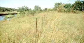
 Indian Village Site on the NRHP
- National Register of Historic Places listings in O'Brien County, Iowa
- Indian Village Site in the Witrock Area
References
- ^ a b c "Population and Housing Occupancy Status: 2010 - State -- County". United States Census Bureau American FactFinder. http://factfinder2.census.gov/faces/tableservices/jsf/pages/productview.xhtml?pid=DEC_10_PL_GCTPL2.ST05&prodType=table. Retrieved March 26, 2011.
- ^ a b "Data from the 2010 Census". State Data Center of Iowa. http://www.iowadatacenter.org/archive/2011/02/feb10. Retrieved March 26, 2011.
- ^ "Mapping the 2010 U.S. Census". The New York Times. http://projects.nytimes.com/census/2010/map?hp. Retrieved 2011-03-26.
- ^ "Find a County". National Association of Counties. http://www.naco.org/Counties/Pages/FindACounty.aspx. Retrieved 2011-06-07.
- ^ Columbia-Lippincott Gazeteer, (New York:Columbia University Press, 1952), p. 1363
- ^ "O’Brien County Courthouse". Iowa Judicial Branch. http://www.iowacourtsonline.org/wfdata/frame1759-1464/pressrel99.asp. Retrieved 2011-03-07.
- ^ "Census 2000 U.S. Gazetteer Files: Counties". United States Census. http://www.census.gov/tiger/tms/gazetteer/county2k.txt. Retrieved 2011-02-13.
- ^ "American FactFinder". United States Census Bureau. http://factfinder.census.gov. Retrieved 2008-01-31.
External links
- O'Brien County Portal style website, Government, Business, Tourism and more
- IaGenWeb O'Brien county history, Biographies, and more
- City-Data Comprehensive Statistical Data and more about O'Brien County

Osceola County Sioux County 
Clay County  O'Brien County, Iowa

Cherokee County Municipalities and communities of O'Brien County, Iowa Cities 
Footnotes ‡This populated place also has portions in an adjacent county or counties
Coordinates: 43°04′53″N 95°37′34″W / 43.08139°N 95.62611°W
Categories:- Iowa counties
- O'Brien County, Iowa
- 1851 establishments in the United States


Wikimedia Foundation. 2010.