- Monroe County, Iowa
-
Monroe County, Iowa 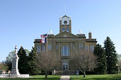
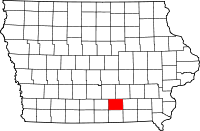
Location in the state of Iowa
Iowa's location in the U.S.Founded 1843 Seat Albia Area
- Total
- Land
- Water
434.11 sq mi (1,124 km²)
433.41 sq mi (1,123 km²)
0.70 sq mi (2 km²), 0.16%Population
- (2010)
- Density
7,970
18/sq mi (7/km²)Time zone Central: UTC-6/-5 Website monroecoia.us Footnotes: Population [1] Monroe County is a county located in the U.S. state of Iowa. The population was 7,970 in the 2010 census, a decline from 8,016 in the 2000 census.[1][2] The county seat is Albia.[3]
Contents
Geography
According to the 2000 census, the county has a total area of 434.11 square miles (1,124.3 km2), of which 433.41 square miles (1,122.5 km2) (or 99.84%) is land and 0.70 square miles (1.8 km2) (or 0.16%) is water.[4]
Major highways
 U.S. Highway 34
 Iowa Highway 5
 Iowa Highway 137
Adjacent counties
- Marion County (northwest)
- Mahaska County (northeast)
- Wapello County (east)
- Appanoose County (south)
- Lucas County (west)
Demographics
Historical populations Census Pop. %± 1850 2,884 — 1860 8,612 198.6% 1870 12,724 47.7% 1880 13,719 7.8% 1890 13,666 −0.4% 1900 17,985 31.6% 1910 25,429 41.4% 1920 23,467 −7.7% 1930 15,010 −36.0% 1940 14,553 −3.0% 1950 11,814 −18.8% 1960 10,463 −11.4% 1970 9,357 −10.6% 1980 9,209 −1.6% 1990 8,114 −11.9% 2000 8,016 −1.2% 2010 7,970 −0.6% Iowa Data Center [2] 2010 census
The 2010 census recorded a population of 7,970 in the county, with a population density of 18.389/sq mi (7.100/km2). There were 3,884 housing units, of which 3,213 were occupied.[1]
2000 census
 2000 Census Age Pyramid for Monroe County
As of the census[5] of 2000, there were 8,016 people, 3,228 households, and 2,211 families residing in the county. The population density was 18 people per square mile (7/km²). There were 3,588 housing units at an average density of 8 per square mile (3/km²). The racial makeup of the county was 98.40% White, 0.20% Black or African American, 0.36% Native American, 0.40% Asian, 0.12% from other races, and 0.51% from two or more races. 0.50% of the population were Hispanic or Latino of any race.
There were 3,228 households out of which 30.50% had children under the age of 18 living with them, 56.20% were married couples living together, 8.60% had a female householder with no husband present, and 31.50% were non-families. 28.00% of all households were made up of individuals and 15.30% had someone living alone who was 65 years of age or older. The average household size was 2.43 and the average family size was 2.97.
In the county the population is spread out with 25.30% under the age of 18, 7.20% from 18 to 24, 25.00% from 25 to 44, 23.00% from 45 to 64, and 19.50% who were 65 years of age or older. The median age was 40 years. For every 100 females there were 94.90 males. For every 100 females age 18 and over, there were 92.60 males.
The median income for a household in the county was $34,877, and the median income for a family was $41,611. Males had a median income of $31,667 versus $21,401 for females. The per capita income for the county was $17,155. About 5.60% of families and 9.00% of the population were below the poverty line, including 12.20% of those under age 18 and 5.90% of those age 65 or over.
Communities
Cities
Unincorporated communities
- Avery
Ghost town
- Buxton
See also
References
- ^ a b c "Population & Housing Occupancy Status 2010". United States Census Bureau American FactFinder. http://factfinder2.census.gov/faces/tableservices/jsf/pages/productview.xhtml?pid=DEC_10_PL_GCTPL2.ST05&prodType=table. Retrieved May 31, 2011.
- ^ a b "Data from the 2010 Census". State Data Center of Iowa. http://www.iowadatacenter.org/archive/2011/02/feb10. Retrieved May 31, 2011.
- ^ "Find a County". National Association of Counties. http://www.naco.org/Counties/Pages/FindACounty.aspx. Retrieved 2011-06-07.
- ^ "Census 2000 U.S. Gazetteer Files: Counties". United States Census. http://www.census.gov/tiger/tms/gazetteer/county2k.txt. Retrieved 2011-02-13.
- ^ "American FactFinder". United States Census Bureau. http://factfinder.census.gov. Retrieved 2008-01-31.
External links

Marion County Mahaska County Lucas County 
Wapello County  Monroe County, Iowa

Appanoose County Municipalities and communities of Monroe County, Iowa Cities 
Unincorporated
communityAvery
Ghost town Buxton
Footnotes ‡This populated place also has portions in an adjacent county or counties
Categories:- Iowa counties
- Monroe County, Iowa
- 1843 establishments in the United States
- Populated places established in 1843


Wikimedia Foundation. 2010.