- Jefferson County, Iowa
-
Jefferson County, Iowa 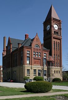
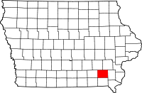
Location in the state of Iowa
Iowa's location in the U.S.Founded 1839 Seat Fairfield Area
- Total
- Land
- Water
436.72 sq mi (1,131 km²)
435.34 sq mi (1,128 km²)
1.38 sq mi (4 km²), 0.32%Population
- (2010)
- Density
16,843
39/sq mi (15/km²)Time zone Central: UTC-6/-5 Footnotes: Population [1] Jefferson County is a county located in the U.S. state of Iowa. The population was 16,843 in the 2010 census, an increase from 16,181 in the 2000 census.[1][2] The county seat is Fairfield. [3]
Contents
Geography
According to the 2000 census, the county has a total area of 436.72 square miles (1,131.1 km2), of which 435.34 square miles (1,127.5 km2) (or 99.68%) is land and 1.38 square miles (3.6 km2) (or 0.32%) is water.[4]
Major highways
 U.S. Highway 34
 Iowa Highway 1
 Iowa Highway 78
Adjacent counties
- Keokuk County (northwest)
- Washington County (northeast)
- Henry County (east)
- Van Buren County (south)
- Wapello County (west)
History
Jefferson County was formed on January 21, 1839. It was named for the US President Thomas Jefferson.[5]
Demographics
Historical populations Census Pop. %± 1850 9,904 — 1860 15,038 51.8% 1870 17,839 18.6% 1880 17,469 −2.1% 1890 15,184 −13.1% 1900 17,437 14.8% 1910 15,951 −8.5% 1920 16,440 3.1% 1930 16,241 −1.2% 1940 15,762 −2.9% 1950 15,696 −0.4% 1960 15,818 0.8% 1970 15,774 −0.3% 1980 16,316 3.4% 1990 16,310 0% 2000 16,181 −0.8% 2010 16,843 4.1% Iowa Data Center [2] 2010 census
The 2010 census recorded a population of 16,843 in the county, with a population density of 38.6893/sq mi (14.9380/km2). There were 7,594 housing units, of which 6,846 were occupied.[1]
2000 census
 2000 Census Age Pyramid for Jefferson County
As of the census[6] of 2000, there were 16,181 people, 6,649 households, and 4,281 families residing in the county. The population density was 37 people per square mile (14/km²). There were 7,241 housing units at an average density of 17 per square mile (6/km²). The racial makeup of the county was 96.02% White, 0.64% Black or African American, 0.17% Native American, 1.70% Asian, 0.04% Pacific Islander, 0.53% from other races, and 0.91% from two or more races. 1.84% of the population were Hispanic or Latino of any race.
There were 6,649 households out of which 31.10% had children under the age of 18 living with them, 53.10% were married couples living together, 8.00% had a female householder with no husband present, and 35.60% were non-families. 30.40% of all households were made up of individuals and 10.70% had someone living alone who was 65 years of age or older. The average household size was 2.34 and the average family size was 2.93.
In the county the population was spread out with 24.40% under the age of 18, 7.60% from 18 to 24, 24.40% from 25 to 44, 29.80% from 45 to 64, and 13.80% who were 65 years of age or older. The median age was 41 years. For every 100 females there were 95.90 males. For every 100 females age 18 and over, there were 93.60 males.
The median income for a household in the county was $33,851, and the median income for a family was $43,819. Males had a median income of $32,066 versus $22,479 for females. The per capita income for the county was $19,579. About 7.40% of families and 10.90% of the population were below the poverty line, including 12.40% of those under age 18 and 9.00% of those age 65 or over.
Cities and towns
Law and government
Jefferson County's executive branch is a three-member board of supervisors. Supervisors are elected to four-year terms. The current board members, their party affiliations and the years in which they were last elected are: Steve Burgmeier (Republican, 2004), Mike Pech (Republican, 2004), and Dick Reed (Republican, 2002). Other elected officials are Scott Reneker, county auditor; Jerry Droz, county sheriff; Connie Hedger, county treasurer; and Charlotte Fleig, county recorder.[citation needed]
See also
Notes
- ^ a b c "Population & Housing Occupancy Status 2010". United States Census Bureau American FactFinder. http://factfinder2.census.gov/faces/tableservices/jsf/pages/productview.xhtml?pid=DEC_10_PL_GCTPL2.ST05&prodType=table. Retrieved May 19, 2011.
- ^ a b "Data from the 2010 Census". State Data Center of Iowa. http://www.iowadatacenter.org/archive/2011/02/feb10. Retrieved May 19, 2011.
- ^ "Find a County". National Association of Counties. http://www.naco.org/Counties/Pages/FindACounty.aspx. Retrieved 2011-06-07.
- ^ "Census 2000 U.S. Gazetteer Files: Counties". United States Census. http://www.census.gov/tiger/tms/gazetteer/county2k.txt. Retrieved 2011-02-13.
- ^ Jefferson County
- ^ "American FactFinder". United States Census Bureau. http://factfinder.census.gov. Retrieved 2008-01-31.
- ^ http://jefferson.iowaassessors.com/parcel.php?gid=7851
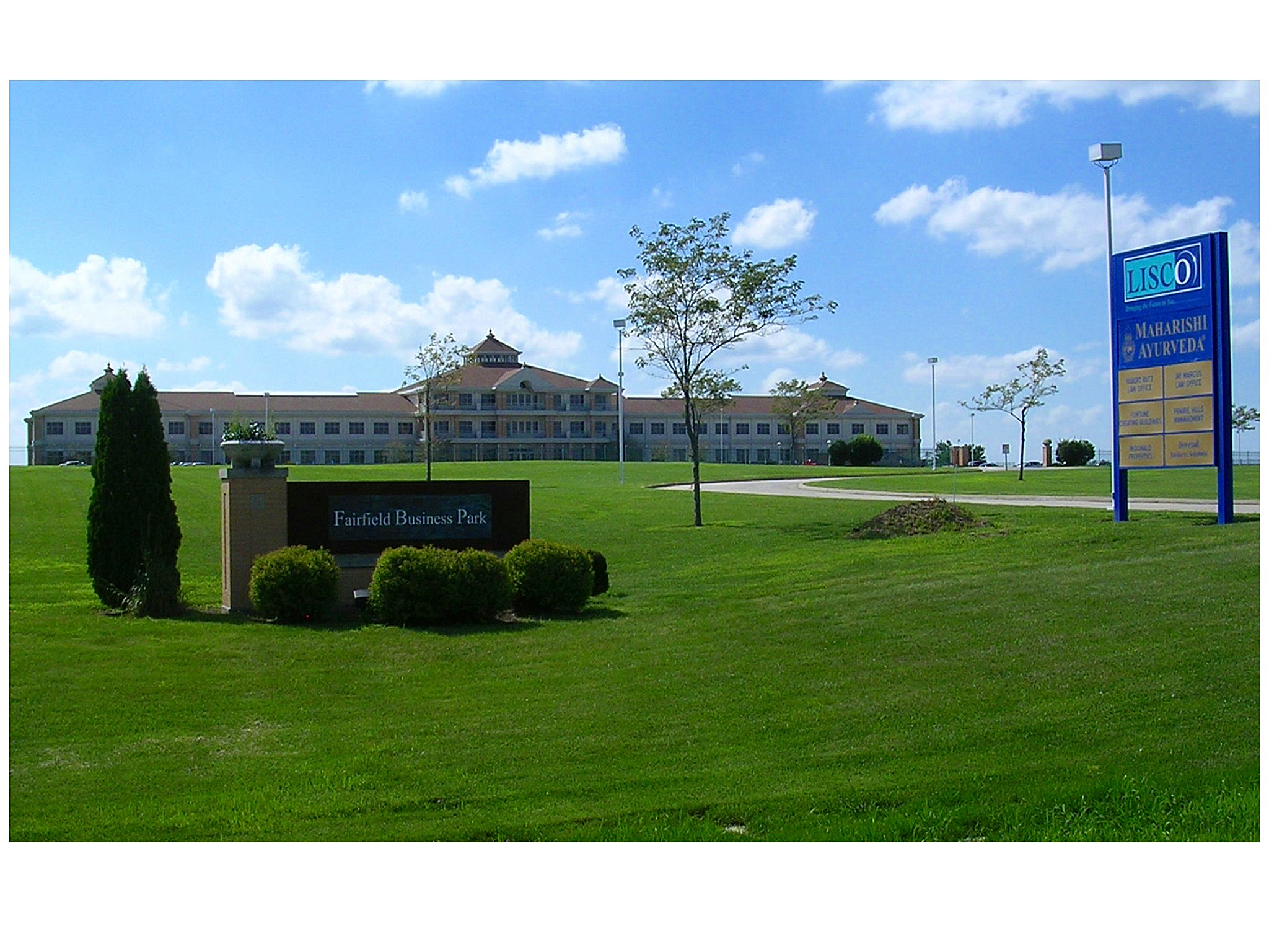
- ^ Fairfield Business Park 41°03′50″N 91°58′18″W / 41.0639°N 91.9716°W
External links

Keokuk County Washington County Wapello County 
Henry County  Jefferson County, Iowa

Van Buren County Municipalities and communities of Jefferson County, Iowa Cities Batavia | Coppock‡ | Fairfield | Libertyville | Lockridge | Maharishi Vedic City | Packwood | Pleasant Plain

Townships Black Hawk | Buchanan | Cedar | Center | Des Moines | Liberty | Lockridge | Locust Grove | Penn | Polk | Round Prairie | Walnut
Unincorporated
communitiesAbingdon | Pekin
Footnotes ‡This populated place also has portions in an adjacent county or counties
Coordinates: 41°01′53″N 91°56′41″W / 41.03139°N 91.94472°W
Categories:- Iowa counties
- Jefferson County, Iowa
- 1839 establishments in the United States
- Populated places established in 1839


Wikimedia Foundation. 2010.