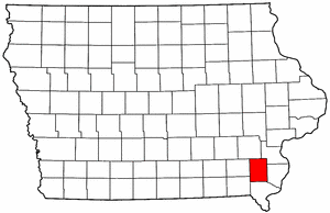
- Henry County, Iowa
Infobox U.S. County
county = Henry County
state = Iowa
seallink =
map size = 250
founded = 1836
seat = Mount Pleasant
largest city =
area_total_sq_mi = 437
area_total_km2 = 1131
area_land_sq_mi = 434
area_land_km2 = 1125
area_water_sq_mi = 2
area_water_km2 = 6
area percentage = 0.51%
census yr = 2000
pop = 20336
density_sq_mi = 47
density_km2 = 18
time zone = Central
UTC offset = -6
DST offset= -5
footnotes =
web = www.co.henry.ia.us|Henry County is a
county located in theU.S. state ofIowa . It was named for GeneralHenry Dodge , governor of Wisconsin Territory. As of 2000, the population was 20,336. Itscounty seat is Mount Pleasant.GR|6Geography
According to the
U.S. Census Bureau , the county has a total area of 437square mile s (1,131km² ), of which, 434 square miles (1,125 km²) of it is land and 2 square miles (6 km²) of it (0.51%) is water.Major highways
*
*
*
*Adjacent counties
*Washington County (north)
*Louisa County (northeast)
*Des Moines County (east)
*Lee County (south)
*Van Buren County (southwest)
*Jefferson County (west)History
Henry County was formed on December 7, 1836. It was named for General
Henry Dodge . [ [http://www.iowacounties.org/About%20Us/AboutCoGov/County%20Pages/Henry.htm Henry County ] ]In 1839, construction of the first courthouse was begun and completed in 1840. In 1871, construstion of a second courthouse began and on August 4, 1914, the third courthouse was completed which is still presently used as such. [ [http://www.henrycountyiowa.us/aboutcourthouse.html Henry County Courthouse History ] ]
Demographics
USCensusPop
1900= 20022
1910= 18640
1920= 18298
1930= 17660
1940= 17994
1950= 18708
1960= 18187
1970= 18114
1980= 18890
1990= 19226
2000= 20336
footnote= [http://www.census.gov/population/cencounts/ia190090.txt IA Counties 1900-1990] As of thecensus GR|2 of 2000, there were 20,336 people, 7,626 households, and 5,269 families residing in the county. Thepopulation density was 47 people per square mile (18/km²). There were 8,246 housing units at an average density of 19 per square mile (7/km²). The racial makeup of the county was 94.78% White, 1.49% Black or African American, 0.24% Native American, 1.88% Asian, 0.02% Pacific Islander, 0.52% from other races, and 1.07% from two or more races. 1.26% of the population were Hispanic or Latino of any race.There were 7,626 households out of which 32.80% had children under the age of 18 living with them, 57.70% were married couples living together, 8.20% had a female householder with no husband present, and 30.90% were non-families. 26.80% of all households were made up of individuals and 12.20% had someone living alone who was 65 years of age or older. The average household size was 2.46 and the average family size was 2.98.
In the county the population was spread out with 24.70% under the age of 18, 9.00% from 18 to 24, 29.20% from 25 to 44, 22.50% from 45 to 64, and 14.70% who were 65 years of age or older. The median age was 37 years. For every 100 females there were 102.50 males. For every 100 females age 18 and over, there were 102.80 males.
The median income for a household in the county was $39,087, and the median income for a family was $46,985. Males had a median income of $31,801 versus $23,075 for females. The
per capita income for the county was $18,192. About 6.70% of families and 8.80% of the population were below thepoverty line , including 10.30% of those under age 18 and 9.30% of those age 65 or over.Localities
Cities
*Coppock
*Hillsboro
*Mount Pleasant
*Mount Union
*New London
*Olds
*Rome
*Salem
*Wayland
*Westwood
*WinfieldOther community
Notes
External links
* [http://www.co.henry.ia.us Henry County's official website]
* [http://www.henrycountytourism.org Henry County Tourism]
* [http://www.winfieldhistoricalsociety.com Winfield Historical Society & Museum]
Wikimedia Foundation. 2010.