- Crawford County, Iowa
-
Crawford County, Iowa  County Courthouse, Denison.
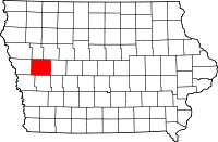
Location in the state of Iowa
Iowa's location in the U.S.Founded 1837 Seat Denison Area
- Total
- Land
- Water
714.99 sq mi (1,852 km²)
714.36 sq mi (1,850 km²)
0.63 sq mi (2 km²), 0.09%Population
- (2010)
- Density
17,096
23.9/sq mi (9.2/km²)Time zone Central: UTC-6/-5 Website www.crawfordcounty.org Footnotes: Population [1] Crawford County is a county located in the U.S. state of Iowa. The county was named for William Harris Crawford, U.S. senator from Georgia and United States Secretary of the Treasury. The population was 17,096 in the 2010 census, an increase from 16,942 in 2000.[1][2] Its county seat is Denison.[3]
Contents
Geography
According to the 2000 census, the county has a total area of 714.99 square miles (1,851.8 km2), of which 714.36 square miles (1,850.2 km2) (or 99.91%) is land and 0.63 square miles (1.6 km2) (or 0.09%) is water.[4]
Major highways
 U.S. Highway 30
 U.S. Highway 59
 Iowa Highway 37
Adjacent counties
- Ida County (north)
- Sac County (northeast)
- Carroll County (east)
- Shelby County (south)
- Harrison County (southwest)
- Monona County (west)
Demographics
Historical populations Census Pop. %± 1860 383 — 1870 2,530 560.6% 1880 12,413 390.6% 1890 18,894 52.2% 1900 21,685 14.8% 1910 20,041 −7.6% 1920 20,614 2.9% 1930 21,028 2.0% 1940 20,538 −2.3% 1950 19,741 −3.9% 1960 18,569 −5.9% 1970 19,116 2.9% 1980 18,935 −0.9% 1990 16,775 −11.4% 2000 16,942 1.0% 2010 17,096 0.9% Iowa Data Center [2] 2010 census
The 2010 census recorded a population of 17,096 in the county, with a population density of 23.944/sq mi (9.245/km2). There were 6,943 housing units, of which 6,413 were occupied.[1]
2000 census
 2000 Census Age Pyramid for Crawford County.
As of the census[5] of 2000, there were 16,942 people, 6,441 households, and 4,489 families residing in the county. The population density was 24 people per square mile (9/km²). There were 6,958 housing units at an average density of 10 per square mile (4/km²). The racial makeup of the county was 93.10% White, 0.76% Black or African American, 0.28% Native American, 0.49% Asian, 0.01% Pacific Islander, 4.59% from other races, and 0.77% from two or more races. 8.75% of the population were Hispanic or Latino of any race.
There were 6,441 households out of which 31.60% had children under the age of 18 living with them, 58.50% were married couples living together, 7.00% had a female householder with no husband present, and 30.30% were non-families. 26.20% of all households were made up of individuals and 13.10% had someone living alone who was 65 years of age or older. The average household size was 2.53 and the average family size was 3.03.
In the county the population was spread out with 26.50% under the age of 18, 8.10% from 18 to 24, 25.70% from 25 to 44, 22.50% from 45 to 64, and 17.10% who were 65 years of age or older. The median age was 38 years. For every 100 females there were 100.90 males. For every 100 females age 18 and over, there were 98.80 males.
The median income for a household in the county was $33,922, and the median income for a family was $40,231. Males had a median income of $28,696 versus $19,798 for females. The per capita income for the county was $15,851. About 6.90% of families and 11.10% of the population were below the poverty line, including 12.70% of those under age 18 and 5.60% of those age 65 or over.
Localities
Cities
Townships
Crawford County is divided into these townships:
See also
- National Register of Historic Places listings in Crawford County, Iowa
- The Crawford County Courthouse Article
References
- ^ a b c "Population and Housing Occupancy Status: 2010 - State -- County". United States Census Bureau American FactFinder. http://factfinder2.census.gov/faces/tableservices/jsf/pages/productview.xhtml?pid=DEC_10_PL_GCTPL2.ST05&prodType=table. Retrieved March 12, 2011.
- ^ a b "Data from the 2010 Census". State Data Center of Iowa. http://www.iowadatacenter.org/archive/2011/02/feb10. Retrieved March 12, 2011.
- ^ "Find a County". National Association of Counties. http://www.naco.org/Counties/Pages/FindACounty.aspx. Retrieved 2011-06-07.
- ^ "Census 2000 U.S. Gazetteer Files: Counties". United States Census. http://www.census.gov/tiger/tms/gazetteer/county2k.txt. Retrieved 2011-02-13.
- ^ "American FactFinder". United States Census Bureau. http://factfinder.census.gov. Retrieved 2008-01-31.
External links

Ida County Sac County Monona County 
Carroll County  Crawford County, Iowa

Harrison County Shelby County Municipalities and communities of Crawford County, Iowa Cities 
Townships Boyer | Charter Oak | Denison | East Boyer | Goodrich | Hanover | Hayes | Iowa | Jackson | Milford | Morgan | Nishnabotny | Otter Creek | Paradise | Soldier | Stockholm | Union | Washington | West Side | Willow
Footnotes ‡This populated place also has portions in an adjacent county or counties
Coordinates: 42°02′14″N 95°22′43″W / 42.03722°N 95.37861°W
Categories:- Iowa counties
- Crawford County, Iowa
- 1837 establishments in the United States
- Populated places established in 1837


Wikimedia Foundation. 2010.