- Oxford, Nova Scotia
-
Oxford — Town — 
SealNickname(s): Wild Blueberry Capital of Canada Location of Oxford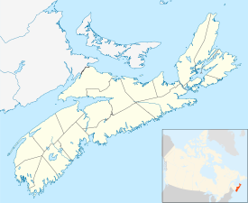
 Oxford
Coordinates: 45°43′50″N 63°52′24″W / 45.73056°N 63.87333°WCoordinates: 45°43′50″N 63°52′24″W / 45.73056°N 63.87333°W Country  Canada
Province  Nova Scotia
Municipality Cumberland County Founded 1791 Incorporated April 19, 1904 Electoral Districts
Federal
Cumberland-Colchester-Musquodoboit ValleyProvincial Cumberland South Government – Mayor Lloyd Jenkins – Governing Body Oxford Town Council – MLA Murray Scott (PC) – MP Scott Armstrong (C) Area – Total 10.76 km2 (4.2 sq mi) Elevation 5-18 m (16-59 ft) Population (2006) – Total 1,178 – Density 109.5/km2 (283.6/sq mi) Time zone AST (UTC-4) – Summer (DST) ADT (UTC-3) Postal code B0M Area code(s) 902 Telephone Exchange 447, 552 Median Earnings* $37,734 NTS Map GNBC Code Website http://www.town.oxford.ns.ca/ *Median household income, 2005 ($) (all households)  This giant blueberry makes a distinctive entry feature for the community.
Oxford is a town in Cumberland County, Nova Scotia, Canada 32 km (20 mi) east of Amherst. The town is directly serviced by Routes 104, 204, 301, and 321.
Contents
History
Oxford was founded in 1791 by settler Richard Thompson. The name "Oxford" is derived from the shallow river that was used to enter Oxford. Early settlers often found it easy to use Oxen to cross, or "ford", the river, and thus the town's name was born.
Oxford is the Canadian wild blueberry capital and houses several blueberry attractions, such as The Wild Blueberry and Maple Center, a blueberry museum, and a giant blueberry sculpture. The part of Cumberland County south of Oxford hosts numerous lowbush blueberry fields. Oxford Frozen Foods is the largest employer in the town and is owned by John Bragg of Collingwood who also owns Bragg Communications, a telecommunications company in the Maritime Provinces.(WBMC is closed)
Geography
Oxford is located at the junctions of three rivers (Philip, Little and Black). A lot of the town lies in a floodplain and floods are common during the springtime. Other than the rivers there is also Salt Lake located between Black River Road and the Trans Canada Highway. Connecting the lake to River Philip are meadows and swampy areas. Because of its location in a flood plain the centre of town has little to no slope and only a few hills are located further away from the rivers.
Infastructure
Transportation
Oxford is directly serviced by one freeway, three provincial collector roads, and at least one interprovincial bus line.
The Trans Canada Highway (Highway 104) has its Exit 6 in the southern part of Oxford. Provincial routes 204, 301, and 321 all travel through town via Pugwash Road, Brichwood Road, Water Street, Upper/Lower Main Street and Little River Road.
The town is also serviced via a stop by Acadian Bus Lines.
External links
- Official Oxford website
- Central Nova Tourist Association - official website
- Oxford, Nova Scotia on Google maps
Foot notes
Categories:- Communities in Cumberland County, Nova Scotia
- Towns in Nova Scotia
- Populated places established in 1791
- General Service Areas in Nova Scotia


Wikimedia Foundation. 2010.