- LaPorte County, Indiana
-
Coordinates: 41°36′N 86°43′W / 41.6°N 86.717°W
LaPorte County, Indiana 
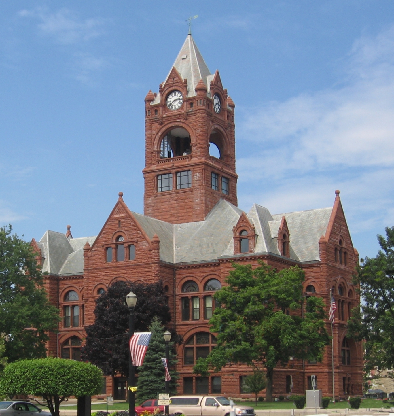
LaPorte County courthouse 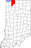
Location in the state of Indiana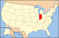
Indiana's location in the U.S.Founded January 1, 1832 Named for French for "The Door" Seat La Porte Largest city Michigan City Area
- Total
- Land
- Water
613.26 sq mi (1,588 km²)
598.30 sq mi (1,550 km²)
14.96 sq mi (39 km²), 2.44%Population
- (2010)
- Density
111,467
186/sq mi (72/km²)Congressional district 2nd Time zone Central: UTC-6/-5 Website www.LaPorteCounty.org Footnotes: - Indiana county number 46
- Third largest county in Indiana by area
LaPorte County [1] is a county located in the U.S. state of Indiana. As of 2010, the population was 111,467.[2] The county seat is the city of La Porte[3]. This county is part of the Chicago metropolitan area, Northwest Indiana and Michiana. The largest city is Michigan City. It is included in the Michigan City-La Porte, IN Metropolitan Statistical Area.
Contents
History
LaPorte County was formed in 1832. La porte means "the door" in French. French travelers or explorers so named the area after discovering a natural opening in the dense forests that used to exist in this region, providing a gateway to lands further west.[4][5]
Before white settlement, all of the land that forms modern-day LaPorte County, and adjacent Starke County to the south belonged to the Potawatomi Indian nation. These Indians were forcibly removed to Kansas by the United States government in 1838, and many died on what survivors called the Trail of Death.[6][7]
When the county was initially proposed and organized, its boundaries did not extend as far south or east as they do today. A section of land north of the Kankakee River originally belonged to Starke County. However, residents living in that area had difficulty crossing the river in order to reach the rest of the county. It was necessary to travel some distance east to Lemon's bridge, before making the journey south. Effectively isolated from the rest of Starke County, these residents asked that their land be annexed to LaPorte County, which was completed on January 28, 1842. Thereafter, the Kankakee River formed the southern boundary of the county. Finally, on January 10, 1850, some twenty sections of land were annexed from St. Joseph County to the east, giving LaPorte County the boundaries that essentially exist to this day.[6]
Geography
According to the 2010 census, the county has a total area of 613.26 square miles (1,588.3 km2), of which 598.30 square miles (1,549.6 km2) (or 97.56%) is land and 14.96 square miles (38.7 km2) (or 2.44%) is water.[8]
Adjacent counties
- Berrien County, Michigan (north)
- St. Joseph County (east)
- Starke County (south)
- Jasper County (southwest)
- Porter County (west)
National protected area
Major highways
Railroads
- Amtrak
- Canadian National Railway
- Chesapeake and Indiana Railroad
- Chicago, Fort Wayne and Eastern Railroad
- Chicago SouthShore and South Bend Railroad
- CSX Transportation
- Norfolk Southern Railway
Historical populations Census Pop. %± 1840 8,184 — 1850 12,145 48.4% 1860 22,919 88.7% 1870 27,062 18.1% 1880 30,985 14.5% 1890 34,445 11.2% 1900 38,386 11.4% 1910 45,797 19.3% 1920 50,443 10.1% 1930 60,490 19.9% 1940 63,660 5.2% 1950 76,808 20.7% 1960 95,111 23.8% 1970 105,342 10.8% 1980 108,632 3.1% 1990 107,066 −1.4% 2000 110,106 2.8% 2010 111,467 1.2% Sources: United States Department of Commerce,
Bureau of the Census, Population Division[9]
Census Quickfacts[2]Communities
Cities
Towns
- Kingsbury
- Kingsford Heights
- LaCrosse
- Long Beach
- Michiana Shores
- Pottawattamie Park
- Trail Creek
- Wanatah
- Westville
Townships
Unincorporated communities
Climate and weather
LaPorte, Indiana Climate chart (explanation) J F M A M J J A S O N D 1.830121.73616347274.160374.371474.880583.984623.981603.37551363393.648302.73519Average max. and min. temperatures in °F Precipitation totals in inches Source: The Weather Channel[10] Metric conversion J F M A M J J A S O N D 47-1-11432-9758-3104163110228122271498291798271685241176174919-1692-7Average max. and min. temperatures in °C Precipitation totals in mm In recent years, average temperatures in LaPorte have ranged from a low of 12 °F (−11 °C) in January to a high of 84 °F (29 °C) in July, although a record low of −28 °F (−33 °C) was recorded in January 1977 and a record high of 104 °F (40 °C) was recorded in June 1988. Average monthly precipitation ranged from 1.68 inches (43 mm) in February to 4.79 inches (122 mm) in June.[10]
Education
Public schools in LaPorte County are administered by eight different districts:
- LaPorte Community School Corporation [1]
- Metropolitan School District of New Durham Township [2]
- Michigan City Area Schools [3]
- New Prairie United School Corporation [4]
- South Central Community School Corporation [5]
- Tri-Township Consolidated School Corporation
Government
See also: Government of IndianaThe county government is a constitutional body, and is granted specific powers by the Constitution of Indiana, and by the Indiana Code.
County Council: The county council is the legislative branch of the county government and controls all the spending and revenue collection in the county. Representatives are elected from county districts. The council members serve four year terms. They are responsible for setting salaries, the annual budget, and special spending. The council also has limited authority to impose local taxes, in the form of an income and property tax that is subject to state level approval, excise taxes, and service taxes.[11][12]
Board of Commissioners: The executive body of the county is made of a board of commissioners. The commissioners are elected county-wide, in staggered terms, and each serves a four-year term. One of the commissioners, typically the most senior, serves as president. The commissioners are charged with executing the acts legislated by the council, collecting revenue, and managing the day-to-day functions of the county government.[11][12]
Court: The county has five elected trial court judges. They include the LaPorte Circuit Court and Superior Courts No. 1-4. The judges are elected to six-year terms on partisan ballots. Superior Courts 3 and 4 maintain small claims dockets. Decisions from any trial court may be appealed to the Indiana Court of Appeals]].[12]
County Officials: The county has several other elected offices, including sheriff, coroner, auditor, treasurer, recorder, surveyor, and circuit court clerk. Each of these elected officers serves a term of four years and oversees a different part of county government. Members elected to county government positions are required to declare party affiliations and to be residents of the county.[12]
Laporte County is part of Indiana's 2nd congressional district and in 2008 was represented by Joe Donnelly in the United States Congress.[13] It is also part of Indiana Senate districts 5 and 8[14] and Indiana House of Representatives districts 9, 17 and 20.[15]
Demographics
As of 2000, there were 110,106 people, 41,050 households, and 28,611 families residing in the county. The population density was 184 people per square mile (71/km²). There were 45,621 housing units at an average density of 29 persons/km² (76 persons/sq mi). The racial makeup of the county was 86.26% White, 10.13% African American, 0.31% Native American, 0.45% Asian, 0.02% Pacific Islander, 1.31% from other races, and 1.52% from two or more races. Hispanic or Latino of any race were 3.09% of the population. 25.9% were of German, 12.2% Poles, 10.2% American, 9.0% Irish and 5.5% English ancestry according to the 2000 United States Census.
There were 41,050 households out of which 31.80% had children under the age of 18 living with them, 53.80% were married couples living together, 11.70% had a female householder with no husband present, and 30.30% were non-families. 25.20% of all households were made up of individuals and 10.50% had someone living alone who was 65 years of age or older. The average household size was 2.52 and the average family size was 3.02.
In the county the population was spread out with 24.50% under the age of 18, 8.60% from 18 to 24, 29.70% from 25 to 44, 23.60% from 45 to 64, and 13.50% who were 65 years of age or older. The median age was 37 years. For every 100 females there were 105.50 males. For every 100 females age 18 and over, there were 105.30 males.
The median income for a household in the county was $41,430, and the median income for a family was $49,872. Males had a median income of $36,686 versus $23,955 for females. The per capita income for the county was $18,913. About 6.30% of families and 8.70% of the population were below the poverty line, including 11.50% of those under the age of 18 and 9.00% ages 65 or older.
See also
References
- ^ LaPorte County Government website
- ^ a b "La Porte County QuickFacts". United States Census Bureau. http://quickfacts.census.gov/qfd/states/18/18091.html. Retrieved 2011-09-25.
- ^ "Find a County". National Association of Counties. http://www.naco.org/Counties/Pages/FindACounty.aspx. Retrieved 2011-06-07.
- ^ Calumet Beginnings: Schoon, Kenneth J. (2003)
- ^ De Witt Clinton Goodrich & Charles Richard Tuttle (1875). An Illustrated History of the State of Indiana. Indiana: R. S. Peale & co.. pp. 560. http://books.google.com/books?id=YDIUAAAAYAAJ.
- ^ a b La Porte County Historical Society
- ^ History of 1838 Trail of Death
- ^ "Census 2010 U.S. Gazetteer Files: Counties". United States Census. http://www.census.gov/geo/www/gazetteer/files/Gaz_counties_national.txt. Retrieved 2011-10-10.
- ^ Forstall, Richard L. (editor) (1996). Population of states and counties of the United States: 1790 to 1990 : from the twenty-one decennial censuses. United States Department of Commerce, Bureau of the Census, Population Division. pp. 50–53. ISBN 0-934213-48-8. http://books.google.com/books?id=Z12v1lrkv2IC&lpg=PA50&pg=PA50#v=onepage&q&f=false.
- ^ a b "Monthly Averages for LaPorte, Indiana". The Weather Channel. http://www.weather.com/weather/wxclimatology/monthly/graph/USIN0142. Retrieved 2011-01-27.
- ^ a b Indiana Code. "Title 36, Article 2, Section 3". IN.gov. http://www.in.gov/legislative/ic/code/title36/ar2/ch3.html. Retrieved 2008-09-16.
- ^ a b c d Indiana Code. "Title 2, Article 10, Section 2" (PDF). IN.gov. http://www.in.gov/legislative/ic/code/title3/ar10/ch2.pdf. Retrieved 2008-09-16.
- ^ "US Congressman Joe Donnelly". US Congress. http://www.house.gov/donnelly/. Retrieved 2008-10-08.
- ^ "Indiana Senate Districts". State of Indiana. http://www.in.gov/sos/elections/3006.htm. Retrieved 2011-07-14.
- ^ "Indiana House Districts". State of Indiana. http://www.in.gov/sos/elections/3005.htm. Retrieved 2011-07-14.
External links
- Access LaPorte County official community site
- Greater LaPorte Chamber of Commerce
- Healthy Communities of LaPorte County

Lake Michigan Berrien County, Michigan Porter County 
St. Joseph County  LaPorte County, Indiana

Jasper County Starke County Municipalities and communities of LaPorte County, Indiana County seat: La Porte Cities 
Towns Townships Unincorporated
communitiesAlida | Ambler | Andry | Beattys Corner | Birchim | Byron | Door Village | Duneland Beach | Durham | Fish Lake | Hanna | Hesston | Hicks | Hillside | Holmesville | Hudson Lake | Kankakee | Lake Park | Magee | Mill Creek | Monroe Manor | Oakwood | Orchard Highlands | Otis | Pinhook | Pinola | Plainfield | Riverside | Rolling Prairie | Salem Heights | Smith | South Center | South Wanatah | Springfield | Springville | Stillwell | Summit | Tee Lake | Thomaston | Tracy | Union Center | Union Mills | Waterford | Wellsboro | Wilders
 State of Indiana
Indianapolis (capital) Topics Index · Demographics · Economy · Geography · Government · Governor (List) · Congressional districts (Delegations) · History · Hoosiers · City Nicknames · National Historic Landmarks · Sports · State parks · Symbols · Transportation · Visitor Attractions · Index of Indiana-related articles · Outline
Regions Central Indiana · East Central Indiana · Illinois-Indiana-Kentucky Tri-State Area · Indiana-Kentucky-Ohio Tri-State Area · Michiana · Northern Indiana · Northwest Indiana · Southern Indiana · Southwestern Indiana · Wabash Valley
Largest cities Indianapolis · Fort Wayne · Evansville · South Bend · Hammond · Bloomington · Gary · Carmel · Lafayette · Muncie · Anderson · Terre Haute · Elkhart · Kokomo · Mishawaka · Richmond · Columbus · Lawrence · Jeffersonville · Greenwood · New Albany · Portage · Michigan City · East Chicago · Goshen · Marion · Valparaiso · Noblesville · West Lafayette · Hobart · Crown Point · Franklin · La Porte · Seymour · Logansport · New Castle · Connersville · Vincennes · Bedford · Jasper · Washington · Princeton · Westfield
Largest towns Fishers · Merrillville · Schererville · Clarksville · Plainfield · Highland · Munster
Counties Adams · Allen · Bartholomew · Benton · Blackford · Boone · Brown · Carroll · Cass · Clark · Clay · Clinton · Crawford · Daviess · Dearborn · Decatur · DeKalb · Delaware · Dubois · Elkhart · Fayette · Floyd · Fountain · Franklin · Fulton · Gibson · Grant · Greene · Hamilton · Hancock · Harrison · Hendricks · Henry · Howard · Huntington · Jackson · Jasper · Jay · Jefferson · Jennings · Johnson · Knox · Kosciusko · LaGrange · Lake · LaPorte · Lawrence · Madison · Marion · Marshall · Martin · Miami · Monroe · Montgomery · Morgan · Newton · Noble · Ohio · Orange · Owen · Parke · Perry · Pike · Porter · Posey · Pulaski · Putnam · Randolph · Ripley · Rush · Saint Joseph · Scott · Shelby · Spencer · Starke · Steuben · Sullivan · Switzerland · Tippecanoe · Tipton · Union · Vanderburgh · Vermillion · Vigo · Wabash · Warren · Warrick · Washington · Wayne · Wells · White · Whitley
Categories:- Indiana counties
- LaPorte County, Indiana
- 1832 establishments in the United States
- Populated places established in 1832
- Northwest Indiana


Wikimedia Foundation. 2010.