- Fayette County, Indiana
-
Fayette County, Indiana 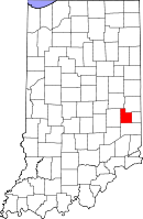
Location in the state of Indiana
Indiana's location in the U.S.Founded 1819 Named for Marquis de la Fayette Seat Connersville Area
- Total
- Land
- Water
215.16 sq mi (557 km²)
215.01 sq mi (557 km²)
0.15 sq mi (0 km²), 0.07%Population
- (2010)
- Density
24,277
113/sq mi (43.61/km²)Congressional district 6th Time zone Eastern: UTC-5/-4 Footnotes: Indiana county number 21
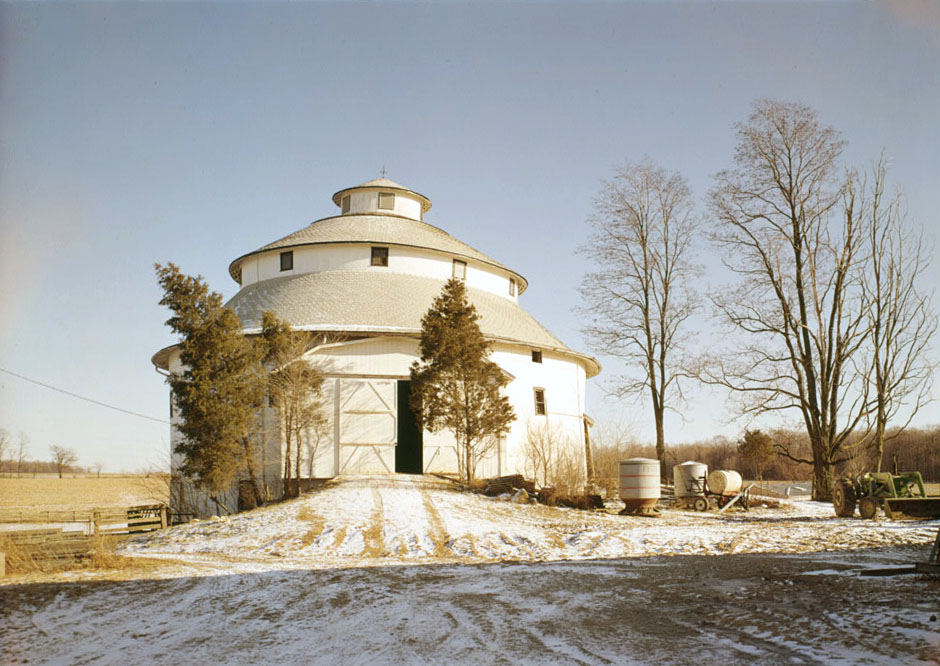
 A round barn in Fayette County
Fayette County is a county located in the U.S. state of Indiana. As of 2010, the population was 24,277.[1] The county seat is Connersville[2].
Contents
History
Fayette County was formed in 1819. It was named for the Marquis de la Fayette, a French hero of the Revolutionary War.[3]
Geography
According to the 2010 census, the county has a total area of 215.16 square miles (557.3 km2), of which 215.01 square miles (556.9 km2) (or 99.93%) is land and 0.15 square miles (0.39 km2) (or 0.07%) is water.[4]
Cities and towns
Townships
Major highways
Adjacent counties
- Henry County (north)
- Wayne County (northeast)
- Union County (east)
- Franklin County (south)
- Rush County (west)
Climate and weather
Connersville, Indiana Climate chart (explanation) J F M A M J J A S O N D 2.432152.337183.448274.260364.971484.479574.283613.581582.875502.864383.650303.13821Average max. and min. temperatures in °F Precipitation totals in inches Source: The Weather Channel[5] Metric conversion J F M A M J J A S O N D 620-9593-8859-310616212422911226141062816892714712410711839010-1773-6Average max. and min. temperatures in °C Precipitation totals in mm In recent years, average temperatures in Connersville have ranged from a low of 15 °F (−9 °C) in January to a high of 83 °F (28 °C) in July, although a record low of −31 °F (−35 °C) was recorded in January 1994 and a record high of 102 °F (39 °C) was recorded in July 1952. Average monthly precipitation ranged from 2.33 inches (59 mm) in February to 4.89 inches (124 mm) in May.[5]
Government
See also: Government of IndianaThe county government is a constitutional body, and is granted specific powers by the Constitution of Indiana, and by the Indiana Code.
County Council: The county council is the legislative branch of the county government and controls all the spending and revenue collection in the county. Representatives are elected from county districts. The council members serve four year terms. They are responsible for setting salaries, the annual budget, and special spending. The council also has limited authority to impose local taxes, in the form of an income and property tax that is subject to state level approval, excise taxes, and service taxes.[6][7]
Board of Commissioners: The executive body of the county is made of a board of commissioners. The commissioners are elected county-wide, in staggered terms, and each serves a four-year term. One of the commissioners, typically the most senior, serves as president. The commissioners are charged with executing the acts legislated by the council, collecting revenue, and managing the day-to-day functions of the county government.[6][7]
Court: The county maintains a small claims court that can handle some civil cases. The judge on the court is elected to a term of four years and must be a member of the Indiana Bar Association. The judge is assisted by a constable who is also elected to a four-year term. In some cases, court decisions can be appealed to the state level circuit court.[7]
County Officials: The county has several other elected offices, including sheriff, coroner, auditor, treasurer, recorder, surveyor, and circuit court clerk. Each of these elected officers serves a term of four years and oversees a different part of county government. Members elected to county government positions are required to declare party affiliations and to be residents of the county.[7]
Fayette County is part of Indiana's 6th congressional district; Indiana Senate district 42;[8] and Indiana House of Representatives district 55.[9]
Demographics
Historical populations Census Pop. %± 1820 5,950 — 1830 9,112 53.1% 1840 9,837 8.0% 1850 10,217 3.9% 1860 10,225 0.1% 1870 10,476 2.5% 1880 11,394 8.8% 1890 12,630 10.8% 1900 13,495 6.8% 1910 14,415 6.8% 1920 17,142 18.9% 1930 19,243 12.3% 1940 19,411 0.9% 1950 23,391 20.5% 1960 24,454 4.5% 1970 26,216 7.2% 1980 28,272 7.8% 1990 26,015 −8.0% 2000 25,588 −1.6% 2010 24,277 −5.1% Sources: United States Department of Commerce,
Bureau of the Census, Population Division[10]
Census Quickfacts[1]2010 Census Data
As of the census[11] of 2010, there were 24,277 people and 9,719 households residing in the county. The population density was 113 people per square mile (44/km²). There were 10,898 housing units at an average density of 51 per square mile (20/km²). The racial makeup of the county was 96.93% White, 1.37% Black or African American, 0.16% Native American, 0.34% Asian, 0.07% Pacific Islander, 0.13% from other races, and 1.00% from two or more races. 0.96% of the population were Hispanic or Latino of any race.
2000 Census Data
As of the census[11] of 2000, there were 25,588 people, 10,199 households, and 7,149 families residing in the county. The population density was 119 people per square mile (46/km²). There were 10,981 housing units at an average density of 51 per square mile (20/km²). The racial makeup of the county was 97.16% White, 1.67% Black or African American, 0.09% Native American, 0.27% Asian, 0.02% Pacific Islander, 0.13% from other races, and 0.66% from two or more races. 0.52% of the population were Hispanic or Latino of any race. 39.2% were of American, 18.9% German, 10.6% English and 9.7% Irish ancestry according to Census 2000.
There were 10,199 households out of which 30.80% had children under the age of 18 living with them, 55.60% were married couples living together, 10.20% had a female householder with no husband present, and 29.90% were non-families. 25.80% of all households were made up of individuals and 12.30% had someone living alone who was 65 years of age or older. The average household size was 2.46 and the average family size was 2.94.
In the county the population was spread out with 24.30% under the age of 18, 8.60% from 18 to 24, 27.10% from 25 to 44, 24.50% from 45 to 64, and 15.50% who were 65 years of age or older. The median age was 38 years. For every 100 females there were 94.00 males. For every 100 females age 18 and over, there were 90.70 males.
The median income for a household in the county was $38,840, and the median income for a family was $46,111. Males had a median income of $34,493 versus $23,082 for females. The per capita income for the county was $18,624. About 6.00% of families and 7.90% of the population were below the poverty line, including 8.40% of those under age 18 and 7.70% of those age 65 or over.
See also
- McFarlan Automobile
- National Register of Historic Places listings in Fayette County, Indiana
- Thomas Ranck Round Barn
- Edward E. Moore, Indiana state senator and Los Angeles City Council member
References
- ^ a b "Fayette County QuickFacts". United States Census Bureau. http://quickfacts.census.gov/qfd/states/18/18041.html. Retrieved 2011-09-17.
- ^ "Find a County". National Association of Counties. http://www.naco.org/Counties/Pages/FindACounty.aspx. Retrieved 2011-06-07.
- ^ De Witt Clinton Goodrich & Charles Richard Tuttle (1875). An Illustrated History of the State of Indiana. Indiana: R. S. Peale & co.. pp. 557. http://books.google.com/books?id=YDIUAAAAYAAJ.
- ^ "Census 2010 U.S. Gazetteer Files: Counties". United States Census. http://www.census.gov/geo/www/gazetteer/files/Gaz_counties_national.txt. Retrieved 2011-10-10.
- ^ a b "Monthly Averages for Connersville, Indiana". The Weather Channel. http://www.weather.com/weather/wxclimatology/monthly/graph/USIN0128. Retrieved 2011-01-27.
- ^ a b Indiana Code. "Title 36, Article 2, Section 3". IN.gov. http://www.in.gov/legislative/ic/code/title36/ar2/ch3.html. Retrieved 2008-09-16.
- ^ a b c d Indiana Code. "Title 2, Article 10, Section 2". IN.gov. http://www.in.gov/legislative/ic/code/title3/ar10/ch2.pdf. Retrieved 2008-09-16.
- ^ "Indiana Senate Districts". State of Indiana. http://www.in.gov/sos/elections/3006.htm. Retrieved 2011-01-23.
- ^ "Indiana House Districts". State of Indiana. http://www.in.gov/sos/elections/3005.htm. Retrieved 2011-01-23.
- ^ Forstall, Richard L. (editor) (1996). Population of states and counties of the United States: 1790 to 1990 : from the twenty-one decennial censuses. United States Department of Commerce, Bureau of the Census, Population Division. pp. 50–53. ISBN 0-934213-48-8. http://books.google.com/books?id=Z12v1lrkv2IC&lpg=PA50&pg=PA50#v=onepage&q&f=false.
- ^ a b "American FactFinder". United States Census Bureau. http://factfinder.census.gov. Retrieved 2008-01-31.

Henry County Wayne County Rush County 
Union County  Fayette County, Indiana

Franklin County Municipalities and communities of Fayette County, Indiana City 
Town Townships Unincorporated
communitiesAlpine | Alquina | Bentonville | Bunker Hill | Columbia | Everton | Falmouth | Harrisburg | Huber | Lyonsville | Nulltown | Orange | Springersville | Waterloo
Footnotes ‡This populated place also has portions in an adjacent county or counties
Categories:- Indiana counties
- Fayette County, Indiana
- 1819 establishments in the United States
- Populated places established in 1819


Wikimedia Foundation. 2010.