- Newton County, Georgia
-
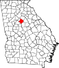
Newton County, Georgia  Newton County courthouse in Covington, Georgia
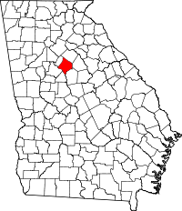
Location in the state of Georgia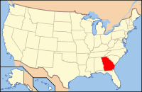
Georgia's location in the U.S.Founded 1821 Seat Covington Largest city Covington Area
- Total
- Land
- Water
279.19 sq mi (723 km²)
276.43 sq mi (716 km²)
2.76 sq mi (7 km²), 0.99%PopulationEst.
- (2006)
- Density
98,451
225/sq mi (87/km²)Website www.co.newton.ga.us Newton County is a county located in the U.S. state of Georgia. As of 2000, the population was 62,001. The 2010 Census showed a population of 99,958.[1] The county seat is Covington.[2]
This county is a part of the Atlanta Metropolitan Area (Atlanta-Sandy Springs-Marietta, Georgia Metropolitan Statistical Area).
Contents
History
Newton county is named after Sgt. John Newton, who served under Gen. Francis Marion, the "Swamp Fox", in the American Revolutionary War. It was created on December 24, 1821. During the American Civil War, the county provided the Lamar Infantry, which was a part of Cobb's Legion. Georgia is one of many states which have a Newton County and a Jasper County that border each other.
In late 1978, the first five episodes of The Dukes of Hazzard were filmed in and around Covington, Georgia. The TV series In The Heat of the Night was filmed in Covington from 1988 to 1995. Also, in Remember the Titans, there were many scenes shot on "The Square" and the final football scene in was shot at Homer Sharp Stadium, which is located right off "The Square" in downtown Covington. Currently part of the new series The Vampire Diaries is being fiimed on the Square. Additionally, major films including My Cousin Vinny, Friday the 13th Part VI: Jason Lives and Halloween II, Rob Zombie's sequel to his 2007 film Halloween were also filmed near and around "The Square" in downtown Covington.
Newton county is the place where Georgia 4-H was founded as the Girls Canning and Boys Corn Clubs in 1904 by G.C. Adams.
Geography
According to the 2000 census, the county has a total area of 279.19 square miles (723.1 km2), of which 276.43 square miles (716.0 km2) (or 99.01%) is land and 2.76 square miles (7.1 km2) (or 0.99%) is water.[3]
Major highways
 Interstate 20
 U.S. Highway 278
 Georgia State Route 11
 Georgia State Route 36
 Georgia State Route 81
 Georgia State Route 142
 Georgia State Route 162
 Georgia State Route 212
 Georgia State Route 402
Adjacent counties
- Walton County (north)
- Morgan County (east)
- Jasper County (southeast)
- Butts County (south)
- Henry County (southwest)
- Rockdale County (northwest)
Demographics
As of the census[4] of 2000, there were 62,001 people, 21,997 households, and 17,113 families residing in the county. The population density was 224 people per square mile (87/km²). There were 23,033 housing units at an average density of 83 per square mile (32/km²). The racial makeup of the county was 55.27% White, 45.21% Black or African American, 0.22% Native American, 0.72% Asian, 0.02% Pacific Islander, 0.58% from other races, and 0.98% from two or more races. 1.87% of the population were Hispanic or Latino of any race.
There were 21,997 households out of which 37.70% had children under the age of 18 living with them, 59.20% were married couples living together, 14.10% had a female householder with no husband present, and 22.20% were non-families. 18.30% of all households were made up of individuals and 6.60% had someone living alone who was 65 years of age or older. The average household size was 2.77 and the average family size was 3.14.
In the county the population was spread out with 27.70% under the age of 18, 8.90% from 18 to 24, 32.10% from 25 to 44, 21.50% from 45 to 64, and 9.90% who were 65 years of age or older. The median age was 33 years. For every 100 females there were 94.70 males. For every 100 females age 18 and over, there were 90.20 males.
The median income for a household in the county was $44,875, and the median income for a family was $49,748. Males had a median income of $36,742 versus $26,097 for females. The per capita income for the county was $19,317. About 7.20% of families and 10.00% of the population were below the poverty line, including 14.90% of those under age 18 and 8.80% of those age 65 or over.
Education
Main article: Covington, Georgia#EducationCities and towns
- Covington
- Mansfield
- Newborn
- Oxford
- Porterdale
- Social Circle
- Starrsville - a largely forgotten but historic settlement southeast of Covington
See also
References
- ^ [1]
- ^ "Find a County". National Association of Counties. http://www.naco.org/Counties/Pages/FindACounty.aspx. Retrieved 2011-06-07.
- ^ "Census 2000 U.S. Gazetteer Files: Counties". United States Census. http://www.census.gov/tiger/tms/gazetteer/county2k.txt. Retrieved 2011-02-13.
- ^ "American FactFinder". United States Census Bureau. http://factfinder.census.gov. Retrieved 2008-01-31.
External links
- The City of Covington official site
- Downtown Covington
- The Covington/Newton County Chamber of Commerce
- The Center for Community Preservation and Planning
- The Covington News
- The Newton Citizen
Coordinates: 33°35′57″N 83°51′31″W / 33.599243°N 83.858729°W

Rockdale County Walton County 
Morgan County  Newton County, Georgia

Henry County Butts County Jasper County Municipalities and communities of Newton County, Georgia Cities Covington | Mansfield | Oxford | Porterdale | Social Circle‡
Town Unincorporated
communityStarrsville
Footnotes ‡This populated place also has portions in an adjacent county or counties
Metro Atlanta Counties 
Major city Municipalities & communities 100k-250k 25k-100k Alpharetta • Brookhaven • Candler-McAfee • Duluth • Dunwoody • East Point • Gainesville • Johns Creek • Lawrenceville • Mableton • Marietta • Milton • Newnan • Peachtree City • Peachtree Corners • Redan • Smyrna • Tucker10k-25k Acworth • Belvedere Park • Buford • Carrollton • Cartersville • Chamblee • College Park • Conyers • Covington • Decatur • Doraville • Druid Hills • Douglasville • Fayetteville • Forest Park • Griffin • Kennesaw • Suwanee • Lilburn • Monroe • Mountain Park • North Decatur • North Druid Hills • Panthersville • Powder Springs • Riverdale • Snellville • Stockbridge • Sugar Hill • Union City • Vinings • Winder • WoodstockTopics Architecture • Culture • History • Media • Neighborhoods • People • Tourism • Transportation Categories:- Georgia (U.S. state) counties
- Atlanta metropolitan area
- Newton County, Georgia
- 1821 establishments in the United States
- Populated places established in 1821


Wikimedia Foundation. 2010.