- Ouse, Tasmania
-
Ouse
Tasmania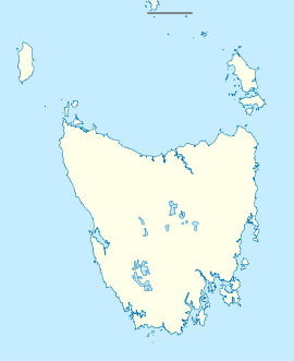
 Ouse
OusePopulation: 137 (2006 Census)[1] Established: 1842 Postcode: 7140 Elevation: 150 m (492 ft) Location: - 95 km (59 mi) NW of Hobart
- 58 km (36 mi) NW of New Norfolk
LGA: Central Highlands Council State District: Lyons Federal Division: Lyons Ouse is a small town in the Central Highlands Council local government area in Tasmania along Lyell Highway. At the 2006 census, Ouse had a population of 137.[1]
The town briefly made national headlines in August 2006 when the Ouse District Hospital, originally established as a Bush Nursing Centre and reconstituted in its present form in 1956,[2] was downgraded to a health centre due to the lack of a GP to service the area.[3]
Ouse District High School
Ouse District High School is a public school which caters for students from kindergarten to grade 10.
References
- ^ a b Australian Bureau of Statistics (25 October 2007). "Ouse (State Suburb)". 2006 Census QuickStats. http://www.censusdata.abs.gov.au/ABSNavigation/prenav/LocationSearch?collection=Census&period=2006&areacode=SSC65891&producttype=QuickStats&breadcrumb=PL&action=401. Retrieved 21 November 2011.
- ^ Archives Office of Tasmania. "Agency Details - TA455 Ouse District Hospital". http://search.archives.tas.gov.au/default.aspx?detail=1&type=A&id=TA00455. Retrieved 2007-04-23.
- ^ ABC Online (27 August 2006). "Ouse hospital downgraded to health centre". http://www.abc.net.au/news/2006-08-27/ouse-hospital-downgraded-to-health-centre/1248810. Retrieved 2007-04-23.
ABC Online (28 August 2006). "Abetz canvasses options for Ouse hospital". http://www.abc.net.au/news/newsitems/200608/s1725547.htm. Retrieved 2007-04-23.
External links
- Ouse, Tasmania is at coordinates 42°29′06″S 146°42′32″E / 42.485°S 146.709°ECoordinates: 42°29′06″S 146°42′32″E / 42.485°S 146.709°E
- Ouse - Community History
Categories:- Towns in Tasmania
- Tasmania geography stubs

Wikimedia Foundation. 2010.