- Bacon County, Georgia
Infobox U.S. County
county = Bacon County
state = Georgia
seallink =
map size = 225
founded = 1914
seat = Alma
largest city = Alma
area_total_sq_mi = 286
area_total_km2 = 741
area_land_sq_mi = 285
area_land_km2 = 738
area_water_sq_mi = 1
area_water_km2 = 3
area percentage = 0.34%
census estimate yr = 2006
pop = 10482
density_sq_mi = 36
density_km2 = 14
time zone = Eastern
UTC offset = -5
DST offset = -4
web =Bacon County is a
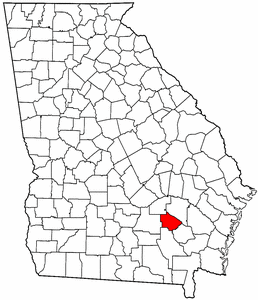
county located in theU.S. state of Georgia. The constitutional amendment to create the county was proposed July 7, 1914, and ratified November 3, 1914. As of 2000, the population is 10,103. The 2006 Census Estimate placed the population at 10,507 [http://www.census.gov/popest/counties/tables/CO-EST2007-01-13.xls] . Thecounty seat is Alma, GeorgiaGR|6.Geography
According to the
U.S. Census Bureau , the county has a total area of 286square mile s (741km² ), of which, 285 square miles (738 km²) of it is land and 1 square miles (3 km²) of it (0.34%) is water.Major highways
*
*
*
*
*
*Adjacent counties
*Appling County (northeast)
*Pierce County (east)
*Ware County (south)
*Coffee County (west)
*Jeff Davis County (northwest)Demographics
As of the
census GR|2 of 2000, there were 10,103 people, 3,833 households, and 2,813 families residing in the county. Thepopulation density was 36 people per square mile (14/km²). There were 4,464 housing units at an average density of 16 per square mile (6/km²). The racial makeup of the county was 81.48% White, 15.70% Black or African American, 0.15% Native American, 0.30% Asian, 1.46% from other races, and 0.91% from two or more races. 3.39% of the population were Hispanic or Latino of any race.There were 3,833 households out of which 33.00% had children under the age of 18 living with them, 55.20% were married couples living together, 14.10% had a female householder with no husband present, and 26.60% were non-families. 23.60% of all households were made up of individuals and 9.50% had someone living alone who was 65 years of age or older. The average household size was 2.60 and the average family size was 3.03.
In the county the population was spread out with 26.20% under the age of 18, 9.90% from 18 to 24, 28.00% from 25 to 44, 23.00% from 45 to 64, and 12.80% who were 65 years of age or older. The median age was 35 years. For every 100 females there were 96.10 males. For every 100 females age 18 and over, there were 91.40 males.
The median income for a household in the county was $26,910, and the median income for a family was $32,579. Males had a median income of $27,780 versus $19,049 for females. The
per capita income for the county was $14,289. About 20.20% of families and 23.70% of the population were below thepoverty line , including 31.40% of those under age 18 and 25.70% of those age 65 or over.Home of 2004 aa baseball state champs
Cities and towns
*Alma
Wikimedia Foundation. 2010.