- Moffat County, Colorado
-
Moffat County, Colorado 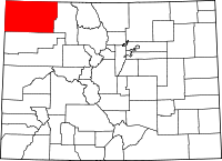
Location in the state of Colorado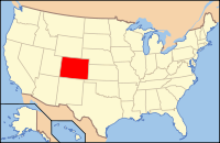
Colorado's location in the U.S.Founded February 27, 1911 Named for David H. Moffat Seat Craig Largest city Craig Area
- Total
- Land
- Water
4,750.94 sq mi (12,305 km²)
4,742.25 sq mi (12,282 km²)
8.69 sq mi (23 km²), 0.18%Population
- (2000)
- Density
13,184
3/sq mi (1/km²)Time zone Mountain: UTC-7/-6 Website www.co.moffat.co.us Moffat County is the northwesternmost and the second most extensive of the 64 counties of the State of Colorado of the United States. The county population was 13,184 at U.S. Census 2000.[1] The county seat is Craig.
Contents
History
Moffat County was created out of the western portion of Routt County on February 27, 1911. The county was named for David H. Moffat, a Colorado tycoon who died in 1911. His railroad, the Denver, Northwestern & Pacific, attempted to build a route from Denver to Salt Lake City. In 1913, a reorganized railroad, the Denver & Salt Lake, reached as far as Craig, the county seat, but no further.
Geography
 Wolf Creek Wildlife Management Area, in Moffat County, Colorado
According to the 2000 census, the county has a total area of 4,750.94 square miles (12,304.9 km2), of which 4,742.25 square miles (12,282.4 km2) (or 99.82%) is land and 8.69 square miles (22.5 km2) (or 0.18%) is water.[2]
Adjacent counties
- Routt County, Colorado - east
- Rio Blanco County, Colorado - south
- Uintah County, Utah - west
- Daggett County, Utah - west
- Sweetwater County, Wyoming - north
- Carbon County, Wyoming - north
Demographics
As of the census[3] of 2000, there were 13,184 people, 4,983 households, and 3,577 families residing in the county. The population density was 3 people per square mile (1/km²). There were 5,635 housing units at an average density of 1 per square mile (0/km²). The racial makeup of the county was 93.61% White, 0.21% Black or African American, 0.88% Native American, 0.33% Asian, 0.02% Pacific Islander, 3.17% from other races, and 1.77% from two or more races. 9.46% of the population were Hispanic or Latino of any race.
There were 4,983 households out of which 38.20% had children under the age of 18 living with them, 58.70% were married couples living together, 8.20% had a female householder with no husband present, and 28.20% were non-families. 23.60% of all households were made up of individuals and 8.10% had someone living alone who was 65 years of age or older. The average household size was 2.58 and the average family size was 3.05.
In the county the population was spread out with 28.50% under the age of 18, 8.60% from 18 to 24, 29.90% from 25 to 44, 23.80% from 45 to 64, and 9.40% who were 65 years of age or older. The median age was 35 years. For every 100 females there were 107.70 males. For every 100 females age 18 and over, there were 106.20 males.
The median income for a household in the county was $41,528, and the median income for a family was $45,511. Males had a median income of $37,288 versus $22,080 for females. The per capita income for the county was $18,540. About 6.90% of families and 8.30% of the population were below the poverty line, including 8.30% of those under age 18 and 9.30% of those age 65 or over.
Cities and towns
National park
- Dinosaur National Monument is located in Moffat County, Colorado, and Uintah County, Utah. The headquarters of Dinosaur National Monument are located east of Dinosaur, Colorado.
Other protected areas
- Browns Park National Wildlife Refuge
- Routt National Forest
- White River National Forest
- Yampa River State Park
Scenic byway
- Dinosaur Diamond Prehistoric Highway National Scenic Byway
See also
- Colorado census statistical areas
- Colorado counties
- Colorado municipalities
- National Register of Historic Places listings in Moffat County, Colorado
References
- ^ "Annual County Population Estimates and Estimated Components of Change: April 1, 2000 to July 1, 2006 (CO-EST2006-alldata)" (CSV). 2006 Population Estimates. United States Census Bureau, Population Division. 2007-03-22. http://www.census.gov/popest/counties/files/CO-EST2006-ALLDATA.csv. Retrieved 2007-05-10.
- ^ "Census 2000 U.S. Gazetteer Files: Counties". United States Census. http://www.census.gov/tiger/tms/gazetteer/county2k.txt. Retrieved 2011-02-13.
- ^ "American FactFinder". United States Census Bureau. http://factfinder.census.gov. Retrieved 2008-01-31.
External links
- Moffat County Government website
- Dinosaur National Monument website
- Colorado County Evolution by Don Stanwyck
- Colorado Historical Society

Sweetwater County, Wyoming and Carbon County, Wyoming Uintah County, Utah and Daggett County, Utah 
Routt County  Moffat County, Colorado

Rio Blanco County Municipalities and communities of Moffat County, Colorado City 
Town Unincorporated
communitiesElk Springs | Hamilton | Maybell | Slater
Categories:- Colorado counties
- Moffat County, Colorado
- 1911 establishments in the United States
- Populated places established in 1911


Wikimedia Foundation. 2010.