- Cuminestown
-
 The square and the main street in Cuminestown
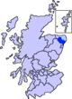
Cuminestown is a small village in the heart of Aberdeenshire, approximately six miles east of Turriff.
As of 2004, it has an estimated population of 500 [1] and a primary school called Monquhitter Primary School which also covers the small hamlet of Garmond, about a mile north of Cuminestown.
External links
Settlements and places of interest in Formartine, Aberdeenshire Primary settlements Balmedie · Cuminestown · Ellon · Fyvie · Newburgh · Oldmeldrum · Pitmedden · Potterton · Rothienorman · Tarves · Turriff
Other settlements Auchterless · Barthol Chapel · Belhelvie · Blackdog · Cairnorrie · Collieston · Craigdam · Foveran · Garmond · Gight · Inverkeithny · Methlick · Udny Green · Udny Station · Whitecairns · Whiterashes · Woodhead of Fyvie · Ythanbank
Places of interest Balmedie Country Park · Craigston Castle · Delgatie Castle · Esslemont Castle · Formartine and Buchan Way · Fyvie Castle · Haddo House · Knockhall Castle · Pitmedden Garden · Sands of Forvie · Tolquhon Castle · Ythan Estuary
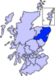
Areas and primary settlements in Aberdeenshire
(see also: Aberdeen City)in Banff and Buchan Aberchirder · Banff · Fraserburgh · Gardenstown · Inverallochy and Cairnbulg · Macduff · Portsoy · Rosehearty · Sandhaven · Whitehills
in Buchan Boddam · Crimond · Cruden Bay · Fetterangus · Hatton · Longside · Maud · Mintlaw · New Deer · New Pitsligo · Peterhead · St Combs · St Fergus · Strichen · Stuartfield
in Formartine Balmedie · Cuminestown · Ellon · Fyvie · Newburgh · Oldmeldrum · Pitmedden · Potterton · Rothienorman · Tarves · Turriff
in Garioch in Kincardine and Mearns Drumoak · Fettercairn · Gourdon · Inverbervie · Johnshaven · Laurencekirk · Newtonhill · Portlethen · St Cyrus · Stonehaven
in Marr Categories:- Aberdeenshire geography stubs
- Villages in Aberdeenshire


Wikimedia Foundation. 2010.