- Cahaba River
Geobox | River
name = Cahaba River
category = River
image_size = 300
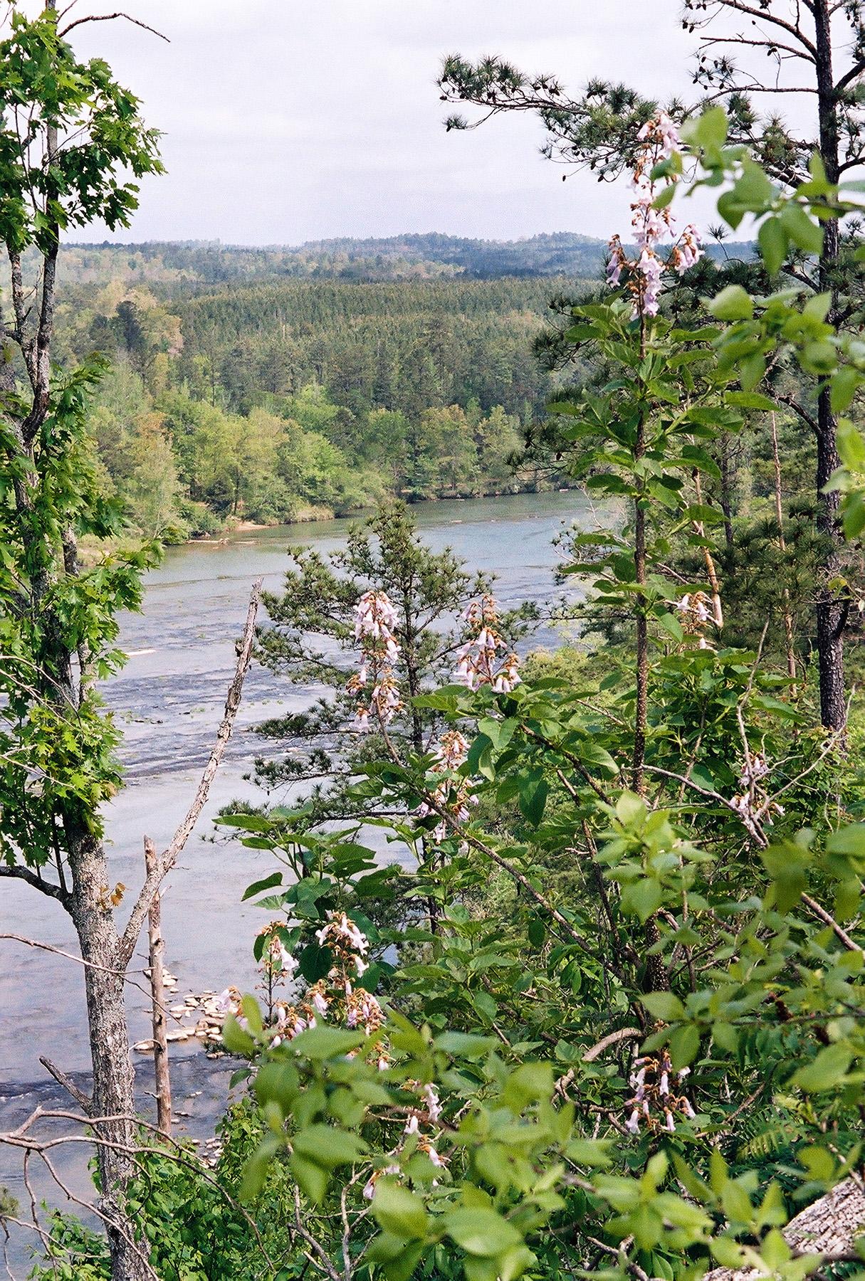
image_caption = The Cahaba River in theCahaba River National Wildlife Refuge
etymology =
country = United States
country_
state = Alabama
region_type = County
region =
district =
parent =
tributary_left =
tributary_right =
source =
source_location = Jefferson County
source_region =
source_state = Alabama
source_elevation_imperial =
source_elevation_note =
source_length_imperial =
source_lat_d = 33
source_lat_m = 41
source_lat_s = 15
source_lat_NS = N
source_long_d = 86
source_long_m = 36
source_long_s = 0
source_long_EW = W
source_coordinates_note = GNIS|159294|Cahaba River]
mouth =Alabama River
mouth_location = Dallas County
mouth_district =
mouth_region =
mouth_state = Alabama
mouth_country =
mouth_note =
mouth_lat_d = 32
mouth_lat_m = 19
mouth_lat_s = 9
mouth_lat_NS = N
mouth_long_d = 87
mouth_long_m = 35
mouth_long_s = 41
mouth_long_EW = W
mouth_coordinates_note =
mouth_elevation_imperial =
mouth_elevation_note =
length_imperial = 191
length_note =
watershed_imperial = 1870
watershed_note =
discharge_location =
discharge_round =
discharge_imperial =
discharge_note =
discharge_min_imperial =
discharge_max_imperial =
discharge1_location =
discharge1_imperial =
discharge1_note =
map_size =
map_caption =
map1 =
map1_size =
map1_caption =
map1_locator =
commons = The Cahaba River is the longest free-flowing river inAlabama and is among the most scenic and biologically diverse rivers in theUnited States . The Cahaba River is a major tributary of theAlabama River and part of the largerMobile River Basin. It is convert|191|mi|km long and drains an area of convert|1870|sqmi|km2.History
The town of "Cahawba" was founded at the mouth of the Cahaba River in 1819 as the first provisional capital of Alabama and was a center of riverboat commerce on the
Alabama River until sometime after the Civil War. [cite book |last=Jackson |first=Harvey H. III |title=Rivers of History-Life on the Coosa, Tallapoosa, Cahaba and Alabama" |year=1995 |publisher=The University of Alabama Press |location=Tuscaloosa, Alabama |pages=50–52 |isbn=0817307710 ] , [ [http://www.cahawba.com Old Cahawba] ]Natural history
The waters of the Cahaba are home to more than 131 species of freshwater fishes (18 of which have been found in no other river system), 40 species of mussels, and 35 species of snails. Sixty-nine of these animal species are endangered. Among the countless plant species that thrive in and around the Cahaba is the beautiful Cahaba Lily. As a result; a portion of the Cahaba River, near West Blocton, AL, has been designated as the
Cahaba River National Wildlife Refuge . [ [http://www.fws.gov/southeast/cahabariver/ Cahaba River National Wildlife Refuge] ] .Water use
The Cahaba flows through heavily populated areas in the Birmingham metropolitan area. It serves as the source of drinking water in the upper course for over 1 million people and is also a popular
canoeing destination. Pressure to develop the land around the Cahaba presents a growing threat to the health of the river.Fact|date=March 2008.Major Cities
A number of Alabama cities lie on the banks of or in close proximity to the Cahaba River. They include:
*Birmingham, Alabama – Cahaba Headwaters
*Hoover, Alabama –
*Helena, Alabama –
*Centreville, Alabama -
*Heiberger, Alabama -
*Marion, Alabama -
*Selma, Alabama -
* Cahaba (Cahawba), Alabama – 1st permanent State Capital at the mouth. Now abandoned.Tributaries
Advocates
* The Cahaba River Society is Alabama’s largest watershed conservation organization and is recognized nationally for river stewardship. CRS’s success is due to a balanced, science-based, and inclusive approach. Its mission is to restore and protect the Cahaba River watershed and its rich diversity of life. [ [http://www.cahabariversociety.org/ The Cahaba River Society] ]
* The Nature Conservancy Sustainable Waters Program The Sustainable Waters Program works with a range of partners to address freshwater issues relating to farms, energy, cities and floodplains. [ [http://www.nature.org/initiatives/freshwater/work/cahabariver.html The Nature Conservancy] ]
* The Cahaba River Basin Clean Water Partnership mission is to identify issues, explore solutions, and make recommendations for the management and stewardship of the Cahaba River basin while maintaining the balance between protecting the environment and promoting the economy. [ [http://www.cahabariver.com/ Cahaba River Basin] ]
* The Alabama Rivers Alliance works to unite the citizens of Alabama to protect peoples right to clean, healthy, waters. [ [http://www.alabamarivers.org/ Alabama Rivers Alliance Website] ]
* Alabama Water Watch is dedicated to volunteer citizen monitoring of water quality in Alabama Rivers. [ [https://aww.auburn.edu Alabama Water Watch Website] ]
* The Presbytery of Sheppards and Lapsley, the regional governing body for the Presbyterian Church (USA) in Central Alabama, is developing a camp and conference center on the Cahaba River called "Living River" [ [http://www.livingriver.org Living River Website] ] . PSL is working diligently to develop this center in an environmentally sound way, and to protect the river. PSL helped remove the Marvel Slab in partnership with many other organizations, which helped a large portion of the river return to its natural, free flowing state.References
*
Notes

Wikimedia Foundation. 2010.