- Griffintown
Infobox Settlement
name = Griffintown
official_name =
settlement_type =Neighbourhood
motto =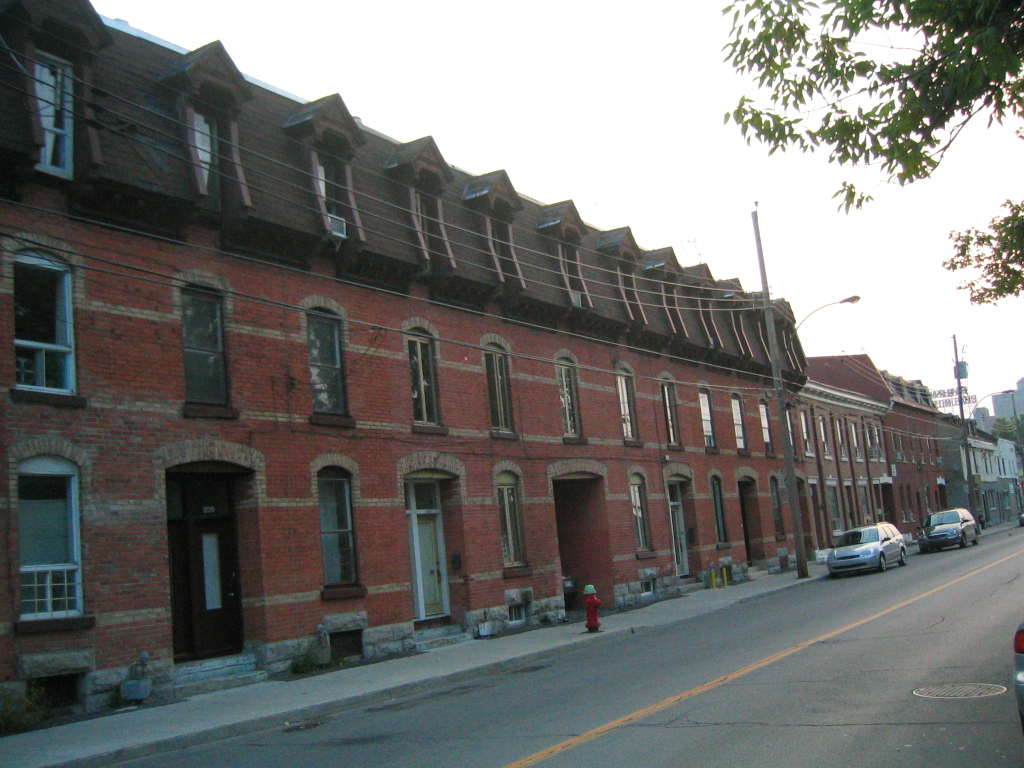
imagesize =
image_caption =
image_
mapsize =
map_caption =
mapsize1 =
map_caption1 =
pushpin_
pushpin_label_position = bottom
pushpin_map_caption = Location of Griffintown inMontreal
pushpin_mapsize =
subdivision_type = Country
subdivision_name =Canada
subdivision_type1 = Province
subdivision_name1 =Quebec
subdivision_type2 = City
subdivision_name2 = Montreal
subdivision_type2 = Borough
subdivision_name2 =Le Sud-Ouest
government_footnotes =
government_type =
leader_title =
leader_name =
leader_title1 =
leader_name1 =
established_title =
established_date =unit_pref = Imperial
area_footnotes =
area_magnitude =
area_total_km2 =
area_land_km2 =
area_water_km2 =
area_total_sq_mi =
area_land_sq_mi =
area_water_sq_mi =population_as_of = 2007
population_footnotes = [ [http://www.canada.com/montrealgazette/news/story.html?id=a00e7254-b5fc-4fa3-bd32-63efeccd8d07&k=64403 Montreal Gazette: Huge Griffintown Plan Unveiled] ]
population_total = 47
population_density_km2 =
population_density_sq_mi =timezone =
utc_offset =
timezone_DST =
utc_offset_DST =
elevation_footnotes =
elevation_m = 20
latd=45.48756|longd=-73.56677postal_code_type =
postal_code =
area_code =
blank_name =
blank_info =
blank1_name =
blank1_info =
website =
footnotes =Griffintown is the popular name given to the former southwestern downtown part of
Montreal ,Quebec , which existed from the 1820s until the 1960s and was mainly populated by Irish immigrants and their descendants. It is believed to have been vaguely defined by "Notre-Dame" street to the North, "McGill" and "Guy" streets to the East and the West respectively, and theLachine Canal to the South, making Griffintown the earliest and largestfaubourg ever annexed to Old Montreal (and its outskirts) before the introduction of thetram car in the 1840s.Etymology
The name "Griffintown" was derived from Mary Griffin. Griffin illegally obtained the lease to the land from a business associate of Thomas McCord in 1799. She then commissioned land surveyor Louis Charland to subdivide the land and plan streets for the area in 1804. Griffin's husband, Robert, owned a soap manufactory in the area and went on to become the first clerk of the Bank of Montreal upon its formation in 1817. [cite web
url = http://www.quebecheritageweb.com/trail/trail_details.aspx?&trailId=33
title = Griffintown and Point St. Charles (Trail)
accessdate = 2007-12-09
accessdaymonth =
accessmonthday =
accessyear =
author =
last =
first =
authorlink =
coauthors =
date =
year =
month =
format = HTML
work =
publisher = Quebec Anglophone Heritage Network
pages =
language =
doi =
archiveurl =
archivedate =
quote = ]History
Griffintown was first settled by mostly Irish immigrants in the early nineteenth century, though Irish Catholics were supplemented with French Canadians and Anglo Protestants as the century progressed. The Irish Catholic residents of Griffintown in the nineteenth century were primarily unskilled labourers, who constructed the
Lachine Canal (built 1821-5, expanded in the 1840s and 1870s), the Victoria Bridge (opened 1859), as well as the various railways and Montreal harbour expansions of the nineteenth century. They also found employment in the developing industry in Griffintown and along the Canal in the 1840s and 50s.The Irish community was centred around St. Ann's Catholic Church, at the corner of McCord (now
Mountain Street ) and Basin Streets, across from Gallery Square. St. Ann's opened in 1854, and was closed and torn down in 1970, having lost most of its parishioners. [cite web
url = http://www.quebecheritageweb.com/trail/trail_details.aspx?&trailId=33
title = GRIFFINTOWN AND POINT ST. CHARLES (Trail)
accessdate = 2007-12-09
accessdaymonth =
accessmonthday =
accessyear =
author =
last =
first =
authorlink =
coauthors =
date =
year =
month =
format = HTML
work =
publisher = Quebec Anglophone Heritage Network
pages =
language =
doi =
archiveurl =
archivedate =
quote = ] The site is now a park, appropriately named Parc Griffintown-St-Ann. The old foundation of the church can still be seen, and park benches are placed as if they were pews in the once-erected church.By the early twentieth century, Griffintown was also home to growing Jewish and Italian communities. The Irish, for their part, were moving out by the early twentieth century. By 1941, they had lost their status as the largest group in "the Griff," replaced, briefly, by the French Canadians. By the early 1960s, Italians and Ukrainians were the majority. In 1968, the Irish comprised one-fourteenth of the population of Griffintown, which itself had fallen to 810 by 1971. The neighbourhood itself was officially bulldozed in the 1960s in order to make way for the
Bonaventure Expressway . [cite web
url = http://www.quebecheritageweb.com/trail/trail_details.aspx?&trailId=33
title = GRIFFINTOWN AND POINT ST. CHARLES (Trail)
accessdate = 2007-12-09
accessdaymonth =
accessmonthday =
accessyear =
author =
last =
first =
authorlink =
coauthors =
date =
year =
month =
format = HTML
work =
publisher = Quebec Anglophone Heritage Network
pages =
language =
doi =
archiveurl =
archivedate =
quote = ] However, it still remains a central point in Irish Catholic history in Montreal. The debates surrounding the aftermath ofdeindustrialization surround this area.In 1962, the city of Montreal re-zoned the neighbourhood as "light industrial", though by this point, Griffintown was already seriously depopulated, as the residents moved out en masse during the 1950s, during the postwar economic boom in Canada. The neighbourhood disappeared in the 1970s, as a result of this industrialization and the construction of the Bonaventure expressway. [cite web
url = http://www.montrealroads.com/roads/bonaventure/
title = Bonaventure Autoroute A-10
accessdate = 2007-11-28
accessdaymonth =
accessmonthday =
accessyear =
author =
last =
first =
authorlink =
coauthors =
date =
year =
month =
format = HTML
work =
publisher = Eastern Roads
pages =
doi =
archiveurl =
archivedate =
quote = ] It was renamed the "Faubourg des Recollets" in 1990, and only somewhat resembles what it once was due to the historical architecture that remains. TheCité Multimédia was built partly above the ruins. The remainders are preserved in theMcCord Museum .Administrative status
Today, this area is part of the borough of
Le Sud-Ouest . It spans theoretically from the neighbourhood of Point St. Charles to the Old Port, and north to Notre-Dame street. Currently, it holds the stables ( the Griffintown Horse Palace, corner Ottawa and Eleanor ) for the horses that provide tours in carriages (calèche) around the Old Port. Many technological companies built office space in the area, andÉcole de Technologie Supérieure (ÉTS) built its residence there. Very few residents still live in the area, and very little of the original architecture remains, however. Those who grew up in the area keep old ghost stories alive.In 2006, the project to move the
Montreal Casino to the Peel Basin, as part of an entertainment complex in partnership with theCirque du Soleil , caused a controversy because of the social impact of the establishment of gambling in an underprivileged district. The project was finally abandoned. In July 2007, promoter Devimco announced plans to develop 12 hectares of the neighborhood into a modern complex of office towers,big-box stores , and residential homes [cite web
url = http://www.940news.com/local.php?news=11200
title = Mega-Project Proposed
accessdate = 2007-11-28
accessdaymonth =
accessmonthday =
accessyear =
author =
last =
first =
authorlink =
coauthors =
date =
year =
month =
format = HTML
work =
publisher = 940 MONTREAL
pages =
doi =
archiveurl =
archivedate =
quote = ] .On the [http://ville.montreal.qc.ca/portal/page?_pageid=2762,3101117&_dad=portal&_schema=PORTAL City of Montreal Website] , additional plans to update the now-renamed Griffintown are described.
Culture
Michel Régnier made a film on the subject in 1972, which used archival photos of Griffintown, along with interviews of former residents in order to paint a picture of the landscape, community, and a people.Richard Burman made a documentary in 2003 call 'Ghosts of Griffintown'. It starts off telling the story of Mary Gallagher, a prostitute who was brutally murdered in 1879 and returns every seven years to William Street in search of her head. It then explores the history using this story as a metaphor on how the community itself has disappeared like a ghost. [ [http://www.mcgilldaily.com/view.php?aid=1229 The McGill Daily ] ] Alan Hustak has written a book 'The Ghost of Griffintown' which explores in great detail the murder of Mary Gallagher. [ [http://www.montrealmirror.com/2005/062305/news1.html Montreal Mirror : The Front Page : Local Legends ] ] Lisa Gasior created the Griffinsound Project that is a walking tour designed to be completed individually. It provides a background and interviews regarding the changing landscape of this space. [ [http://www.griffinsound.ca/griffintown/index.htm Sounding Griffintown ] ]
ee also
*
Goose Village, Montreal References
External links
* [http://www.quebecheritageweb.com/trail/trail_details.aspx?&trailId=33 Quebec Heritage Web site]
* [http://www.montrealmirror.com/2008/032008/news1.html The Siege of Griffintown, "Montreal Mirror"]
* [http://www.montrealmirror.com/ARCHIVES/2004/031104/news2.html Last Irishman standing, "Montreal Mirror"]
* [http://ourworld.cs.com/_ht_a/Griffintowndoc/ Ghosts of Griffinitown: Stories of an Irish Neighbourhood]
* [http://www.griffinsound.ca/griffintown/index.htm Sounding Griffintown]
*McCord Museum. [http://www.mccord-museum.qc.ca/scripts/games_jeux.php?Lang=1&id=15&full Griffintown Game, the Irish in Montreal]

Wikimedia Foundation. 2010.