Maryburgh — 1) MARYBURGH, Inverness shire. See Fort William. 2) MARYBURGH, a hamlet, in the parish of Cleish, county of Kinross, 3 miles (N. N. W.) from Kinross; containing 39 inhabitants. It is situated in the south eastern part of the parish, and… … A Topographical dictionary of Scotland
Fodderty — FODDERTY, a parish, in the county of Ross and Cromarty, 2 miles (W.) from Dingwall; containing, with the villages of Auchterneed, Keithtown, and Maryburgh, the island of Balblair, and part of the quoad sacra districts of Carnoch and… … A Topographical dictionary of Scotland
Fort William, Scotland — infobox UK place country = Scotland official name = Fort William gaelic name = An Gearasdan scots name = population = 9,908 (2001 Census) os grid reference = NN103738 longitude = 5.10963 latitude = 56.81689 unitary scotland = Highland lieutenancy … Wikipedia
Inverness — This article is about the city in Scotland. For other uses, see Inverness (disambiguation). Coordinates: / 72745) 57°28′18″N 4°13′31″W / 57.4717°N 4.2254°W … Wikipedia
Burgh — For other uses, see Burgh (disambiguation). A sign in Linlithgow, Scotland A burgh ( … Wikipedia
Inverness-shire — County of Inverness until circa 1890 Missing map County of Inverness circa 1890 to 1975 … Wikipedia
William Adam (architect) — Infobox Architect caption = Portrait by William Aikman, 1727 name = William Adam nationality = Scottish birth date = October 1689 birth place = Linktown of Abbotshall (now Kirkcaldy), Fife death date = 24 June 1748 (aged 58) death place =… … Wikipedia
Black Isle — The Black Isle (Scottish Gaelic an t Eilean Dubh, pronounced|ən̴̪ tʲelan d̪̊uh) is an eastern area of the Highland local government council area of Scotland, within the county of Ross and Cromarty. The name nearly always includes the article the … Wikipedia
Ross, Skye and Lochaber (UK Parliament constituency) — UK constituency infobox alt Name = Ross, Skye and Lochaber Type = County Entity = Scotland DivisionType = Council areas Division = Highland Year = 2005 MP = Charles Kennedy Party = Liberal Democrats EP = ScotlandRoss, Skye and Lochaber is a… … Wikipedia
Conon Bridge — Coordinates: 57°34′00″N 4°26′00″W / 57.56667°N 4.43333°W / 57.56667; 4.43333 … Wikipedia
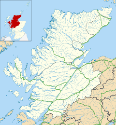
 Maryburgh