- Newton County, Arkansas
-
Newton County, Arkansas 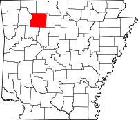
Location in the state of Arkansas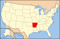
Arkansas's location in the U.S.Founded December 14, 1842 Seat Jasper Area
- Total
- Land
- Water
823.18 sq mi (2,132 km²)
822.97 sq mi (2,131 km²)
0.21 sq mi (1 km²), 0.03%Population
- (2010)
- Density
8,330
10/sq mi (3.91/km²)Newton County is a county located in the U.S. state of Arkansas. As of 2010, the population is 8,330. The county seat is Jasper.[1] Newton County is Arkansas's 46th county, formed on December 14, 1842, and named for Thomas W. Newton, an Arkansas Congressman. It is an alcohol prohibition or dry county.
Newton County part of the Harrison Micropolitan Statistical Area.
Contents
History
"Newton County was formed in 1842 and named for Thomas W. Newton, an Arkansas Congressman. The Choctaw Indians once lived in the hill country. The landscapes of Newton County are the rugged and mountainous Ozark Mountains. The Ozark National Forest provides wilderness hiking, backpacking, camping, and hunting. The Buffalo National River, the nation's first federally protected river, is one of the last free-flowing streams in mid-America and offers clear blue water for fishing and canoeing along the towering limestone bluffs. The county seat is Jasper where the county courthouse is located. As of the 2000 census, Newton County had a population of 8,608 residents." [2]
Newton County residents were very divided during the Civil War, serving in both the Confederate and Union armies. John Cecil, who had earlier served as Newton County's sheriff, served as a Confederate Captain. Jasper blacksmith James R. Vanderpool (ca. 1832-1880) served as Captain of Union Company C, 1st Regiment Arkansas Infantry Volunteers, while farmer and teacher John McCoy (1820–1903) served as Captain of Union Company F, 1st Regiment Arkansas Infantry Volunteers. Many Newton County citizens served under each of these men, as well as in other units. As an example of how the war divided families, Confederate Captain Cecil's brother, Sam, served as a sergeant in Union Company D, 2nd Regiment Arkansas Cavalry Volunteers. Violence took a severe toll on the civilian population, and at one point, Captains McCoy and Vanderpool escorted 20 wagons of Unionist families from Newton County to Missouri to seek refuge.[3]
Geography
According to the 2000 census, the county has a total area of 823.18 square miles (2,132.0 km2), of which 822.97 square miles (2,131.5 km2) (or 99.97%) is land and 0.21 square miles (0.54 km2) (or 0.03%) is water.[4]
Newton County lies almost entirely within the rugged Boston Mountain range of the Ozark Mountains where elevations exceed 2,500 feet (760 m). The Buffalo National River, a popular destination for canoeing and recreation, runs through the county from west to east. Highway 7, which traverses the county from north to south, has been rated as one of the most scenic drives in the region.
Major highways
 U.S. Highway 65
 Arkansas Highway 7
 Arkansas Highway 16
 Arkansas Highway 21
 Arkansas Highway 43
 Arkansas Highway 74
 Arkansas Highway 123
Adjacent counties
- Boone County (north)
- Searcy County (east)
- Pope County (southeast)
- Johnson County (south)
- Madison County (west)
- Carroll County (northwest)
National protected areas
- Buffalo National River (part)
- Ozark National Forest (part)
Demographics
Historical populations Census Pop. %± 1850 1,758 — 1860 3,393 93.0% 1870 4,374 28.9% 1880 6,120 39.9% 1890 9,950 62.6% 1900 12,538 26.0% 1910 10,612 −15.4% 1920 11,199 5.5% 1930 10,564 −5.7% 1940 10,881 3.0% 1950 8,685 −20.2% 1960 5,963 −31.3% 1970 5,844 −2.0% 1980 7,756 32.7% 1990 7,666 −1.2% 2000 8,608 12.3% 2010 8,330 −3.2% [5][6][7]  Age pyramid Newton County[8]
As of the census[9] of 2000, there were 8,608 people, 3,500 households, and 2,495 families residing in the county. The population density was 4/km² (10/sq mi), one of the most sparse among county populations in Arkansas. There were 4,316 housing units at an average density of 5 per square mile (2/km²). The racial makeup of the county was 99.29% White, 0.00% Black or African American, 0.56% Native American, 0.06% Asian, 0.00% Pacific Islander, 0.09% from other races, and 0.00% from two or more races. 0.00% of the population were Hispanic or Latino of any race.
There were 3,500 households out of which 32.20% had children under the age of 18 living with them, 60.00% were married couples living together, 7.70% had a female householder with no husband present, and 28.70% were non-families. 26.00% of all households were made up of individuals and 10.90% had someone living alone who was 65 years of age or older. The average household size was 2.44 and the average family size was 2.94.
In the county the population was spread out with 24.90% under the age of 18, 7.60% from 18 to 24, 25.00% from 25 to 44, 27.60% from 45 to 64, and 14.80% who were 65 years of age or older. The median age was 40 years. For every 100 females there were 102.30 males. For every 100 females age 18 and over, there were 98.60 males.
The median income for a household in the county was $24,756, and the median income for a family was $30,134. Males had a median income of $22,406 versus $17,654 for females. The per capita income for the county was $13,788. About 15.70% of families and 20.40% of the population were below the poverty line, including 27.80% of those under age 18 and 16.90% of those age 65 or over.
Native residents of Newton County were interviewed in 1970 for research being done by a doctoral student at the University of Arkansas in Fayetteville. A Ph.D. degree was awarded to Bethany K. Dumas in May 1971 after she completed "A Study of the Dialect of Newton County, Arkansas." Results are discussed in two of her published articles/chapters: “The Morphology of Newton County, Arkansas: An Exercise in Studying Ozark Dialect,” Mid–South Folklore 3 (1975), 115–125, and “Southern Mountain English” Chapter 5 of The Workings of Language, ed. R. S. Wheeler, Westport, CT, and London: Praeger, 1999, 67-79.
Cities and towns
Incorporated
Unincorporated
- Bass
- Compton
- Deer
- Hasty
- Marble Falls
- Mount Judea
- Parthenon
- Ponca
- Vendor
- Wayton
Townships
 Townships in Newton County, Arkansas as of 2010
Townships in Arkansas are the divisions of a county. Each township includes unincorporated areas and some may have incorporated towns or cities within part of their space. Townships have limited purposes in modern times. However, the US Census does list Arkansas population based on townships (often referred to as "minor civil divisions"). Townships are also of value for historical purposes in terms of genealogical research. Each town or city is within one or more townships in an Arkansas county based on census maps. The townships of Newton County are listed below with the town(s) and/or city that are fully or partially inside them listed in parentheses. [10]
- Big Creek
- Boston
- Grove (Western Grove)
- Hasty
- Hickory Grove
- Hudson
- Jackson (Jasper)
- Jefferson
- Jones
- Kentucky
- Lincoln
- Low Gap
- Marble Falls
- Murray
- Osage
- Ponca
- Pleasant Hill
- Plumlee
- Polk
- Prairie
- Richland
- Van Buren
- White
See also
References
- ^ "Find a County". National Association of Counties. http://www.naco.org/Counties/Pages/FindACounty.aspx. Retrieved 2011-06-07.
- ^ http://local.arkansas.gov/local.php?agency=Newton%20County
- ^ Lackey, Walter F. History of Newton County, Arkansas, Point Lookout, MO: S of O Press, 1950.
- ^ "Census 2000 U.S. Gazetteer Files: Counties". United States Census. http://www.census.gov/tiger/tms/gazetteer/county2k.txt. Retrieved 2011-02-13.
- ^ http://www.census.gov/population/www/censusdata/cencounts/files/ar190090.txt
- ^ http://factfinder2.census.gov
- ^ http://mapserver.lib.virginia.edu/
- ^ Based on 2000 census data
- ^ "American FactFinder". United States Census Bureau. http://factfinder.census.gov. Retrieved 2008-01-31.
- ^ US Census Bureau. 2011 Boundary and Annexation Survey (BAS): Newton County, AR (Map). http://www2.census.gov/geo/pvs/bas/bas11/st05_ar/cou/c05101_newton/BAS11C20510100000_000.pdf. Retrieved 20110628.
4. Lackey, Walter F. History of Newton County, Arkansas, Point Lookout, MO: S of O Press, 1950.
External links
- Map of Newtown County from the US Census Bureau
- Map of Newton County from the Encyclopedia of Arkansas
- Newton County entry in the Encyclopedia of Arkansas
- Jasper/Newton County Chamber of Commerce
- Newton County Historical Society
- Newton County Scrap book

Carroll County Boone County Madison County 
Searcy County  Newton County, Arkansas

Johnson County Pope County Municipalities and communities of Newton County, Arkansas City 
Town Unincorporated
communitiesBass | Compton | Deer | Hasty | Marble Falls | Mount Judea | Parthenon | Ponca | Vendor | Wayton
 State of Arkansas
Topics - Index
- Arkansans
- Constitution
- Delegations
- Geography
- Government
- Governor (List)
- History
- Images
- Places
- Transportation
- Visitor Attractions
Society - Culture
- Crime
- Demographics
- Economy
- Education
- Politics
Regions Metros Largest cities Other cities Counties - Arkansas
- Ashley
- Baxter
- Benton
- Boone
- Bradley
- Calhoun
- Carroll
- Chicot
- Clark
- Clay
- Cleburne
- Cleveland
- Columbia
- Conway
- Craighead
- Crawford
- Crittenden
- Cross
- Dallas
- Desha
- Drew
- Faulkner
- Franklin
- Fulton
- Garland
- Grant
- Greene
- Hempstead
- Hot Spring
- Howard
- Independence
- Izard
- Jackson
- Jefferson
- Johnson
- Lafayette
- Lawrence
- Lee
- Lincoln
- Little River
- Logan
- Lonoke
- Madison
- Marion
- Miller
- Mississippi
- Monroe
- Montgomery
- Nevada
- Newton
- Ouachita
- Perry
- Phillips
- Pike
- Poinsett
- Polk
- Pope
- Prairie
- Pulaski
- Randolph
- Saline
- Scott
- Searcy
- Sebastian
- Sevier
- Sharp
- St. Francis
- Stone
- Union
- Van Buren
- Washington
- White
- Woodruff
- Yell
Coordinates: 35°56′08″N 93°13′19″W / 35.93556°N 93.22194°W
Categories:- Arkansas counties
- 1842 establishments in the United States
- Populated places established in 1842
- Newton County, Arkansas
- Harrison micropolitan area


Wikimedia Foundation. 2010.