- Miller County, Arkansas
-
Miller County, Arkansas 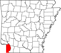
Location in the state of Arkansas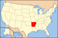
Arkansas's location in the U.S.Founded April 1, 1820;
recreated December 1874,
following abolishment in 1838Seat Texarkana Area
- Total
- Land
- Water
637.48 sq mi (1,651 km²)
623.98 sq mi (1,616 km²)
13.50 sq mi (35 km²), 2.12%Population
- (2010)
- Density
43,462
70/sq mi (26.89/km²)Miller County is a county located in the southwestern corner of the U.S. state of Arkansas. It is part of the Texarkana, Texas - Texarkana, Arkansas, Metropolitan Statistical Area. As of 2010, the population was 43,462. The county seat is Texarkana. When first formed, Miller County was Arkansas's sixth county, established on April 1, 1820, and named for James Miller, the first governor of the Arkansas Territory. Additionally, Miller County was the first of the state's counties to be formed upon the creation of the Arkansas Territory. The first five — Arkansas, Lawrence, Clark, Hempstead and Pulaski — were formed during Arkansas's days as part of the Missouri Territory.
The county was abolished in 1838, and later recreated in December 1874 from a portion of neighboring Lafayette County. [1]
Despite its proximity to Texas (which has no state personal income tax), Miller County residents are not exempt from Arkansas's state personal income tax unless they reside within the city limits of Texarkana. Miller County is also one of only two counties in Arkansas (along with Little River County) to be separated from all surrounding counties in the state by water — the Red River, in this case.
Contents
History
See also: Miller County, Arkansas TerritoryMiller County was originally created in 1820 and included most of the current Miller County as well as most of what are now counties in Texas: Bowie, Red River, Lamar, Fannin, Cass, Morris, Titus, Franklin, Hopkins, Delta, and Hunt. In 1831 the county seat was located what is the current day Clarksville, Texas. When Arkansas achieved statehood the same year Texas declared itself an independent republic in 1836 a dispute over the common border arose, with the area in Miller County having representation in both the Arkansas legislature and the Texas congress. In 1837 and 1838, Texas organized Red River and Fannin counties, respectively, in the area. Arkansas attempted to counter by making it a misdemeanor for Miller County residents to hold office in Texas, and then by establishing a county court in Fannin. The attempts were ultimately unsuccessful, and in 1845 Texas was annexed by the United States, settling the boundary between Texas and Arkansas. As much of Miller County was lost to Texas, the county was dissolved with the remaining territory returning to Lafayette County.[1]
The modern Miller County was re-created in 1874 from the parts of Lafayette County lying west and south of the Red River.
Geography
According to the 2000 census, the county has a total area of 637.48 square miles (1,651.1 km2), of which 623.98 square miles (1,616.1 km2) (or 97.88%) is land and 13.50 square miles (35.0 km2) (or 2.12%) is water.[2]
Major highways
 Interstate 30
 U.S. Highway 59
 US Highway 67
 U.S. Highway 71
 U.S. Highway 82
 Arkansas State Highway 108
 Arkansas State Highway 134
 Arkansas State Highway 160
 Arkansas State Highway 196
 Arkansas State Highway 237
 Arkansas State Highway 245
 Arkansas State Highway 296
 Arkansas State Highway 549
Adjacent counties
- Little River County (north)
- Hempstead County (northeast)
- Lafayette County (east)
- Bossier Parish, Louisiana (southeast)
- Caddo Parish, Louisiana (south)
- Cass County, Texas (southwest)
- Bowie County, Texas (west)
Demographics
Historical populations Census Pop. %± 1830 356 — 1880 9,919 — 1890 14,714 48.3% 1900 17,558 19.3% 1910 19,555 11.4% 1920 24,021 22.8% 1930 30,586 27.3% 1940 31,874 4.2% 1950 32,614 2.3% 1960 31,686 −2.8% 1970 33,385 5.4% 1980 37,766 13.1% 1990 38,467 1.9% 2000 40,443 5.1% 2010 43,462 7.5% [3][4][5]  Age pyramid Miller County[6]
As of the census[7] of 2000, there were 40,443 people, 15,637 households, and 11,086 families residing in the county. The population density was 65 people per square mile (25/km²). There were 17,727 housing units at an average density of 28 per square mile (11/km²). The racial makeup of the county was 74.02% White, 22.99% Black or African American, 0.63% Native American, 0.37% Asian, 0.02% Pacific Islander, 0.54% from other races, and 1.43% from two or more races. 1.58% of the population were Hispanic or Latino of any race.
There were 15,637 households out of which 34.00% had children under the age of 18 living with them, 50.90% were married couples living together, 16.00% had a female householder with no husband present, and 29.10% were non-families. 25.60% of all households were made up of individuals and 10.70% had someone living alone who was 65 years of age or older. The average household size was 2.52 and the average family size was 3.02.
In the county the population was spread out with 26.50% under the age of 18, 9.70% from 18 to 24, 28.60% from 25 to 44, 22.10% from 45 to 64, and 13.10% who were 65 years of age or older. The median age was 35 years. For every 100 females there were 95.00 males. For every 100 females age 18 and over, there were 90.10 males.
The median income for a household in the county was $30,951, and the median income for a family was $36,665. Males had a median income of $33,080 versus $21,376 for females. The per capita income for the county was $16,444. About 15.40% of families and 19.30% of the population were below the poverty line, including 27.90% of those under age 18 and 16.50% of those age 65 or over.
Cities and towns
Unincorporated communities
- Doddridge
- Genoa
Townships
Townships in Arkansas are the divisions of a county. Each township includes unincorporated areas and some may have incorporated towns or cities within part of their space. Townships have limited purposes in modern times. However, the US Census does list Arkansas population based on townships (often referred to as "minor civil divisions"). Townships are also of value for historical purposes in terms of genealogical research. Each town or city is within one or more townships in an Arkansas county based on census maps. The townships of Miller County are listed below with the town(s) and/or city that are fully or partially inside them listed in parentheses. [8][9]
See also
References
- ^ "Miller County, Arkansas". Handbook of Texas Online. http://www.tshaonline.org/handbook/online/articles/MM/hcm91.html/.
- ^ "Census 2000 U.S. Gazetteer Files: Counties". United States Census. http://www.census.gov/tiger/tms/gazetteer/county2k.txt. Retrieved 2011-02-13.
- ^ http://www.census.gov/population/www/censusdata/cencounts/files/ar190090.txt
- ^ http://factfinder2.census.gov
- ^ http://mapserver.lib.virginia.edu/
- ^ Based on 2000 census data
- ^ "American FactFinder". United States Census Bureau. http://factfinder.census.gov. Retrieved 2008-01-31.
- ^ US Census Bureau. 2011 Boundary and Annexation Survey (BAS): Miller County, AR (Map). http://www2.census.gov/geo/pvs/bas/bas11/st05_ar/cou/c05091_miller/BAS11C20509100000_000.pdf. Retrieved 20110824.
- ^ http://www.census.gov/geo/www/maps/DC10_GUBlkMap/cousub/dc10blk_st05_cousub.html#M

Little River County Hempstead County Bowie County, Texas 
Lafayette County  Miller County, Arkansas

Cass County, Texas Caddo Parish, Louisiana Bossier Parish, Louisiana Municipalities and communities of Miller County, Arkansas City 
Towns Unincorporated
communitiesDoddridge | Genoa | Mandeville
 State of Arkansas
Topics - Index
- Arkansans
- Constitution
- Delegations
- Geography
- Government
- Governor (List)
- History
- Images
- Places
- Transportation
- Visitor Attractions
Society - Culture
- Crime
- Demographics
- Economy
- Education
- Politics
Regions Metros Largest cities Other cities Counties - Arkansas
- Ashley
- Baxter
- Benton
- Boone
- Bradley
- Calhoun
- Carroll
- Chicot
- Clark
- Clay
- Cleburne
- Cleveland
- Columbia
- Conway
- Craighead
- Crawford
- Crittenden
- Cross
- Dallas
- Desha
- Drew
- Faulkner
- Franklin
- Fulton
- Garland
- Grant
- Greene
- Hempstead
- Hot Spring
- Howard
- Independence
- Izard
- Jackson
- Jefferson
- Johnson
- Lafayette
- Lawrence
- Lee
- Lincoln
- Little River
- Logan
- Lonoke
- Madison
- Marion
- Miller
- Mississippi
- Monroe
- Montgomery
- Nevada
- Newton
- Ouachita
- Perry
- Phillips
- Pike
- Poinsett
- Polk
- Pope
- Prairie
- Pulaski
- Randolph
- Saline
- Scott
- Searcy
- Sebastian
- Sevier
- Sharp
- St. Francis
- Stone
- Union
- Van Buren
- Washington
- White
- Woodruff
- Yell
Coordinates: 33°19′40″N 93°52′38″W / 33.32778°N 93.87722°W
Categories:- Arkansas counties
- Miller County, Arkansas
- 1820 establishments in the United States
- Populated places established in 1820


Wikimedia Foundation. 2010.