- Omagh
-
This article is about the town of Omagh. For the film of same name, see Omagh (film).
Coordinates: 54°35′N 7°17′W / 54.59°N 7.29°W
Omagh Scots: Omey[1][2] Irish: an Ómaigh 
Omagh Coat of Arms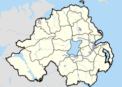
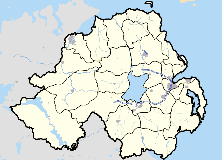
 Omagh
Omagh
Omagh shown within Northern IrelandPopulation 19,910 (2001 Census) District Omagh County County Tyrone Country Northern Ireland Sovereign state United Kingdom Post town OMAGH Postcode district BT78, BT79 Dialling code 028 Police Northern Ireland Fire Northern Ireland Ambulance Northern Ireland EU Parliament Northern Ireland UK Parliament West Tyrone NI Assembly West Tyrone Website Official website List of places: UK • Northern Ireland • Tyrone Omagh (English pronunciation: /ˈoʊmə/[3] or /ˈoʊmɑː/; Irish pronunciation: [ˈomæ][citation needed] – from Irish: an Ómaigh, meaning "the virgin plain")[4] is the county town of County Tyrone, Northern Ireland. It is situated where the rivers Drumragh and Camowen meet to form the Strule. The town, which is the largest in the county, had a population of 19,910 at the 2001 Census. Omagh also contains the headquarters of Omagh District Council and the Western Education and Library Board. The town is twinned with East Kilbride (Scotland) and L'Haÿ-les-Roses (France).
Contents
History
The name Omagh is an anglicisation of the Irish name an Óghmaigh (modern Irish an Ómaigh), meaning "the virgin plain". A Franciscan friary was built on the site of the town in about 792 AD. Omagh was founded as a town in 1610. It served as a refuge for fugitives from the east of Tyrone during the 1641 Rebellion. In 1689, the same year as the Battle of the Boyne, James II arrived at Omagh, en route to Derry. Supporters of William III, Prince of Orange, burned the town.
In 1768 Omagh replaced Dungannon as the county town of County Tyrone. Omagh acquired railway links to Derry in 1852, Enniskillen in 1853 and Belfast in 1861. The military barracks were built in 1881. In 1899 Tyrone County Hospital was opened. Today the hospital is the subject of a major campaign to save its services. The Government of Northern Ireland made the Great Northern Railway Board close the Omagh – Enniskillen railway line in 1957.[5] In accordance with The Benson Report submitted to the Northern Ireland Government in 1963, the Ulster Transport Authority closed the Portadown – Omagh – Derry main line in 1965,[6] leaving Omagh with no rail service. St Lucia Barracks in the town closed on 1 August 2007.
Visitors to Omagh have included Queen Elizabeth II, Charles, Prince of Wales, former US president Bill Clinton and his wife Hillary Clinton, Irish president Mary McAleese, and former British Prime Minister Tony Blair.
The Troubles
Main articles: The Troubles in Omagh and Omagh bombingOmagh came into the international focus of the media on 15 August 1998, when the Real Irish Republican Army exploded a car bomb in the town centre. 29 people were killed in the blast – 14 women (including one pregnant with twins), 9 children and 6 men. Hundreds more were injured as a result of the blast.
In April 2011, a car bomb killed police constable Ronan Kerr. A group of former Provisional IRA members calling itself the Irish Republican Army made its first public statement later that month claiming responsibility for the killing.[7]
Geography
 Omagh as seen from the Strule bridge. In the background is the Sacred Heart Catholic church.
Wards
These wards are only those that cover the town.
- Camowen (2001 Population – 2,377)
- Coolnagard (2001 Population – 2,547)
- Dergmoney (2001 Population – 1,930)
- Drumragh (2001 Population – 2,481)
- Gortrush (2001 Population – 2,786)
- Killyclogher (2001 Population – 2,945)
- Lisanelly (2001 Population – 2,973)
- Strule (2001 Population – 1,780)
Townlands
The town sprang up within the townland of Omagh, in the parish of Drumragh. Over time, the urban area has spread into the surrounding townlands. They include:[8]
- Campsie (from Irish: Camsán meaning "riverbend"[9])
- Conywarren
- Coolnagard Lower, Coolnagard Upper (from Irish: Cúil na gCeard meaning "nook/corner of the craftsmen" or from Irish: Cúl na gCeard meaning "hill-back of the craftsmen")[10]
- Creevenagh
- Culmore (from Irish: Cúil Mhór meaning "big nook/corner")[11]
- Dergmoney Lower, Dergmoney Upper (from Irish: Deargmhuine meaning "red thicket")[12]
- Gortin (from Irish: Goirtín meaning "small enclosed field")[13]
- Gortmore (from Irish: Gort Mór meaning "big enclosed field")[14]
- Killybrack (from Irish: Coillidh Bhreac meaning "speckled wood")[15]
- Killyclogher (from Irish: Coillidh Chlochair meaning "wood of the stony place")[16]
- Lammy (from Irish: Leamhaigh meaning "place of elms")[17]
- Lisanelly (from Irish: Lios an Ailigh meaning "ringfort of the stony place")[18]
- Lisnamallard (from Irish: Lios na Mallacht meaning "ringfort of the curse")[19]
- Lissan (from Irish: Liosán meaning "small ringfort")[20]
- Mullaghmore (from Irish: Mullach Mór meaning "big hilltop")[21]
- Sedennan (possibly from Irish: Sidh Dianáin meaning "Dennan's fairy mound")[22]
- Straughroy (from Irish: Srath Rua meaning "the red strath" or from Irish: Srath Crua meaning "hard strath")[23]
Weather
 Snow is common in Omagh during the winter months. Shown here is the River Strule.
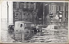 One of the major floods of 1969, shown here on Drumragh Avenue.
An air temperature of −19.4 °C (−3 °F) was recorded once, and it remains the coldest air temperature ever recorded in Ireland.[24] Omagh has a history of flooding and suffered major floods in 1909, 1929, 1954, 1969, 1987, 1999 and, most recently, 12 June 2007. As a result of this, flood-walls were built to keep the water in the channel (River Strule) and to prevent it from overflowing into the flood plain. Large areas of land, mainly around the meanders, are unsuitable for development and were developed into large, green open areas, walking routes and parks.
Demography
Omagh is classified as a large town settlement by the NI Statistics and Research Agency (NISRA). On Census day (29 April 2001) there were 19,910 people living in Omagh. Of these:
- 24.8% were aged under 16 years and 14.9% were aged 60 and over, with an average age of 34.0 years.
- 48.9% of the population were male and 51.1% were female.
- 68.2% were from a Catholic background and 29.5% were from a Protestant background.
- 3.9% of people aged 16–74 were unemployed.
- 13.8% of people where born outside Northern Ireland.
For more details see: NI Neighbourhood Information Service
Population change
According to the World Gazetter, the following reflects the census data for Omagh since 1981:[25]
- 1981 – 14,627 (Official census)
- 1991 – 17,280 (Official census)
- 2000 – 18,031 (Official estimate)
- 2001 – 19,910 (Official census)
- 2010 – 22,834 (Calculation)
Places of interest
Tourist attractions
- The Ulster American Folk Park near Omagh includes the cottage where Thomas Mellon was born in 1813, before emigrating to Pennsylvania, in the United States when he was five. His son Andrew W. Mellon became secretary to the US Treasury. The park is an open-air museum that explores the journey made by the Irish (specifically those from Ulster) to America during the 1800s. The park is famous for its large events during Easter, Christmas, Fourth of July and Halloween. It also hosts a major Bluegrass festival every year. Over 127,000 people visited the park in 2003.[26]
- The Gortin Glens Forest Park, 16 kilometres (9.9 mi) north of Omagh is a large forest with many attractions, including a deer enclosure and many areas of natural beauty, including waterfalls, lakes, etc.
- Strule Arts Centre opened in 2007 is good example of urban renewal in Omagh town centre. Creating a modern civic building, in a newly created public space reclaimed from the formerly disused area, between the River Strule and High Street.
Parks
- Omagh boasts over 20 playgrounds for children,[27] and a large amount of green open area for all the public. The largest of these is the Grange Park, located near the town centre. Many areas around the meanders of the River Strule have also been developed into open areas. Omagh Leisure Complex is a large public amenity, near the Grange Park and is set in 11 hectares (26 acres) of landscaped grounds and features a leisure centre, boating pond, astroturf pitch and cycle paths.
Retail
Omagh is the main retail centre for Tyrone, as well as the West of Ulster (behind Derry and Letterkenny), due to its central location. In the period 2000–2003, over £80 million was invested in Omagh, and 60,960 m2 (200,000 sq ft) of new retail space was created. Shopping areas in Omagh include the Main Street Mall, Great Northern Road Retail Park and the Showgrounds Retail Park on Sedan Avenue in the town centre. High Street is also a prominent shopping street.
Transport
 Looking at the town's Bridge Street area from an elevated height at the College.
Former railways
Neither the town nor the district of Omagh has any railway service.
The Irish gauge 1,600 mm (5 ft 3 in) Londonderry and Enniskillen Railway (L&ER) opened as far as Omagh on 3 September 1852[28] and was extended to Enniskillen in 1854.[29] The Portadown, Dungannon and Omagh Junction Railway (PD&O) reached Omagh in 1861,[29] completing the Portadown – Derry route that came to be informally called "The Derry Road".[30] The Great Northern Railway (Ireland) absorbed the PD&O in 1876[31] and the L&ER in 1883.[31]
The Government of Northern Ireland made the GNR Board close the Omagh – Enniskillen line in 1957.[32] The Ulster Transport Authority took over the GNR's remaining lines in Northern Ireland in 1958. In accordance with The Benson Report submitted to the Northern Ireland Government in 1963, the UTA closed the "Derry Road" through Omagh on 15 February 1965.[28][33][34] Later the Omagh Throughpass road was built on the disused trackbed.
Proposed railways
There is a proposal for Omagh to become a rail hub again by 2050.[citation needed] This is a proposal to reopen the rail line to Belfast via Portadown and also a rail link between Derry and Limerick via Omagh.[citation needed] However, this is only a proposal in the planning stage, and no plan has been finalised as yet.
Road connections
- A32 (Omagh – Enniskillen – Ballinamore) (Becomes N87 at border)
- A5 (Northbound) (Omagh – Strabane [and from here north-west to Letterkenny, via Lifford, becoming the N14 at the county border] – Derry)
- A5 (Southbound) (Omagh – Monaghan – Ashbourne – Dublin) (Becomes N2 at border)
- A4 (Eastbound) (Omagh – Dungannon – Belfast) (A4 joins A5 near Ballygawley)
- A505 (Eastbound) (Omagh – Cookstown)
- The Omagh Throughpass (Stage 3) opened on 18 August 2006.
Education
Omagh has a large variety of educational institutions at all levels. Omagh is also the headquarters of the Western Education and Library Board (WELB), which is located in Campsie House on the Hospital Road.
Primary schools (elementary schools)
- St. Colmcille's Primary School
- Christ The King Primary School
- Gibson Primary School
- Loreto Primary School
- Omagh County Primary School (and Nursery School)
- Omagh Integrated Primary School
- St Mary's Primary School
- St Conor's Primary School
- Gaelscoil na gCrann Irish language Primary school (and Naíscoil – Irish language nursery school)
- Recarson Primary School – Arvalee
Grammar/secondary school
- Christian Brothers Grammar School
 Omagh College
 - Drumragh Integrated College
- Loreto Grammar School, Omagh
- Omagh Academy
- Omagh High School
- Sacred Heart College
Colleges/universities
Religious buildings
 Omagh Community House
The following is a list of religious buildings in Omagh:
- Christ the King (Roman Catholic)
- Evangelical Presbyterian Church
- First Omagh Presbyterian
- Independent Methodist
- Kingdom Hall of Jehovah's Witnesses
- Omagh Baptist
- Omagh Community Church (non-denominational)
- Omagh Free Presbyterian Church
- Omagh Gospel Hall (A company of Christians sometimes referred to as "open brethren")
- Omagh Methodist
- Sacred Heart (Roman Catholic)
- St. Columba's (Church of Ireland)
- St. Mary's (Roman Catholic)
- The Church of Jesus Christ of Latter Day Saints (Mormon)
- Trinity Presbyterian Church
Media
Local newspapers and magazines
- Omagh Today
- Tyrone Advertiser
- Tyrone Constitution
- Tyrone Herald
- Ulster Herald
Local radio
- Q101.2 FM West – Broadcast from Omagh
- BBC Radio Ulster has a studio in the town.
Community Radio project Strule FM broadcast for 4 weeks in December 2008. The station featured a mixture of local interest programming and music programming produced by local radio presenters, historians and South West College Media/Music students. The station received the Bronze award for Community Radio at the 2009 Sony Radio Academy Awards.
Internet
Omagh was one of the first areas in Northern Ireland, outside the Belfast commuter belt, to transfer to broadband internet.[citation needed] Prior to this, the only means for internet connection was through dial-up connections.
Sport
Gaelic games
Gaelic games, primarily Gaelic football, are the most popular sports in Omagh.[citation needed] The town has two Gaelic football clubs, Omagh St. Enda's, which plays its home games in Healy Park, and Drumragh Sarsfields, which plays its home games at Clanabogan.
Healy Park, the main GAA stadium in the town, located on the Gortin Road, has a capacity nearing 25,000,[35][36] and had the distinction of being the first Gaelic-games stadium in Ulster to have floodlights.This was completed by Barrett Sports lighting.[37]
The stadium now hosts the latter matches of the Tyrone Senior Football Championship, as well as Tyrone's home games, and other inter-county matches that require a neutral venue.[38]
Association football (soccer)
Omagh no longer has a top-flight local football team, since the demise of Omagh Town F.C. in 2005.
Rugby
Omagh's rugby team, Omagh Academicals (nicknamed the "Accies"), is an amateur team, made up of primarily of local players.
People
Notable residents or people born in Omagh include:
- Willie Anderson – Ireland Rugby Union International
- Charles Beattie – Auctioneer and briefly Member of Parliament
- Jimmy Kennedy (1902–1984) – Songwriter's Hall of Fame-inductee (Red Sails in the Sunset, Teddy Bears Picnic)[39]
- Benedict Kiely (1919–2007) – author (Land Without Stars)[40][41]
- Linda Martin – musician (Eurovision Song Contest-winner 1992)
- Patrick McAlinney (1913–1990) – Actor[42] (The Tomorrow People)
- Frankie McBride – country musician
- Robert McDonald – Canadian soccer international and Rangers player.
- Joe McMahon – All-Ireland-winning Tyrone Gaelic footballer.
- Justin McMahon – All-Ireland-winning Tyrone Gaelic footballer.
- Gerard McSorley – actor[43] (Veronica Guerin), (Omagh)
- Sam Neill – Jurassic Park actor (born in Omagh[44])
- Pat Sharkey – Ipswich Town F.C. and Northern Irish soccer player in the 1970s.
- Ivan Sproule – current Northern Irish soccer international and Bristol City F.C. player.
- Juliet Turner – singer/songwriter
- Arty McGlynn – International renowned guitarist.
- Gerald Grosvenor – 6th Duke of Westminster.
- Aaron McCormack – company CEO and one of the Young Global Leaders of the World Economic Forum
- Daryl Simpson – Musician and Tenor. Performs with the Celtic Tenors and founder of the Omagh Community Youth Choir.
- Brian Friel – playwright was born in Killyclogher near Omagh.
- Philip Turbett – bassoonist, clarinettist and saxophonist
- Janet Devlin - Xfactor Finalist 2011
References
- ^ 2006 annual report in Ulster-Scots – North/South Ministerial Council
- ^ Guide to Beaghmore stone circles – Ulster-Scots Department of the Environment.
- ^ G. M. Miller, BBC Pronouncing Dictionary of British Names (Oxford University Press, 1971), pg. 110
- ^ Placenames Database of Ireland
- ^ Baker, Michael H.C. (1972). Irish Railways since 1916. London: Ian Allan. pp. 153, 207. ISBN 7110 0282 7.
- ^ Baker, 1972, pages 155, 209
- ^ Suzanne Breen (22 April 2011). "Former Provos claim Kerr murder and vow more attacks". Belfast Telegraph. http://www.belfasttelegraph.co.uk/news/local-national/northern-ireland/former-provos-claim-kerr-murder-and-vow-more-attacks-15146426.html. Retrieved 26 April 2011.
- ^ "Northern Ireland Placenames Project". http://www.placenamesni.org/resultsdetail.phtml?entry=. Retrieved 28 June 2010.
- ^ "Northern Ireland Placenames Project – Campsie". http://www.placenamesni.org/resultsdetail.phtml?entry=20465. Retrieved 28 June 2010.
- ^ "Northern Ireland Placenames Project – Coolnagard". http://www.placenamesni.org/resultsdetail.phtml?entry=4854. Retrieved 28 June 2010.
- ^ "Northern Ireland Placenames Project – Culmore". http://www.placenamesni.org/resultsdetail.phtml?entry=20700. Retrieved 28 June 2010.
- ^ "Northern Ireland Placenames Project – Dergmoney". http://www.placenamesni.org/resultsdetail.phtml?entry=20701. Retrieved 28 June 2010.
- ^ "Northern Ireland Placenames Project – Gortin". http://www.placenamesni.org/resultsdetail.phtml?entry=4162. Retrieved 28 June 2010.
- ^ "Northern Ireland Placenames Project – Gortmore". http://www.placenamesni.org/resultsdetail.phtml?entry=20705. Retrieved 28 June 2010.
- ^ "Northern Ireland Placenames Project – Killybrack". http://www.placenamesni.org/resultsdetail.phtml?entry=4632. Retrieved 28 June 2010.
- ^ "Northern Ireland Placenames Project – Killyclogher". http://www.placenamesni.org/resultsdetail.phtml?entry=5028. Retrieved 28 June 2010.
- ^ "Northern Ireland Placenames Project – Lammy". http://www.placenamesni.org/resultsdetail.phtml?entry=3557. Retrieved 28 June 2010.
- ^ "Northern Ireland Placenames Project – Lisanelly". http://www.placenamesni.org/resultsdetail.phtml?entry=20914. Retrieved 28 June 2010.
- ^ "Northern Ireland Placenames Project – Lisnamallard". http://www.placenamesni.org/resultsdetail.phtml?entry=20463. Retrieved 28 June 2010.
- ^ "Northern Ireland Placenames Project – Lissan". http://www.placenamesni.org/resultsdetail.phtml?entry=4932. Retrieved 28 June 2010.
- ^ "Northern Ireland Placenames Project – Mullaghmore". http://www.placenamesni.org/resultsdetail.phtml?entry=8450. Retrieved 28 June 2010.
- ^ "Northern Ireland Placenames Project – Sadennan". http://www.placenamesni.org/resultsdetail.phtml?entry=20710. Retrieved 28 June 2010.
- ^ "Northern Ireland Placenames Project – Straughroy". http://www.placenamesni.org/resultsdetail.phtml?entry=3659. Retrieved 28 June 2010.
- ^ Premier Irish Forestry Fund
- ^ World Gazeteer
- ^ Ulster American Folk Park
- ^ Omagh District Council
- ^ a b "Omagh station". Railscot – Irish Railways. http://www.railscot.co.uk/Ireland/Irish_railways.pdf. Retrieved 22 November 2007.
- ^ a b Hajducki, S. Maxwell (1974). A Railway Atlas of Ireland. Newton Abbott: David & Charles. map 7. ISBN 0 7153 5167 2.
- ^ FitzGerald, J.D. (1995). The Derry Road. Colourpoint Transport. Gortrush: Colourpoint Press. ISBN 1 898392 09 9.
- ^ a b Hajducki, op. cit., page xiii
- ^ Baker, Michael H.C. (1972). Irish Railways since 1916. London: Ian Allan. pp. 153, 207. ISBN 7110 0282 7.
- ^ Hajducki, op. cit., map 39
- ^ Baker, op. cit., pages 155, 209
- ^ "World Stadiums". http://www.worldstadiums.com/europe/countries/united_kingdom/northern_ireland.shtml. Retrieved 7 March 2011.
- ^ "Healy Park, Omagh". Ulster Colleges GAA. http://www.ulstercollegesgaa.org/venues/healy-park. Retrieved 7 March 2011.
- ^ "Healy Park set to unveil lights". BBC News. 6 April 2006. http://news.bbc.co.uk/sport2/hi/northern_ireland/gaelic_games/4875746.stm. Retrieved 7 March 2011.
- ^ GAA
- ^ Songwritershalloffam.org
- ^ RTI.ie
- ^ Irishwriters-online.com
- ^ Patrick McAlinney at the Internet Movie Database
- ^ Gerard McSorley at the Internet Movie Database
- ^ Sam Neill at the Internet Movie Database
External links
- Omagh District Council Website
- Omagh Chamber of Commerce & Industry Website
- Omagh Directory 1910
- Flickr group of Omagh photos
Towns in Northern Ireland List of towns by populationLarge Antrim · Ballymena · Bangor · Carrickfergus · Coleraine · Larne ·
Lisburn · Lurgan · Newry · Newtownabbey · Newtownards · Omagh · Portadown
Medium Small Ballycastle · Ballyclare · Ballymoney · Ballynahinch · Carryduff · Coalisland · Comber · Donaghadee ·
Drumore · Kilkeel · Magherafelt · Newcastle · Portrush · Portstewart · Randalstown · WarrenpointCategories:- Omagh
- County towns in Northern Ireland


Wikimedia Foundation. 2010.