- National Highway 48 (India)
-
National Highway 48
48
Road map of India with National Highway 48 highlighted in solid blue colorRoute information Length: 328 km (204 mi) Major junctions East end: Bangalore, Karnataka West end: Mangalore, Karnataka Location States: Karnataka Primary
destinations:Bangalore - Hassan - Mangalore Highway system Indian Road Network
National • Expressways • State
State Highways in ¬← NH 47A NH 49 → National Highway 48 or NH-48, now renamed as NH-75[1] is a National Highway of India running entirely within the state of Karnataka. It links the coastal city of Mangalore with the state capital Bangalore, two major cities of Karnataka state. NH 48 passes through towns of Nelamangala, Kunigal, Hassan, Sakleshpura, Uppinaangadi and B.C.Road. It climbs the Western ghats through the Shiradi range. Total length of this highway is 328 km (204 mi). [2]
 NH 48
NH 48
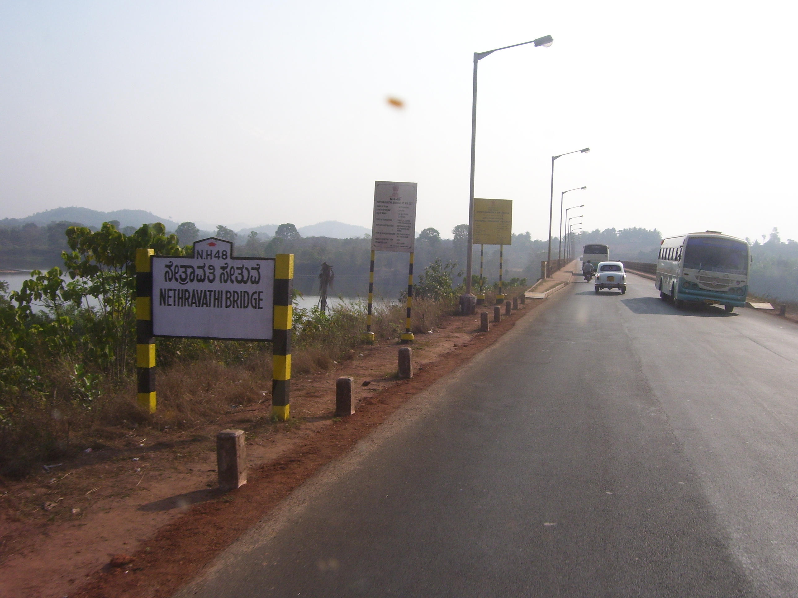
 Bridge across Netravati river on NH-48 near Panemangalore
The traffic on this highway has increased after 1990 mainly due to the setting up of MRPL at Katipalla, Mangalore. This highway for movement of goods to and from New Mangalore Port. The government undertaking KSRTC runs several buses day and night in between these two cities along with private operators.The trucks and trailers carrying LPG and other petroleum products from MRPL to Bangalore have been frequent cause of accidents in this road. Also the condition of this national highway gets worse during monsoon ( rainy ) season especially in ghat section. Travellers avoid this route and take either Bangalore-Mysore-Kushalnagara-Mangalore or Charmadi route during rains from month of June to October, Even if it takes longer time.
The road traverses through ghats till Sakleshpura from Mangalooru and then it is Bayaluseemae region up to Bengaluru, where road is much straight.One can see coconut and arecanut plantation, coffee estates, dense forests of western ghats and paddy fields. This national highway 48 offers breathtaking view of western ghats ( Sahayadri ) of India during the monsoon season. The NH-48 starts at Mahaveer circle at Kankanady which is junction of NH 17 and road coming from Mangalore city and joins the NH 4 near Nelamangala, which is approximately 25 km (16 mi) north from heart of Bangalore city.
Indian railway has resumed train services between Mangaluru and Bengaluru after conversion of railway track gauges from metre gauge to broad gauge under Project Unigauge. This railway follows Bantwal- Kaniyoor- Subramanya road- Yedakumeri- Sakleshapura route. Many people prefer train journey in this route, as its less stressful even though it takes longer time.
See also
- List of National Highways in India (by Highway Number)
- National Highways Development Project
References
- ^ http://www.bellevision.com/index.php?action=topnews&type=1853
- ^ [1] Details of National Highways in India-Source-Government of India
External links
- [2] NH-48 on MapsofIndia.com
Indian Highways Network National Expressways NE 1 • NE 2


State Expressways Mumbai-Pune • Delhi-Gurgaon • DND Flyway • Bengaluru-Mysore • Chennai HSCTC • Hyderabad Elevated ExpresswaysNational Highways 1 • 1A • 1B • 1C • 1D • 2 • 2A • 3 • 4 • 4A • 4B • 5 • 5A • 6 • 7 • 7A • 8 • 8A • 8B • 8C • 8D • 8E • 9 • 10 • 11 • 11A • 11B • 12 • 12A • 13 • 14 • 15 • 16 • 17 • 17A • 17B • 18 • 19 • 20 • 21 • 21A • 22 • 23 • 24 • 24A • 24B • 25 • 25A • 26 • 26A • 27 • 28 • 28A • 28B • 28C • 29 • 30 • 30A • 31 • 31A • 31B • 31C • 31D • 32 • 33 • 34 • 35 • 36 • 37 • 37A • 38 • 39 • 40 • 41 • 42 • 43 • 44 • 44A • 45 • 45A • 45B • 45C • 46 • 47 • 47A • 47B • 47C • 48 • 49 • 50 • 51 • 52 • 52A • 52B • 53 • 54 • 54A • 55 • 56 • 57 • 57A • 58 • 59 • 59A • 60 • 60A • 61 • 62 • 63 • 64 • 65 • 66 • 67 • 68 • 69 • 70 • 71 • 71A • 71B • 72 • 72A • 73 • 73A • 74 • 75 • 76 • 77 • 78 • 79 • 79A • 80 • 81 • 82 • 83 • 84 • 85 • 86 • 86A • 87 • 88 • 89 • 90 • 91 • 91A • 92 • 93 • 94 • 95 • 96 • 97 • 98 • 99 • 100 • 101 • 102 • 103 • 104 • 105 • 106 • 107 • 108 • 109 • 110 • 111 • 112 • 113 • 114 • 116 • 117 • 119 • 121 • 123 • 125 • 126 • 127 • 128 • 129 • 150 • 151 • 152 • 153 • 154 • 155 • 200 • 201 • 202 • 203 • 203A • 204 • 205 • 206 • 207 • 208 • 209 • 210 • 211 • 212 • 213 • 214 • 214A • 215 • 216 • 217 • 218 • 219 • 220 • 221 • 222 • 223 • 224 • 226 • 227 • 228 • 229 • 234 • 235State Highways Andhra Pradesh • Arunachal Pradesh • Assam • Bihar • Chhattisgarh • Goa • Gujarat • Haryana • Himachal Pradesh • Jammu and Kashmir • Jharkhand • Karnataka • Kerala • Madhya Pradesh • Maharashtra • Manipur • Meghalaya • Mizoram • Nagaland • Orissa • Punjab • Rajasthan • Sikkim • Tamil Nadu • Tripura • Uttarakhand • Uttar Pradesh • West BengalNotable Categories:- National Highways in Karnataka
- Transport in Mangalore
- Indian National Highways
- India road stubs


Wikimedia Foundation. 2010.