- Copperbelt Province
-
 Location of Copperbelt Province in Zambia
Copperbelt Province in Zambia covers the mineral-rich Copperbelt, and farming and bush areas to the south. It was the backbone of the Northern Rhodesian economy during British colonial rule and fuelled the hopes of the immediate post-independence period, but its economic importance was severely damaged by a crash in global copper prices in 1973 and the nationalization of the copper mines by the government of Kenneth Kaunda. The province adjoins Katanga province of the Democratic Republic of the Congo, which is similarly mineral-rich.
The main cities of the Copperbelt are Kitwe, Ndola, Mufulira, Luanshya, Chingola and Chililabombwe. Roads and rail links extend north into the Congo to Lubumbashi, but the Second Congo War brought economic contact between the two countries to a standstill, now recovering.
Wildlife areas
- For more detail see Copperbelt Province in the Wildlife of Zambia
There are no national parks in this most urban and industrial of Zambia's provinces. Other parks with wildlife aspects:
- Chembe Bird Sanctuary west of Kitwe includes crocodiles and Sitatunga as well as plentiful bird life.
- Chimfunshi Wildlife Orphanage (established mainly to rescue captive non-indigenous chimpanzees).
Districts
 Districts of Copperbelt
Copperbelt Province is divided into 10 districts:
Geology
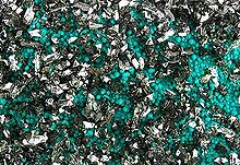
The Copperbelt region of Zambia and Congo D.R. is a 500 million year old mountain chain, the Lufilian Arc, which formed when two large pieces of continental crust, the Kalahari craton and the Congo craton, collided. This collision was one of the many that happened between 700 and 500 million years ago to form the Gondwana supercontinent.
This collision is thought to have remobilised base metals, largely already present in the sediments that had accumulated in the basin between the two cratons. These brines then concentrated the base metals either along stratigraphic boundaries, or along fractures, faults or within structurally controlled 'traps' (such as the nose of a fold). The collision also produced crustal shortening, during which the stratigraphic sequence was tectonically pushed northwards on top of the Congo Craton.
The Lufilian Arc contains two diamictites, megaconglomerates of glacial origin. One of those is correlated with the Sturtian glaciation, while another correlates with the Marinoan Glaciation, both global glaciation events that had profound influence on the history of the planet.
The Lufilian Arc is correlated along trend to the west with the Damara Orogen in Namibia, which also hosts large mineral deposits.
 Districts of Zambia
Central Chibombo District · Kabwe District · Kapiri Mposhi District · Mkushi District · Mumbwa District · Serenje DistrictCopperbelt Chililabombwe District · Chingola District · Kalulushi District · Kitwe District · Luanshya District · Lufwanyama District · Masaiti District · Mpongwe District · Mufulira District · Ndola DistrictEastern Chadiza District · Chama District · Chipata District · Katete District · Lundazi District · Mambwe District · Nyimba District · Petauke DistrictLuapula Chiengi District · Kawambwa District · Mansa District · Milenge District · Mwense District · Nchelenge District · Samfya DistrictLusaka Northern Chilubi District · Chinsali District · Isoka District · Kaputa District · Kasama District · Luwingu District · Mafinga District · Mbala District · Mpika District · Mporokoso District · Mpulungu District · Mungwi District · Nakonde DistrictNorthwestern Chavuma District · Kabompo District · Kasempa District · Mufumbwe District · Mwinilunga District · Solwezi District · Zambezi DistrictSouthern Choma District · Gwembe District · Itezhi-Tezhi District · Kalomo District · Kazungula District · Livingstone · Mazabuka District · Monze District · Namwala District · Siavonga District · Sinazongwe DistrictWestern Kalabo District · Kaoma District · Lukulu District · Mongu District · Senanga District · Sesheke District · Shangombo DistrictCategories:- Plate tectonics
- Copperbelt Province
- Provinces of Zambia
- Copper
- Geology of Zambia


Wikimedia Foundation. 2010.