- Nackenheim
-
Nackenheim 
 NackenheimLocation of Nackenheim within Mainz-Bingen district
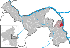
Coordinates 49°55′47″N 8°20′48″E / 49.92972°N 8.34667°ECoordinates: 49°55′47″N 8°20′48″E / 49.92972°N 8.34667°E Administration Country Germany State Rhineland-Palatinate District Mainz-Bingen Municipal assoc. Bodenheim Mayor Heinz Hassemer (CDU) Basic statistics Area 8.63 km2 (3.33 sq mi) Elevation 84 m (276 ft) Population 5,499 (31 December 2010)[1] - Density 637 /km2 (1,650 /sq mi) Other information Time zone CET/CEST (UTC+1/+2) Licence plate MZ Postal code 55299 Area code 06135 Website www.nackenheim.de Nackenheim is an Ortsgemeinde – a municipality belonging to a Verbandsgemeinde, a kind of collective municipality – and a winegrowing centre in the Mainz-Bingen district in Rhineland-Palatinate, Germany.
Contents
Geography
Location
Nackenheim lies in Rhenish Hesse near Mainz. It belongs to the Verbandsgemeinde of Bodenheim, whose seat is in the like-named municipality, and is the only Ortsgemeinde in this Verbandsgemeinde that lies right on the Rhine. It is a municipality idyllically set between hillside vineyards on the one side and the Rhine on the other, whose vineyards were first mentioned more than 1,200 years ago. The islands of Kisselwörth (35 ha) and Sändchen cut Nackenheim off from the Rhine’s mainstream. The two islands have conservation status and belong to the Rheinauen (“Rhine Floodplains”) Habitats Directive area. Formerly, the area was under cultuvation, but nowadays, meadow orchards (Streuobstwiesen) are found there. In the course of the Rhine straightening project in the 19th century, Kisselwörth and Sändchen were enlarged with landfill and current control works [2].
Neighbouring municipalities
Nackenheim’s neighbours are Bodenheim, Nierstein, Lörzweiler and Trebur.
History
Chronology 2200 BC New Stone Age village of the Rössen culture in the Fruchtgewann (cadastral area) in the Nackenheim municipal area 1200 BC Urnfield on the Oppenheimer Berg (mountain) witnesses Bronze Age settlement in the municipal area 600 BC In the Late Iron Age, a Hallstatt culture settlement exists on the Vogelsreich (cadastral area) 250 Roman villae rusticae in the Rudelheck and Thierhäupter cadastral areas 580 Frankish grave finds from these years An der Heidenpforte (cadastral area) confirm the village’s founding in the lower Eichelbach valley 630 The Frankish village is split from the Imperial estate by royal donation and ends up in the ownership of the Bishopric of Cologne 772 First document about Nacheim, made out at the Lorsch Abbey early 8th century The Archbishop of Cologne donates his holdings in Nackenheim to the newly founded Saint Gereon’s Monastery 1024 Emperor Conrad II’s election on the Königsstuhl (mountain) 1100 Sunsweiler and Albisheim are hamlets within the Nakheimer Mark, although both later vanish. 1258 Nachenn passes from Saint Gereon’s Monastery in Cologne to Saint Stephen’s Monastery in Mainz 14th to 16th century From the resident knightly nobility come important priests (Godefried von Nacknheim, Vicar of Saint Stephen’s, Herbord von Nackheim, Cantor of the Teutonic Knights in Mainz, among others) 1615 Nackenheim is placed under the Elector of Mainz 1714 In a treaty between Electoral Mainz and Electoral Palatinate the alignment of the Mainz state border was set south of Nackenheim. In Nackenheim there is a customs station (the one where Prof. Pierplatz stayed until 1938). 1792/1793 The populace jointly takes the oath of French citizenship in the “Nackenheim Revolution” 1816 Nackenheim passes to the Grand Duchy of Hesse-Darmstadt. The 12 floodplains on the Rhine’s right bank are lost The name Nackenheim
The actual derivation of the name Nackenheim is not known. One supposition holds that the name goes back to prehistoric Nackenheim and a chieftain named Nacho, yielding a name meaning “Nacho’s Home”. Another explanation that has developed in the course of history according to which the name derives from the place’s location in the “neck of the mountain” (in German: im Nacken des Berges). Thus far, neither theory has been confirmed.
Politics
Municipal council
Town council
The council is made up of 22 council members, counting the parttime mayor, with seats apportioned thus:
CDU SPD FWG FDP Total 2009 9 8 4 1 22 seats (as at municipal election held on 7 June 2009)
Mayor
Nackenheim’s mayor is Heinz Hassemer.
Coat of arms
The municipality’s arms might be described thus: A bar argent, in chief sable an orb of the first, in base a wheel spoked of six of the first.
In an expert’s report from 25 May 1984, Chief Archivist Dr. Debus from the Speyer State Archive (Landesarchiv Speyer) made the following remarks:
“Above the Nackenheim Town Hall entrance is found an arms stone, which deviates from the arms in question on the following points: Instead of the cross, a hook with a pointed angle adorns the globus cruciger, and the wheel is eight-spoked. … The keystone above the Town Hall entrance yields, surely in unwitting transformation, the always six-spoked Wheel of Mainz, for it could only be this, with eight spokes. As to the other, the meaning of the Imperial apple (Reichsapfel – the globus cruciger) was unclear. Demandt-Renkhoff (Hessisches Ortswappenbuch, 1956, S. 124 f) state that the Wheel of Mainz originally replaced seal representations of Saint Stephen’s stoning – a reference to Saint Stephen’s Monastery in Mainz as patronage lords of Nackenheim’s Saint Gereon’s Church. Likewise, the municipal sign with Stephen’s stoning in it, which at first looked more like a Sester, underwent a gradual shift to a globus cruciger, which is why this form is used in the current municipal arms. The colours black and red, suggested by Demandt-Renkhoff and now also widespread, were retained, but on heraldic grounds and following the keystone already named several times furnished with a stripe, whose silver colour together with the red in the lower half of the escutcheon refers to Electoral Mainz.
“The arms are historically well founded and heraldically flawless; their approval is recommended.”
Town partnerships
The partnership is represented at the yearly wine festival by a wine stand.
Culture and sightseeing
Buildings
Town Hall
Into the 15th century, the village court’s and the local administration’s official business was being done outdoors under a tree on the lordly estate of Saint Stephen’s Monastery, which held the local lordship.
In the 16th century, a town hall was built on the monastery land, before which hereditary homage for the new local lord, the Elector of Mainz, was paid in 1616 by the inhabitants of the “market town (Flecken) of Nackenheim”.
This old town hall had to give way in 1751 to a new timber-frame building. The upper floors housed a room for the local court and a consulting room. On the ground floor was found a firefighting equipment room with the leather fire-quenching pails and the calibration master’s equipment. His job was to measure the wine casks and certify with a brand stamp that they were calibrated. Moreover, there was a holding cell, locally called the Kittje, where wrongdoers were kept for short periods of time.
Serving as the first Schultheiß at the new town hall was Paul Kertz (1749–1763). In 1792, after the French Revolutionary army had marched in, a commander’s office under Civil General Daniel Stamm moved in. In 1793, the citizenry elected, instead of the Schultheiß Johannes Herd the local clergyman Dr. Karl Melchior Arand as maire. During the short occupation in 1796, the French installed Wilhelm Jans as agent municipal. Beginning in 1797, when Nackenheim would belong to France for 17 years, only an adjunct was in office at town hall; the maire sat in Bodenheim. This double-municipality administrative arrangement was kept by the Grand Duchy of Hesse beginning in 1816. The mayor of Bodenheim was also responsible for Nackenheim. In 1822, Nackenheim got an independent “Grand-Ducal Hessian Mayoralty” (Großherzogliche Hessische Bürgermeisterei) under mayor Johann Schneider (1822–1831).
Above the Town Hall entrance with its coat of arms and yeardate 1751 was a niche in which it is believed a statue of the local patron saint, Stephen, once stood; since the French Revolution it had stood empty. Only in 1931 was a Madonna figure – “Mary Mother of Peace” – put there on council member Dr. Franz Usinger’s motion to give thanks for the freeing of the Rhineland by Allied troops. During the Third Reich, the figure had to be taken down until it could assume its place once again when the Second World War ended in 1945.
In 1935 the Town Hall was thoroughly converted. Among other things, the entrance was put in the middle, where it is today. Further renovations followed in 1950 and 1951 for the Town Hall’s 200th anniversary. The last overhauls came in 1962 and 1980.
In the framework of a review in November 1992, considerable damage to ceiling beams by brown rot was observed, which led in December 1992 to the first damage analysis, confirming this damage. Together with the municipality of Nackenheim, the historic preservation authorities and the assigned structural engineer, a far-reaching, extensive structural investigation was agreed upon with the goal of planning an overhaul for the Town Hall befitting a monument. This was also to include a building deformation survey. These important preliminary investigations had been and were necessary for a detailed tender to begin an overhaul whose cost could be calculated for the municipality. Work began in November 1994. It was an outstanding performance.
Regular events
 Der fröhliche Weinberg in Nackenheim.
- Procession with John’s Fire on the Rhine at the feast of John of Nepomuk
- Inselfest (“Island Festival”) of the DLRG Ortsgruppe-Nackenheim e. V. on the second last weekend in July
- Wine festival on the last weekend in July
- Inselfest (“Island Festival”) of the Männeresangverein 1857 (men’s singing club) on the last weekend in August
- Parish festival at Corpus Christi
- Church consecration festival on the fourth Sunday in September
- Outdoor theatre productions by the Carl Zuckmayer-Gesellschaft Mainz in summer
- Baked fish festival of the angling club on the idyllic angling pond
- Carnival sessions and parade on Carnival Thursday through the local streets with the Carnival club Entenbrüder (“Duck Brothers”)
Economy and infrastructure
Winegrowing
 Gunderloch Winery
The Gunderloch Winery is a member of the Verband Deutscher Prädikats- und Qualitätsweingüter e.V. (VDP).
Education
- Carl Zuckmayer Grundschule (primary school)
- Janusz Korczak Regionalschule (Gymnasium as of 2008)
Transport
- 14 km south of Mainz, linked to the Autobahn network by the four-lane Bundesstraße 9.
- Mainz-Worms railway line with synchronized timetabling.
- A landing stage on the Rhine’s bank allows passenger ships of all sizes to land.
- Cycle paths link Nackenheim with Bodenheim, Mainz and Nierstein. A path between Nackenheim and Lörzweiler was also newly built and opened between autumn 2006 and early 2007.
Famous people
Sons and daughters of the town
 Bust of Carl Zuckmayer
- Carl Zuckmayer, born here in 1896. In his play Der fröhliche Weinberg (“The Merry Vineyard”) he gave his homeland a lasting memorial. A bust at the entrance to the municipal administration still recalls him today.
- Prof. Dr. Matthias Pier, was a chemist, above all in the fields of hydrogenation of coal.
- Regine Usinger, (b. 1958), later Usinger-Frank, German Wine Queen 1980/1981
Famous people who have worked in the community
- Christine Darmstadt was a very well known midwife in the time of the Second World War. Her house stands at the foot of Christine-Darmstadt Straße, which leads to the "Am Sprunk" new development area. She was named an honorary citizen of Nackenheim in the 1960s.
References
- ^ "Bevölkerung der Gemeinden am 31.12.2010" (in German). Statistisches Landesamt Rheinland-Pfalz. 31 December 2010. http://www.statistik.rlp.de/fileadmin/dokumente/berichte/A1033_201022_hj_G.pdf.
- ^ Kisselwörth web presentation
External links
- This article incorporates information from the German Wikipedia.
Appenheim · Aspisheim · Bacharach · Badenheim · Bingen am Rhein · Bodenheim · Breitscheid · Bubenheim · Budenheim · Dalheim · Dexheim · Dienheim · Dolgesheim · Dorn-Dürkheim · Eimsheim · Engelstadt · Essenheim · Friesenheim · Gau-Algesheim · Gau-Bischofsheim · Gensingen · Grolsheim · Guntersblum · Hahnheim · Harxheim · Heidesheim am Rhein · Hillesheim · Horrweiler · Ingelheim am Rhein · Jugenheim in Rheinhessen · Klein-Winternheim · Köngernheim · Lörzweiler · Ludwigshöhe · Manubach · Mommenheim · Münster-Sarmsheim · Nackenheim · Nieder-Hilbersheim · Nieder-Olm · Niederheimbach · Nierstein · Ober-Hilbersheim · Ober-Olm · Oberdiebach · Oberheimbach · Ockenheim · Oppenheim · Sankt Johann · Schwabenheim an der Selz · Selzen · Sörgenloch · Sprendlingen · Stadecken-Elsheim · Trechtingshausen · Uelversheim · Undenheim · Wackernheim · Waldalgesheim · Weiler bei Bingen · Weinolsheim · Welgesheim · Wintersheim · Wolfsheim · Zornheim · Zotzenheim Categories:
- Municipalities in Rhineland-Palatinate


Wikimedia Foundation. 2010.