- Coalpit Heath
-
Coordinates: 51°31′34″N 2°28′12″W / 51.526°N 2.47°W
Coalpit Heath 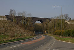
The South Wales Main Line viaduct
at Coalpit Heath.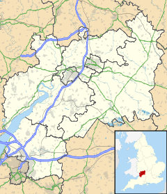
 Coalpit Heath
Coalpit Heath shown within GloucestershirePopulation c. 8,000 OS grid reference ST675806 Unitary authority South Gloucestershire Ceremonial county Gloucestershire Region South West Country England Sovereign state United Kingdom Post town BRISTOL Postcode district BS36 Dialling code 01454 Police Avon and Somerset Fire Avon Ambulance Great Western EU Parliament South West England UK Parliament Northavon List of places: UK • England • Gloucestershire Coalpit Heath is a small village in the parish of Westerleigh, South Gloucestershire, England, south of Yate and east of Frampton Cotterell in South Gloucestershire.
Contents
Background
 Bitterwell Lake
(see Henfield) Coalpit Heath Cricket Club
(see Ram Hill) The Kendleshire Golf Club
(see Henfield)Due to the expansion of Coalpit Heath and the neighbouring villages in the late 20th century, the borders of Coalpit Heath with Frampton Cotterell have become vague. The village contains three Pubs, one post office, a 27-hole golf course (The Kendleshire) and numerous local stores. The village also includes a parish church (St. Saviours), and a local primary school, the Manor CE VC Primary school.
It was founded as a coal mining settlement. One pit was on Frog Lane at ST 685 815 (to the north east of the village). Other mines operated between Mays Hill and Nibley to the north and at Ram Hill and Henfield to the south.[1] These were served by a railway line, closed some decades ago and no longer visible on the ground. In 1949 the coal ran out, and since then it has become a sought after place to live, with fields and easy accommodation.
Frampton Cotterell lies along the northwest border, but the rest of the village is surrounded by the rolling Cotswold countryside, stocked full of wildlife and country pursuits.
St Saviour's Church lies within the village. It was designed by William Butterfield in 1844 and was his first Anglican Church.
Amenities used and supported by the village include Bitterwell Lake at Henfield and Coalpit Heath Cricket Club at Ram Hill.
Coalpit Heath in literature
A number of sources, including Frank Barrett's book Where Was Wonderland? A Traveller's Guide to the Settings of Classic Children's Books, cite Coalpit Heath as the setting for the Dick King Smith children's book The Sheep-Pig, later adapted for film as Babe.[citation needed]
Location grid
Neighbouring town, villages, and hamlets 
Frampton Cotterell Iron Acton Nibley Winterbourne 
Yate  Coalpit Heath

Kendleshire Henfield / Ram Hill Westerleigh External links
- St Saviour's Church, Coalpit Heath
- The Manor C of E Primary School, Coalpit Heath
- Review of Frank Barrett's "Where Was Wonderland? A Traveller's Guide to the Settings of Classic Children's book, which, within the text of the review, identifies Coalpit Heath as the location of the Sheep-Pig
- A site detailing the locations of popular books, which also identifies Coalpit Heath as the Sheep-Pig's location
- interview with Paul Hawkins for God is in the TV magazine in which he talks about a song being set in Coalpit Heath
References
- ^ Ordance survey one-inch map of Great Britain, Sheet 156 Bristol and Stroud, Seventh series 1949, 1963 revision
Categories:- Villages in South Gloucestershire


Wikimedia Foundation. 2010.