- Tingri County
-
Tingri County — County — Tibetan transcription(s) – Tibetan – Wylie transliteration – pronunciation in IPA – official transcription (PRC) – THDL – other transcriptions Chinese transcription(s) – Traditional – Simplified – Pinyin  Location of Tingri County within Tibet
 Location in Tibet
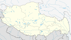
 Tingri County
Coordinates: 28°28′34″N 87°13′01″E / 28.47611°N 87.21694°E Country China Province Tibet Prefecture Xigazê Prefecture Capital Tingri Time zone China Standard (UTC+8) Tingri County or Dhringgri County (Tibetan: དིང་རི་རྫོང་, Wylie: ding ri rdzong; Chinese: 定日县; pinyin: Dìngrì Xiàn), is a county of the Xigazê Prefecture in the Tibet Autonomous Region.
The county comprises the upper valley of the Bum-chu or Arun River, with the valleys of its tributaries plus the valleys of the Rongshar Tsangpo and the Lapchi Gang Tsanpo which flow south into Nepal. It is bordered on the south by the main range of the Himalayas including Mt. Everest (Tib. Chomolungma), Makalu and Cho Oyo. The present county administration is located at Shelkar, about 87 km (54 mi) east of Tingri (town).[1]
Transport
Footnotes
- ^ Footprint Tibet Handbook with Bhutan, p. 296. 2nd edition (1999). Gyume Dorje. Footprint Handbooks, Bath, England. ISBN 1 900949 33 4.
Xigazê Prefecture, Tibet County-level divisions 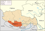
Settlements Landmarks Changmoche Monastery · Lhatse · Chokorgyel Monastery · Daklha Gampo · Donggar Monastery · Dorje Pakmo · Drongtse Monastery · Garju Monastery · Manmogang Monastery · Menri Monastery · Milarepa's Cave · Narthang Monastery · Ngor · Palcho Monastery · Ralung Monastery · Samding Monastery · Sakya Monastery · Ṣalu Monastery · Samding Monastery · Shelkar · Tashilhunpo · Tsi Nesar ·Coordinates: 28°28′34″N 87°13′01″E / 28.47611°N 87.21694°E
Categories:- Counties of Tibet
- Xigazê Prefecture
- Xigazê Prefecture geography stubs


Wikimedia Foundation. 2010.